
37 Broad St
Marlborough, MA 01752

-
Monthly Rent
$2,200
-
Bedrooms
3 bd
-
Bathrooms
1 ba
-
Square Feet
Details
About This Property
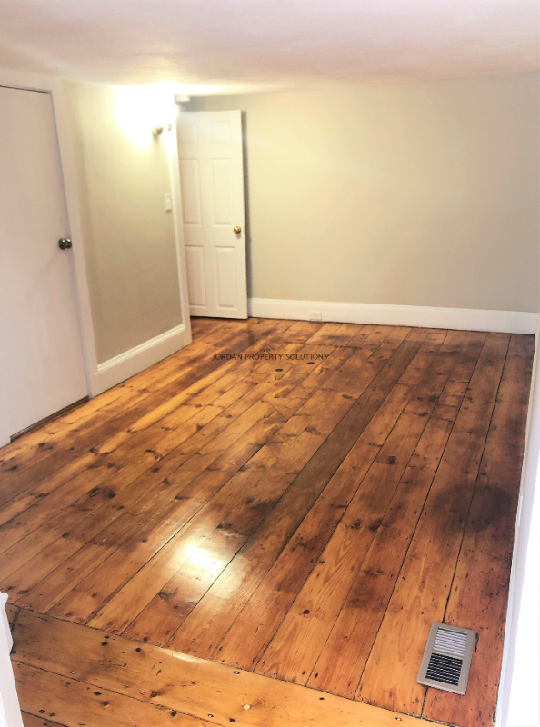
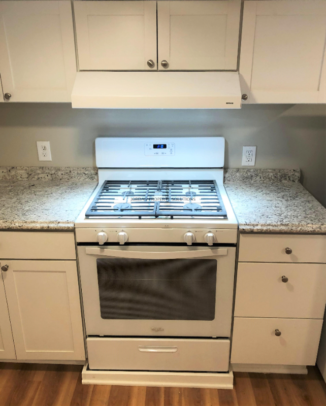
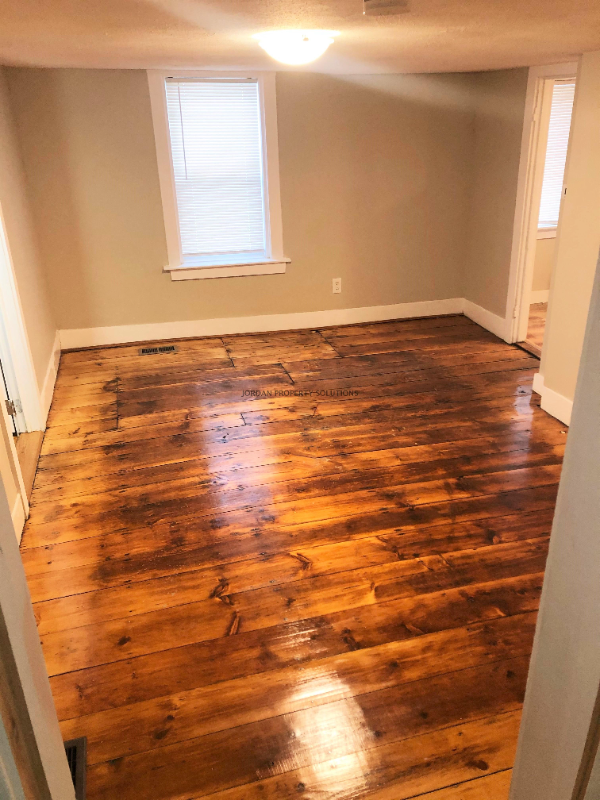
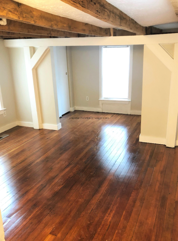
Property Id: 1706580 Welcome to this charming 3 bedroom, 1 bathroom single unit in Marlborough, MA! This multi-family property on Broad St features hardwood floors, forced air heating, and off-street parking. With amenities like an oven and refrigerator included and utilities like sewage and water covered, this is the perfect place to call home. No smoking or pets allowed. Don't miss out on this opportunity - schedule a showing today!
37 Broad St is an apartment community located in Middlesex County and the 01752 ZIP Code.
Features
- Oven
- Refrigerator
- Hardwood Floors
Fees and Policies
The fees below are based on community-supplied data and may exclude additional fees and utilities.
Details
Utilities Included
-
Water
-
Sewer
 This Property
 Available Property
- Oven
- Refrigerator
- Hardwood Floors
Just west of Boston and East of Worcester sits Metro West, a region that houses a group of towns and cities with significant historical backgrounds. A total of 19 municipalities make up the core of this community, but other municipalities are considered to be a part of the Interstate 495/Metro West Corridor.
Learn more about living in Metro West| Colleges & Universities | Distance | ||
|---|---|---|---|
| Colleges & Universities | Distance | ||
| Drive: | 17 min | 9.1 mi | |
| Drive: | 23 min | 12.3 mi | |
| Drive: | 21 min | 15.2 mi | |
| Drive: | 24 min | 17.5 mi |
Transportation options available in Marlborough include Riverside Station, located 21.0 miles from 37 Broad St. 37 Broad St is near Worcester Regional, located 21.7 miles or 32 minutes away, and General Edward Lawrence Logan International, located 34.1 miles or 50 minutes away.
| Transit / Subway | Distance | ||
|---|---|---|---|
| Transit / Subway | Distance | ||
|
|
Drive: | 32 min | 21.0 mi |
|
|
Drive: | 32 min | 21.3 mi |
|
|
Drive: | 33 min | 22.0 mi |
|
|
Drive: | 36 min | 23.6 mi |
|
|
Drive: | 36 min | 23.8 mi |
| Commuter Rail | Distance | ||
|---|---|---|---|
| Commuter Rail | Distance | ||
|
|
Drive: | 14 min | 6.8 mi |
|
|
Drive: | 16 min | 10.5 mi |
|
|
Drive: | 24 min | 10.6 mi |
|
|
Drive: | 21 min | 11.1 mi |
|
|
Drive: | 22 min | 11.2 mi |
| Airports | Distance | ||
|---|---|---|---|
| Airports | Distance | ||
|
Worcester Regional
|
Drive: | 32 min | 21.7 mi |
|
General Edward Lawrence Logan International
|
Drive: | 50 min | 34.1 mi |
Time and distance from 37 Broad St.
| Shopping Centers | Distance | ||
|---|---|---|---|
| Shopping Centers | Distance | ||
| Walk: | 11 min | 0.6 mi | |
| Walk: | 20 min | 1.1 mi | |
| Drive: | 4 min | 2.1 mi |
| Parks and Recreation | Distance | ||
|---|---|---|---|
| Parks and Recreation | Distance | ||
|
Felton Conservation Area
|
Drive: | 4 min | 2.0 mi |
|
Cedar Hill and Sawink Farm Reservation
|
Drive: | 10 min | 4.2 mi |
|
Wilfred J. Turenne Wildlife Habitat
|
Drive: | 11 min | 5.8 mi |
|
Honey Pot Hill Orchards
|
Drive: | 14 min | 6.5 mi |
|
Walkup And Robinson Memorial Reservation
|
Drive: | 10 min | 6.7 mi |
| Hospitals | Distance | ||
|---|---|---|---|
| Hospitals | Distance | ||
| Drive: | 2 min | 1.1 mi | |
| Drive: | 20 min | 10.5 mi |
| Military Bases | Distance | ||
|---|---|---|---|
| Military Bases | Distance | ||
| Drive: | 25 min | 13.9 mi |
You May Also Like
What Are Walk Score®, Transit Score®, and Bike Score® Ratings?
Walk Score® measures the walkability of any address. Transit Score® measures access to public transit. Bike Score® measures the bikeability of any address.
What is a Sound Score Rating?
A Sound Score Rating aggregates noise caused by vehicle traffic, airplane traffic and local sources
37 Broad St
Marlborough, MA 01752