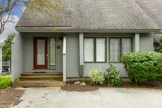
$1,800 / Month
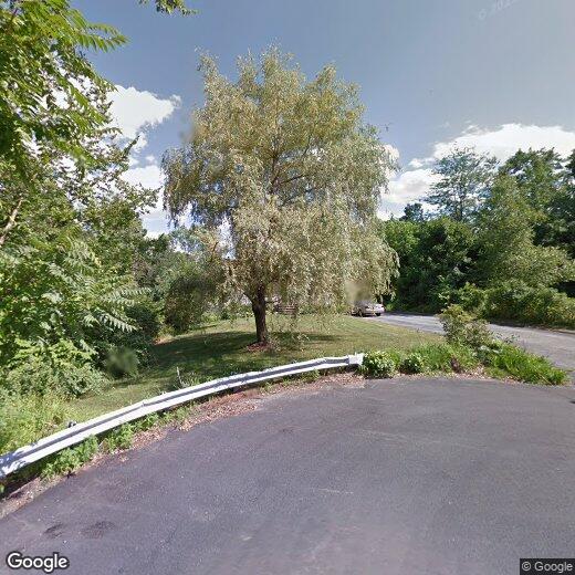
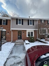
37 Brox Rd
Dracut, MA 01826
Today
Favorites
781-346-3265
-
Bedrooms
2
-
Bathrooms
1
-
Square Feet
--
-
Available
Available Jun 1
37 Brox Rd

Favorites
About This Home
$800 deposit,
Available Jun 1
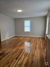
Unit in family home for rent move in date June 1st. Contact landlord for more details.
37 Brox Rd is a house located in Middlesex County and the 01826 ZIP Code. This area is served by the Dracut attendance zone.
* Price shown is base rent and may not include non-optional fees and utilities.
Price, availability, fees, and any applicable rent special are subject to change without notice.
* Square footage definitions vary. Displayed square footage is approximate.
Contact
- Listed by Akima
- Phone Number
- Contact
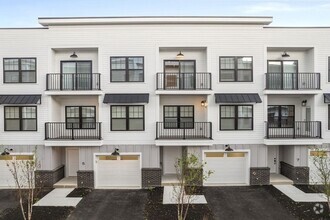
$1,844 / month
$294,900 Listing Price
2 Beds
•1.5 Baths
•
1,536 Sq Ft
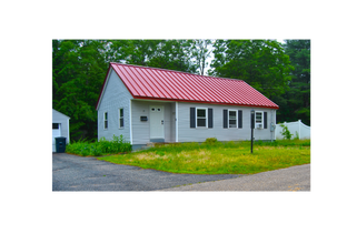
$1,758 / month
$320,000 Listing Price
3 Beds
•1.5 Baths
•
2,104 Sq Ft
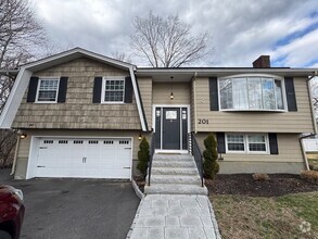
$1,975 / month
$299,900 Listing Price
2 Beds
•1 Baths
•
1,152 Sq Ft
Location
Get Directions
Bordering downtown Lowell, the Centralville neighborhood lies about 30 miles north of downtown Boston. The area is primarily residential, with the downtown business district within walking distance across the Merrimack River. Loft-style apartments line the streets near the river, allowing for views of Riverfront Park. The nearby highways of I-93 and I-495 connect the area to Boston, Worcester, and the state of New Hampshire.
Get fresh air by riding your bike along the paths of Merrimack River Bike Path in Centralville, then cross the bridge to Brew'd Awakening Coffeehaus for a cup of coffee and a grilled cheese sandwich. Remember hometown hero Jack Kerouac each year at the Lowell Celebrates Kerouac! festival, where you can join your neighbors on a tour of the city, listen to students read their poetry, or discuss the author's most famous works.
Learn more about living in Centralville
Education
| Colleges & Universities | Distance | ||
|---|---|---|---|
| Colleges & Universities | Distance | ||
| Drive: | 4 min | 1.5 mi | |
| Drive: | 5 min | 2.3 mi | |
| Drive: | 22 min | 11.3 mi | |
| Drive: | 23 min | 13.0 mi |
37 Brox Rd is within 4 minutes or 1.5 miles from Middlesex C.C., Lowell Campus. It is also near UMass Lowell and Middlesex C.C., Bedford Campus.
Schools


Public Elementary School
Grades PK-5
596 Students
Attendance Zone
Public Middle School
Grades 6-8
848 Students
Attendance Zone
Public High School
Grades 9-12
847 Students
Attendance Zone
Private Elementary & Middle School
Grades PK-8
234 Students
Nearby
Private Elementary & Middle School
Grades PK-8
186 Students
Nearby
School data provided by
 The GreatSchools Rating helps parents compare schools within a state based on a variety of school quality indicators and provides a helpful picture of how effectively each school serves all of its students. Ratings are on a scale of 1 (below average) to 10 (above average) and can include test scores, college readiness, academic progress, advanced courses, equity, discipline and attendance data. We also advise parents to visit schools, consider other information on school performance and programs, and consider family needs as part of the school selection process.
View GreatSchools Rating Methodology
View GreatSchools Rating Methodology
Transportation options available in Dracut include Alewife Station, located 23.2 miles from 37 Brox Rd. 37 Brox Rd is near Manchester Boston Regional, located 30.9 miles or 49 minutes away, and General Edward Lawrence Logan International, located 31.7 miles or 49 minutes away.
| Transit / Subway | Distance | ||
|---|---|---|---|
| Transit / Subway | Distance | ||
|
|
Drive: | 39 min | 23.2 mi |
|
|
Drive: | 38 min | 23.8 mi |
|
|
Drive: | 38 min | 25.2 mi |
| Drive: | 38 min | 25.3 mi | |
|
|
Drive: | 40 min | 26.3 mi |
| Commuter Rail | Distance | ||
|---|---|---|---|
| Commuter Rail | Distance | ||
|
|
Drive: | 6 min | 2.4 mi |
|
|
Drive: | 14 min | 5.9 mi |
|
|
Drive: | 22 min | 10.3 mi |
|
|
Drive: | 19 min | 10.5 mi |
|
|
Drive: | 21 min | 12.3 mi |
| Airports | Distance | ||
|---|---|---|---|
| Airports | Distance | ||
|
Manchester Boston Regional
|
Drive: | 49 min | 30.9 mi |
|
General Edward Lawrence Logan International
|
Drive: | 49 min | 31.7 mi |
Time and distance from 37 Brox Rd.
| Shopping Centers | Distance | ||
|---|---|---|---|
| Shopping Centers | Distance | ||
| Drive: | 3 min | 1.4 mi | |
| Drive: | 4 min | 1.7 mi | |
| Drive: | 5 min | 1.9 mi |
37 Brox Rd has 3 shopping centers within 1.9 miles, which is about a 5-minute drive. The miles and minutes will be for the farthest away property.
| Parks and Recreation | Distance | ||
|---|---|---|---|
| Parks and Recreation | Distance | ||
|
Lowell National Historical Park
|
Drive: | 5 min | 1.9 mi |
|
Lowell Heritage State Park
|
Drive: | 9 min | 4.6 mi |
|
Lowell-Dracut-Tyngsboro State Forest
|
Drive: | 11 min | 5.0 mi |
|
Ralph Hill Conservation Area
|
Drive: | 18 min | 8.8 mi |
|
Lawrence Heritage State Park
|
Drive: | 18 min | 10.1 mi |
37 Brox Rd has 5 parks within 10.1 miles, including Lowell National Historical Park, Lowell Heritage State Park, and Lowell-Dracut-Tyngsboro State Forest.
| Hospitals | Distance | ||
|---|---|---|---|
| Hospitals | Distance | ||
| Drive: | 6 min | 3.3 mi | |
| Drive: | 17 min | 9.9 mi |
37 Brox Rd is 3.3 miles from Lowell General Hospital, and is convenient to other hospitals, including Holy Family Hospital.
| Military Bases | Distance | ||
|---|---|---|---|
| Military Bases | Distance | ||
| Drive: | 29 min | 16.7 mi |
37 Brox Rd is 16.7 miles and a 29 minute drive from Hanscom Air Force Base.
You May Also Like
Similar Rentals Nearby


What Are Walk Score®, Transit Score®, and Bike Score® Ratings?
Walk Score® measures the walkability of any address. Transit Score® measures access to public transit. Bike Score® measures the bikeability of any address.
What is a Sound Score Rating?
A Sound Score Rating aggregates noise caused by vehicle traffic, airplane traffic and local sources

37 Brox Rd
Dracut, MA 01826