
$4,190 / Month
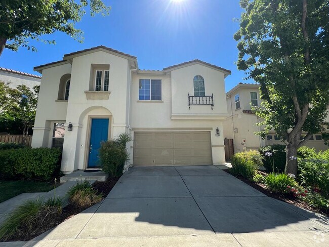
37332 Suncrest St
Newark, CA 94560
2 Weeks Ago
Favorites
37332 Suncrest St

Favorites
Check Back Soon for Upcoming Availability
| Beds | Baths | Average SF |
|---|---|---|
| 4 Bedrooms 4 Bedrooms 4 Br | 3.25 Baths 3.25 Baths 3.25 Ba | 1,920 SF |
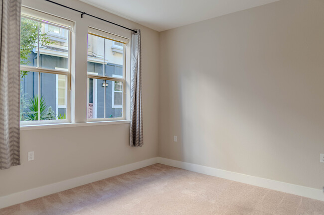
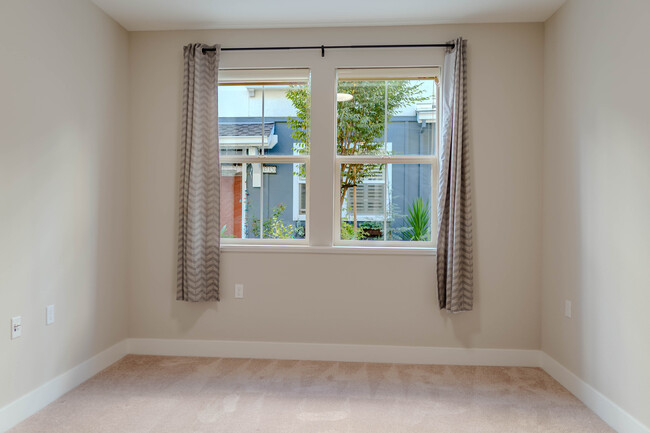
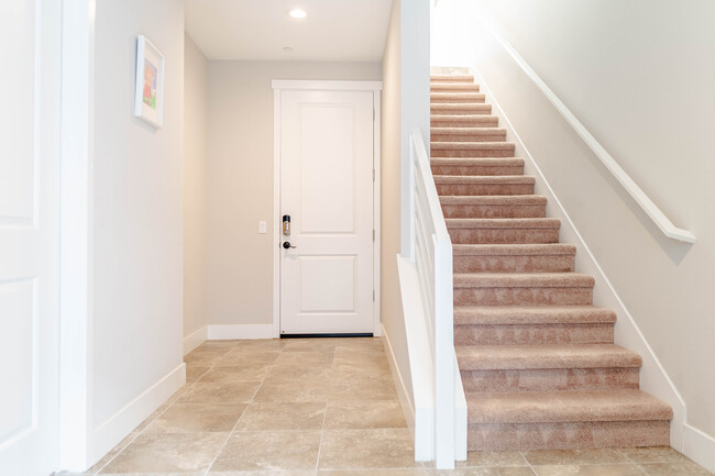
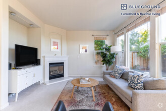
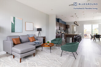
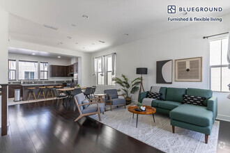
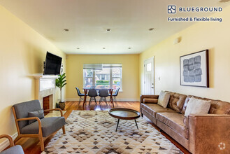
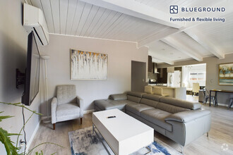
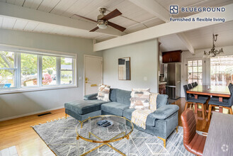
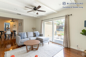
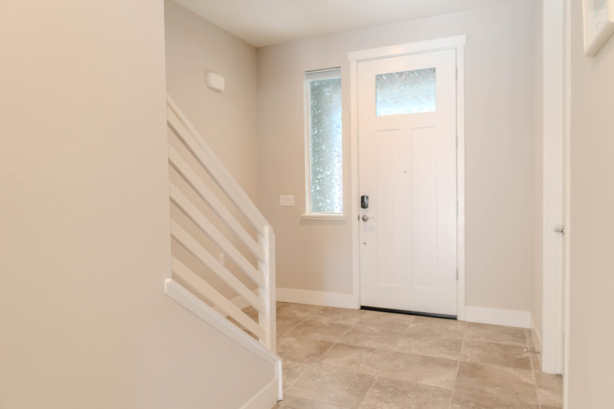
About This Property
Don't miss an opportunity to rent this 3-year old stunning townhouse in a nice and safe Compass bay community. Award-winning design of sunny rooms. Conveniently located near Dumbarton bridge and Coyote hills. Near Meta, Lucid, etc. 5-8 minutes driving to 99 Ranch market, Sprouts, CVS, and Safeway. Solar panels owned covers your utilities. EV car charger built in the garage. Modern designed home with newer appliance. BBQ place in onsite. move-in ready!
37332 Suncrest St is a house located in Alameda County and the 94560 ZIP Code. This area is served by the Newark Unified attendance zone.
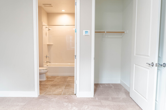
House Features
- Washer/Dryer
- Washer/Dryer Hookup
- Dishwasher
Fees and Policies
Property Address:
37332 Suncrest St,
Newark,
CA
94560
Newark, California is a quiet community fringed by thousands of acres of pristine wetlands on the eastern edge of the San Francisco Bay. Located 25 miles south of Oakland, Newark forms part of the Tri-City area, along with Union City and Fremont. The neighborhood is family-oriented with rows of small homes and many parks interspersed throughout. Many people who work in nearby San Jose or across the bay in Palo Alto choose to live in Newark for the more affordable cost of living and more laid-back pace of life.
Five parks are housed within Newark’s boundaries, adding the aquatic scenery and outdoor attractions of the area. Amenity-laden apartment communities sit just minutes from the conveniences along the Nimitz Freeway and Fremont.
Learn more about living in Newark
Amenities
- Washer/Dryer
- Washer/Dryer Hookup
- Dishwasher
Education
| Colleges & Universities | Distance | ||
|---|---|---|---|
| Colleges & Universities | Distance | ||
| Drive: | 8 min | 3.5 mi | |
| Drive: | 18 min | 10.7 mi | |
| Drive: | 19 min | 12.6 mi | |
| Drive: | 24 min | 14.8 mi |
37332 Suncrest St is within 8 minutes or 3.5 miles from Ohlone College, Newark. It is also near Ohlone College, Fremont Campus and Chabot College.
Schools


Public Elementary School
Grades K-5
343 Students
Nearby
Public Elementary School
Grades K-5
321 Students
Attendance Zone
Public Middle School
Grades 6-8
1,047 Students
Attendance Zone
Public High School
Grades 9-12
1,510 Students
Attendance Zone
Private Elementary, Middle & High School
Grades 1-12
Nearby
Private Elementary & Middle School
Grades PK-8
806 Students
Nearby
School data provided by
 The GreatSchools Rating helps parents compare schools within a state based on a variety of school quality indicators and provides a helpful picture of how effectively each school serves all of its students. Ratings are on a scale of 1 (below average) to 10 (above average) and can include test scores, college readiness, academic progress, advanced courses, equity, discipline and attendance data. We also advise parents to visit schools, consider other information on school performance and programs, and consider family needs as part of the school selection process.
View GreatSchools Rating Methodology
View GreatSchools Rating Methodology
Transportation options available in Newark include Fremont Station, located 6.3 miles from 37332 Suncrest St. 37332 Suncrest St is near Norman Y Mineta San Jose International, located 20.1 miles or 27 minutes away, and Metro Oakland International, located 21.3 miles or 29 minutes away.
| Transit / Subway | Distance | ||
|---|---|---|---|
| Transit / Subway | Distance | ||
|
|
Drive: | 12 min | 6.3 mi |
|
|
Drive: | 13 min | 6.8 mi |
|
|
Drive: | 15 min | 8.9 mi |
|
|
Drive: | 26 min | 19.3 mi |
|
|
Drive: | 26 min | 19.9 mi |
| Commuter Rail | Distance | ||
|---|---|---|---|
| Commuter Rail | Distance | ||
| Drive: | 8 min | 4.3 mi | |
| Drive: | 22 min | 11.5 mi | |
| Drive: | 21 min | 11.8 mi | |
| Drive: | 23 min | 13.7 mi | |
| Drive: | 25 min | 15.6 mi |
| Airports | Distance | ||
|---|---|---|---|
| Airports | Distance | ||
|
Norman Y Mineta San Jose International
|
Drive: | 27 min | 20.1 mi |
|
Metro Oakland International
|
Drive: | 29 min | 21.3 mi |
Time and distance from 37332 Suncrest St.
| Shopping Centers | Distance | ||
|---|---|---|---|
| Shopping Centers | Distance | ||
| Drive: | 3 min | 1.2 mi | |
| Drive: | 5 min | 2.2 mi | |
| Drive: | 4 min | 2.3 mi |
37332 Suncrest St has 3 shopping centers within 2.3 miles, which is about a 4-minute drive. The miles and minutes will be for the farthest away property.
| Parks and Recreation | Distance | ||
|---|---|---|---|
| Parks and Recreation | Distance | ||
|
San Francisco Bay National Wildlife Refuge
|
Drive: | 5 min | 1.8 mi |
|
Ardenwood Historic Farm
|
Drive: | 9 min | 4.8 mi |
|
Quarry Lakes Regional Recreation Area
|
Drive: | 9 min | 5.0 mi |
|
Alameda Creek Regional Trail
|
Drive: | 10 min | 5.2 mi |
|
Coyote Hills Regional Park
|
Drive: | 10 min | 5.2 mi |
37332 Suncrest St has 5 parks within 5.2 miles, including San Francisco Bay National Wildlife Refuge, Ardenwood Historic Farm, and Quarry Lakes Regional Recreation Area.
| Hospitals | Distance | ||
|---|---|---|---|
| Hospitals | Distance | ||
| Drive: | 12 min | 6.3 mi | |
| Drive: | 12 min | 6.4 mi | |
| Drive: | 15 min | 10.4 mi |
37332 Suncrest St has 3 hospitals within 10.4 miles, the nearest is Kaiser Foundation Hospital - Fremont which is 6.3 miles away and a 12 minute drive.
| Military Bases | Distance | ||
|---|---|---|---|
| Military Bases | Distance | ||
| Drive: | 28 min | 17.6 mi |
37332 Suncrest St is 17.6 miles and a 28 minute drive from Ames Research Center.
You May Also Like
Similar Rentals Nearby

What Are Walk Score®, Transit Score®, and Bike Score® Ratings?
Walk Score® measures the walkability of any address. Transit Score® measures access to public transit. Bike Score® measures the bikeability of any address.
What is a Sound Score Rating?
A Sound Score Rating aggregates noise caused by vehicle traffic, airplane traffic and local sources
37332 Suncrest St
Newark, CA 94560