
$2,195 / Month
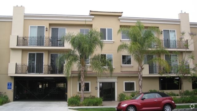
3749 Mercury Ave Unit #A
Los Angeles, CA 90031
Today
Favorites
415-533-8377
-
Bedrooms
2
-
Bathrooms
1
-
Square Feet
780 sq ft
-
Available
Available Now
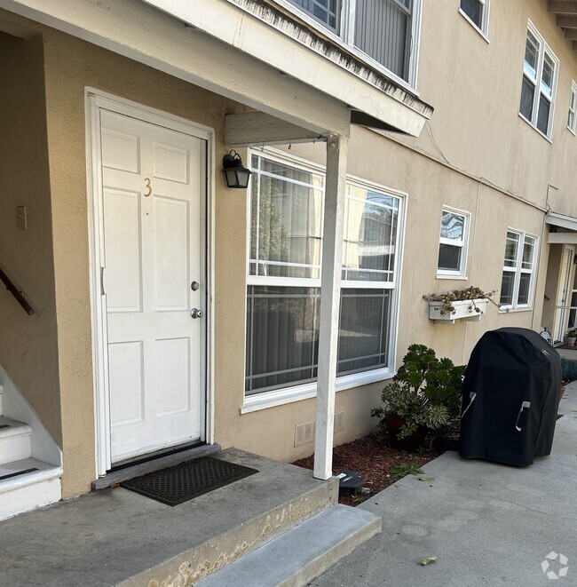
Highlights
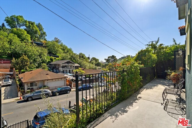
- Views
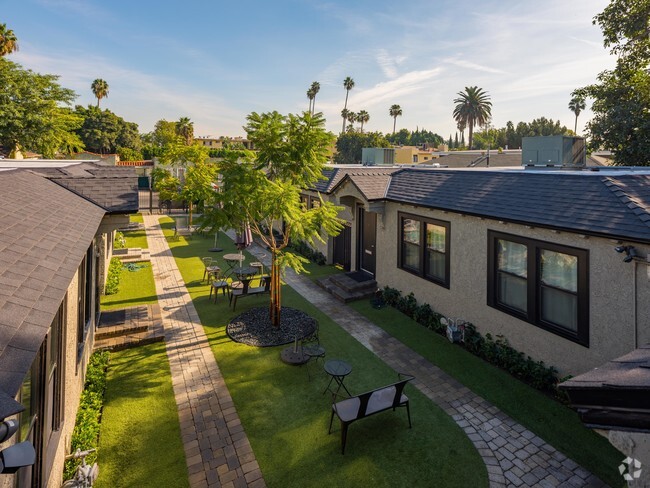
- Open Patio
- Bungalow
- Stone Flooring
- Ceiling Fan
- 1-Story Property
3749 Mercury Ave Unit #A

Favorites
About This Home
$2,195 deposit,
Available Now
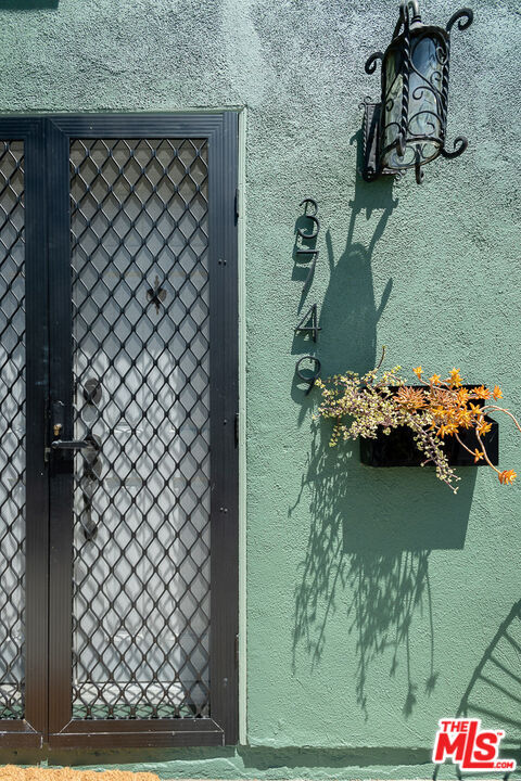
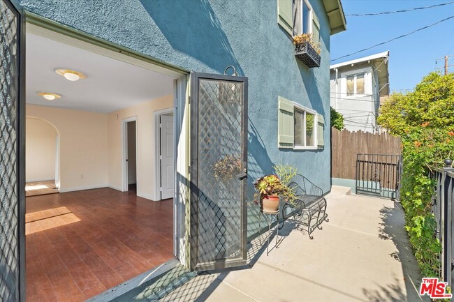
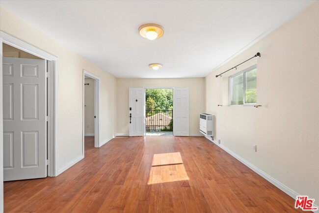
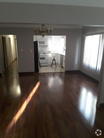
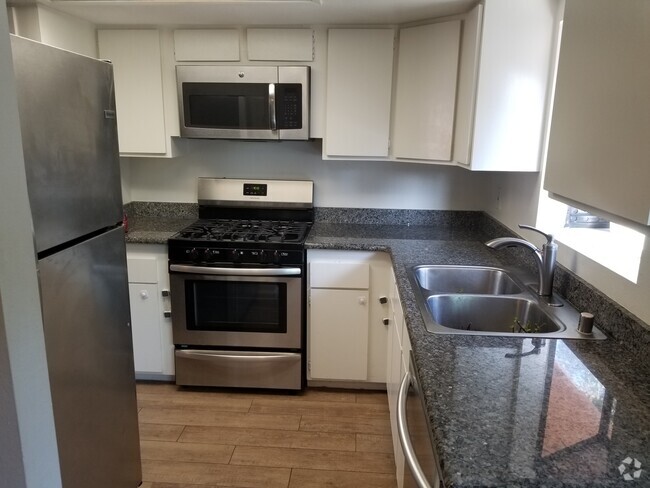
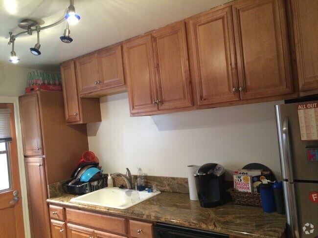
Built on an upslope lot in Montecito Heights, this quiet unit has a total of 2 bedrooms and 1 bath with incredible views to the Southwest through the rolling hills of Northeast Los Angeles. This lower unit is light and bright, has wood floors, a large kitchen with dining area, in unit laundry hookups and great light from the south facing doors. This unit sits perched on its own floor, providing privacy and seclusion with views of the treetops. Mercury Avenue connects to North Broadway for quick trips to Downtown Los Angeles and Monterey Pass Road for access to Highland Park, Pasadena and all things East. Mercury offers your desired indoor/outdoor lifestyle with your private outdoor patio and large storage unit. Debs Park, with miles of hiking trails, is around the corner. Fresco Community Market, The Airliner Bar, Zizou, Tierra Mia Coffee and Bambino Stone Pizza are nearby to welcome you to the neighborhood!
3749 Mercury Ave is a condo located in Los Angeles County and the 90031 ZIP Code.
* Price shown is base rent and may not include non-optional fees and utilities.
Price, availability, fees, and any applicable rent special are subject to change without notice.
* Square footage definitions vary. Displayed square footage is approximate.
Home Details
Home Type
Condominium
Year Built
Built in 1918
Bedrooms and Bathrooms
1 Full Bathroom
2 Bedrooms
Flooring
Stone
Laminate
Home Design
Bungalow
Split Level Home
Interior Spaces
Ceiling Fan
780 Sq Ft Home
1-Story Property
Kitchen
Oven or Range
Laundry
Laundry in unit
Stacked Washer and Dryer Hookup
Listing and Financial Details
Security Deposit $2,195
12 Month Lease Term
Assessor Parcel Number 5304-036-009
Tenant pays for gas, electricity
Lot Details
4,209 Sq Ft Lot
Outdoor Features
Open Patio
Utilities
Heating System Mounted To A Wall or Window
Community Details
Pet Policy
Pets Allowed
Fees and Policies
The fees below are based on community-supplied data and may exclude additional fees and utilities.
- Dogs Allowed
-
Fees not specified
- Cats Allowed
-
Fees not specified
Contact
- Listed by Jane Lee | Highland Premiere Real Estate
- Phone Number
- Contact
-
Source
 MLS(TM)/CLAW
Copyright 2025 TheMLS/CLAW. All rights reserved. Information is deemed reliable but not guaranteed.
Location
Get Directions
Amenities
- Washer/Dryer
- Ceiling Fans
- Refrigerator
- Vinyl Flooring
- Views
Situated in northeast Los Angeles, just four miles from downtown, Montecito Heights sits atop a hilly landscape separating LA from the San Gabriel Valley. From the neighborhood’s steep hills, you can catch stunning views of downtown and the San Gabriel Valley in addition to the Arroyo Seco and even the Pacific Ocean (on a clear day).
Montecito Heights is known for its secluded feel despite being minutes away from Downtown LA. Natural beauty and lush parks abound in Montecito Heights. Ernest E. Debs Regional Park is one of the neighborhood’s defining features, touting 300 acres of scenic hiking trails, biking paths, picnic tables, a peaceful pond, and the striking panoramic views the neighborhood is revered for.
Montecito Heights is also home to the Heritage Square Museum, a living history museum that details life in 19th-century Southern California.
Learn more about living in Montecito Heights
Education
| Colleges & Universities | Distance | ||
|---|---|---|---|
| Colleges & Universities | Distance | ||
| Drive: | 6 min | 2.3 mi | |
| Drive: | 9 min | 4.2 mi | |
| Drive: | 13 min | 5.1 mi | |
| Drive: | 14 min | 6.8 mi |
3749 Mercury Ave Unit #A is within 6 minutes or 2.3 miles from USC, Health Sciences Campus. It is also near Cal State Los Angeles and Occidental College.
Transportation options available in Los Angeles include Lincoln Heights/Cypress Park Station, located 2.4 miles from 3749 Mercury Ave Unit #A. 3749 Mercury Ave Unit #A is near Bob Hope, located 16.9 miles or 25 minutes away, and Los Angeles International, located 20.0 miles or 34 minutes away.
| Transit / Subway | Distance | ||
|---|---|---|---|
| Transit / Subway | Distance | ||
|
|
Drive: | 6 min | 2.4 mi |
|
|
Drive: | 8 min | 2.5 mi |
|
|
Drive: | 7 min | 2.5 mi |
|
|
Drive: | 8 min | 3.0 mi |
|
|
Drive: | 7 min | 3.5 mi |
| Commuter Rail | Distance | ||
|---|---|---|---|
| Commuter Rail | Distance | ||
|
|
Drive: | 10 min | 3.8 mi |
|
|
Drive: | 9 min | 3.9 mi |
|
|
Drive: | 12 min | 6.2 mi |
| Drive: | 12 min | 7.8 mi | |
|
|
Drive: | 19 min | 11.3 mi |
| Airports | Distance | ||
|---|---|---|---|
| Airports | Distance | ||
|
Bob Hope
|
Drive: | 25 min | 16.9 mi |
|
Los Angeles International
|
Drive: | 34 min | 20.0 mi |
Time and distance from 3749 Mercury Ave Unit #A.
| Shopping Centers | Distance | ||
|---|---|---|---|
| Shopping Centers | Distance | ||
| Drive: | 3 min | 1.3 mi | |
| Drive: | 5 min | 1.9 mi | |
| Drive: | 6 min | 2.3 mi |
3749 Mercury Ave Unit #A has 3 shopping centers within 2.3 miles, which is about a 6-minute drive. The miles and minutes will be for the farthest away property.
| Parks and Recreation | Distance | ||
|---|---|---|---|
| Parks and Recreation | Distance | ||
|
Audubon Center at Debs Park
|
Drive: | 6 min | 1.7 mi |
|
Chavez Ravine Arboretum
|
Drive: | 9 min | 4.3 mi |
|
Elysian Park
|
Drive: | 12 min | 4.4 mi |
|
Elyria Canyon Park
|
Drive: | 11 min | 4.9 mi |
|
Marsh Park
|
Drive: | 12 min | 5.2 mi |
3749 Mercury Ave Unit #A has 5 parks within 5.2 miles, including Audubon Center at Debs Park, Elyria Canyon Park, and Elysian Park.
| Hospitals | Distance | ||
|---|---|---|---|
| Hospitals | Distance | ||
| Drive: | 5 min | 2.2 mi | |
| Drive: | 6 min | 2.7 mi | |
| Drive: | 7 min | 3.5 mi |
3749 Mercury Ave Unit #A has 3 hospitals within 3.5 miles, the nearest is Keck Hospital of USC which is 2.2 miles away and a 5 minute drive.
| Military Bases | Distance | ||
|---|---|---|---|
| Military Bases | Distance | ||
| Drive: | 31 min | 21.6 mi | |
| Drive: | 40 min | 27.1 mi |
3749 Mercury Ave Unit #A is 21.6 miles from Los Angeles Air Force Base, and is convenient to other military bases, including Los Alamitos Army Airfield.
You May Also Like
Similar Rentals Nearby
What Are Walk Score®, Transit Score®, and Bike Score® Ratings?
Walk Score® measures the walkability of any address. Transit Score® measures access to public transit. Bike Score® measures the bikeability of any address.
What is a Sound Score Rating?
A Sound Score Rating aggregates noise caused by vehicle traffic, airplane traffic and local sources

3749 Mercury Ave
Los Angeles, CA 90031