38 S Lenox St Unit 2
Worcester, MA 01602

-
Monthly Rent
$2,100
-
Bedrooms
3 bd
-
Bathrooms
1 ba
-
Square Feet
Details
About This Property
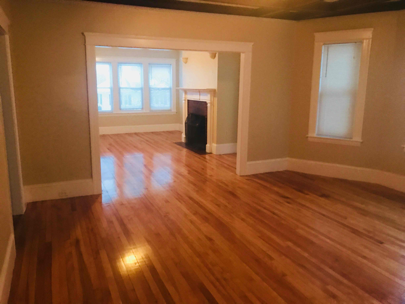
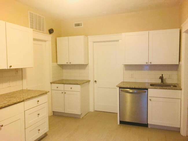
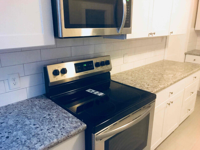
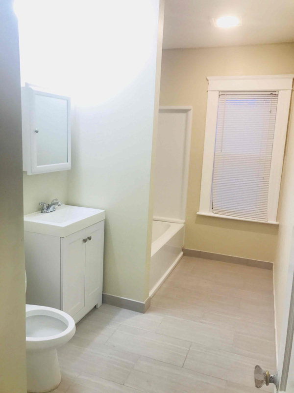
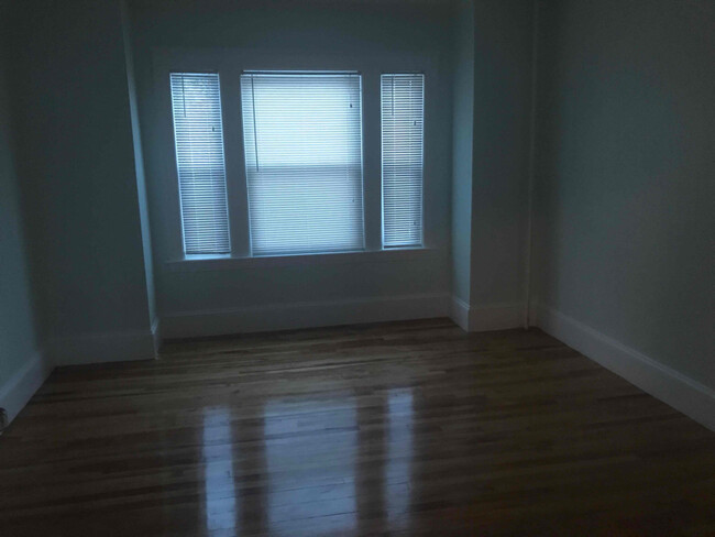
Property Id: 1736979 Mint 2nd floor unit in great location!! Double parlor, hardwood floors, sunroom, laundry room in apartment, pantry, parking. Under renovation. Will get more pictures soon. Large beautiful unit To view, please text Wally RE Agent .
38 S Lenox St is an apartment community located in Worcester County and the 01602 ZIP Code.
Features
- Hardwood Floors
Fees and Policies
The fees below are based on community-supplied data and may exclude additional fees and utilities.
Details
Utilities Included
-
Water
-
Sewer
 This Property
 Available Property
- Hardwood Floors
The Tatnuck community is largely made up of the Worcester State University campus. The college is smack dab in the middle of it all, surrounded by Rockwood Field and local elementary schools. Encompassing this suburban community are local restaurants, convenience stores, and quick-bites establishments.
When you live in Tatnuck, you’re down the road from Tatnuck Country Club, Boynton Park, and the Worcester Regional Airport. The Shoppes at Blackstone Valley mall is just eight miles southeast of the neighborhood, and the perfect spot for a day of shopping, lunch, and watching a movie. Near Interstate 290 is Wormtown Brewing Company, which is known for their “Blizzard of ‘78” English-style brown ale.
Learn more about living in Tatnuck| Colleges & Universities | Distance | ||
|---|---|---|---|
| Colleges & Universities | Distance | ||
| Walk: | 18 min | 0.9 mi | |
| Drive: | 3 min | 1.6 mi | |
| Drive: | 6 min | 2.0 mi | |
| Drive: | 5 min | 2.2 mi |
Transportation options available in Worcester include Riverside Station, located 36.1 miles from 38 S Lenox St Unit 2. 38 S Lenox St Unit 2 is near Worcester Regional, located 3.5 miles or 8 minutes away.
| Transit / Subway | Distance | ||
|---|---|---|---|
| Transit / Subway | Distance | ||
|
|
Drive: | 49 min | 36.1 mi |
|
|
Drive: | 50 min | 36.4 mi |
|
|
Drive: | 51 min | 37.1 mi |
|
|
Drive: | 53 min | 38.6 mi |
|
|
Drive: | 53 min | 38.9 mi |
| Commuter Rail | Distance | ||
|---|---|---|---|
| Commuter Rail | Distance | ||
|
|
Drive: | 5 min | 2.5 mi |
|
|
Drive: | 6 min | 2.7 mi |
|
|
Drive: | 18 min | 10.2 mi |
|
|
Drive: | 19 min | 10.9 mi |
|
|
Drive: | 31 min | 17.9 mi |
| Airports | Distance | ||
|---|---|---|---|
| Airports | Distance | ||
|
Worcester Regional
|
Drive: | 8 min | 3.5 mi |
Time and distance from 38 S Lenox St Unit 2.
| Shopping Centers | Distance | ||
|---|---|---|---|
| Shopping Centers | Distance | ||
| Walk: | 17 min | 0.9 mi | |
| Drive: | 2 min | 1.2 mi | |
| Drive: | 4 min | 1.6 mi |
| Parks and Recreation | Distance | ||
|---|---|---|---|
| Parks and Recreation | Distance | ||
|
Quinsigamond State Park
|
Drive: | 8 min | 4.4 mi |
|
EcoTarium
|
Drive: | 10 min | 4.6 mi |
|
Mass Audubon's Broad Meadow Brook Conservation Center and Wildlife Sanctuary
|
Drive: | 10 min | 5.2 mi |
|
Moore State Park
|
Drive: | 13 min | 7.2 mi |
|
Mass Audubon's Eagle Lake Wildlife Sanctuary
|
Drive: | 16 min | 8.2 mi |
| Hospitals | Distance | ||
|---|---|---|---|
| Hospitals | Distance | ||
| Drive: | 4 min | 2.4 mi | |
| Drive: | 5 min | 2.7 mi | |
| Drive: | 8 min | 4.5 mi |
You May Also Like
What Are Walk Score®, Transit Score®, and Bike Score® Ratings?
Walk Score® measures the walkability of any address. Transit Score® measures access to public transit. Bike Score® measures the bikeability of any address.
What is a Sound Score Rating?
A Sound Score Rating aggregates noise caused by vehicle traffic, airplane traffic and local sources

38 S Lenox St
Worcester, MA 01602