$1,395 / Month
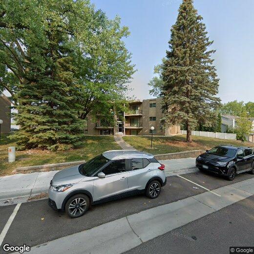
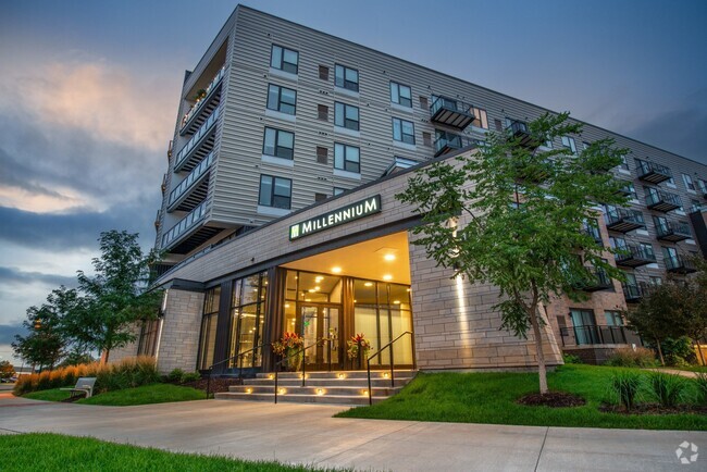
3800 Foss Rd Unit 10
Saint Anthony, MN 55421
Today
Favorites
612-249-7112
-
Bedrooms
3
-
Bathrooms
1
-
Square Feet
1,200 sq ft
-
Available
Available Now
3800 Foss Rd Unit 10

Favorites
Contact
- Listed by Level 10 Management, LLC | Level 10 Management, LLC
- Phone Number
- Contact
Location
Get Directions
Nicknamed "A Village within a City" and located across the river from Downtown Minneapolis, the Saint Anthony neighborhood straddles the border of Ramsey and Hennepin counties. Many residents call this neighborhood home, thanks to its quiet streets, picturesque houses and apartments, multiple recreational activities, and great schools.
Ranked as one of the top ten schools in the state of Minnesota, Saint Anthony High School has 70 percent of its students earning free college credits through advanced placement classes or free courses at the University of Minnesota. The neighborhood features a charming commercial area and bike paths along the banks of the Mississippi River. Saint Anthony has great views of the Minneapolis skyline, and it overlaps Minneapolis's North East neighborhood.
Learn more about living in St Anthony-Ramsey
Education
| Colleges & Universities | Distance | ||
|---|---|---|---|
| Colleges & Universities | Distance | ||
| Drive: | 6 min | 2.6 mi | |
| Drive: | 10 min | 4.8 mi | |
| Drive: | 9 min | 5.5 mi | |
| Drive: | 11 min | 6.6 mi |
3800 Foss Rd Unit 10 is within 6 minutes or 2.6 miles from Northwestern College. It is also near Bethel University, Saint Paul and Univ. of Minnesota, Saint Paul.
Transportation options available in Saint Anthony include East Bank Station, located 5.8 miles from 3800 Foss Rd Unit 10. 3800 Foss Rd Unit 10 is near Minneapolis-St Paul International/Wold-Chamberlain, located 16.0 miles or 28 minutes away.
| Transit / Subway | Distance | ||
|---|---|---|---|
| Transit / Subway | Distance | ||
| Drive: | 13 min | 5.8 mi | |
| Drive: | 13 min | 6.0 mi | |
| Drive: | 12 min | 6.0 mi | |
| Drive: | 11 min | 6.8 mi | |
| Drive: | 13 min | 7.4 mi |
| Commuter Rail | Distance | ||
|---|---|---|---|
| Commuter Rail | Distance | ||
|
|
Drive: | 11 min | 6.2 mi |
|
|
Drive: | 15 min | 7.1 mi |
|
|
Drive: | 18 min | 12.2 mi |
|
|
Drive: | 22 min | 17.4 mi |
|
|
Drive: | 24 min | 19.0 mi |
| Airports | Distance | ||
|---|---|---|---|
| Airports | Distance | ||
|
Minneapolis-St Paul International/Wold-Chamberlain
|
Drive: | 28 min | 16.0 mi |
Time and distance from 3800 Foss Rd Unit 10.
| Shopping Centers | Distance | ||
|---|---|---|---|
| Shopping Centers | Distance | ||
| Walk: | 15 min | 0.8 mi | |
| Drive: | 3 min | 1.1 mi | |
| Drive: | 3 min | 1.2 mi |
3800 Foss Rd Unit 10 has 3 shopping centers within 1.2 miles, which is about a 3-minute walk. The miles and minutes will be for the farthest away property.
| Parks and Recreation | Distance | ||
|---|---|---|---|
| Parks and Recreation | Distance | ||
|
Waite Park
|
Drive: | 5 min | 1.9 mi |
|
Silverwood Park
|
Drive: | 5 min | 2.0 mi |
|
Cavell Park
|
Drive: | 5 min | 2.1 mi |
|
Deming Heights Park
|
Drive: | 7 min | 2.6 mi |
|
Audubon Park
|
Drive: | 7 min | 2.7 mi |
3800 Foss Rd Unit 10 has 5 parks within 2.7 miles, including Silverwood Park, Waite Park, and Cavell Park.
| Hospitals | Distance | ||
|---|---|---|---|
| Hospitals | Distance | ||
| Drive: | 13 min | 6.3 mi | |
| Drive: | 13 min | 6.7 mi | |
| Drive: | 17 min | 7.1 mi |
3800 Foss Rd Unit 10 has 3 hospitals within 7.1 miles, the nearest is University of Minnesota Medical Center, Fairview which is 6.3 miles away and a 13 minute drive.
| Military Bases | Distance | ||
|---|---|---|---|
| Military Bases | Distance | ||
| Drive: | 23 min | 12.2 mi |
3800 Foss Rd Unit 10 is 12.2 miles and a 23 minute drive from Fort Snelling Military Reservation.
You May Also Like
Similar Rentals Nearby


What Are Walk Score®, Transit Score®, and Bike Score® Ratings?
Walk Score® measures the walkability of any address. Transit Score® measures access to public transit. Bike Score® measures the bikeability of any address.
What is a Sound Score Rating?
A Sound Score Rating aggregates noise caused by vehicle traffic, airplane traffic and local sources

3800 Foss Rd
Saint Anthony, MN 55421