$4,300 / Month
39 Addington Rd
Brookline, MA 02445
Today
Favorites
-
Bedrooms
3
-
Bathrooms
1
-
Square Feet
1,350 sq ft
39 Addington Rd

Favorites
About This Home
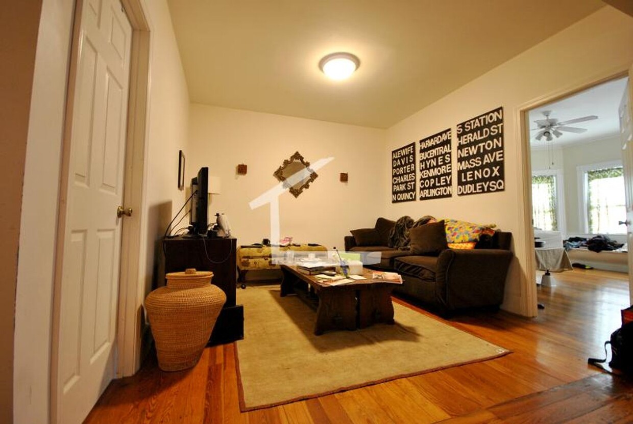
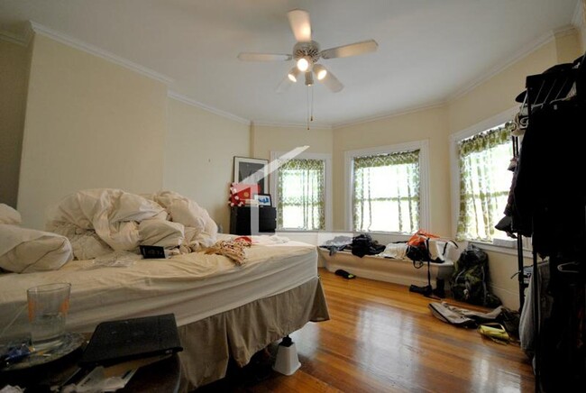
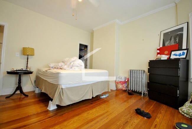
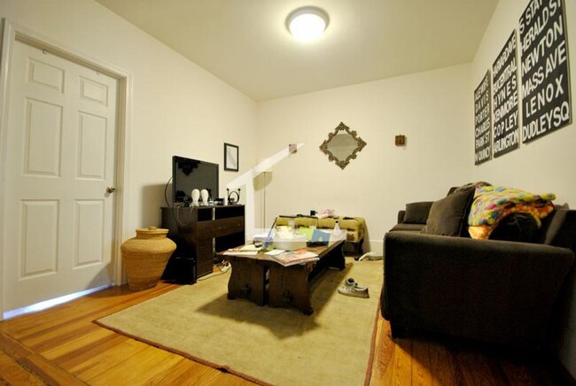
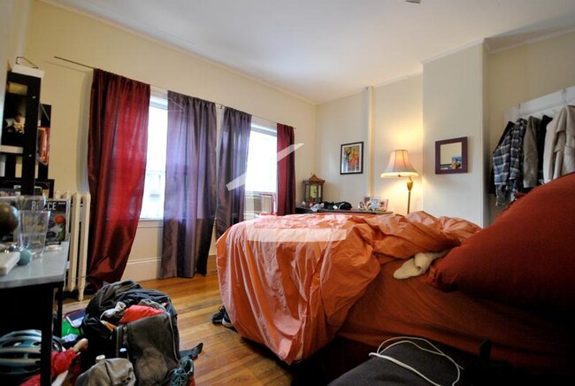
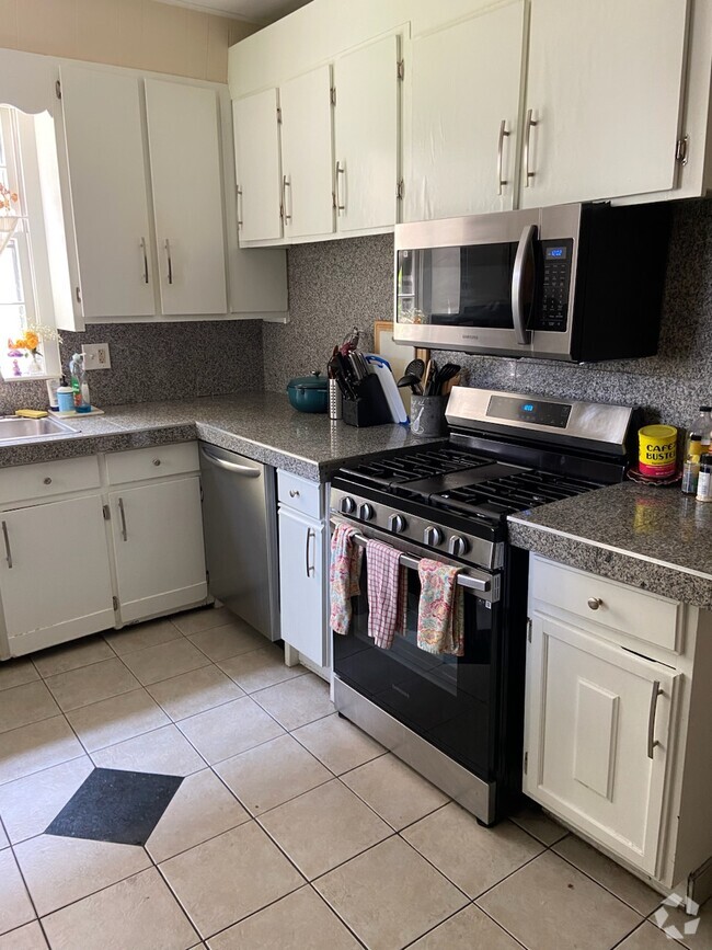
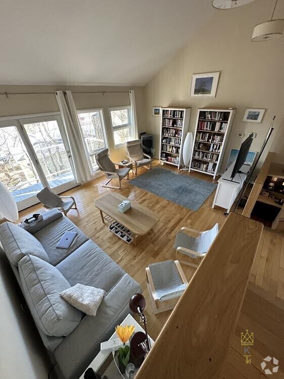
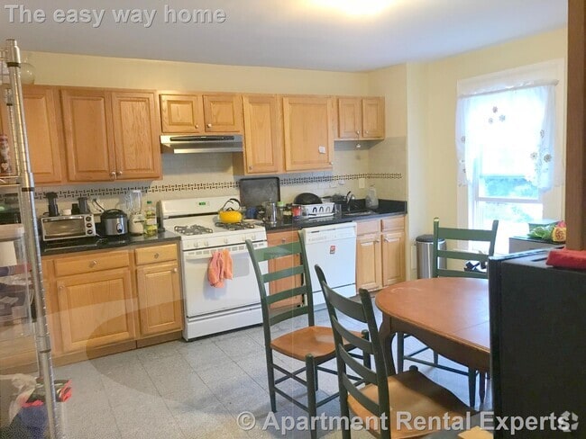
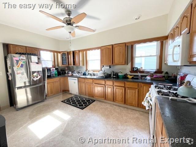
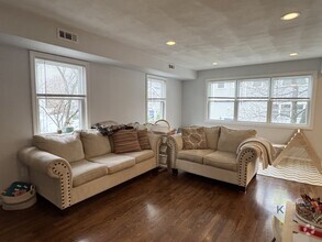
Dishwasher Fireplace (Decorative) Hardwood Cabinets Heat & Hot Water Included Living Room Top Floor Eat-In Kitchen graduate ok Hardwood Floors Large Bedrooms Laundry in basement Parking For Rent, Outdoor, $200 / Month No Pets
39 Addington Rd is a townhome located in Norfolk County and the 02445 ZIP Code. This area is served by the Brookline attendance zone.
* Price shown is base rent and may not include non-optional fees and utilities.
Price, availability, fees, and any applicable rent special are subject to change without notice.
* Square footage definitions vary. Displayed square footage is approximate.
Location
Get Directions
Washington Square’s charming, yet urban community delights residents – and it’s only seven miles from Downtown Boston. Beacon Street is where the action is, dotted with local and gourmet eateries, businesses, and coffee shops near Massachusetts Bay Transportation Authority light rail stations.
Corey Hill Outlook Park and Schick Park provide residents two great locations for outdoor recreational activities. Both are about equal distance from Washington Square Station and feature a playground. In addition to popular restaurants like the Publick House and La Voile, staff and students appreciate the short commute to Boston University.
Learn more about living in Washington Square
Education
| Colleges & Universities | Distance | ||
|---|---|---|---|
| Colleges & Universities | Distance | ||
| Drive: | 6 min | 2.4 mi | |
| Drive: | 6 min | 2.7 mi | |
| Drive: | 6 min | 2.7 mi | |
| Drive: | 6 min | 2.7 mi |
39 Addington Rd is within 6 minutes or 2.7 miles from Boston University. It is also near Boston College, Brighton and Simmons College.
Schools


Public Elementary & Middle School
Grades PK-8
508 Students
Attendance Zone
Public High School
Grades 9-12
2,087 Students
Attendance Zone
Private Elementary & Middle School
Grades PK-8
274 Students
Nearby
Private Elementary School
Grades K-5
450 Students
Nearby
School data provided by
 The GreatSchools Rating helps parents compare schools within a state based on a variety of school quality indicators and provides a helpful picture of how effectively each school serves all of its students. Ratings are on a scale of 1 (below average) to 10 (above average) and can include test scores, college readiness, academic progress, advanced courses, equity, discipline and attendance data. We also advise parents to visit schools, consider other information on school performance and programs, and consider family needs as part of the school selection process.
View GreatSchools Rating Methodology
View GreatSchools Rating Methodology
Transportation options available in Brookline include Tappan Street Station, located 0.4 mile from 39 Addington Rd. 39 Addington Rd is near General Edward Lawrence Logan International, located 8.5 miles or 19 minutes away.
| Transit / Subway | Distance | ||
|---|---|---|---|
| Transit / Subway | Distance | ||
|
|
Walk: | 7 min | 0.4 mi |
|
|
Walk: | 8 min | 0.4 mi |
|
|
Walk: | 10 min | 0.5 mi |
|
|
Walk: | 10 min | 0.5 mi |
|
|
Drive: | 3 min | 1.2 mi |
| Commuter Rail | Distance | ||
|---|---|---|---|
| Commuter Rail | Distance | ||
|
|
Drive: | 8 min | 3.0 mi |
|
|
Drive: | 10 min | 3.7 mi |
|
|
Drive: | 12 min | 4.2 mi |
|
|
Drive: | 10 min | 4.3 mi |
| Drive: | 12 min | 5.5 mi |
| Airports | Distance | ||
|---|---|---|---|
| Airports | Distance | ||
|
General Edward Lawrence Logan International
|
Drive: | 19 min | 8.5 mi |
Time and distance from 39 Addington Rd.
| Shopping Centers | Distance | ||
|---|---|---|---|
| Shopping Centers | Distance | ||
| Walk: | 7 min | 0.4 mi | |
| Walk: | 15 min | 0.8 mi | |
| Drive: | 6 min | 2.3 mi |
39 Addington Rd has 3 shopping centers within 2.3 miles, which is about a 6-minute walk. The miles and minutes will be for the farthest away property.
| Parks and Recreation | Distance | ||
|---|---|---|---|
| Parks and Recreation | Distance | ||
|
Frederick Law Olmsted National Historic Site
|
Drive: | 4 min | 1.2 mi |
|
Chestnut Hill Reservation
|
Drive: | 3 min | 1.4 mi |
|
John Fitzgerald Kennedy National Historic Site
|
Drive: | 4 min | 1.6 mi |
|
Coit Observatory
|
Drive: | 7 min | 3.2 mi |
|
Charles River Reservation
|
Drive: | 8 min | 3.5 mi |
39 Addington Rd has 5 parks within 3.5 miles, including Chestnut Hill Reservation, Frederick Law Olmsted National Historic Site, and John Fitzgerald Kennedy National Historic Site.
| Hospitals | Distance | ||
|---|---|---|---|
| Hospitals | Distance | ||
| Drive: | 5 min | 1.7 mi | |
| Drive: | 5 min | 1.7 mi | |
| Drive: | 5 min | 2.1 mi |
39 Addington Rd has 3 hospitals within 2.1 miles, the nearest is Franciscan Children's Hospital & Rehab Center which is 1.7 miles away and a 5 minute drive.
| Military Bases | Distance | ||
|---|---|---|---|
| Military Bases | Distance | ||
| Drive: | 25 min | 14.1 mi | |
| Drive: | 31 min | 15.0 mi |
39 Addington Rd is 14.1 miles from US Military Reservation, and is convenient to other military bases, including Hanscom Air Force Base.
You May Also Like
Similar Rentals Nearby


What Are Walk Score®, Transit Score®, and Bike Score® Ratings?
Walk Score® measures the walkability of any address. Transit Score® measures access to public transit. Bike Score® measures the bikeability of any address.
What is a Sound Score Rating?
A Sound Score Rating aggregates noise caused by vehicle traffic, airplane traffic and local sources

39 Addington Rd
Brookline, MA 02445