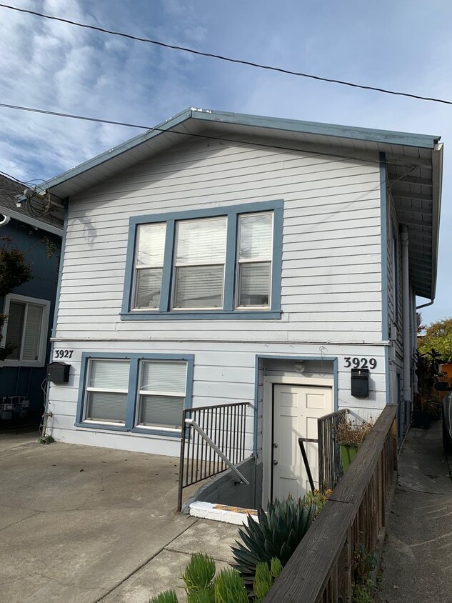
-
Monthly Rent
$2,195
-
Bedrooms
2 bd
-
Bathrooms
1 ba
-
Square Feet
Details

 This Property
 Available Property
Conveniently positioned in North Oakland at the junction of Interstates 580 and 980, Mosswood is a delightful neighborhood with a quirky personality. The community is mainly residential, with a full network of tree-lined sidewalks allowing residents to walk to the neighborhood’s various shops and cafes with ease.
On the southeast corner of the neighborhood, Mosswood Park is a terrific place to unwind, with playgrounds, sports fields, and a popular community amphitheater. Several branches of the Kaiser Permanente Medical Center are located within easy walking distance of the neighborhood, making Mosswood a highly convenient place for healthcare professionals to live.
Learn more about living in Mosswood| Colleges & Universities | Distance | ||
|---|---|---|---|
| Colleges & Universities | Distance | ||
| Walk: | 14 min | 0.7 mi | |
| Drive: | 6 min | 2.5 mi | |
| Drive: | 9 min | 3.2 mi | |
| Drive: | 8 min | 3.5 mi |
Transportation options available in Oakland include Rockridge Station, located 1.6 miles from 3927-3929 Ruby St Unit 3929 Ruby St. 3927-3929 Ruby St Unit 3929 Ruby St is near Metro Oakland International, located 11.2 miles or 19 minutes away, and San Francisco International, located 23.0 miles or 36 minutes away.
| Transit / Subway | Distance | ||
|---|---|---|---|
| Transit / Subway | Distance | ||
|
|
Drive: | 5 min | 1.6 mi |
|
|
Drive: | 4 min | 1.8 mi |
|
|
Drive: | 5 min | 2.0 mi |
|
|
Drive: | 4 min | 2.1 mi |
|
|
Drive: | 6 min | 2.2 mi |
| Commuter Rail | Distance | ||
|---|---|---|---|
| Commuter Rail | Distance | ||
|
|
Drive: | 6 min | 2.3 mi |
|
|
Drive: | 7 min | 2.9 mi |
|
|
Drive: | 9 min | 5.3 mi |
| Drive: | 17 min | 10.6 mi | |
| Drive: | 19 min | 11.8 mi |
| Airports | Distance | ||
|---|---|---|---|
| Airports | Distance | ||
|
Metro Oakland International
|
Drive: | 19 min | 11.2 mi |
|
San Francisco International
|
Drive: | 36 min | 23.0 mi |
Time and distance from 3927-3929 Ruby St Unit 3929 Ruby St.
| Shopping Centers | Distance | ||
|---|---|---|---|
| Shopping Centers | Distance | ||
| Walk: | 3 min | 0.2 mi | |
| Walk: | 8 min | 0.4 mi | |
| Walk: | 10 min | 0.5 mi |
| Parks and Recreation | Distance | ||
|---|---|---|---|
| Parks and Recreation | Distance | ||
|
Morcom Rose Garden
|
Drive: | 4 min | 1.3 mi |
|
Lakeside Park
|
Drive: | 4 min | 1.8 mi |
|
Rotary Nature Center
|
Drive: | 5 min | 2.2 mi |
|
Lakeside Park Garden Center
|
Drive: | 4 min | 2.2 mi |
|
Juan Bautista de Anza National Historic Trail
|
Drive: | 6 min | 2.5 mi |
| Hospitals | Distance | ||
|---|---|---|---|
| Hospitals | Distance | ||
| Walk: | 9 min | 0.5 mi | |
| Walk: | 11 min | 0.6 mi | |
| Walk: | 18 min | 1.0 mi |
| Military Bases | Distance | ||
|---|---|---|---|
| Military Bases | Distance | ||
| Drive: | 14 min | 5.1 mi | |
| Drive: | 14 min | 5.6 mi |
You May Also Like
Similar Rentals Nearby
What Are Walk Score®, Transit Score®, and Bike Score® Ratings?
Walk Score® measures the walkability of any address. Transit Score® measures access to public transit. Bike Score® measures the bikeability of any address.
What is a Sound Score Rating?
A Sound Score Rating aggregates noise caused by vehicle traffic, airplane traffic and local sources
