$3,500 / Month
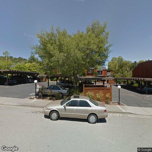
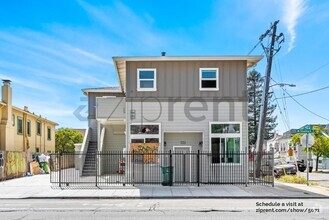
4 Cielo Ln
Novato, CA 94949
2 Weeks Ago
Favorites
4 Cielo Ln Unit 5

Favorites
Check Back Soon for Upcoming Availability
| Beds | Baths | Average SF |
|---|---|---|
| 2 Bedrooms 2 Bedrooms 2 Br | 1 Bath 1 Bath 1 Ba | 1,160 SF |
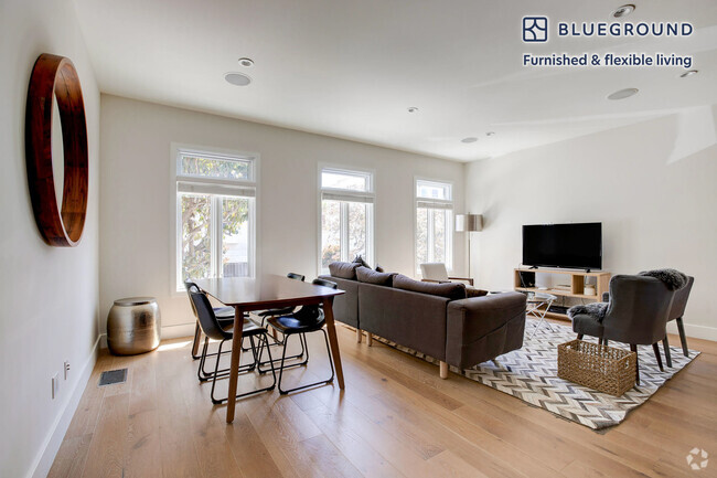
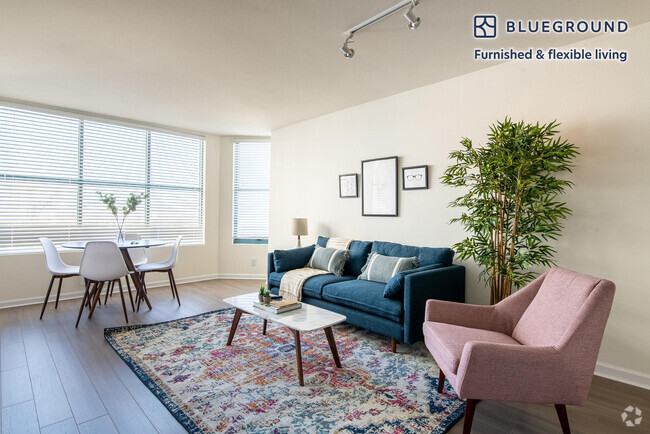
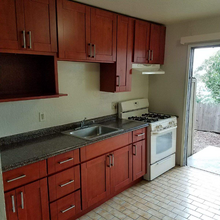
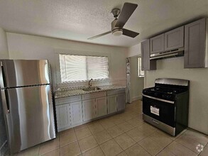
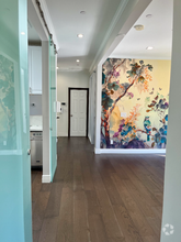
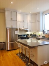
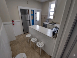
About This Property
MLS# Listing provided by Matthew Greenberg Lic.#
4 Cielo Ln is a condo located in Marin County and the 94949 ZIP Code. This area is served by the Novato Unified attendance zone.
Fees and Policies
The fees below are based on community-supplied data and may exclude additional fees and utilities.
- Parking
-
Covered--
Property Address:
4 Cielo Ln,
Novato,
CA
94949
Situated along San Pablo Bay north of San Rafael, Novato is a stunning city with fantastic views of the bay and the mountains. It is directly east of Point Reyes National Seashore, a spectacular park covering more than 71,000 acres on the Point Reyes Peninsula. This is the place to go for whale-watching, visiting the Point Reyes Lighthouse, and hiking (see the views from Arch Rock or walk the 308 steps to the lighthouse).
Being part of the San Francisco Bay area, Novato feels country cool with an urban edge. It is home to some major companies, such as BioMarin Pharmaceutical and SPG Solar, and it offers fantastic shops and restaurants in its historic and trendy downtown, wrapped around Grant Avenue. Must-visits include the Novato History Museum, the Marin Museum of Contemporary Art, the San Pablo Bay National Wildlife Refuge, and Olompali State Historic Park.
Learn more about living in Novato
Education
| Colleges & Universities | Distance | ||
|---|---|---|---|
| Colleges & Universities | Distance | ||
| Drive: | 11 min | 7.3 mi | |
| Drive: | 25 min | 17.5 mi | |
| Drive: | 31 min | 20.5 mi | |
| Drive: | 32 min | 21.6 mi |
4 Cielo Ln Unit 5 is within 11 minutes or 7.3 miles from Dominican Univ. of Ca. It is also near Santa Rosa Jr Coll., Petaluma and Contra Costa College.
Schools
Public Elementary School
Grades K-5
99 Students
Nearby
Public Elementary & Middle School
Grades K-8
531 Students
Nearby
4
Out of 10
Public Elementary School
Grades K-5
429 Students
Attendance Zone
7
Out of 10
Public High School
Grades 9-12
1,458 Students
Attendance Zone
7
Out of 10
Private Elementary School
Grades PK-2
Nearby
Private Elementary, Middle & High School
Grades K-12
Nearby
School data provided by
GreatSchools
The GreatSchools Rating helps parents compare schools within a state based on a variety of school quality indicators and provides a helpful picture of how effectively each school serves all of its students. Ratings are on a scale of 1 (below average) to 10 (above average) and can include test scores, college readiness, academic progress, advanced courses, equity, discipline and attendance data. We also advise parents to visit schools, consider other information on school performance and programs, and consider family needs as part of the school selection process.
Transportation options available in Novato include Richmond Station, located 17.7 miles from 4 Cielo Ln Unit 5. 4 Cielo Ln Unit 5 is near San Francisco International, located 37.4 miles or 57 minutes away, and Metro Oakland International, located 37.5 miles or 50 minutes away.
| Transit / Subway | Distance | ||
|---|---|---|---|
| Transit / Subway | Distance | ||
|
|
Drive: | 25 min | 17.7 mi |
|
|
Drive: | 28 min | 19.2 mi |
|
|
Drive: | 29 min | 21.1 mi |
|
|
Drive: | 35 min | 23.0 mi |
|
|
Drive: | 36 min | 23.4 mi |
| Commuter Rail | Distance | ||
|---|---|---|---|
| Commuter Rail | Distance | ||
| Drive: | 5 min | 2.1 mi | |
| Drive: | 5 min | 4.3 mi | |
| Drive: | 9 min | 4.9 mi | |
| Drive: | 9 min | 5.6 mi | |
| Drive: | 9 min | 6.7 mi |
| Airports | Distance | ||
|---|---|---|---|
| Airports | Distance | ||
|
San Francisco International
|
Drive: | 57 min | 37.4 mi |
|
Metro Oakland International
|
Drive: | 50 min | 37.5 mi |
Time and distance from 4 Cielo Ln Unit 5.
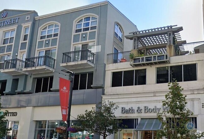
| Shopping Centers | Distance | ||
|---|---|---|---|
| Shopping Centers | Distance | ||
| Walk: | 14 min | 0.7 mi | |
| Walk: | 19 min | 1.0 mi | |
| Drive: | 4 min | 1.3 mi |
4 Cielo Ln Unit 5 has 3 shopping centers within 1.3 miles, which is about a 4-minute drive. The miles and minutes will be for the farthest away property.
| Parks and Recreation | Distance | ||
|---|---|---|---|
| Parks and Recreation | Distance | ||
|
John F. McInnis County Park
|
Drive: | 9 min | 4.6 mi |
|
Deer Island Preserve
|
Drive: | 13 min | 7.3 mi |
|
Rush Creek Preserve
|
Drive: | 13 min | 7.4 mi |
|
China Camp State Park
|
Drive: | 16 min | 8.7 mi |
|
Loma Alta Preserve
|
Drive: | 23 min | 12.2 mi |
4 Cielo Ln Unit 5 has 5 parks within 12.2 miles, including John F. McInnis County Park, Deer Island Preserve, and Rush Creek Preserve.
| Hospitals | Distance | ||
|---|---|---|---|
| Hospitals | Distance | ||
| Drive: | 8 min | 4.0 mi | |
| Drive: | 8 min | 4.6 mi | |
| Drive: | 16 min | 10.6 mi |
4 Cielo Ln Unit 5 has 3 hospitals within 10.6 miles, the nearest is Novato Community Hospital which is 4.0 miles away and a 8 minutes drive.
| Military Bases | Distance | ||
|---|---|---|---|
| Military Bases | Distance | ||
| Drive: | 30 min | 20.7 mi | |
| Drive: | 30 min | 21.0 mi |
4 Cielo Ln Unit 5 is 20.7 miles from Armory West Contra Costa, and is convenient to other military bases, including Mare Island Naval Reserve.
You May Also Like
Similar Rentals Nearby
-
-
-
-
-
 $2,1502 Beds, 1 BathApartment for Rent
 -
 $3,6353 Beds, 2 Baths, 1,127 sq ftApartment for Rent
 -
 $6,7493 Beds, 3 Baths, 1,400 sq ftApartment for Rent
 -
-
 $4,9953 Beds, 1 Bath, 730 sq ftApartment for Rent
 -
What Are Walk Score®, Transit Score®, and Bike Score® Ratings?
Walk Score® measures the walkability of any address. Transit Score® measures access to public transit. Bike Score® measures the bikeability of any address.
What is a Sound Score Rating?
A Sound Score Rating aggregates noise caused by vehicle traffic, airplane traffic and local sources

4 Cielo Ln
Novato, CA 94949