4 High St
4 High St,
North Andover,
MA
01845

Check Back Soon for Upcoming Availability
About 4 High St North Andover, MA 01845
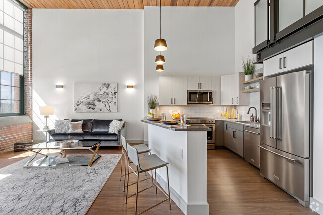
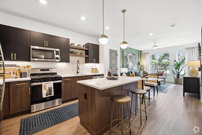
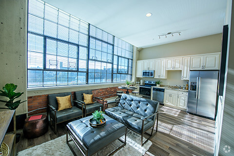
Stunning 3 bedroom loft in North Andover! The newly constructed lofts feature a large kitchen with granite countertops, stainless steel appliances and hardwood floors. Lots of exposed brick, large windows and a W/D make these lofts the new 'it place' to live in the Andovers. Fitness center and parking included! Check out NALofts.com
4 High St is an apartment community located in Essex County and the 01845 ZIP Code.
Apartment Features
- Washer/Dryer
- Smoke Free
Fees and Policies
The fees below are based on community-supplied data and may exclude additional fees and utilities.
- Dogs Allowed
-
Fees not specified
- Cats Allowed
-
Fees not specified
- Parking
-
Surface Lot--
Details
Lease Options
-
12 Months
Property Information
-
4 units
- Washer/Dryer
- Smoke Free
| Colleges & Universities | Distance | ||
|---|---|---|---|
| Colleges & Universities | Distance | ||
| Drive: | 7 min | 2.8 mi | |
| Drive: | 19 min | 11.9 mi | |
| Drive: | 21 min | 12.4 mi | |
| Drive: | 22 min | 13.4 mi |
Transportation options available in North Andover include Oak Grove Station, located 20.0 miles from 4 High St. 4 High St is near Manchester Boston Regional, located 28.7 miles or 47 minutes away, and General Edward Lawrence Logan International, located 31.4 miles or 45 minutes away.
| Transit / Subway | Distance | ||
|---|---|---|---|
| Transit / Subway | Distance | ||
|
|
Drive: | 34 min | 20.0 mi |
|
|
Drive: | 34 min | 24.9 mi |
| Drive: | 35 min | 25.1 mi | |
| Drive: | 35 min | 25.6 mi | |
|
|
Drive: | 37 min | 26.2 mi |
| Commuter Rail | Distance | ||
|---|---|---|---|
| Commuter Rail | Distance | ||
|
|
Drive: | 4 min | 1.8 mi |
|
|
Drive: | 8 min | 3.9 mi |
|
|
Drive: | 14 min | 6.1 mi |
|
|
Drive: | 13 min | 6.3 mi |
|
|
Drive: | 13 min | 8.3 mi |
| Airports | Distance | ||
|---|---|---|---|
| Airports | Distance | ||
|
Manchester Boston Regional
|
Drive: | 47 min | 28.7 mi |
|
General Edward Lawrence Logan International
|
Drive: | 45 min | 31.4 mi |
Time and distance from 4 High St.
| Shopping Centers | Distance | ||
|---|---|---|---|
| Shopping Centers | Distance | ||
| Walk: | 7 min | 0.4 mi | |
| Walk: | 14 min | 0.7 mi | |
| Drive: | 4 min | 1.5 mi |
| Parks and Recreation | Distance | ||
|---|---|---|---|
| Parks and Recreation | Distance | ||
|
Stevens-Coolidge Place
|
Drive: | 4 min | 1.8 mi |
|
Lawrence Heritage State Park
|
Drive: | 5 min | 2.4 mi |
|
Smolak Farms
|
Drive: | 10 min | 4.0 mi |
|
Bradford Ski Area
|
Drive: | 18 min | 6.1 mi |
|
Windrush Farm
|
Drive: | 17 min | 6.9 mi |
| Hospitals | Distance | ||
|---|---|---|---|
| Hospitals | Distance | ||
| Drive: | 9 min | 4.1 mi | |
| Drive: | 15 min | 9.2 mi |
| Military Bases | Distance | ||
|---|---|---|---|
| Military Bases | Distance | ||
| Drive: | 41 min | 20.5 mi | |
| Drive: | 47 min | 23.6 mi | |
| Drive: | 39 min | 26.8 mi |
You May Also Like
Similar Rentals Nearby
What Are Walk Score®, Transit Score®, and Bike Score® Ratings?
Walk Score® measures the walkability of any address. Transit Score® measures access to public transit. Bike Score® measures the bikeability of any address.
What is a Sound Score Rating?
A Sound Score Rating aggregates noise caused by vehicle traffic, airplane traffic and local sources


