

$3,600 - $4,800 / Month
4 School St
Boston, MA 02119
2 Weeks Ago
Favorites
-
Bedrooms
2 - 4
-
Bathrooms
2 - 3
-
Square Feet
900 - 9,999 sq ft
-
Available
Available Now
Highlight
- Pets Allowed
4 School St

Favorites
2 Available Units
1
$3,600
2 beds,
2 baths,
900 sq ft
12 Month Lease, $3,600 deposit,
Available Now
2
$4,800
4 beds,
3 baths,
9,999 sq ft
12 Month Lease, $4,800 deposit,
Sep 1
* Price shown is base rent and may not include non-optional fees and utilities.
Price, availability, fees, and any applicable rent special are subject to change without notice.
* Square footage definitions vary. Displayed square footage is approximate.
About 4 School St Boston, MA 02119
12 Month Lease,
$3,600 deposit,
Available Now
Wonderful location in the heart of Jamaica Plain between Jamaica Pond and Franklin Park! Close to Egleston Square, Hyde Square, and Jackson Square, as well as shopping, dining, and more on trendy Centre Street! Easy access to Orange Line with Stony Brook station just minutes away as well as multiple major MBTA bus routes! Convenient to many local schools and universities including Northeastern, Simmons, Berklee, Emmauel, Wheelock, Mass College of Pharmacy, NE Conservatory, School of The Museum of Fine Arts, Mass College of Art, Wentworth, Roxbury Community College, Boston Architectural College, Boston Latin High School, Harvard Medical School, and more! Nearby Longwood Medical Area's many hospitals such as Brigham & Women's, Beth Israel, Children's Hospital as well as NE Baptist, Dimmock Commuinity Health, and VA Medical Center. A great location to call home!
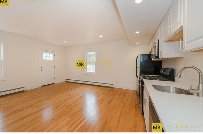
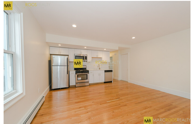
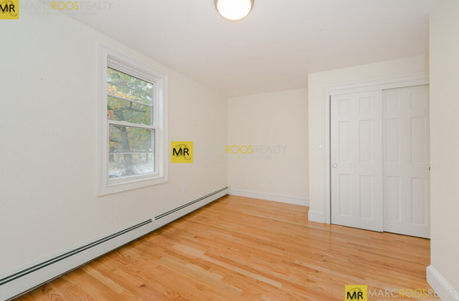
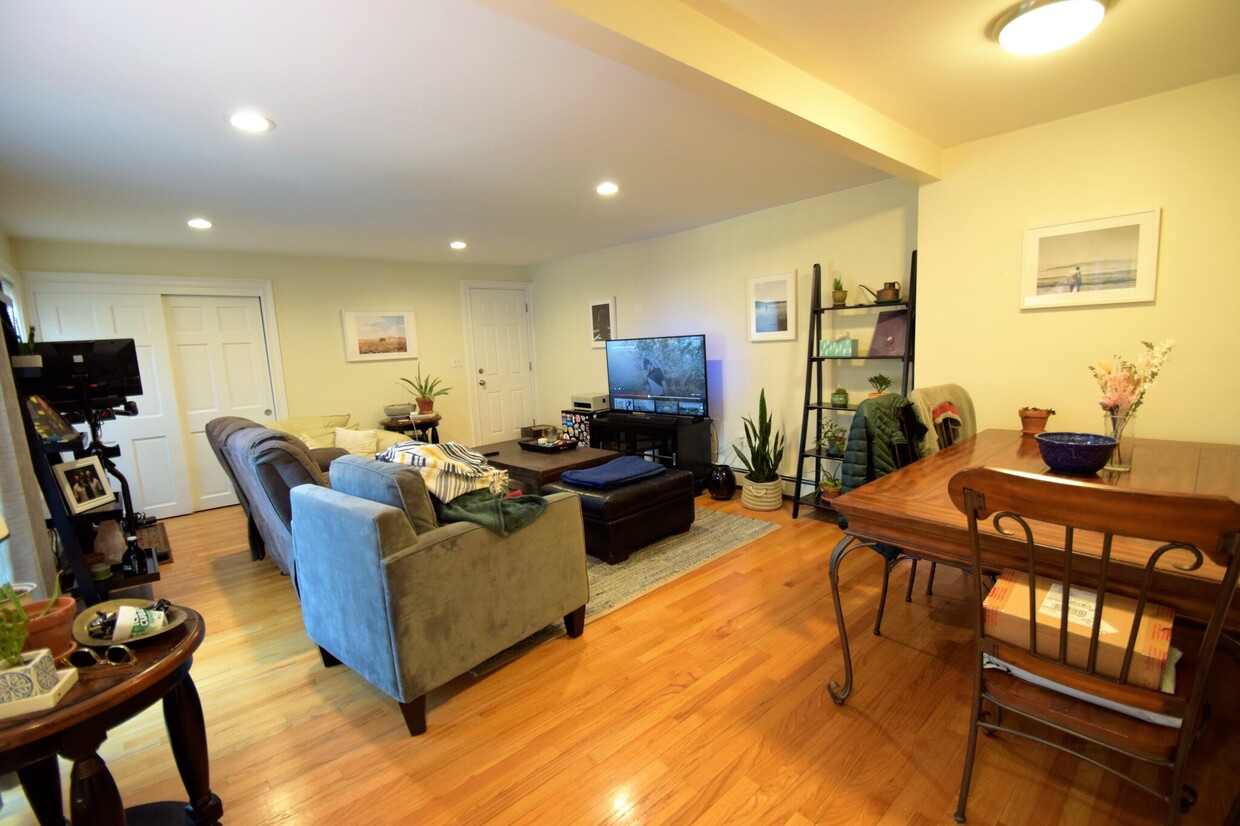
IMMEDIATELY MOVE IN !! Renovated 1st floor unit in Jamaica Plain with private front entrance that features: - Hardwood flooring shining throughout! - High end, fully quipped kitchen! - Stainless appliances inc dishwasher! - Open concept floorplan w/ high ceilings! - Spacious & sun drenched living room! - 2 very generously sized bedrooms! - Ample closet & storage space! - 2 luxuriously updated full bathrooms! - In unit stacked washer & dryer! - Side door to shared patio & yard!
4 School St is a condo located in Suffolk County and the 02119 ZIP Code.
* Price shown is base rent and may not include non-optional fees and utilities.
Price, availability, fees, and any applicable rent special are subject to change without notice.
* Square footage definitions vary. Displayed square footage is approximate.
Condo Features
- Washer/Dryer
- Pond
Fees and Policies
The fees below are based on community-supplied data and may exclude additional fees and utilities.
- Dogs Allowed
-
Fees not specified
- Cats Allowed
-
Fees not specified
Details
Utilities Included
-
Water
Property Information
-
2 units
Contact
- Listed by Sunny Kim
- Contact
Location
Get Directions
The tree-lined streets of Egleston Square are full of big, beautiful Victorian-style homes and vintage red brick buildings, an architectural feast for the eyes. The diverse population brings an eclectic mix of artistic, cultural, and culinary influences to the community, resulting in one of the more unique neighborhood personalities in Boston.
Residents enjoy enviable access to Franklin Park, which borders the neighborhood to the southeast; White Stadium, Franklin Park Playstead, and the trail network are just a short walk from anywhere in Egleston Square. One of the most popular attractions is the Samuel Adams brewery on the west side of the neighborhood, which is as popular with locals as it is with visitors.
Be sure to stop by the Saturday farmers’ market throughout the summer… it’s the best place to find fresh groceries, food trucks, local art, and live music all in one place.
Learn more about living in Egleston Square
Education
| Colleges & Universities | Distance | ||
|---|---|---|---|
| Colleges & Universities | Distance | ||
| Drive: | 4 min | 2.0 mi | |
| Drive: | 4 min | 2.4 mi | |
| Drive: | 4 min | 2.5 mi | |
| Drive: | 6 min | 2.8 mi |
4 School St is within 4 minutes or 2.0 miles from Wentworth Inst. of Technology. It is also near MCPHS University, Boston and MassArt.
Transportation options available in Boston include Stony Brook Station, located 0.6 mile from 4 School St. 4 School St is near General Edward Lawrence Logan International, located 7.3 miles or 14 minutes away.
| Transit / Subway | Distance | ||
|---|---|---|---|
| Transit / Subway | Distance | ||
|
|
Walk: | 11 min | 0.6 mi |
|
|
Walk: | 14 min | 0.8 mi |
|
|
Walk: | 18 min | 0.9 mi |
|
|
Drive: | 3 min | 1.6 mi |
|
|
Drive: | 3 min | 1.7 mi |
| Commuter Rail | Distance | ||
|---|---|---|---|
| Commuter Rail | Distance | ||
| Drive: | 4 min | 1.6 mi | |
|
|
Drive: | 3 min | 1.7 mi |
| Drive: | 5 min | 2.1 mi | |
|
|
Drive: | 5 min | 2.5 mi |
|
|
Drive: | 5 min | 2.7 mi |
| Airports | Distance | ||
|---|---|---|---|
| Airports | Distance | ||
|
General Edward Lawrence Logan International
|
Drive: | 14 min | 7.3 mi |
Time and distance from 4 School St.
| Shopping Centers | Distance | ||
|---|---|---|---|
| Shopping Centers | Distance | ||
| Walk: | 17 min | 0.9 mi | |
| Drive: | 3 min | 1.6 mi | |
| Drive: | 5 min | 2.5 mi |
4 School St has 3 shopping centers within 2.5 miles, which is about a 5-minute walk. The miles and minutes will be for the farthest away property.
| Parks and Recreation | Distance | ||
|---|---|---|---|
| Parks and Recreation | Distance | ||
|
Lower Neponset River Trail
|
Walk: | 17 min | 0.9 mi |
|
Franklin Park Zoo
|
Walk: | 17 min | 0.9 mi |
|
Roxbury Heritage State Park
|
Drive: | 3 min | 1.9 mi |
|
Mass Audubon's Boston Nature Center and Wildlife Sanctuary
|
Drive: | 7 min | 2.7 mi |
|
Arnold Arboretum of Harvard University
|
Drive: | 6 min | 3.2 mi |
4 School St has 5 parks within 3.2 miles, including Lower Neponset River Trail, Franklin Park Zoo, and Roxbury Heritage State Park.
| Hospitals | Distance | ||
|---|---|---|---|
| Hospitals | Distance | ||
| Drive: | 4 min | 1.4 mi | |
| Drive: | 4 min | 1.9 mi | |
| Drive: | 4 min | 2.2 mi |
4 School St has 3 hospitals within 2.2 miles, the nearest is Arbour Hospital which is 1.4 miles away and a 4 minute drive.
| Military Bases | Distance | ||
|---|---|---|---|
| Military Bases | Distance | ||
| Drive: | 30 min | 17.2 mi |
4 School St is 17.2 miles and a 30 minute drive from US Military Reservation.
Amenities
- Washer/Dryer
- Pond
4 School St Photos
Which floor plans are available, and what are the price ranges?
4 School St Boston, MA 02119 has two to four bedrooms with rent ranges from $3,600/mo. to $4,800/mo.
Can I see a model or tour available condos at 4 School St Boston, MA 02119?
Yes, to view the floor plan in person, please schedule a personal tour.
What neighborhood is the property located in?
4 School St Boston, MA 02119 is in Egleston Square in the city of Boston. Here you’ll find three shopping centers within 2.5 miles of the property. Five parks are within 3.2 miles, including Lower Neponset River Trail, Franklin Park Zoo, and Roxbury Heritage State Park.
What Are Walk Score®, Transit Score®, and Bike Score® Ratings?
Walk Score® measures the walkability of any address. Transit Score® measures access to public transit. Bike Score® measures the bikeability of any address.
What is a Sound Score Rating?
A Sound Score Rating aggregates noise caused by vehicle traffic, airplane traffic and local sources
4 School St
Boston, MA 02119