-
Monthly Rent
$2,000
-
Bedrooms
3 bd
-
Bathrooms
2 ba
-
Square Feet
Details

About This Property
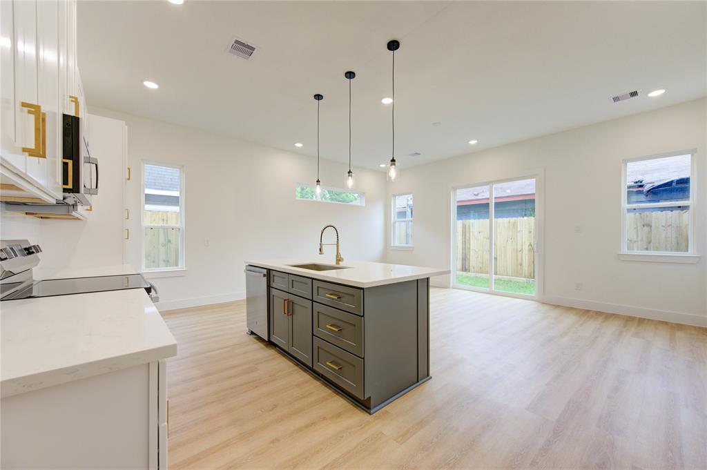
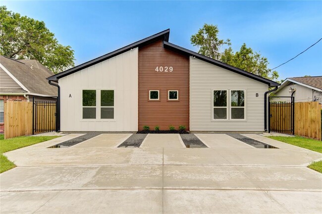
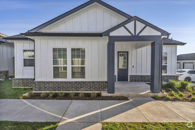
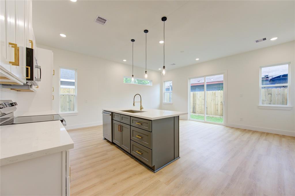
Beautiful Duplex with modern finishes. This 3 bedrooms 2 bath has an open concept, granite and small backyard low maintenance. Centrally located to University of Houston, Medical Center and Downtown.
4029 Knoxville St is a house located in Harris County and the 77051 ZIP Code. This area is served by the Houston Independent attendance zone.
Unique Features
- NewConstruction
Contact
House Features
Dishwasher
Microwave
Disposal
Smoke Free
- Smoke Free
- Dishwasher
- Disposal
- Microwave
Fees and Policies
Details
Lease Options
-
12 Months
 This Property
 Available Property
- Smoke Free
- Dishwasher
- Disposal
- Microwave
- NewConstruction
Nestled just eight miles south of Downtown Houston, residents of Sunnyside find its close proximity to city attractions and low cost of living attractive. The community borders the 610 Loop and is inside the Beltway 8, making it simple for locals to commute to work.
There’s definitely a suburban vibe to the area. Students of Sunnyside are zoned to the Houston Independent School District. Residents look forward to the amenities at Sunnyside Park, including the playground, sports courts, walking/biking trails, and the gym that’s located in the community center.
Cullen Boulevard and Reed Road house many local restaurants and quick-bite establishments. It’s only a short ride to Houston attractions like the zoo, aquarium, and the Children’s Museum of Houston. Need to get to William P. Hobby Airport? You’re only a 15-minute drive away.
Learn more about living in Sunnyside| Colleges & Universities | Distance | ||
|---|---|---|---|
| Colleges & Universities | Distance | ||
| Drive: | 9 min | 4.7 mi | |
| Drive: | 9 min | 5.0 mi | |
| Drive: | 10 min | 5.1 mi | |
| Drive: | 11 min | 5.3 mi |
Transportation options available in Houston include Fannin South, located 2.7 miles from 4029 Knoxville St. 4029 Knoxville St is near William P Hobby, located 9.2 miles or 20 minutes away, and George Bush Intcntl/Houston, located 26.1 miles or 36 minutes away.
| Transit / Subway | Distance | ||
|---|---|---|---|
| Transit / Subway | Distance | ||
|
|
Drive: | 5 min | 2.7 mi |
|
|
Drive: | 6 min | 3.6 mi |
| Drive: | 7 min | 4.0 mi | |
|
|
Drive: | 8 min | 4.3 mi |
|
|
Drive: | 10 min | 5.6 mi |
| Commuter Rail | Distance | ||
|---|---|---|---|
| Commuter Rail | Distance | ||
|
|
Drive: | 15 min | 8.9 mi |
| Airports | Distance | ||
|---|---|---|---|
| Airports | Distance | ||
|
William P Hobby
|
Drive: | 20 min | 9.2 mi |
|
George Bush Intcntl/Houston
|
Drive: | 36 min | 26.1 mi |
Time and distance from 4029 Knoxville St.
| Shopping Centers | Distance | ||
|---|---|---|---|
| Shopping Centers | Distance | ||
| Walk: | 15 min | 0.8 mi | |
| Walk: | 17 min | 0.9 mi | |
| Walk: | 18 min | 1.0 mi |
| Parks and Recreation | Distance | ||
|---|---|---|---|
| Parks and Recreation | Distance | ||
|
Houston Zoo
|
Drive: | 9 min | 4.9 mi |
|
Children's Museum of Houston
|
Drive: | 9 min | 5.1 mi |
|
Hermann Park
|
Drive: | 10 min | 5.2 mi |
|
Houston Maritime Museum
|
Drive: | 10 min | 5.4 mi |
|
Cockrell Butterfly Center
|
Drive: | 10 min | 5.6 mi |
| Hospitals | Distance | ||
|---|---|---|---|
| Hospitals | Distance | ||
| Drive: | 6 min | 2.9 mi | |
| Drive: | 8 min | 4.4 mi | |
| Drive: | 9 min | 5.0 mi |
| Military Bases | Distance | ||
|---|---|---|---|
| Military Bases | Distance | ||
| Drive: | 36 min | 24.9 mi | |
| Drive: | 64 min | 50.5 mi |
You May Also Like
Similar Rentals Nearby
-
-
-
1 / 30Single-Family Homes 2 Months Free
Pets Allowed Fitness Center Pool Refrigerator Walk-In Closets Clubhouse
-
-
$2,3254 Beds, 2.5 Baths, 2,622 sq ftHouse for Rent
-
$2,1153 Beds, 2.5 Baths, 2,127 sq ftHouse for Rent
-
$2,1754 Beds, 2 Baths, 2,125 sq ftHouse for Rent
-
-
$2,3104 Beds, 2.5 Baths, 2,542 sq ftHouse for Rent
-
$1,8153 Beds, 2.5 Baths, 1,912 sq ftHouse for Rent
What Are Walk Score®, Transit Score®, and Bike Score® Ratings?
Walk Score® measures the walkability of any address. Transit Score® measures access to public transit. Bike Score® measures the bikeability of any address.
What is a Sound Score Rating?
A Sound Score Rating aggregates noise caused by vehicle traffic, airplane traffic and local sources
