$2,800 / Month
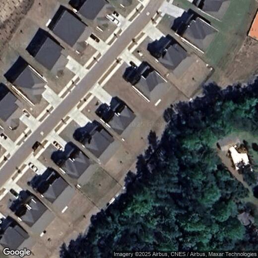
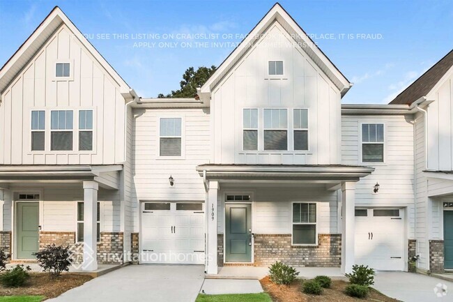
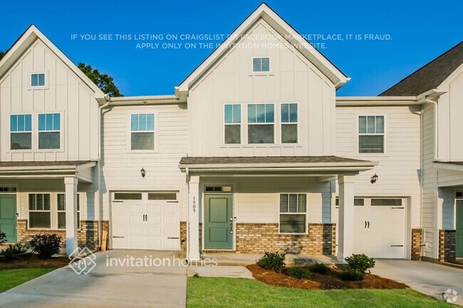
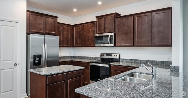
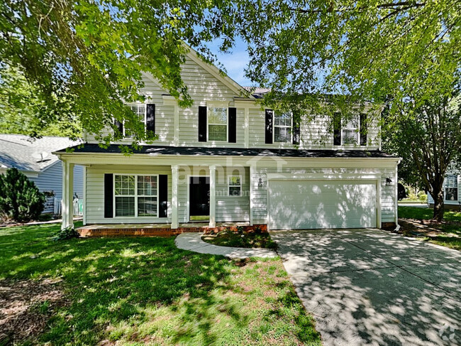
4036 Whipcord Dr
Waxhaw, NC 28173
Today
Favorites
980-800-9999
-
Bedrooms
5
-
Bathrooms
4
-
Square Feet
2,650 sq ft
-
Available
Available Jun 1
4036 Whipcord Dr

Favorites
Waxhaw is a small town positioned roughly twenty miles south of Charlotte Center City and just two miles from the South Carolina state line. While functioning mainly as a suburb of Charlotte, Waxhaw sits just far enough out in the countryside to maintain a distinctive character as a charming rural community, alive with timeless Southern Americana. Residential neighborhoods full of manicured lawns and stately homes make up much of the landscape, with a compact downtown district along North Main and South Main featuring popular cafes, cozy taverns, and unique specialty shops. Renowned for its low crime rate and terrific public schools, Waxhaw is the perfect place for Charlotte-area commuters raising families.
Learn more about living in Waxhaw
Education
| Colleges & Universities | Distance | ||
|---|---|---|---|
| Colleges & Universities | Distance | ||
| Drive: | 38 min | 18.7 mi | |
| Drive: | 41 min | 21.3 mi | |
| Drive: | 46 min | 23.1 mi | |
| Drive: | 41 min | 25.2 mi |
4036 Whipcord Dr is within 38 minutes or 18.7 miles from Central Piedmont C.C., Levine. It is also near Central Piedmont C.C., Harper and Queens University of Charlotte.
Schools


Public Elementary School
Grades PK-5
638 Students
Attendance Zone
Public Middle School
Grades 6-8
828 Students
Attendance Zone
Public High School
Grades 9-12
1,061 Students
Attendance Zone
Private Elementary & Middle School
Grades K-8
127 Students
Nearby
Private Elementary & Middle School
Grades PK-9
178 Students
Nearby
Private Elementary, Middle & High School
Grades K-12
211 Students
Nearby
School data provided by
 The GreatSchools Rating helps parents compare schools within a state based on a variety of school quality indicators and provides a helpful picture of how effectively each school serves all of its students. Ratings are on a scale of 1 (below average) to 10 (above average) and can include test scores, college readiness, academic progress, advanced courses, equity, discipline and attendance data. We also advise parents to visit schools, consider other information on school performance and programs, and consider family needs as part of the school selection process.
View GreatSchools Rating Methodology
View GreatSchools Rating Methodology
Transportation options available in Waxhaw include I-485/South Boulevard, located 19.0 miles from 4036 Whipcord Dr. 4036 Whipcord Dr is near Charlotte/Douglas International, located 28.3 miles or 52 minutes away, and Concord-Padgett Regional, located 42.6 miles or 64 minutes away.
| Transit / Subway | Distance | ||
|---|---|---|---|
| Transit / Subway | Distance | ||
|
|
Drive: | 36 min | 19.0 mi |
|
|
Drive: | 38 min | 19.8 mi |
|
|
Drive: | 39 min | 20.9 mi |
|
|
Drive: | 41 min | 22.1 mi |
|
|
Drive: | 43 min | 22.8 mi |
| Commuter Rail | Distance | ||
|---|---|---|---|
| Commuter Rail | Distance | ||
|
|
Drive: | 51 min | 26.4 mi |
|
|
Drive: | 66 min | 43.2 mi |
| Airports | Distance | ||
|---|---|---|---|
| Airports | Distance | ||
|
Charlotte/Douglas International
|
Drive: | 52 min | 28.3 mi |
|
Concord-Padgett Regional
|
Drive: | 64 min | 42.6 mi |
Time and distance from 4036 Whipcord Dr.
| Shopping Centers | Distance | ||
|---|---|---|---|
| Shopping Centers | Distance | ||
| Drive: | 8 min | 2.6 mi | |
| Drive: | 10 min | 3.7 mi | |
| Drive: | 10 min | 3.8 mi |
4036 Whipcord Dr has 3 shopping centers within 3.8 miles, which is about a 10-minute drive. The miles and minutes will be for the farthest away property.
| Parks and Recreation | Distance | ||
|---|---|---|---|
| Parks and Recreation | Distance | ||
|
Marvin Efird Park
|
Drive: | 17 min | 6.7 mi |
|
Andrew Jackson State Park
|
Drive: | 19 min | 10.8 mi |
|
Cane Creek Park
|
Drive: | 23 min | 11.5 mi |
4036 Whipcord Dr has 3 parks within 11.5 miles, including Marvin Efird Park, Andrew Jackson State Park, and Cane Creek Park.
| Hospitals | Distance | ||
|---|---|---|---|
| Hospitals | Distance | ||
| Drive: | 17 min | 8.6 mi |
4036 Whipcord Dr is 8.6 miles and a 17 minute drive from Rebound Behavioral Health.
| Military Bases | Distance | ||
|---|---|---|---|
| Military Bases | Distance | ||
| Drive: | 132 min | 93.3 mi |
4036 Whipcord Dr is 93.3 miles and a 132 minute drive from Fort Jackson.
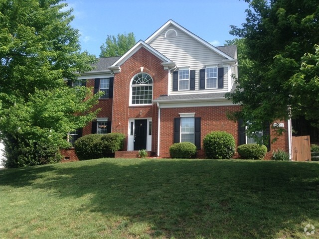
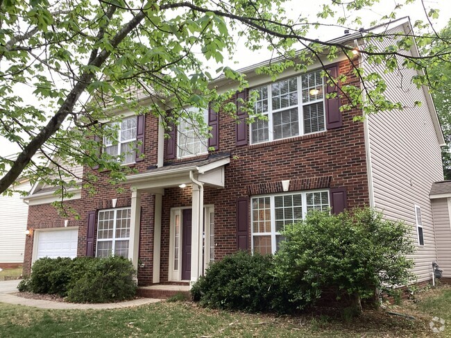
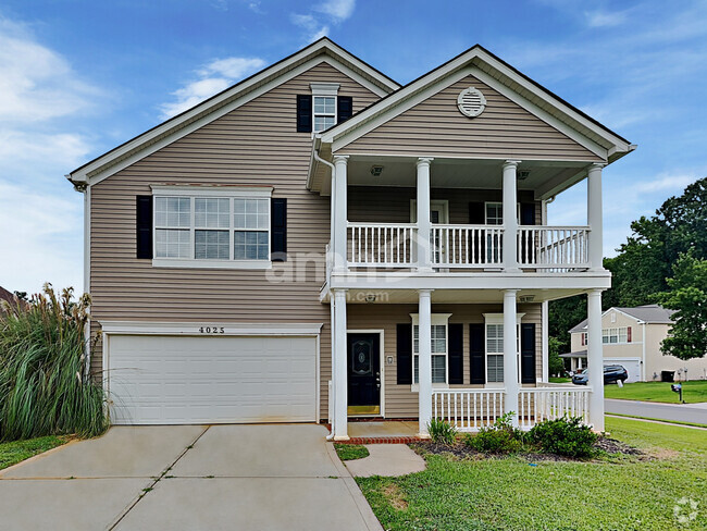
You May Also Like
Similar Rentals Nearby


What Are Walk Score®, Transit Score®, and Bike Score® Ratings?
Walk Score® measures the walkability of any address. Transit Score® measures access to public transit. Bike Score® measures the bikeability of any address.
What is a Sound Score Rating?
A Sound Score Rating aggregates noise caused by vehicle traffic, airplane traffic and local sources

4036 Whipcord Dr
Waxhaw, NC 28173