$3,295 / Month
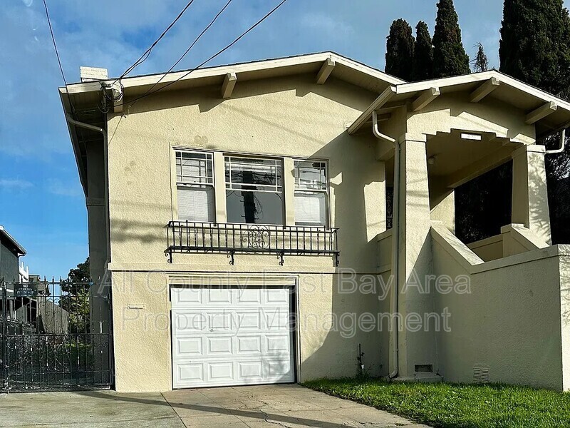
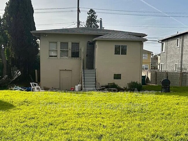
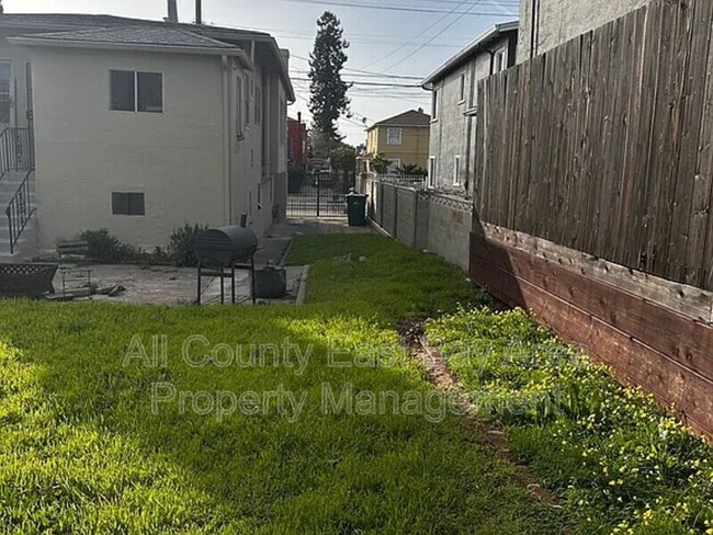
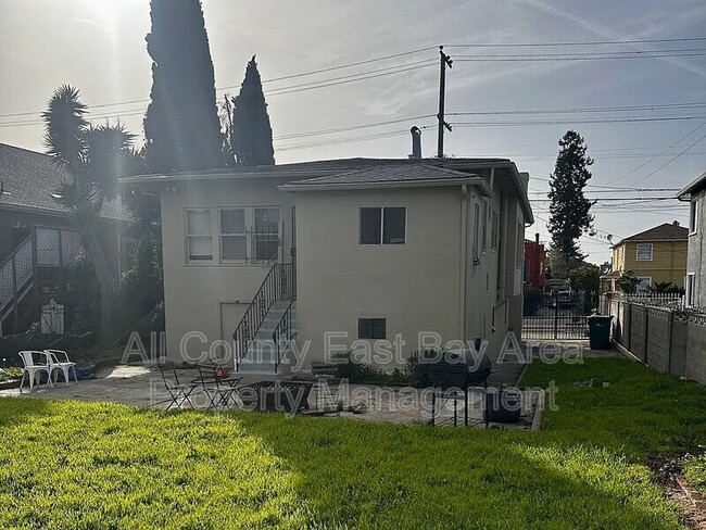
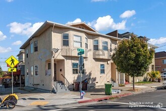
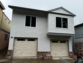
4128 West St
Oakland, CA 94608
Today
Favorites
510-900-4839
-
Bedrooms
2
-
Bathrooms
1
-
Square Feet
1,202 sq ft
-
Available
Available Now
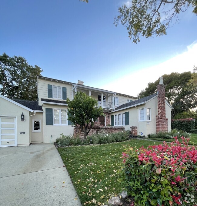
4128 West St

Favorites
About This Home
$3,295 deposit,
Available Now
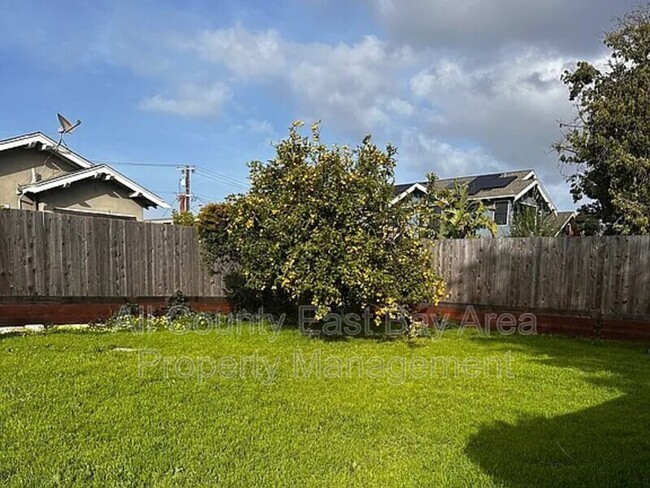
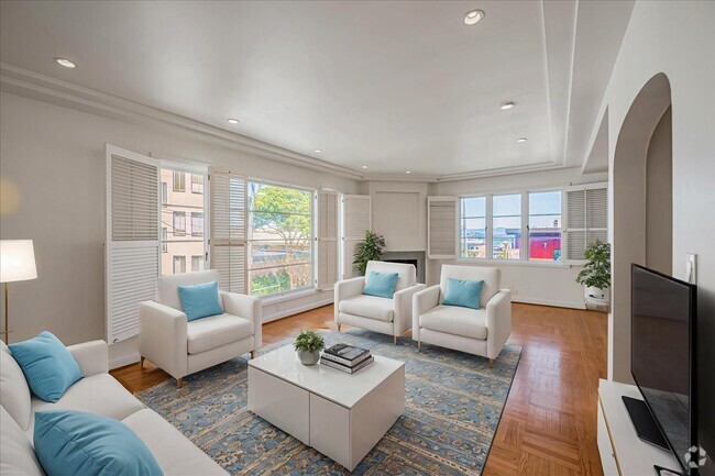
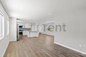
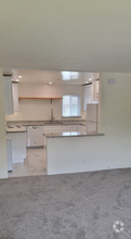
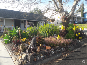
This charming 2-bedroom, 1-bath home in Emeryville offers 1,220 sq. ft. of living space with hardwood floors and tile throughout. Recently updated with a new furnace, the home also includes a washer and dryer for your convenience. There are a few bonus rooms for extra living options. Located in a prime area with easy freeway access, this home is close to BART and near plenty of shopping and dining options. Features: 3 bedrooms, 1 bathroom 1,220 sq. ft. of living space Washer & dryer included New furnace Hardwood & tile floors throughout Near BART, freeways & shopping Tenant Requirements: Good credit, rental history, and qualifying income required.
4128 West St is a house located in Alameda County and the 94608 ZIP Code. This area is served by the Oakland Unified attendance zone.
* Price shown is base rent and may not include non-optional fees and utilities.
Price, availability, fees, and any applicable rent special are subject to change without notice.
* Square footage definitions vary. Displayed square footage is approximate.
Contact
- Phone Number (510) 900-4839
- Contact
$3,025 / month
$499,000 Listing Price
3 Beds
•2 Baths
•
1,253 Sq Ft
$3,136 / month
$520,000 Listing Price
3 Beds
•1 Baths
•
926 Sq Ft
$3,513 / month
$599,000 Listing Price
2 Beds
•1 Baths
•
803 Sq Ft
Location
Get Directions
The Longfellow neighborhood sits about three miles northwest of Oakland, near the junction of the 580 Freeway and State Route 24, and three miles south of the University of California, Berkeley. Downtown San Francisco is a short 10-mile drive or a quick ride on BART away (catch the high-speed train at the MacArthur Station).
Due to its fantastic location near UC Berkeley, San Francisco, and Downtown Oakland, combined with quality schools and reasonable rents, Longfellow is considered one of Oakland's up-and-coming neighborhoods. Add in plentiful bike lanes, historic architecture, and mountain views, and apartments in Longfellow provide everything you want in the Bay area -- without the high price tag.
Learn more about living in Longfellow
Education
| Colleges & Universities | Distance | ||
|---|---|---|---|
| Colleges & Universities | Distance | ||
| Drive: | 3 min | 1.2 mi | |
| Drive: | 5 min | 2.3 mi | |
| Drive: | 8 min | 2.9 mi | |
| Drive: | 8 min | 3.8 mi |
4128 West St is within 3 minutes or 1.2 miles from Samuel Merritt University. It is also near Lincoln University, Oakland and Berkeley City College.
Schools
Charter Elementary & Middle School
Grades K-8
523 Students
Attendance Zone
4
Out of 10
Public Elementary School
Grades K-5
270 Students
Nearby
3
Out of 10
Public Middle School
Grades 6-8
314 Students
Attendance Zone
2
Out of 10
Public High School
Grades 9-12
1,796 Students
Attendance Zone
7
Out of 10
Private Elementary & Middle School
Grades K-8
187 Students
Nearby
Private Elementary School
Grades PK-5
Nearby
Private Middle & High School
Grades 6-12
Nearby
School data provided by
GreatSchools
The GreatSchools Rating helps parents compare schools within a state based on a variety of school quality indicators and provides a helpful picture of how effectively each school serves all of its students. Ratings are on a scale of 1 (below average) to 10 (above average) and can include test scores, college readiness, academic progress, advanced courses, equity, discipline and attendance data. We also advise parents to visit schools, consider other information on school performance and programs, and consider family needs as part of the school selection process.
Transportation options available in Oakland include Ashby Station, located 1.7 miles from 4128 West St. 4128 West St is near Metro Oakland International, located 12.1 miles or 18 minutes away, and San Francisco International, located 22.7 miles or 35 minutes away.
| Transit / Subway | Distance | ||
|---|---|---|---|
| Transit / Subway | Distance | ||
|
|
Drive: | 5 min | 1.7 mi |
|
|
Drive: | 5 min | 1.8 mi |
|
|
Drive: | 4 min | 2.1 mi |
|
|
Drive: | 4 min | 2.1 mi |
|
|
Drive: | 4 min | 2.2 mi |
| Commuter Rail | Distance | ||
|---|---|---|---|
| Commuter Rail | Distance | ||
|
|
Drive: | 5 min | 1.8 mi |
|
|
Drive: | 7 min | 3.8 mi |
|
|
Drive: | 8 min | 4.8 mi |
| Drive: | 16 min | 10.2 mi | |
| Drive: | 18 min | 11.4 mi |
| Airports | Distance | ||
|---|---|---|---|
| Airports | Distance | ||
|
Metro Oakland International
|
Drive: | 18 min | 12.1 mi |
|
San Francisco International
|
Drive: | 35 min | 22.7 mi |
Time and distance from 4128 West St.
| Shopping Centers | Distance | ||
|---|---|---|---|
| Shopping Centers | Distance | ||
| Walk: | 8 min | 0.5 mi | |
| Walk: | 10 min | 0.5 mi | |
| Walk: | 11 min | 0.6 mi |
4128 West St has 3 shopping centers within 0.6 mile, which is about a 11-minute walk. The miles and minutes will be for the farthest away property.
| Parks and Recreation | Distance | ||
|---|---|---|---|
| Parks and Recreation | Distance | ||
|
Morcom Rose Garden
|
Drive: | 5 min | 1.9 mi |
|
Lakeside Park Garden Center
|
Drive: | 4 min | 2.3 mi |
|
Lakeside Park
|
Drive: | 4 min | 2.5 mi |
|
Rotary Nature Center
|
Drive: | 5 min | 2.8 mi |
|
San Francisco Bay Trail (at Emeryville)
|
Drive: | 5 min | 2.9 mi |
4128 West St has 5 parks within 2.9 miles, including Morcom Rose Garden, Lakeside Park Garden Center, and Rotary Nature Center.
| Hospitals | Distance | ||
|---|---|---|---|
| Hospitals | Distance | ||
| Walk: | 9 min | 0.5 mi | |
| Walk: | 21 min | 1.1 mi | |
| Drive: | 3 min | 1.2 mi |
4128 West St has 3 hospitals within 1.2 miles, the nearest is Children's Hospital & Research Center Oakland which is 0.5 mile away and a 9 minute walk.
| Military Bases | Distance | ||
|---|---|---|---|
| Military Bases | Distance | ||
| Drive: | 13 min | 4.7 mi | |
| Drive: | 14 min | 5.8 mi |
4128 West St is 4.7 miles from Oakland Army Base, and is convenient to other military bases, including Alameda/US Naval Air Station Alameda.
You May Also Like
Similar Rentals Nearby
-
-
-
-
-
-
-
-
-
 $5,5003 Beds, 2.5 Baths, 2,200 sq ftHouse for Rent
 -
 $6,0005 Beds, 3.5 Baths, 2,500 sq ftHouse for Rent

What Are Walk Score®, Transit Score®, and Bike Score® Ratings?
Walk Score® measures the walkability of any address. Transit Score® measures access to public transit. Bike Score® measures the bikeability of any address.
What is a Sound Score Rating?
A Sound Score Rating aggregates noise caused by vehicle traffic, airplane traffic and local sources

4128 West St
Oakland, CA 94608