
$2,250 / Month
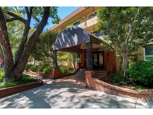
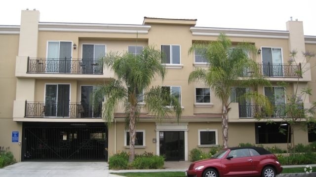
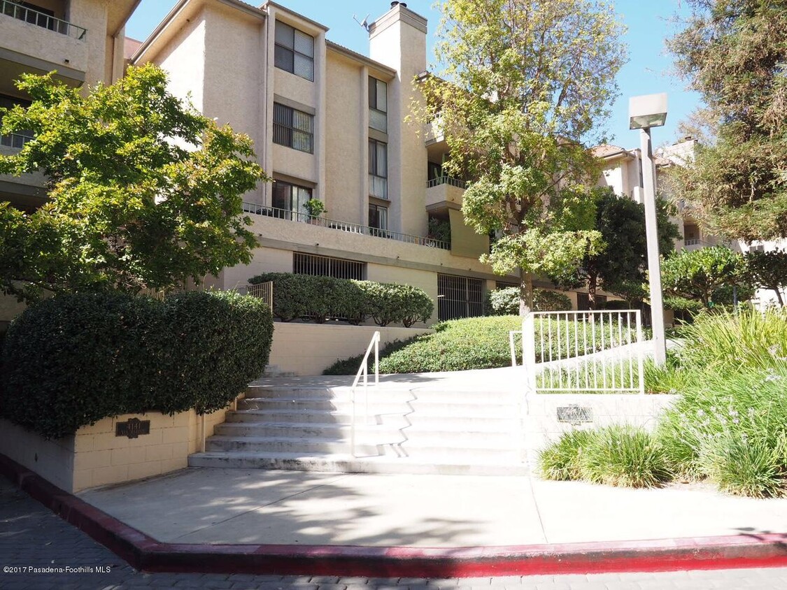
4141 Via Marisol Unit 208
Los Angeles, CA 90042
2 Weeks Ago
Favorites
4141 Via Marisol Unit 208

Favorites
Check Back Soon for Upcoming Availability
| Beds | Baths | Average SF |
|---|---|---|
| 2 Bedrooms 2 Bedrooms 2 Br | 1 Bath 1 Bath 1 Ba | 1,007 SF |
About This Property
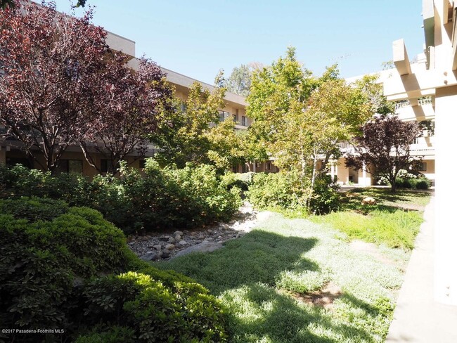
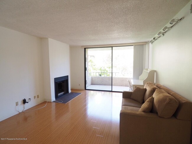
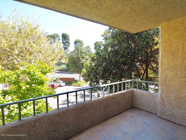
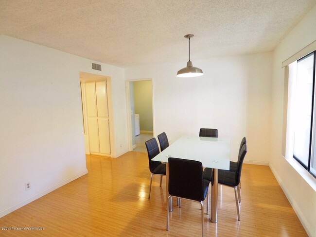
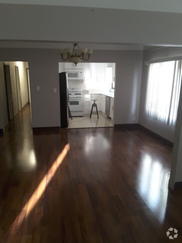
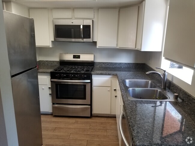
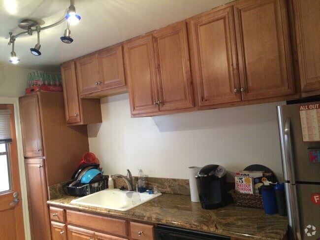
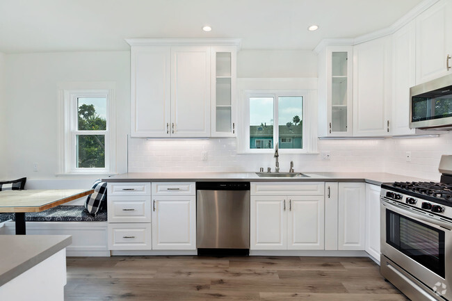
Lovely Monterrey Hills location, quiet and private. Just south of South Pasadena. Beautifully, tastefully remodeled with new kitchen and bath. Master bedroom with additional in-sink vanity and mirror. New designer laminated floor treatment and elegant tile and counter tops at kitchen and bath. Under cabinet lighting with many other upgrades. Decorative fireplace. Move-in condition unit with no shared walls or adjacent units. Second floor unit with easy access to the inviting pool, spa and sports/tennis courts. Elevators New refrigerator. NEW side by side full-size washer and dryer ''as is'' will not replace or repair. Stove, central HVAC, dishwasher, two tandem parking spaces in gated subterranean garage. Direct TV or Time Warner cable available. Easy access to the 110 Freeway. Seven minutes to USC Medical Center and USC Norris Cancer Cen
4141 Via Marisol is a condo located in Los Angeles County and the 90042 ZIP Code. This area is served by the Los Angeles Unified attendance zone.
Condo Features
Dishwasher
Refrigerator
Disposal
Ice Maker
- Fireplace
- Dishwasher
- Disposal
- Ice Maker
- Oven
- Refrigerator
- Tile Floors
- Spa
- Pool
- Gated
Fees and Policies

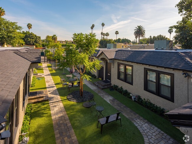
4141 Via Marisol
44 Units
4 Stories
Built in 1981
51,016 Sq Ft
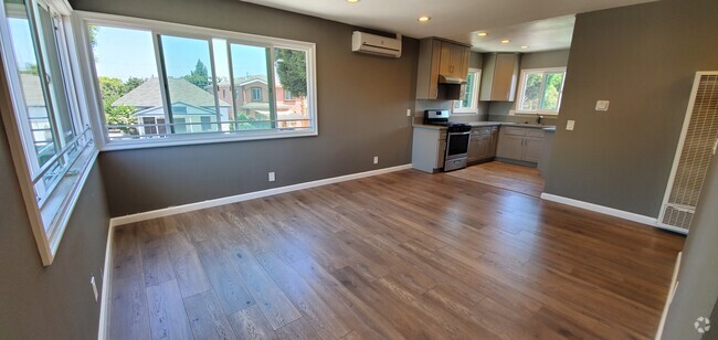
Discover 4141 Via Marisol - a condo community offering many amenities, a great location, and a variety of available units tailored to your lifestyle. Explore your next home today!
Learn more about 4141 Via Marisol
Location
Get Directions
A quiet suburb outside of Los Angeles, Monterey Hills is known for its rolling hills, winding residential streets, and elevated city views. Check out Elephant Hill, a popular place to bike or hike that offers beautiful views of the neighborhood. Herman Park is nestled along Highway 110 in the north end of the neighborhood, offering tennis courts, playgrounds, and a dog park. And for more outdoor recreation, visit the biking paths and hiking trails at Ernest E. Debs Regional Park, bordering Monterey Hills.
Monterey Hills is a more secluded part of Northeast Los Angeles with larger lots, single-family homes, and tree-lined streets. However, if you cross over Highway 110, you’ll find theatres, restaurants, services, and more. Monterey Hills is located just seven miles northeast of Downtown Los Angeles and eight miles east of major attractions such as Griffith Park, the Los Angeles Zoo, the Greek Theatre, and Glendale Galleria.
Learn more about living in Monterey HillsBelow are rent ranges for similar nearby apartments
Amenities
- Fireplace
- Dishwasher
- Disposal
- Ice Maker
- Oven
- Refrigerator
- Tile Floors
- Gated
- Spa
- Pool
Education
| Colleges & Universities | Distance | ||
|---|---|---|---|
| Colleges & Universities | Distance | ||
| Drive: | 8 min | 3.6 mi | |
| Drive: | 10 min | 3.9 mi | |
| Drive: | 10 min | 4.0 mi | |
| Drive: | 8 min | 4.4 mi |
4141 Via Marisol Unit 208 is within 10 minutes or 3.9 miles from Cal State Los Angeles. It is also near USC, Health Sciences Campus and Occidental College.
Schools


Public Elementary School
Grades K-5
181 Students
Attendance Zone
Charter Elementary School
Grades K-5
75 Students
Nearby
Public Middle School
Grades 6-8
904 Students
Attendance Zone
Public High School
Grades 9-12
1,406 Students
Attendance Zone
Public High School
Grades 9-12
1,028 Students
Attendance Zone
Private Elementary & Middle School
Grades K-8
125 Students
Nearby
Private Elementary, Middle & High School
Grades K-12
Nearby
Private Elementary School
Grades PK-5
131 Students
Nearby
School data provided by
 The GreatSchools Rating helps parents compare schools within a state based on a variety of school quality indicators and provides a helpful picture of how effectively each school serves all of its students. Ratings are on a scale of 1 (below average) to 10 (above average) and can include test scores, college readiness, academic progress, advanced courses, equity, discipline and attendance data. We also advise parents to visit schools, consider other information on school performance and programs, and consider family needs as part of the school selection process.
View GreatSchools Rating Methodology
View GreatSchools Rating Methodology
Transportation options available in Los Angeles include Highland Park Station, located 1.9 miles from 4141 Via Marisol Unit 208. 4141 Via Marisol Unit 208 is near Bob Hope, located 18.3 miles or 27 minutes away, and Los Angeles International, located 21.3 miles or 34 minutes away.
| Transit / Subway | Distance | ||
|---|---|---|---|
| Transit / Subway | Distance | ||
|
|
Drive: | 5 min | 1.9 mi |
|
|
Drive: | 7 min | 3.0 mi |
|
|
Drive: | 7 min | 3.3 mi |
|
|
Drive: | 6 min | 3.4 mi |
|
|
Drive: | 8 min | 4.0 mi |
| Commuter Rail | Distance | ||
|---|---|---|---|
| Commuter Rail | Distance | ||
|
|
Drive: | 12 min | 5.1 mi |
|
|
Drive: | 11 min | 5.2 mi |
|
|
Drive: | 13 min | 7.6 mi |
| Drive: | 14 min | 9.1 mi | |
|
|
Drive: | 20 min | 9.9 mi |
| Airports | Distance | ||
|---|---|---|---|
| Airports | Distance | ||
|
Bob Hope
|
Drive: | 27 min | 18.3 mi |
|
Los Angeles International
|
Drive: | 34 min | 21.3 mi |
Time and distance from 4141 Via Marisol Unit 208.
| Shopping Centers | Distance | ||
|---|---|---|---|
| Shopping Centers | Distance | ||
| Drive: | 4 min | 1.6 mi | |
| Drive: | 5 min | 2.2 mi | |
| Drive: | 5 min | 2.3 mi |
4141 Via Marisol Unit 208 has 3 shopping centers within 2.3 miles, which is about a 5-minute drive. The miles and minutes will be for the farthest away property.
| Parks and Recreation | Distance | ||
|---|---|---|---|
| Parks and Recreation | Distance | ||
|
Audubon Center at Debs Park
|
Drive: | 5 min | 2.3 mi |
|
Chavez Ravine Arboretum
|
Drive: | 11 min | 6.0 mi |
|
Elysian Park
|
Drive: | 13 min | 6.0 mi |
|
Elyria Canyon Park
|
Drive: | 12 min | 6.3 mi |
|
Marsh Park
|
Drive: | 13 min | 6.6 mi |
4141 Via Marisol Unit 208 has 5 parks within 6.6 miles, including Audubon Center at Debs Park, Elyria Canyon Park, and Elysian Park.
| Hospitals | Distance | ||
|---|---|---|---|
| Hospitals | Distance | ||
| Drive: | 7 min | 3.3 mi | |
| Drive: | 8 min | 3.4 mi | |
| Drive: | 8 min | 4.1 mi |
4141 Via Marisol Unit 208 has 3 hospitals within 4.1 miles, the nearest is Keck Hospital of USC which is 3.3 miles away and a 7 minute drive.
| Military Bases | Distance | ||
|---|---|---|---|
| Military Bases | Distance | ||
| Drive: | 32 min | 22.9 mi | |
| Drive: | 42 min | 26.8 mi |
4141 Via Marisol Unit 208 is 22.9 miles from Los Angeles Air Force Base, and is convenient to other military bases, including Los Alamitos Army Airfield.
You May Also Like
Similar Rentals Nearby
What Are Walk Score®, Transit Score®, and Bike Score® Ratings?
Walk Score® measures the walkability of any address. Transit Score® measures access to public transit. Bike Score® measures the bikeability of any address.
What is a Sound Score Rating?
A Sound Score Rating aggregates noise caused by vehicle traffic, airplane traffic and local sources
4141 Via Marisol
Los Angeles, CA 90042