
$1,700 / Month
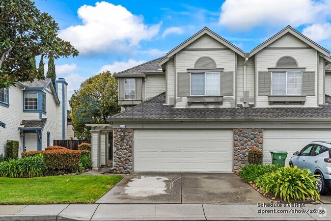
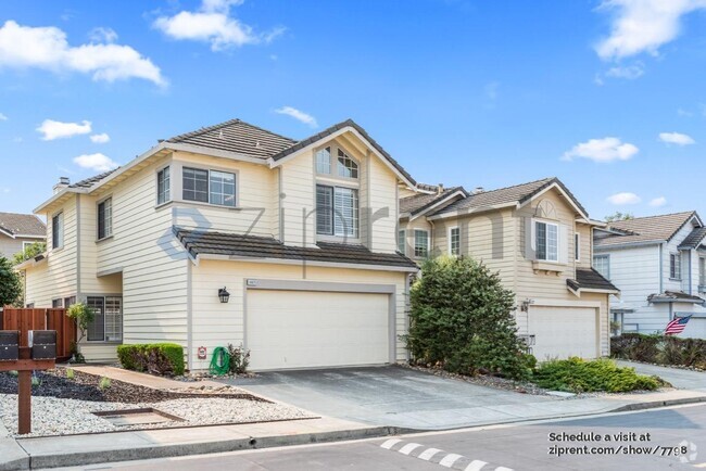
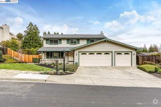
4172 Stevenson Blvd
Fremont, CA 94538
2 Weeks Ago
Favorites
4172 Stevenson Blvd

Favorites
Check Back Soon for Upcoming Availability
| Beds | Baths | Average SF |
|---|---|---|
| 3 Bedrooms 3 Bedrooms 3 Br | 2 Baths 2 Baths 2 Ba | 1,140 SF |
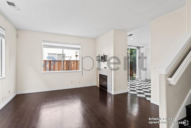
About This Property
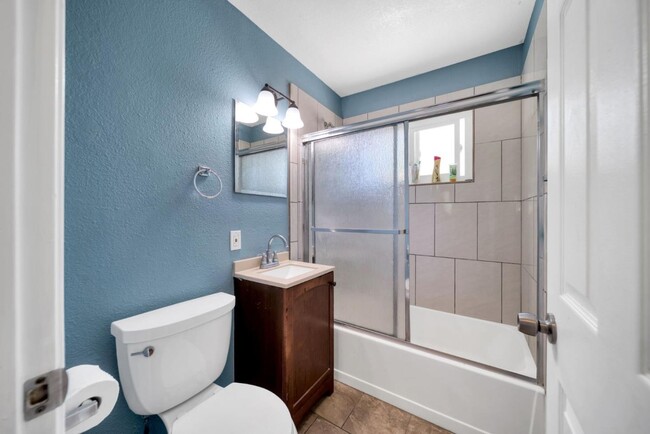
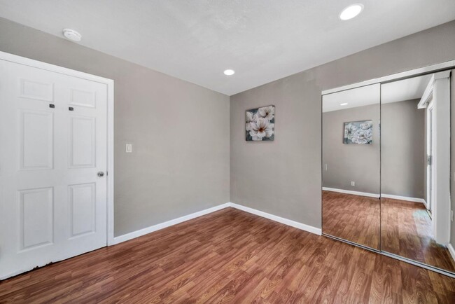
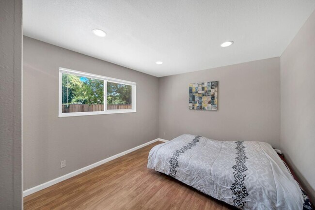
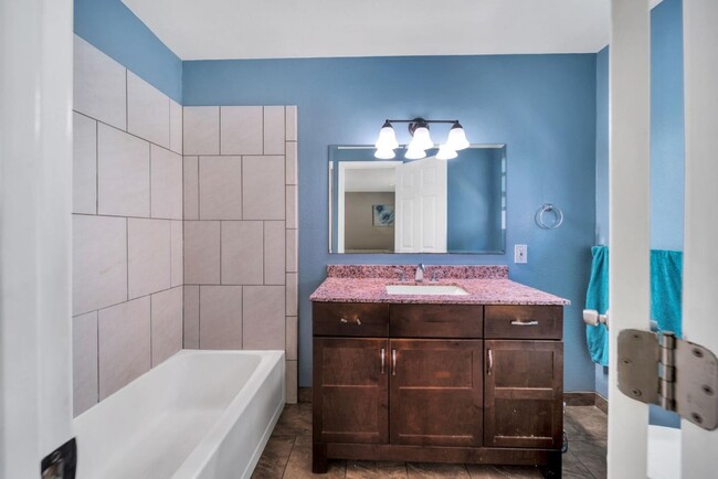
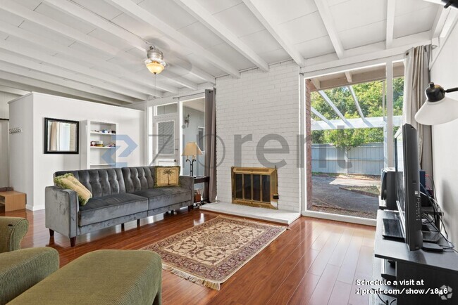
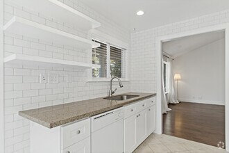
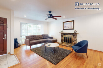
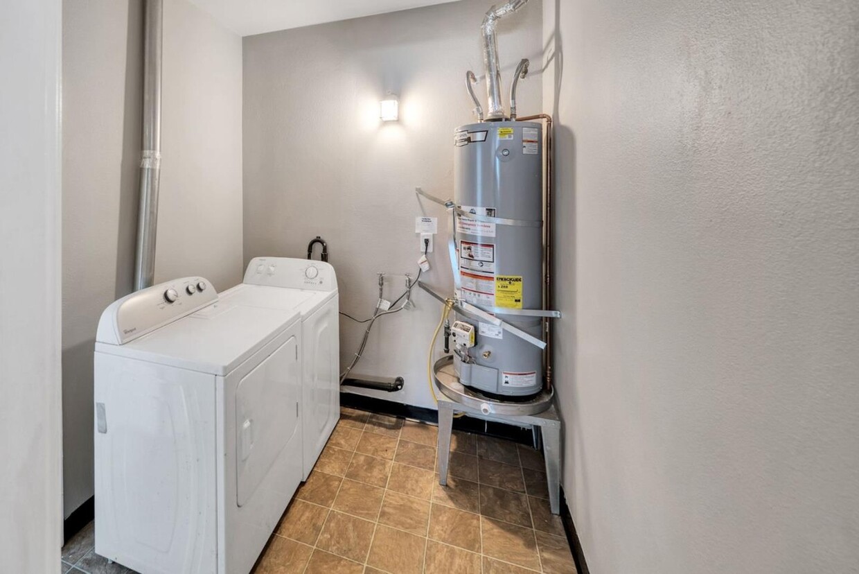
Amazing 3 bedroom, 2 bathroom house in Fremont. Amenities included: wheelchair accessible, central air, central heat, deck, dishwasher, hardwood floors, stainless steel appliance, updated kitchen, updated bathroom, storage, washer dryer, laundry in building, and yard. Utilities included: cable, heat, gas, internet and air conditioning. Is pet friendly. Date Available: Jul 9th 2023. $1,700/month rent. $1,700 security deposit required.
4172 Stevenson Blvd is a house located in Alameda County and the 94538 ZIP Code. This area is served by the Fremont Unified attendance zone.
House Features
- Washer/Dryer
- Washer/Dryer Hookup
- Dishwasher
Fees and Policies
The fees below are based on community-supplied data and may exclude additional fees and utilities.
- Dogs Allowed
-
Fees not specified
- Cats Allowed
-
Fees not specified
Location
Get Directions
South Sundale is a small suburban neighborhood about two miles south of Downtown Fremont. This neighborhood is great for renters looking for a quiet, safe community that is still near plenty of amenities. South Sundale is convenient to some of the city’s largest and most popular commercial hubs. NewPark Mall is less than 15 minutes away, and Fremont Boulevard and Washington Boulevard nearby are filled with authentic global eateries, popular retailers, and more. You’ll find residents frequenting neighborhood parks like Blacow Park, which is great for dog walking, jogging, and riding bikes. Locals also enjoy proximity to Freemont’s largest green space, Central Park. This sprawling natural area has something for everyone to enjoy, boasting a skate park, water park, dog park, a golf course, a lake, and so much more. Complemented by palm-tree-lined streets, South Sundale features moderately priced to upscale, ranch-style single-homes, sleek townhomes, and modern apartments.
Learn more about living in South SundaleBelow are rent ranges for similar nearby apartments
Amenities
- Washer/Dryer
- Washer/Dryer Hookup
- Dishwasher
Education
| Colleges & Universities | Distance | ||
|---|---|---|---|
| Colleges & Universities | Distance | ||
| Drive: | 7 min | 3.1 mi | |
| Drive: | 10 min | 4.1 mi | |
| Drive: | 19 min | 12.9 mi | |
| Drive: | 21 min | 14.8 mi |
4172 Stevenson Blvd is within 7 minutes or 3.1 miles from Ohlone College, Newark. It is also near Ohlone College, Fremont Campus and Palmer College of Chiropractic West Campus.
Schools


Public Elementary School
Grades K-5
343 Students
Nearby
Public Elementary School
Grades 1-5
630 Students
Attendance Zone
Public Middle School
Grades 6-8
1,071 Students
Attendance Zone
Public High School
Grades 9-12
1,347 Students
Attendance Zone
Private Elementary, Middle & High School
Grades 5-12
45 Students
Nearby
Private Elementary & Middle School
Grades PK-8
194 Students
Nearby
School data provided by
 The GreatSchools Rating helps parents compare schools within a state based on a variety of school quality indicators and provides a helpful picture of how effectively each school serves all of its students. Ratings are on a scale of 1 (below average) to 10 (above average) and can include test scores, college readiness, academic progress, advanced courses, equity, discipline and attendance data. We also advise parents to visit schools, consider other information on school performance and programs, and consider family needs as part of the school selection process.
View GreatSchools Rating Methodology
View GreatSchools Rating Methodology
Transportation options available in Fremont include Fremont Station, located 1.6 miles from 4172 Stevenson Blvd. 4172 Stevenson Blvd is near Norman Y Mineta San Jose International, located 16.9 miles or 23 minutes away, and Metro Oakland International, located 22.7 miles or 30 minutes away.
| Transit / Subway | Distance | ||
|---|---|---|---|
| Transit / Subway | Distance | ||
|
|
Drive: | 4 min | 1.6 mi |
|
|
Drive: | 8 min | 3.9 mi |
|
|
Drive: | 13 min | 6.0 mi |
|
|
Drive: | 17 min | 12.1 mi |
|
|
Drive: | 19 min | 12.6 mi |
| Commuter Rail | Distance | ||
|---|---|---|---|
| Commuter Rail | Distance | ||
| Drive: | 6 min | 2.5 mi | |
| Drive: | 21 min | 14.3 mi | |
| Drive: | 20 min | 14.5 mi | |
| Drive: | 20 min | 14.5 mi | |
|
|
Drive: | 20 min | 14.5 mi |
| Airports | Distance | ||
|---|---|---|---|
| Airports | Distance | ||
|
Norman Y Mineta San Jose International
|
Drive: | 23 min | 16.9 mi |
|
Metro Oakland International
|
Drive: | 30 min | 22.7 mi |
Time and distance from 4172 Stevenson Blvd.
| Shopping Centers | Distance | ||
|---|---|---|---|
| Shopping Centers | Distance | ||
| Walk: | 12 min | 0.6 mi | |
| Walk: | 14 min | 0.7 mi | |
| Walk: | 15 min | 0.8 mi |
4172 Stevenson Blvd has 3 shopping centers within 0.8 mile, which is about a 15-minute walk. The miles and minutes will be for the farthest away property.
| Parks and Recreation | Distance | ||
|---|---|---|---|
| Parks and Recreation | Distance | ||
|
Central Park (Lake Elizabeth)
|
Drive: | 5 min | 1.7 mi |
|
Quarry Lakes Regional Recreation Area
|
Drive: | 8 min | 3.9 mi |
|
Niles Canyon Railway
|
Drive: | 8 min | 4.1 mi |
|
Alameda Creek Regional Trail
|
Drive: | 9 min | 4.1 mi |
|
Niles Community Park
|
Drive: | 10 min | 4.6 mi |
4172 Stevenson Blvd has 5 parks within 4.6 miles, including Central Park (Lake Elizabeth), Quarry Lakes Regional Recreation Area, and Niles Canyon Railway.
| Hospitals | Distance | ||
|---|---|---|---|
| Hospitals | Distance | ||
| Walk: | 19 min | 1.0 mi | |
| Drive: | 5 min | 1.9 mi | |
| Drive: | 17 min | 11.7 mi |
4172 Stevenson Blvd has 3 hospitals within 11.7 miles, the nearest is Kaiser Foundation Hospital - Fremont which is 1.0 miles away and a 19 minute walk.
| Military Bases | Distance | ||
|---|---|---|---|
| Military Bases | Distance | ||
| Drive: | 29 min | 19.7 mi |
4172 Stevenson Blvd is 19.7 miles and a 29 minute drive from Ames Research Center.
You May Also Like
Similar Rentals Nearby

What Are Walk Score®, Transit Score®, and Bike Score® Ratings?
Walk Score® measures the walkability of any address. Transit Score® measures access to public transit. Bike Score® measures the bikeability of any address.
What is a Sound Score Rating?
A Sound Score Rating aggregates noise caused by vehicle traffic, airplane traffic and local sources
4172 Stevenson Blvd
Fremont, CA 94538