42 1/2 Cabot St
Beverly, MA 01915
-
Bedrooms
2
-
Bathrooms
1
-
Square Feet
--
-
Available
Available Now

Contact
- Listed by Goldberg Brothers Real Estate LLC
- Phone Number (978) 922-0800
- Contact
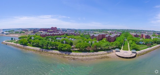
Beverly is a small city on the North Shore of Massachusetts Bay, roughly 25 miles north of Boston. With four MBTA stations (on the east side of town, near Beverly Hospital, and downtown), rail service connects Beverly with Boston and all points in between.
Boating and fishing, both recreational and professional, are very popular in this coastal community—Misery Island Reservation just offshore provides a great day trip destination for adventurous boaters and kayakers to explore.
Beverly apartment residents enjoy the benefits of a small-town atmosphere and a low crime rate. The area around Cabot and Rantoul Streets is the epicenter of the city’s shopping, dining, nightlife, and arts & entertainment scene, with a smaller alcove of shops and cafes closer to the water on West Street.
Learn more about living in Beverly| Colleges & Universities | Distance | ||
|---|---|---|---|
| Colleges & Universities | Distance | ||
| Drive: | 5 min | 2.7 mi | |
| Drive: | 7 min | 3.3 mi | |
| Drive: | 10 min | 5.0 mi | |
| Drive: | 13 min | 6.6 mi |
Transportation options available in Beverly include Wonderland Station, located 11.8 miles from 42 1/2 Cabot St Unit Apt #1. 42 1/2 Cabot St Unit Apt #1 is near General Edward Lawrence Logan International, located 16.2 miles or 29 minutes away.
| Transit / Subway | Distance | ||
|---|---|---|---|
| Transit / Subway | Distance | ||
|
|
Drive: | 21 min | 11.8 mi |
|
|
Drive: | 21 min | 12.1 mi |
|
|
Drive: | 22 min | 12.9 mi |
|
|
Drive: | 23 min | 13.4 mi |
|
|
Drive: | 28 min | 14.7 mi |
| Commuter Rail | Distance | ||
|---|---|---|---|
| Commuter Rail | Distance | ||
|
|
Walk: | 10 min | 0.5 mi |
|
|
Drive: | 3 min | 1.4 mi |
|
|
Drive: | 3 min | 1.6 mi |
|
|
Drive: | 6 min | 3.2 mi |
|
|
Drive: | 9 min | 4.6 mi |
| Airports | Distance | ||
|---|---|---|---|
| Airports | Distance | ||
|
General Edward Lawrence Logan International
|
Drive: | 29 min | 16.2 mi |
Time and distance from 42 1/2 Cabot St Unit Apt #1.
| Shopping Centers | Distance | ||
|---|---|---|---|
| Shopping Centers | Distance | ||
| Walk: | 10 min | 0.5 mi | |
| Drive: | 2 min | 1.4 mi | |
| Drive: | 3 min | 1.5 mi |
| Parks and Recreation | Distance | ||
|---|---|---|---|
| Parks and Recreation | Distance | ||
|
Salem Maritime National Historic Site
|
Drive: | 4 min | 1.8 mi |
|
Mass Audubon's Endicott Wildlife Sanctuary
|
Drive: | 10 min | 5.2 mi |
|
Connors Farm
|
Drive: | 11 min | 6.4 mi |
|
Mass Audubon's Marblehead Neck Wildlife Sanctuary
|
Drive: | 14 min | 6.7 mi |
|
Bradley Palmer State Park
|
Drive: | 18 min | 7.9 mi |
| Hospitals | Distance | ||
|---|---|---|---|
| Hospitals | Distance | ||
| Drive: | 3 min | 1.9 mi | |
| Drive: | 7 min | 2.8 mi |
| Military Bases | Distance | ||
|---|---|---|---|
| Military Bases | Distance | ||
| Drive: | 6 min | 2.5 mi | |
| Drive: | 14 min | 6.7 mi |
You May Also Like
Similar Rentals Nearby
What Are Walk Score®, Transit Score®, and Bike Score® Ratings?
Walk Score® measures the walkability of any address. Transit Score® measures access to public transit. Bike Score® measures the bikeability of any address.
What is a Sound Score Rating?
A Sound Score Rating aggregates noise caused by vehicle traffic, airplane traffic and local sources


