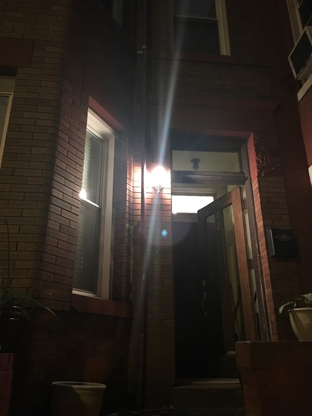
42 T St NW
42 T St NW,
Washington,
DC
20001
2 Weeks Ago
Favorites
42 T St NW

Favorites
Check Back Soon for Upcoming Availability
About 42 T St NW Washington, DC 20001
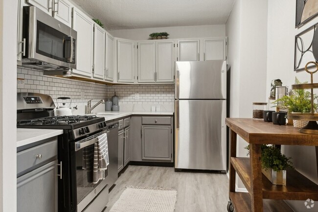
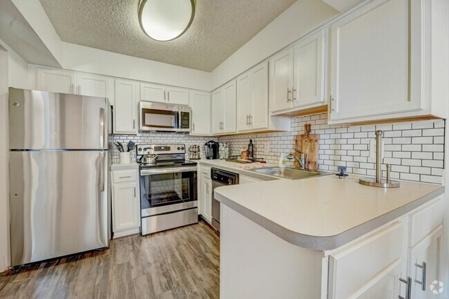
Tiled floor, a/c, w/d, d/w, gas heat, refrigerator; Convenient, close proximity to Universities, Public Transportation and Washington Hospital Center; Many local eateries and entertainment; Quiet neighborhood
42 T St NW is an apartment community located in District of Columbia County and the 20001 ZIP Code.
Apartment Features
- Washer/Dryer
- Smoke Free
Fees and Policies
The fees below are based on community-supplied data and may exclude additional fees and utilities.
- Parking
-
Street--
Details
Lease Options
-
12 Months
Location
Get Directions
Located in northeast Washington, DC, Eckington sits less than a mile from Howard University and the United States Capitol. Surrounded by other popular neighborhoods in the city such as Brentwood and Bloomingdale, Eckington provides an affordable alternative to these traditionally desired locations with the same enviable proximity to the capital’s downtown district. Filled with professionals and the perfect mix of urban and residential features, Eckington’s residential streets display a broad palette of colors, from pink and yellow to green and blue, in its rows of two-level Victorian townhomes and federal flat-roofed buildings.
Learn more about living in EckingtonBelow are rent ranges for similar nearby apartments
| Beds | Average Size | Lowest | Typical | Premium |
|---|---|---|---|---|
| Studio Studio Studio | 458 Sq Ft | $1,716 | $2,087 | $4,214 |
| 1 Bed 1 Bed 1 Bed | 681 Sq Ft | $1,632 | $2,585 | $6,716 |
| 2 Beds 2 Beds 2 Beds | 970 Sq Ft | $2,318 | $3,770 | $8,189 |
| 3 Beds 3 Beds 3 Beds | 1426 Sq Ft | $3,825 | $5,185 | $6,057 |
| 4 Beds 4 Beds 4 Beds | 1553 Sq Ft | $4,685 | $7,236 | $10,477 |
Amenities
- Washer/Dryer
- Smoke Free
Education
| Colleges & Universities | Distance | ||
|---|---|---|---|
| Colleges & Universities | Distance | ||
| Drive: | 4 min | 1.4 mi | |
| Drive: | 4 min | 1.7 mi | |
| Drive: | 5 min | 1.7 mi | |
| Drive: | 3 min | 1.8 mi |
42 T St NW is within 4 minutes or 1.4 miles from Trinity Washington University. It is also near Howard University and Gallaudet University.
Transportation options available in Washington include Noma-Gallaudet U, located 0.8 mile from 42 T St NW. 42 T St NW is near Ronald Reagan Washington Ntl, located 7.1 miles or 13 minutes away, and Washington Dulles International, located 29.9 miles or 47 minutes away.
| Transit / Subway | Distance | ||
|---|---|---|---|
| Transit / Subway | Distance | ||
|
|
Walk: | 14 min | 0.8 mi |
|
|
Walk: | 17 min | 0.9 mi |
|
|
Drive: | 3 min | 1.4 mi |
|
|
Drive: | 4 min | 1.6 mi |
|
|
Drive: | 3 min | 1.9 mi |
| Commuter Rail | Distance | ||
|---|---|---|---|
| Commuter Rail | Distance | ||
|
|
Drive: | 5 min | 1.9 mi |
|
|
Drive: | 6 min | 3.0 mi |
|
|
Drive: | 10 min | 5.8 mi |
|
|
Drive: | 12 min | 6.1 mi |
|
|
Drive: | 13 min | 6.5 mi |
| Airports | Distance | ||
|---|---|---|---|
| Airports | Distance | ||
|
Ronald Reagan Washington Ntl
|
Drive: | 13 min | 7.1 mi |
|
Washington Dulles International
|
Drive: | 47 min | 29.9 mi |
Time and distance from 42 T St NW.
| Shopping Centers | Distance | ||
|---|---|---|---|
| Shopping Centers | Distance | ||
| Walk: | 14 min | 0.7 mi | |
| Drive: | 3 min | 1.1 mi | |
| Drive: | 3 min | 1.1 mi |
42 T St NW has 3 shopping centers within 1.1 miles, which is about a 3-minute walk. The miles and minutes will be for the farthest away property.
| Parks and Recreation | Distance | ||
|---|---|---|---|
| Parks and Recreation | Distance | ||
|
Carter G. Woodson Home National Historic Site
|
Drive: | 3 min | 1.5 mi |
|
Marian Koshland Science Museum
|
Drive: | 3 min | 2.0 mi |
|
Meridian Hill Park
|
Drive: | 7 min | 2.4 mi |
|
Mary McLeod Bethune Council House NHS
|
Drive: | 5 min | 2.5 mi |
|
Washington Youth Garden
|
Drive: | 5 min | 2.6 mi |
42 T St NW has 5 parks within 2.6 miles, including Carter G. Woodson Home National Historic Site, Mary McLeod Bethune Council House NHS, and Marian Koshland Science Museum.
| Hospitals | Distance | ||
|---|---|---|---|
| Hospitals | Distance | ||
| Drive: | 3 min | 1.4 mi | |
| Drive: | 3 min | 1.4 mi | |
| Drive: | 5 min | 2.1 mi |
42 T St NW has 3 hospitals within 2.1 miles, the nearest is Howard University Hospital which is 1.4 miles away and a 3 minute drive.
| Military Bases | Distance | ||
|---|---|---|---|
| Military Bases | Distance | ||
| Drive: | 4 min | 2.0 mi | |
| Drive: | 8 min | 3.6 mi |
42 T St NW is 2.0 miles from US Soldiers & Airmens Home, and is convenient to other military bases, including Washington Navy Yard.
You May Also Like
Similar Rentals Nearby


What Are Walk Score®, Transit Score®, and Bike Score® Ratings?
Walk Score® measures the walkability of any address. Transit Score® measures access to public transit. Bike Score® measures the bikeability of any address.
What is a Sound Score Rating?
A Sound Score Rating aggregates noise caused by vehicle traffic, airplane traffic and local sources