
$2,655 / Month
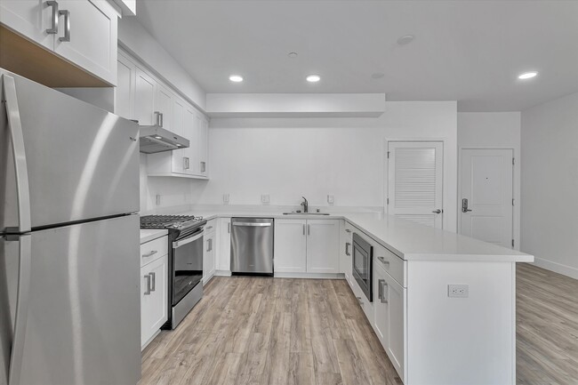
42111 Osgood Rd Unit 221
Fremont, CA 94539
2 Weeks Ago
Favorites
42111 Osgood Rd Unit 221

Favorites
Check Back Soon for Upcoming Availability
| Beds | Baths | Average SF |
|---|---|---|
| 1 Bedroom 1 Bedroom 1 Br | 1 Bath 1 Bath 1 Ba | 1,017 SF |
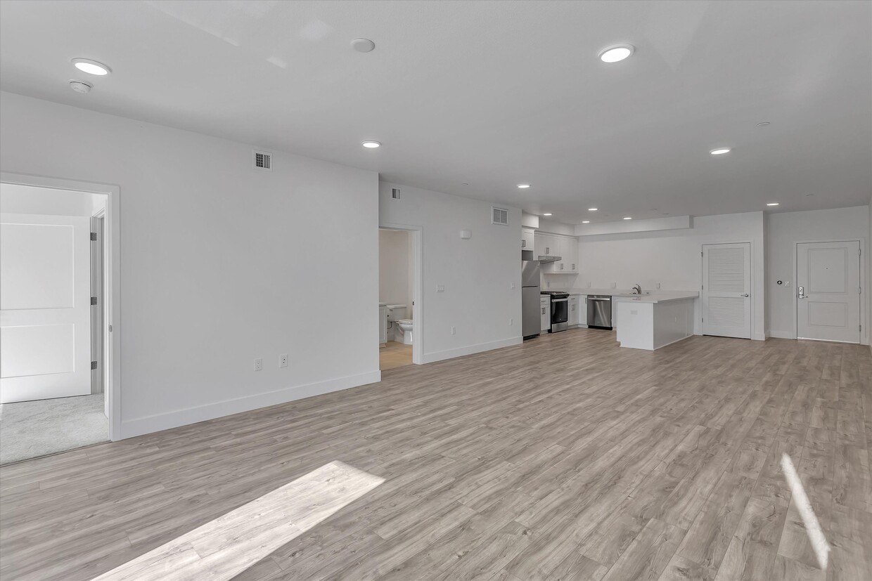
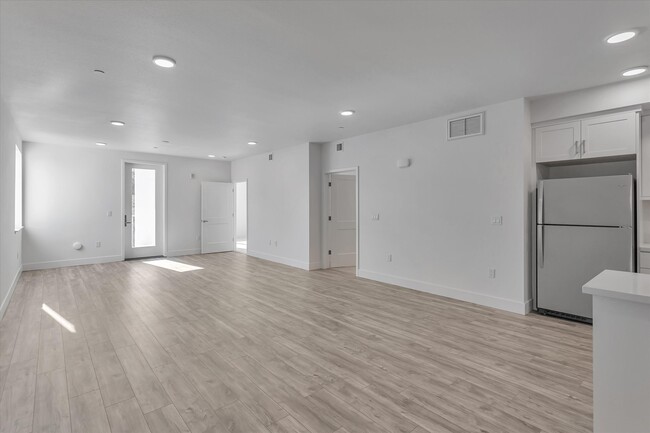
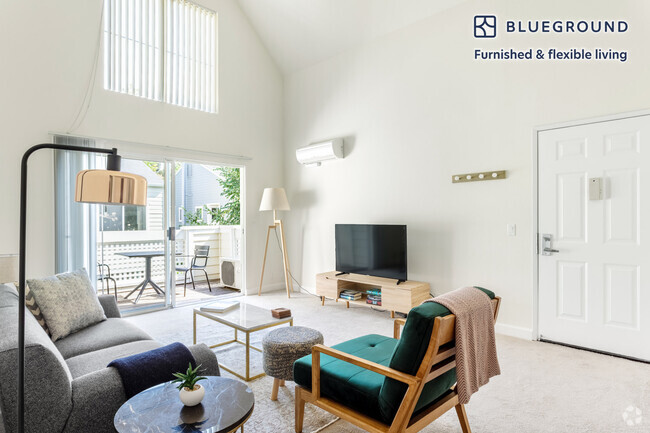
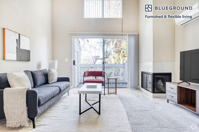
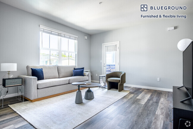
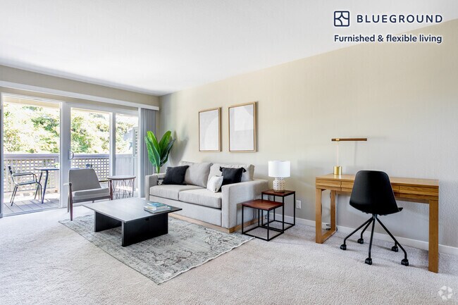
About This Property
This home is managed by Belong. Belong offers a new kind of rental experience with 24/7 support, concierge service, and an app to pay rent and report repairs. To schedule tours or apply for this home, reach out directly through the Belong website!
42111 Osgood Rd is a condo located in Alameda County and the 94539 ZIP Code.
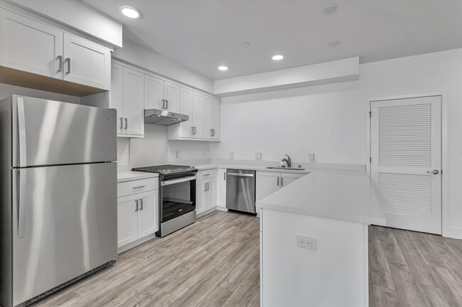
Condo Features
Washer/Dryer
Air Conditioning
Dishwasher
Microwave
- Washer/Dryer
- Air Conditioning
- Heating
- Smoke Free
- Dishwasher
- Disposal
- Kitchen
- Microwave
- Oven
- Range
- Refrigerator
- Concierge
- Fitness Center
Fees and Policies
The fees below are based on community-supplied data and may exclude additional fees and utilities.
- Dogs Allowed
-
Fees not specified
- Cats Allowed
-
Fees not specified
- Parking
-
Garage--
Details
Utilities Included
-
Water
-
Trash Removal
-
Sewer

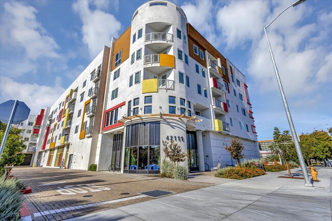
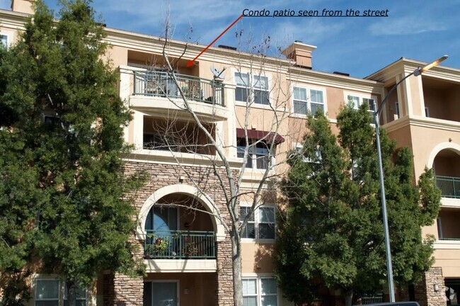
Savant at Irvington
92 Units
4 Stories
Built in 2020
159,403 Sq Ft
Savant at Irvington is a contemporary condominium building located in the bustling Weibel neighborhood of Fremont. Completed in 2020, this four-story structure houses 92 units, offering a blend of modern design and convenience. The building is strategically positioned within a top-tier school district and is a short distance from the newly approved Irvington BART station, making it an attractive choice for those seeking accessibility and quality education.
Learn more about Savant at Irvington
Location
Get Directions
Fremont is a charming city in the San Francisco Bay Area that sits across the Bay from the Silicon Valley. It is known as an ideal destination for families, offering kid-friendly attractions and excellent public schools like the Children’s Natural History Museum and Washington High School. The rapid expansion of the tech industry in recent years has boosted Fremont’s reputation as a commuter-friendly city for those working in the Silicon Valley. Fremont is located directly north of San Jose, and Palo Alto is a short drive across the Dumbarton Bridge on the Bay.
Fremont’s local culture incorporates the area’s rich history and thriving arts scene. Check out the Old Town Niles region that features a popular art walk, antique fair, and a museum celebrating the town’s role in the early days of motion picture production. Exquisite historic architecture is on display around the city, so be sure to explore Fremont’s picturesque streets that blend urban amenities and suburban neighborhoods.
Learn more about living in FremontBelow are rent ranges for similar nearby apartments
Amenities
- Washer/Dryer
- Air Conditioning
- Heating
- Smoke Free
- Dishwasher
- Disposal
- Kitchen
- Microwave
- Oven
- Range
- Refrigerator
- Concierge
- Fitness Center
Expenses
Utilities Included
Water, Trash Removal, Sewer
Included
Education
| Colleges & Universities | Distance | ||
|---|---|---|---|
| Colleges & Universities | Distance | ||
| Drive: | 7 min | 3.0 mi | |
| Drive: | 9 min | 5.2 mi | |
| Drive: | 16 min | 10.6 mi | |
| Drive: | 24 min | 17.2 mi |
42111 Osgood Rd Unit 221 is within 7 minutes or 3.0 miles from Ohlone College, Fremont Campus. It is also near Ohlone College, Newark and Palmer College of Chiropractic West Campus.
Transportation options available in Fremont include Warm Springs / South Fremont, located 2.1 miles from 42111 Osgood Rd Unit 221. 42111 Osgood Rd Unit 221 is near Norman Y Mineta San Jose International, located 14.7 miles or 21 minutes away, and Metro Oakland International, located 25.1 miles or 33 minutes away.
| Transit / Subway | Distance | ||
|---|---|---|---|
| Transit / Subway | Distance | ||
|
|
Drive: | 4 min | 2.1 mi |
|
|
Drive: | 7 min | 3.1 mi |
|
|
Drive: | 16 min | 7.5 mi |
|
|
Drive: | 14 min | 9.4 mi |
|
|
Drive: | 15 min | 9.9 mi |
| Commuter Rail | Distance | ||
|---|---|---|---|
| Commuter Rail | Distance | ||
| Drive: | 9 min | 4.0 mi | |
| Drive: | 17 min | 12.3 mi | |
| Drive: | 18 min | 13.3 mi | |
| Drive: | 23 min | 15.4 mi | |
| Drive: | 23 min | 15.9 mi |
| Airports | Distance | ||
|---|---|---|---|
| Airports | Distance | ||
|
Norman Y Mineta San Jose International
|
Drive: | 21 min | 14.7 mi |
|
Metro Oakland International
|
Drive: | 33 min | 25.1 mi |
Time and distance from 42111 Osgood Rd Unit 221.
| Shopping Centers | Distance | ||
|---|---|---|---|
| Shopping Centers | Distance | ||
| Walk: | 12 min | 0.7 mi | |
| Walk: | 15 min | 0.8 mi | |
| Walk: | 15 min | 0.8 mi |
42111 Osgood Rd Unit 221 has 3 shopping centers within 0.8 mile, which is about a 15-minute walk. The miles and minutes will be for the farthest away property.
| Parks and Recreation | Distance | ||
|---|---|---|---|
| Parks and Recreation | Distance | ||
|
Central Park (Lake Elizabeth)
|
Drive: | 8 min | 3.2 mi |
|
Niles Canyon Railway
|
Drive: | 10 min | 5.1 mi |
|
Quarry Lakes Regional Recreation Area
|
Drive: | 11 min | 5.4 mi |
|
Niles Community Park
|
Drive: | 12 min | 5.6 mi |
|
Mission Peak Regional Preserve
|
Drive: | 20 min | 6.5 mi |
42111 Osgood Rd Unit 221 has 5 parks within 6.5 miles, including Central Park (Lake Elizabeth), Niles Canyon Railway, and Niles Community Park.
| Hospitals | Distance | ||
|---|---|---|---|
| Hospitals | Distance | ||
| Drive: | 5 min | 2.5 mi | |
| Drive: | 8 min | 3.4 mi |
42111 Osgood Rd Unit 221 is 2.5 miles from Kaiser Foundation Hospital - Fremont, and is convenient to other hospitals, including Washington Hospital.
| Military Bases | Distance | ||
|---|---|---|---|
| Military Bases | Distance | ||
| Drive: | 26 min | 17.4 mi |
42111 Osgood Rd Unit 221 is 17.4 miles and a 26 minute drive from Ames Research Center.
You May Also Like
Similar Rentals Nearby

What Are Walk Score®, Transit Score®, and Bike Score® Ratings?
Walk Score® measures the walkability of any address. Transit Score® measures access to public transit. Bike Score® measures the bikeability of any address.
What is a Sound Score Rating?
A Sound Score Rating aggregates noise caused by vehicle traffic, airplane traffic and local sources

42111 Osgood Rd
Fremont, CA 94539