$2,800 / Month
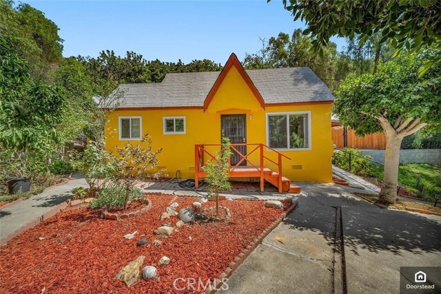
4215 Corona Dr
Los Angeles, CA 90032
2 Weeks Ago
Favorites
4215 Corona Dr

Favorites
Check Back Soon for Upcoming Availability
| Beds | Baths | Average SF |
|---|---|---|
| 3 Bedrooms 3 Bedrooms 3 Br | 1 Bath 1 Bath 1 Ba | 720 SF |
About This Property
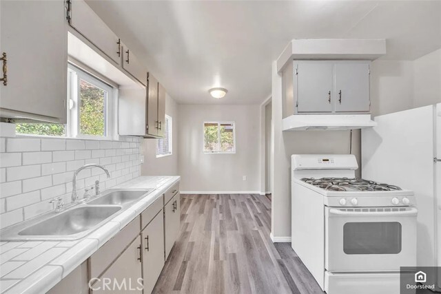
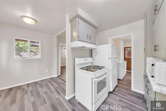
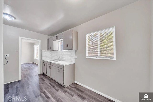
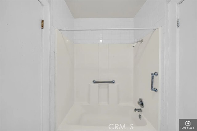
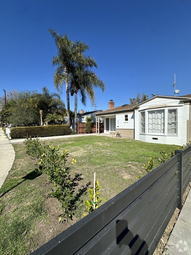
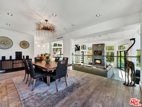
Cute and cozy home bordering the communities of El Sereno and Monterey Hills. Tucked away on a quiet and peaceful hillside, this vintage cottage-style home is a dream come true. Beautiful city views and a feeling of being away from the city even when you are just a minute away. This home has been recently upgraded and central AC and heating has been installed. The exterior garden and greenery is stunning. Plenty of outdoor space, a gazebo area, separate patio area and much more. Storage unit included for your convenience. Come see this home in person, it is guaranteed to impress.
4215 Corona Dr is a house located in Los Angeles County and the 90032 ZIP Code. This area is served by the Los Angeles Unified attendance zone.
House Features
Washer/Dryer
Air Conditioning
Washer/Dryer Hookup
Heating
- Washer/Dryer
- Washer/Dryer Hookup
- Air Conditioning
- Heating
- Oven
- Range
- Vinyl Flooring
- Views
Fees and Policies
The fees below are based on community-supplied data and may exclude additional fees and utilities.
- Parking
-
Street--
-
Other--
Property Address:
4215 Corona Dr,
Los Angeles,
CA
90032
A quiet suburb outside of Los Angeles, Monterey Hills is known for its rolling hills, winding residential streets, and elevated city views. Check out Elephant Hill, a popular place to bike or hike that offers beautiful views of the neighborhood. Herman Park is nestled along Highway 110 in the north end of the neighborhood, offering tennis courts, playgrounds, and a dog park. And for more outdoor recreation, visit the biking paths and hiking trails at Ernest E. Debs Regional Park, bordering Monterey Hills.
Monterey Hills is a more secluded part of Northeast Los Angeles with larger lots, single-family homes, and tree-lined streets. However, if you cross over Highway 110, you’ll find theatres, restaurants, services, and more. Monterey Hills is located just seven miles northeast of Downtown Los Angeles and eight miles east of major attractions such as Griffith Park, the Los Angeles Zoo, the Greek Theatre, and Glendale Galleria.
Learn more about living in Monterey HillsBelow are rent ranges for similar nearby apartments
| Beds | Average Size | Lowest | Typical | Premium |
|---|---|---|---|---|
| Studio Studio Studio | 430-442 Sq Ft | $1,675 | $1,687 | $1,750 |
| 1 Bed 1 Bed 1 Bed | 712-713 Sq Ft | $1,700 | $2,124 | $2,600 |
| 2 Beds 2 Beds 2 Beds | 930-933 Sq Ft | $2,000 | $2,744 | $3,500 |
| 3 Beds 3 Beds 3 Beds | 1376 Sq Ft | $3,750 | $5,591 | $12,500 |
| 4 Beds 4 Beds 4 Beds | 421 Sq Ft | $950 | $1,706 | $3,500 |
Amenities
- Washer/Dryer
- Washer/Dryer Hookup
- Air Conditioning
- Heating
- Oven
- Range
- Vinyl Flooring
- Views
Education
| Colleges & Universities | Distance | ||
|---|---|---|---|
| Colleges & Universities | Distance | ||
| Drive: | 9 min | 3.8 mi | |
| Drive: | 8 min | 3.9 mi | |
| Drive: | 10 min | 4.1 mi | |
| Drive: | 15 min | 5.9 mi |
4215 Corona Dr is within 9 minutes or 3.8 miles from Cal State Los Angeles. It is also near Art Center College of Design and USC, Health Sciences Campus.
Schools


Charter Elementary School
Grades K-5
75 Students
Nearby
Public Elementary School
Grades K-6
262 Students
Attendance Zone
Public Middle School
Grades 6-8
862 Students
Attendance Zone
Public High School
Grades 9-12
1,028 Students
Attendance Zone
Public High School
Grades 9-12
1,406 Students
Attendance Zone
Private Elementary School
Grades PK-5
131 Students
Nearby
Private Elementary, Middle & High School
Grades K-12
93 Students
Nearby
Private Elementary & Middle School
Grades K-8
108 Students
Nearby
School data provided by
 The GreatSchools Rating helps parents compare schools within a state based on a variety of school quality indicators and provides a helpful picture of how effectively each school serves all of its students. Ratings are on a scale of 1 (below average) to 10 (above average) and can include test scores, college readiness, academic progress, advanced courses, equity, discipline and attendance data. We also advise parents to visit schools, consider other information on school performance and programs, and consider family needs as part of the school selection process.
View GreatSchools Rating Methodology
View GreatSchools Rating Methodology
Transportation options available in Los Angeles include South Pasadena, located 3.0 miles from 4215 Corona Dr. 4215 Corona Dr is near Bob Hope, located 18.7 miles or 29 minutes away, and Los Angeles International, located 21.5 miles or 37 minutes away.
| Transit / Subway | Distance | ||
|---|---|---|---|
| Transit / Subway | Distance | ||
|
|
Drive: | 8 min | 3.0 mi |
|
|
Drive: | 9 min | 3.7 mi |
|
|
Drive: | 9 min | 4.2 mi |
|
|
Drive: | 10 min | 4.3 mi |
|
|
Drive: | 12 min | 5.2 mi |
| Commuter Rail | Distance | ||
|---|---|---|---|
| Commuter Rail | Distance | ||
|
|
Drive: | 13 min | 5.4 mi |
|
|
Drive: | 11 min | 5.5 mi |
|
|
Drive: | 15 min | 8.0 mi |
| Drive: | 15 min | 9.4 mi | |
|
|
Drive: | 19 min | 9.8 mi |
| Airports | Distance | ||
|---|---|---|---|
| Airports | Distance | ||
|
Bob Hope
|
Drive: | 29 min | 18.7 mi |
|
Los Angeles International
|
Drive: | 37 min | 21.5 mi |
Time and distance from 4215 Corona Dr.
| Shopping Centers | Distance | ||
|---|---|---|---|
| Shopping Centers | Distance | ||
| Drive: | 5 min | 2.1 mi | |
| Drive: | 5 min | 2.1 mi | |
| Drive: | 6 min | 2.2 mi |
4215 Corona Dr has 3 shopping centers within 2.2 miles, which is about a 6-minute drive. The miles and minutes will be for the farthest away property.
| Parks and Recreation | Distance | ||
|---|---|---|---|
| Parks and Recreation | Distance | ||
|
Audubon Center at Debs Park
|
Drive: | 10 min | 4.2 mi |
|
Elysian Park
|
Drive: | 16 min | 6.2 mi |
|
Huntington Botanical Gardens
|
Drive: | 15 min | 6.4 mi |
|
Elyria Canyon Park
|
Drive: | 15 min | 6.7 mi |
|
Kidspace Children's Museum
|
Drive: | 15 min | 6.8 mi |
4215 Corona Dr has 5 parks within 6.8 miles, including Audubon Center at Debs Park, Elyria Canyon Park, and Kidspace Children's Museum.
| Hospitals | Distance | ||
|---|---|---|---|
| Hospitals | Distance | ||
| Drive: | 5 min | 2.3 mi | |
| Drive: | 7 min | 3.6 mi | |
| Drive: | 10 min | 4.5 mi |
4215 Corona Dr has 3 hospitals within 4.5 miles, the nearest is Alhambra Hospital Medical Center which is 2.3 miles away and a 5 minute drive.
| Military Bases | Distance | ||
|---|---|---|---|
| Military Bases | Distance | ||
| Drive: | 34 min | 23.1 mi | |
| Drive: | 40 min | 26.7 mi |
4215 Corona Dr is 23.1 miles from Los Angeles Air Force Base, and is convenient to other military bases, including Los Alamitos Army Airfield.
You May Also Like
Similar Rentals Nearby


What Are Walk Score®, Transit Score®, and Bike Score® Ratings?
Walk Score® measures the walkability of any address. Transit Score® measures access to public transit. Bike Score® measures the bikeability of any address.
What is a Sound Score Rating?
A Sound Score Rating aggregates noise caused by vehicle traffic, airplane traffic and local sources

4215 Corona Dr
Los Angeles, CA 90032