4220 E Maya Way
Cave Creek, AZ 85331
-
Bedrooms
3
-
Bathrooms
2
-
Square Feet
1,731 sq ft
-
Available
Available Now
Highlights
- Granite Countertops
- Eat-In Kitchen
- Dual Vanity Sinks in Primary Bathroom
- Cooling Available
- No Interior Steps
- Tile Flooring

About This Home
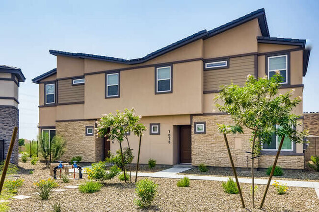
Unfurnished rental with 3-car garage in sought after TATUM HIGHLANDS! No neighbors behind backyard! Professionally maintained home. Cozy family room off the kitchen with gas fireplace. Granite countertops,kitchen island and separate breakfast area. Home has a formal dining area. 9ft Ceilings with back covered patio. Master bedroom has a walk-in closet,double sinks and a separate shower and tub. Quiet neighborhood. Updated: A/C 2022. Garbage Disposal 2023. Washer/Dryer 2023. Hot Water Tank 2023. New Double Garage Door 2023. Exterior House Painted 2024. Great location! Close to dining,shopping,hiking,golfing and much more!
4220 E Maya Way is a house located in Maricopa County and the 85331 ZIP Code. This area is served by the Cave Creek Unified District attendance zone.
Home Details
Year Built
Accessible Home Design
Bedrooms and Bathrooms
Flooring
Home Design
Interior Spaces
Kitchen
Laundry
Listing and Financial Details
Lot Details
Parking
Schools
Utilities
Community Details
Overview
Pet Policy
Contact
- Listed by Diane H Henry | West USA Realty
- Phone Number
- Contact
-
Source
Arizona Regional MLS
Part of the Sonoran Desert, Pinnacle Peak celebrates its environment with quiet roads dotted with majestic cacti as well as a host of local parks and golf clubs. Pinnacle Peak Park sits within the neighborhood while destinations like McDowell Mountain Regional Park, Phoenix Sonoran Preserve, and Lake Pleasant Regional Park are all close by.
A bevy of area attractions are convenient to Pinnacle Peak as well, including the Musical Instrument Museum, OdySea Aquarium, and Fort McDowell Casino. Old Town Scottsdale is also just a few minutes away, providing spectacular shopping, exclusive art galleries, and delectable dining options.
Learn more about living in Pinnacle Peak| Colleges & Universities | Distance | ||
|---|---|---|---|
| Colleges & Universities | Distance | ||
| Drive: | 15 min | 7.9 mi | |
| Drive: | 24 min | 14.9 mi | |
| Drive: | 27 min | 15.2 mi | |
| Drive: | 28 min | 17.0 mi |
 The GreatSchools Rating helps parents compare schools within a state based on a variety of school quality indicators and provides a helpful picture of how effectively each school serves all of its students. Ratings are on a scale of 1 (below average) to 10 (above average) and can include test scores, college readiness, academic progress, advanced courses, equity, discipline and attendance data. We also advise parents to visit schools, consider other information on school performance and programs, and consider family needs as part of the school selection process.
View GreatSchools Rating Methodology
Transportation options available in Cave Creek include 19Th Ave/Dunlap, located 18.3 miles from 4220 E Maya Way. 4220 E Maya Way is near Phoenix Sky Harbor International, located 25.8 miles or 38 minutes away, and Phoenix-Mesa Gateway, located 47.1 miles or 64 minutes away.
| Transit / Subway | Distance | ||
|---|---|---|---|
| Transit / Subway | Distance | ||
|
|
Drive: | 28 min | 18.3 mi |
|
|
Drive: | 29 min | 19.3 mi |
|
|
Drive: | 29 min | 19.9 mi |
|
|
Drive: | 31 min | 20.4 mi |
|
|
Drive: | 31 min | 21.1 mi |
| Airports | Distance | ||
|---|---|---|---|
| Airports | Distance | ||
|
Phoenix Sky Harbor International
|
Drive: | 38 min | 25.8 mi |
|
Phoenix-Mesa Gateway
|
Drive: | 64 min | 47.1 mi |
Time and distance from 4220 E Maya Way.
| Shopping Centers | Distance | ||
|---|---|---|---|
| Shopping Centers | Distance | ||
| Drive: | 5 min | 2.3 mi | |
| Drive: | 6 min | 2.4 mi | |
| Drive: | 7 min | 3.5 mi |
| Parks and Recreation | Distance | ||
|---|---|---|---|
| Parks and Recreation | Distance | ||
|
Dynamite Park
|
Drive: | 5 min | 2.4 mi |
|
Cashman Park
|
Drive: | 9 min | 4.3 mi |
|
Reach 11 Recreation Area
|
Drive: | 11 min | 5.1 mi |
|
Arizona Horse Lover's Park
|
Drive: | 11 min | 6.0 mi |
|
Grovers Basin
|
Drive: | 14 min | 7.4 mi |
| Hospitals | Distance | ||
|---|---|---|---|
| Hospitals | Distance | ||
| Drive: | 12 min | 6.7 mi | |
| Drive: | 14 min | 8.0 mi | |
| Drive: | 15 min | 8.7 mi |
| Military Bases | Distance | ||
|---|---|---|---|
| Military Bases | Distance | ||
| Drive: | 39 min | 25.6 mi | |
| Drive: | 43 min | 31.1 mi | |
| Drive: | 123 min | 94.1 mi |
You May Also Like
Similar Rentals Nearby
-
-
-
-
-
1 / 34
-
-
-
-
-
What Are Walk Score®, Transit Score®, and Bike Score® Ratings?
Walk Score® measures the walkability of any address. Transit Score® measures access to public transit. Bike Score® measures the bikeability of any address.
What is a Sound Score Rating?
A Sound Score Rating aggregates noise caused by vehicle traffic, airplane traffic and local sources


