
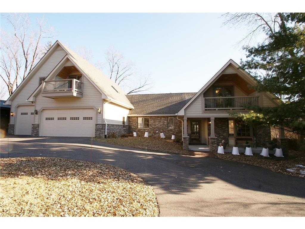
$3,795 / Month
4249 Stinson Blvd NE
Columbia Heights, MN 55421
Today
Favorites
763-227-8614
-
Bedrooms
4
-
Bathrooms
4
-
Square Feet
3,353 sq ft
-
Available
Available May 1
Highlights
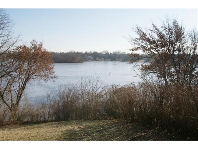
- Lake Front
- Beach Access
- Multiple Garages
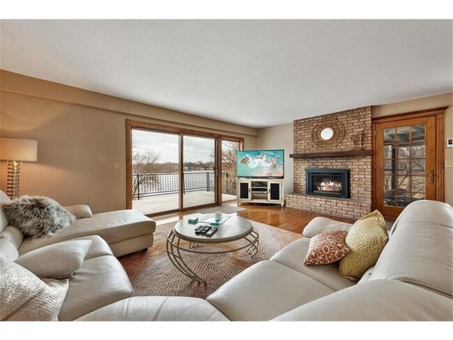
- Deck
- Main Floor Primary Bedroom
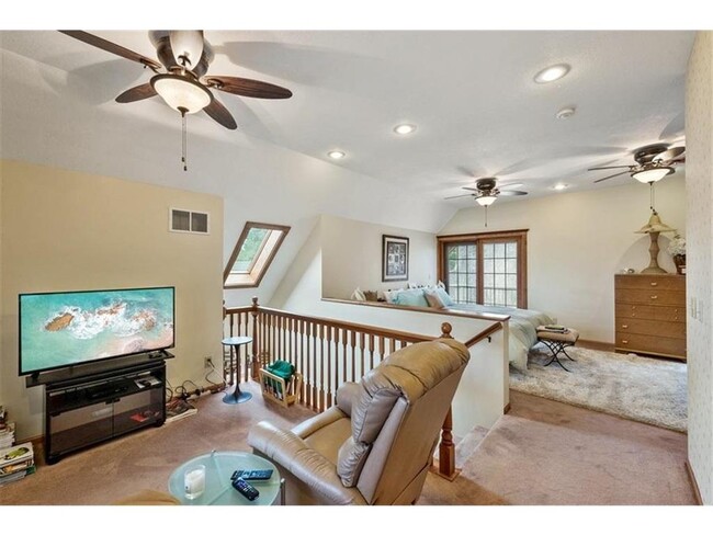
- Sitting Room
4249 Stinson Blvd NE

Favorites
About This Home
$7,390 deposit,
Available May 1
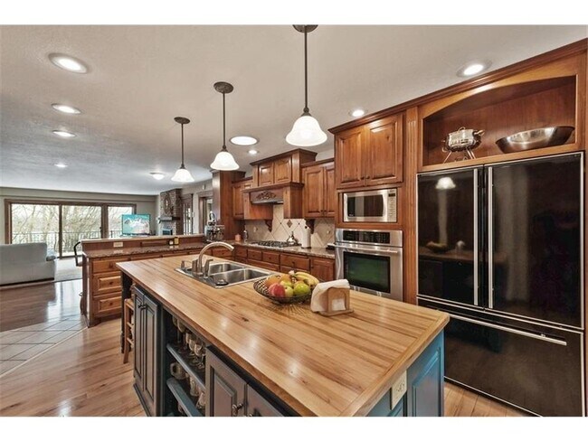
Outstanding, quality 2011 renovation with beautiful views and frontage on Silver Lake from all major rooms. Gourmet kitchen, great room, 2 MBRs and 3 kitchens allow for in-law-suite like option. 10 minutes to either Mpls or St. Paul downtowns, hospitals, Universities. Private lot, yet, next to beach and Silverwood Regional Park and trails with activities. 5 garages total (3 for rental). Walk to nice retail with small-town, main street feel. Great value, location and good quality. Must see.
4249 Stinson Blvd NE is a house located in Anoka County and the 55421 ZIP Code. This area is served by the Columbia Heights Public School Dist attendance zone.
* Price shown is base rent and may not include non-optional fees and utilities.
Price, availability, fees, and any applicable rent special are subject to change without notice.
* Square footage definitions vary. Displayed square footage is approximate.
Home Details
Home Type
Single Family Detached Home
Year Built
Built in 1920
Bedrooms and Bathrooms
Primary Bedroom on Main
4 Bathrooms
4 Bedrooms
Eco-Friendly Details
Electronic Air Cleaner
Finished Basement
Walk-Out Basement
Natural lighting in basement
Basement Storage
Interior Spaces
Living Room with Fireplace
Sitting Room
Entrance Foyer
Family Room
3,353 Sq Ft Home
2-Story Property
Kitchen
Built-In Double Oven
Stainless Steel Appliances
The kitchen features windows
Range
Freezer
Dishwasher
Disposal
Laundry
Dryer
Washer
Listing and Financial Details
Property Available on 5/1/25
Assessor Parcel Number 363024140045
Lot Details
Lake Front
Irregular Lot
Lot Dimensions are 171x355x445x351
Outdoor Features
Beach Access
Deck
Parking
Multiple Garages
3 Car Attached Garage
Guest Parking
Utilities
Forced Air Heating and Cooling System
Community Details
Overview
Property is near a preserve or public land
No Home Owners Association
Silver Lake Add Subdivision
Contact
- Listed by Brett R. Hildreth | Coldwell Banker Realty
- Phone Number
- Contact
-
Source
 NorthstarMLS®
Copyright © 2025 Regional Multiple Listing Service of Minnesota [NorthStarMLS]. All rights reserved. All information provided by the listing agent/broker is deemed reliable but is not guaranteed and should be independently verified.
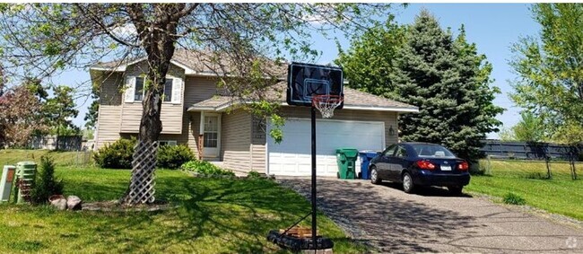
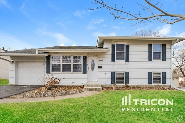
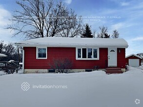
$3,936 / month
$615,000 Listing Price
4 Beds
•4 Baths
•
3,006 Sq Ft
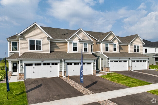
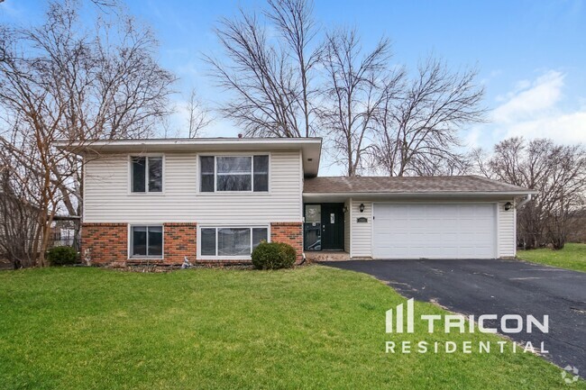
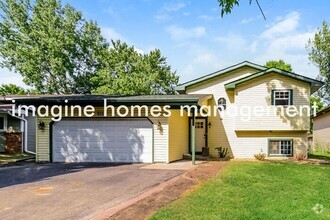
$3,616 / month
$600,000 Listing Price
6 Beds
•4.5 Baths
•
2,822 Sq Ft
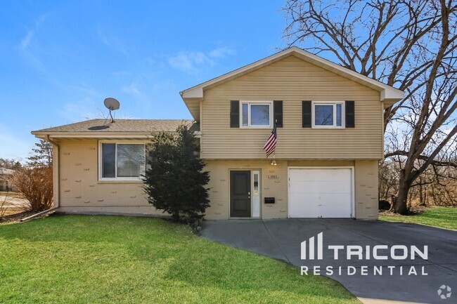
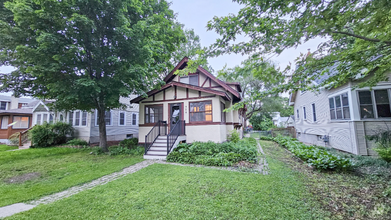
$3,406 / month
$549,900 Listing Price
5 Beds
•4 Baths
•
3,068 Sq Ft
Location
Get Directions
Amenities
- Washer/Dryer
- Air Conditioning
- Heating
- Ceiling Fans
- Security System
- Fireplace
- Dishwasher
- Disposal
- Island Kitchen
- Eat-in Kitchen
- Kitchen
- Oven
- Range
- Refrigerator
- Freezer
- Breakfast Nook
- Hardwood Floors
- Tile Floors
- Dining Room
- Basement
- Sunroom
- Vaulted Ceiling
- Skylights
- Walk-In Closets
- Wet Bar
- Storage Space
- Waterfront
- Balcony
- Patio
- Porch
- Deck
Just five miles north of Downtown Minneapolis, Columbia Heights is a historic community that combines the amenities of the big city with the more relaxed pace of the suburbs. Most of the landscape is occupied by residential neighborhoods, with a rental market spanning from affordable small houses and apartments to more upscale condos and homes.
The majority of the city’s commercial activity runs along Central Avenue, with everything from international grocers to popular local eateries to the historic Heights Theatre located on this corridor. In addition to the urban resources of the Twin Cities, you’ll also be just minutes away from countless parks, golf courses, and other outdoor recreation facilities in the area.
Learn more about living in Columbia Heights
Education
| Colleges & Universities | Distance | ||
|---|---|---|---|
| Colleges & Universities | Distance | ||
| Drive: | 10 min | 4.1 mi | |
| Drive: | 10 min | 5.6 mi | |
| Drive: | 13 min | 6.2 mi | |
| Drive: | 15 min | 8.0 mi |
4249 Stinson Blvd NE is within 10 minutes or 4.1 miles from Northwestern College. It is also near Bethel University, Saint Paul and University of Minnesota.
Schools


Public Elementary School
Grades PK-5
512 Students
Attendance Zone
Public Middle School
Grades 6-8
664 Students
Attendance Zone
Public High School
Grades 9-12
1,092 Students
Attendance Zone
Private Elementary & Middle School
Grades PK-8
148 Students
Nearby
Private Elementary & Middle School
Grades PK-8
321 Students
Nearby
Private High School
Grades 9-12
689 Students
Nearby
School data provided by
 The GreatSchools Rating helps parents compare schools within a state based on a variety of school quality indicators and provides a helpful picture of how effectively each school serves all of its students. Ratings are on a scale of 1 (below average) to 10 (above average) and can include test scores, college readiness, academic progress, advanced courses, equity, discipline and attendance data. We also advise parents to visit schools, consider other information on school performance and programs, and consider family needs as part of the school selection process.
View GreatSchools Rating Methodology
View GreatSchools Rating Methodology
Transportation options available in Columbia Heights include Warehouse District/Hennepin Avenue Station, located 5.8 miles from 4249 Stinson Blvd NE. 4249 Stinson Blvd NE is near Minneapolis-St Paul International/Wold-Chamberlain, located 15.9 miles or 31 minutes away.
| Transit / Subway | Distance | ||
|---|---|---|---|
| Transit / Subway | Distance | ||
|
|
Drive: | 16 min | 5.8 mi |
|
|
Drive: | 16 min | 6.0 mi |
| Drive: | 15 min | 6.5 mi | |
| Drive: | 15 min | 6.7 mi | |
| Drive: | 17 min | 6.7 mi |
| Commuter Rail | Distance | ||
|---|---|---|---|
| Commuter Rail | Distance | ||
|
|
Drive: | 10 min | 4.7 mi |
|
|
Drive: | 17 min | 6.1 mi |
|
|
Drive: | 22 min | 14.7 mi |
|
|
Drive: | 21 min | 14.9 mi |
|
|
Drive: | 24 min | 16.3 mi |
| Airports | Distance | ||
|---|---|---|---|
| Airports | Distance | ||
|
Minneapolis-St Paul International/Wold-Chamberlain
|
Drive: | 31 min | 15.9 mi |
Time and distance from 4249 Stinson Blvd NE.
| Shopping Centers | Distance | ||
|---|---|---|---|
| Shopping Centers | Distance | ||
| Walk: | 12 min | 0.7 mi | |
| Walk: | 15 min | 0.8 mi | |
| Walk: | 17 min | 0.9 mi |
4249 Stinson Blvd NE has 3 shopping centers within 0.9 mile, which is about a 17-minute walk. The miles and minutes will be for the farthest away property.
| Parks and Recreation | Distance | ||
|---|---|---|---|
| Parks and Recreation | Distance | ||
|
Silverwood Park
|
Walk: | 19 min | 1.0 mi |
|
Columbia Park
|
Drive: | 4 min | 1.6 mi |
|
Cavell Park
|
Drive: | 5 min | 1.7 mi |
|
Waite Park
|
Drive: | 5 min | 1.7 mi |
|
Deming Heights Park
|
Drive: | 6 min | 2.2 mi |
4249 Stinson Blvd NE has 5 parks within 2.2 miles, including Silverwood Park, Waite Park, and Cavell Park.
| Hospitals | Distance | ||
|---|---|---|---|
| Hospitals | Distance | ||
| Drive: | 16 min | 6.7 mi | |
| Drive: | 15 min | 7.0 mi | |
| Drive: | 15 min | 7.4 mi |
4249 Stinson Blvd NE has 3 hospitals within 7.4 miles, the nearest is North Memorial Health which is 6.7 miles away and a 16 minute drive.
| Military Bases | Distance | ||
|---|---|---|---|
| Military Bases | Distance | ||
| Drive: | 26 min | 12.9 mi |
4249 Stinson Blvd NE is 12.9 miles and a 26 minute drive from Fort Snelling Military Reservation.
You May Also Like
Similar Rentals Nearby
What Are Walk Score®, Transit Score®, and Bike Score® Ratings?
Walk Score® measures the walkability of any address. Transit Score® measures access to public transit. Bike Score® measures the bikeability of any address.
What is a Sound Score Rating?
A Sound Score Rating aggregates noise caused by vehicle traffic, airplane traffic and local sources
4249 Stinson Blvd NE
Columbia Heights, MN 55421