

$2,300 / Month
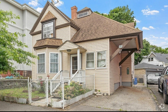
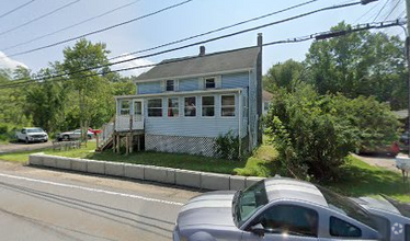
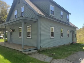
429 Burncoat St
Worcester, MA 01606
2 Weeks Ago
Favorites
429 Burncoat St

Favorites
Check Back Soon for Upcoming Availability
| Beds | Baths | Average SF |
|---|---|---|
| 3 Bedrooms 3 Bedrooms 3 Br | 1.5 Baths 1.5 Baths 1.5 Ba | 1,827 SF |
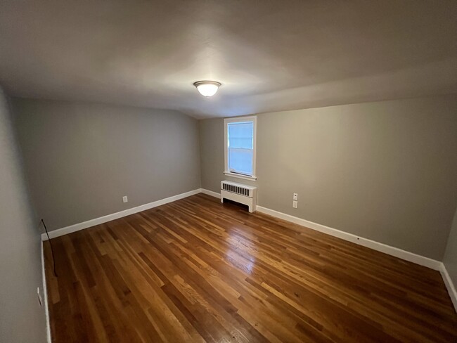
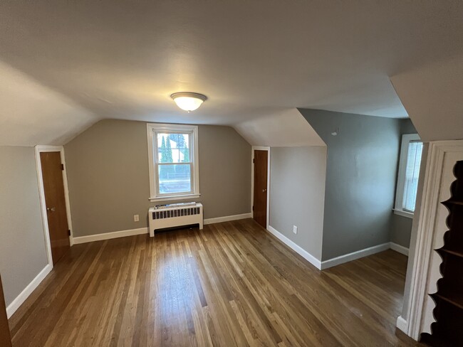
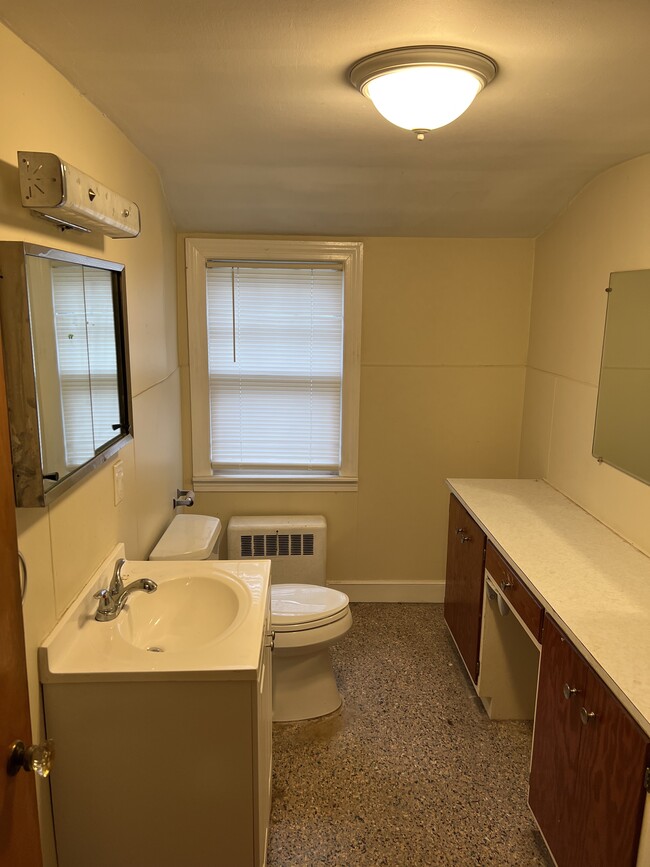
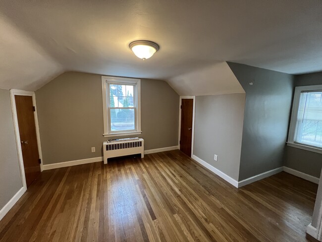
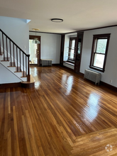
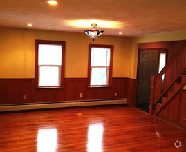
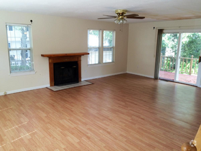
About This Property
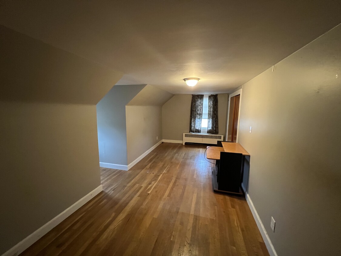
Beautiful 3 Bed & 1 Ba Single Family rental in Highly Desirable Burncoat Area! Spacious 2 level home w/ Laundry in Basement. Eat in kitchen/dining room. Yard,Driveway.
429 Burncoat St is a house located in Worcester County and the 01606 ZIP Code.
House Features
Washer/Dryer
Basement
Dining Room
Kitchen
- Washer/Dryer
- Kitchen
- Dining Room
- Basement
- Laundry Facilities
- Yard
Fees and Policies
The fees below are based on community-supplied data and may exclude additional fees and utilities.
- Dogs Allowed
-
Fees not specified
- Cats Allowed
-
Fees not specified
- Parking
-
Surface Lot--
Details
Utilities Included
-
Water
-
Sewer
Location
Get Directions
A quiet, residential neighborhood in Worcester, Massachusetts, Burncoat combines a tight-knit, neighborly feel with the energy of up-and-coming Worcester and the varied options of nearby Boston. The excellent schools, close community, and low crime rate make this neighborhood an excellent option for people looking for apartments near Boston.
Learn more about living in BurncoatBelow are rent ranges for similar nearby apartments
Amenities
- Washer/Dryer
- Kitchen
- Dining Room
- Basement
- Laundry Facilities
- Yard
Expenses
Utilities Included
Water, Sewer
Included
Education
| Colleges & Universities | Distance | ||
|---|---|---|---|
| Colleges & Universities | Distance | ||
| Walk: | 5 min | 0.3 mi | |
| Drive: | 7 min | 3.3 mi | |
| Drive: | 10 min | 4.7 mi | |
| Drive: | 12 min | 4.9 mi |
429 Burncoat St is within 5 minutes or 0.3 mile from Quinsigamond Community College. It is also near Worcester Polytechnic Inst. and Stillman College.
Transportation options available in Worcester include Riverside Station, located 33.5 miles from 429 Burncoat St. 429 Burncoat St is near Worcester Regional, located 8.4 miles or 18 minutes away.
| Transit / Subway | Distance | ||
|---|---|---|---|
| Transit / Subway | Distance | ||
|
|
Drive: | 52 min | 33.5 mi |
|
|
Drive: | 52 min | 33.8 mi |
|
|
Drive: | 53 min | 34.5 mi |
|
|
Drive: | 56 min | 36.1 mi |
|
|
Drive: | 56 min | 36.3 mi |
| Commuter Rail | Distance | ||
|---|---|---|---|
| Commuter Rail | Distance | ||
|
|
Drive: | 8 min | 4.0 mi |
|
|
Drive: | 9 min | 4.0 mi |
|
|
Drive: | 21 min | 10.6 mi |
|
|
Drive: | 21 min | 11.4 mi |
|
|
Drive: | 33 min | 18.4 mi |
| Airports | Distance | ||
|---|---|---|---|
| Airports | Distance | ||
|
Worcester Regional
|
Drive: | 18 min | 8.4 mi |
Time and distance from 429 Burncoat St.
| Shopping Centers | Distance | ||
|---|---|---|---|
| Shopping Centers | Distance | ||
| Drive: | 4 min | 1.9 mi | |
| Drive: | 4 min | 2.0 mi | |
| Drive: | 6 min | 2.1 mi |
429 Burncoat St has 3 shopping centers within 2.1 miles, which is about a 6-minute drive. The miles and minutes will be for the farthest away property.
| Parks and Recreation | Distance | ||
|---|---|---|---|
| Parks and Recreation | Distance | ||
|
Quinsigamond State Park
|
Drive: | 10 min | 4.9 mi |
|
EcoTarium
|
Drive: | 13 min | 5.6 mi |
|
Tower Hill Botanic Garden
|
Drive: | 13 min | 6.2 mi |
|
Mass Audubon's Eagle Lake Wildlife Sanctuary
|
Drive: | 14 min | 6.5 mi |
|
Ward Hill Ski Area
|
Drive: | 16 min | 7.5 mi |
429 Burncoat St has 5 parks within 7.5 miles, including Quinsigamond State Park, EcoTarium, and Tower Hill Botanic Garden.
| Hospitals | Distance | ||
|---|---|---|---|
| Hospitals | Distance | ||
| Drive: | 6 min | 2.8 mi | |
| Drive: | 8 min | 3.7 mi | |
| Drive: | 10 min | 4.6 mi |
429 Burncoat St has 3 hospitals within 4.6 miles, the nearest is Adcare Hospital of Worcester which is 2.8 miles away and a 6 minute drive.
You May Also Like
Similar Rentals Nearby
What Are Walk Score®, Transit Score®, and Bike Score® Ratings?
Walk Score® measures the walkability of any address. Transit Score® measures access to public transit. Bike Score® measures the bikeability of any address.
What is a Sound Score Rating?
A Sound Score Rating aggregates noise caused by vehicle traffic, airplane traffic and local sources
429 Burncoat St
Worcester, MA 01606