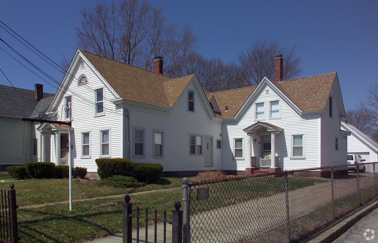
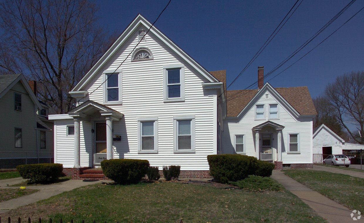
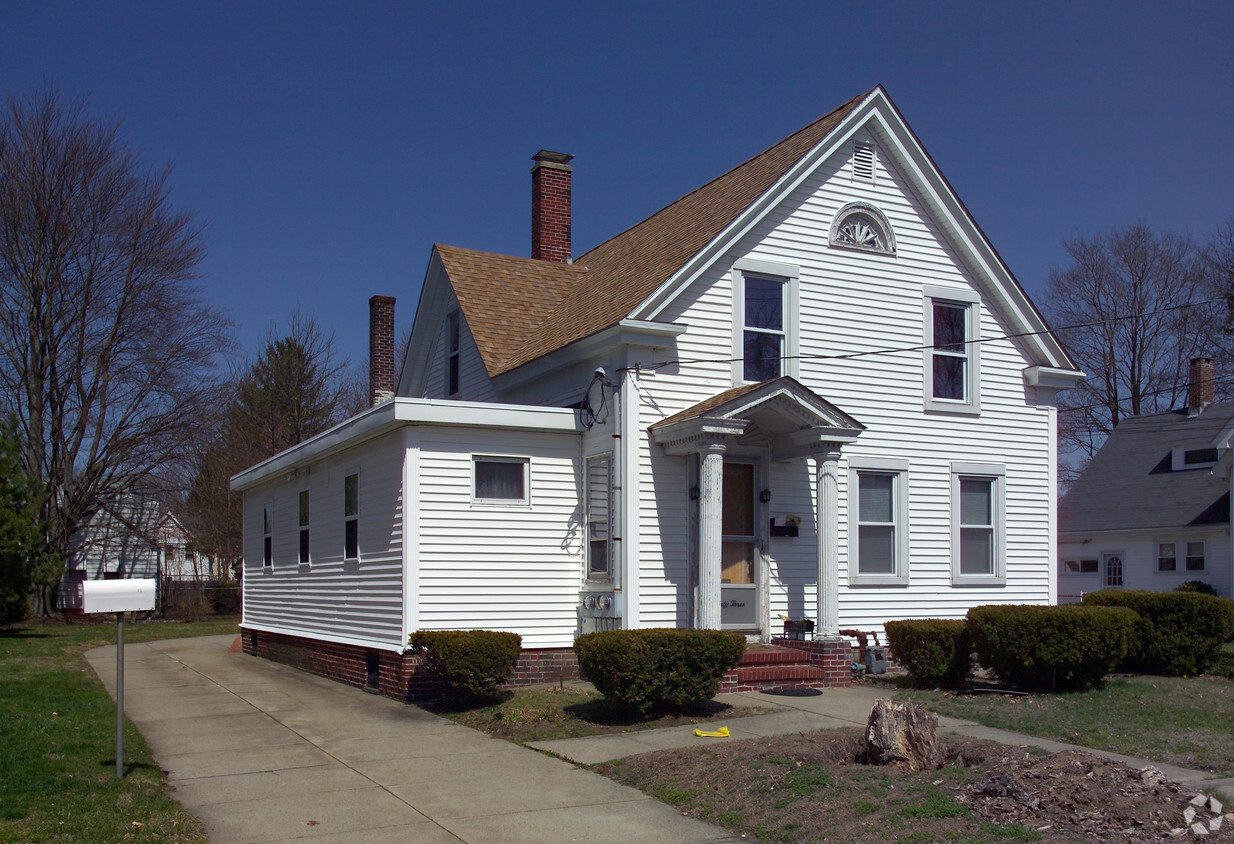
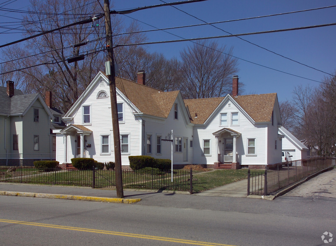
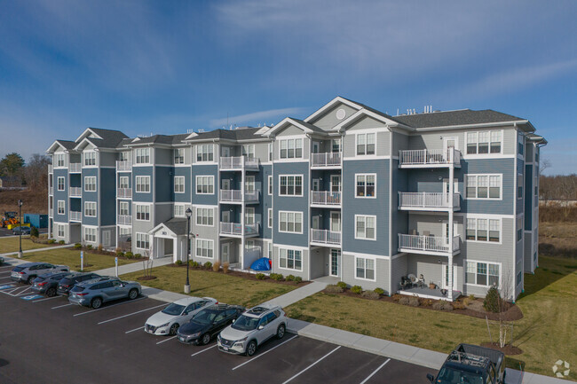
43 W Britannia St
43 W Britannia St,
Taunton,
MA
02780
2 Weeks Ago
Favorites
43 W Britannia St
Favorites
Check Back Soon for Upcoming Availability
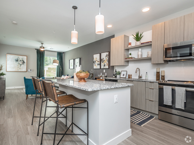
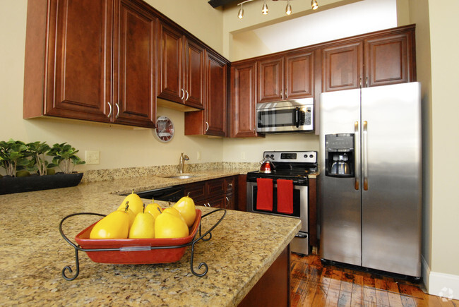
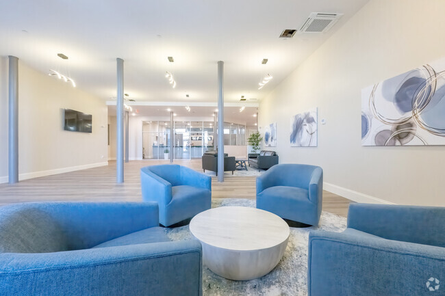
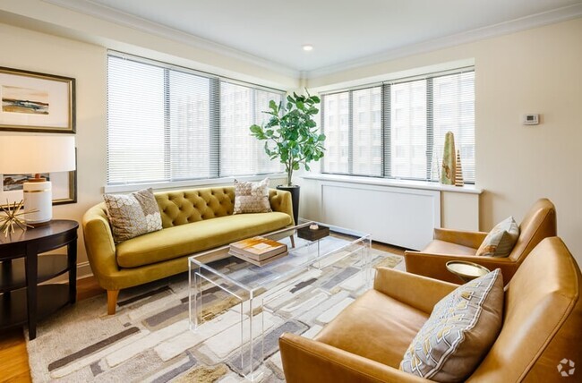
About 43 W Britannia St Taunton, MA 02780
Discover your next home at 43 W Britannia St in Taunton, MA. The location of this community is at 43 W. Britannia St. in the 02780 area of Taunton. Here at this community, the leasing team is available to assist you in finding your perfect place. Be sure to come for a visit to check out the apartment floorplan options. Your new home awaits you at 43 W Britannia St. Stop by the leasing office to schedule a tour.
43 W Britannia St is an apartment community located in Bristol County and the 02780 ZIP Code. This area is served by the Taunton attendance zone.
Fees and Policies
Details
Property Information
-
Built in 1860
-
5 units/2 stories
Location
Get Directions
Education
| Colleges & Universities | Distance | ||
|---|---|---|---|
| Colleges & Universities | Distance | ||
| Drive: | 14 min | 8.0 mi | |
| Drive: | 19 min | 10.1 mi | |
| Drive: | 19 min | 10.9 mi | |
| Drive: | 28 min | 15.0 mi |
43 W Britannia St is within 14 minutes or 8.0 miles from Wheaton College, Norton. It is also near Bridgewater State University and Stonehill College.
Schools


Public Elementary School
Grades K-4
274 Students
Attendance Zone
Public Elementary School
Grades PK-4
533 Students
Nearby
Public Elementary, Middle & High School
Nearby
Public Elementary School
Grades K-3
289 Students
Nearby
Public Elementary & Middle School
Grades 5-7
730 Students
Attendance Zone
Public Middle & High School
Grades 8-12
2,760 Students
Attendance Zone
Private Elementary, Middle & High School
Grades 5-12
257 Students
Nearby
Private Elementary School
Grades PK-5
175 Students
Nearby
School data provided by
 The GreatSchools Rating helps parents compare schools within a state based on a variety of school quality indicators and provides a helpful picture of how effectively each school serves all of its students. Ratings are on a scale of 1 (below average) to 10 (above average) and can include test scores, college readiness, academic progress, advanced courses, equity, discipline and attendance data. We also advise parents to visit schools, consider other information on school performance and programs, and consider family needs as part of the school selection process.
View GreatSchools Rating Methodology
View GreatSchools Rating Methodology
Transportation options available in Taunton include Braintree Station, located 24.8 miles from 43 W Britannia St. 43 W Britannia St is near Rhode Island Tf Green International, located 26.7 miles or 47 minutes away, and General Edward Lawrence Logan International, located 37.8 miles or 55 minutes away.
| Transit / Subway | Distance | ||
|---|---|---|---|
| Transit / Subway | Distance | ||
|
|
Drive: | 41 min | 24.8 mi |
|
|
Drive: | 38 min | 26.3 mi |
|
|
Drive: | 41 min | 27.5 mi |
|
|
Drive: | 41 min | 27.7 mi |
|
|
Drive: | 40 min | 27.8 mi |
| Commuter Rail | Distance | ||
|---|---|---|---|
| Commuter Rail | Distance | ||
|
|
Drive: | 20 min | 10.9 mi |
|
|
Drive: | 23 min | 10.9 mi |
|
|
Drive: | 24 min | 11.6 mi |
|
|
Drive: | 21 min | 12.5 mi |
|
|
Drive: | 23 min | 12.6 mi |
| Airports | Distance | ||
|---|---|---|---|
| Airports | Distance | ||
|
Rhode Island Tf Green International
|
Drive: | 47 min | 26.7 mi |
|
General Edward Lawrence Logan International
|
Drive: | 55 min | 37.8 mi |
Time and distance from 43 W Britannia St.
| Shopping Centers | Distance | ||
|---|---|---|---|
| Shopping Centers | Distance | ||
| Walk: | 9 min | 0.5 mi | |
| Drive: | 4 min | 1.4 mi | |
| Drive: | 4 min | 1.8 mi |
43 W Britannia St has 3 shopping centers within 1.8 miles, which is about a 4-minute walk. The miles and minutes will be for the farthest away property.
| Parks and Recreation | Distance | ||
|---|---|---|---|
| Parks and Recreation | Distance | ||
|
Boyden Refuge
|
Drive: | 8 min | 4.0 mi |
|
Dighton Rock State Park
|
Drive: | 23 min | 9.0 mi |
|
Massasoit State Park
|
Drive: | 24 min | 9.7 mi |
|
Mass Audubon's Oak Knoll Wildlife Sanctuary
|
Drive: | 22 min | 10.0 mi |
|
Freetown - Fall River State Forest
|
Drive: | 20 min | 11.5 mi |
43 W Britannia St has 5 parks within 11.5 miles, including Boyden Refuge, Massasoit State Park, and Dighton Rock State Park.
| Hospitals | Distance | ||
|---|---|---|---|
| Hospitals | Distance | ||
| Drive: | 3 min | 1.2 mi | |
| Drive: | 4 min | 1.3 mi | |
| Drive: | 23 min | 11.7 mi |
43 W Britannia St has 3 hospitals within 11.7 miles, the nearest is Morton Hospital which is 1.2 miles away and a 3 minute drive.
| Military Bases | Distance | ||
|---|---|---|---|
| Military Bases | Distance | ||
| Drive: | 61 min | 39.0 mi |
43 W Britannia St is 39.0 miles and a 61 minute drive from Rhode Island National Gaurd.
You May Also Like
Similar Rentals Nearby


What Are Walk Score®, Transit Score®, and Bike Score® Ratings?
Walk Score® measures the walkability of any address. Transit Score® measures access to public transit. Bike Score® measures the bikeability of any address.
What is a Sound Score Rating?
A Sound Score Rating aggregates noise caused by vehicle traffic, airplane traffic and local sources
Responded To This Review