$1,400 / Month
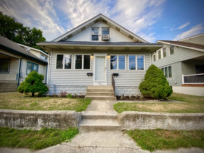
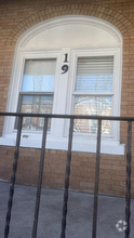
43 Walnut St Unit AptB
Westville, NJ 08093
2 Weeks Ago
Favorites
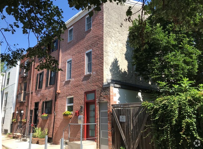
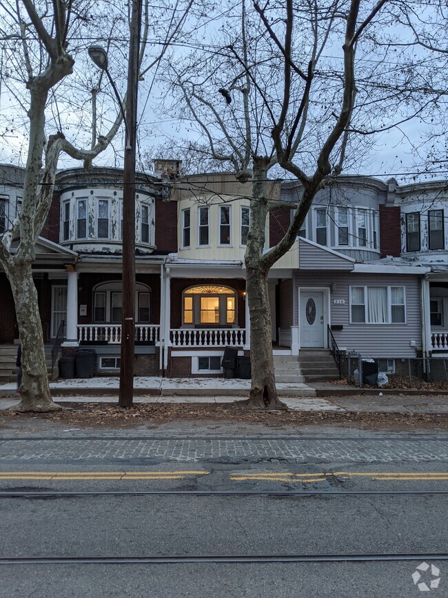
43 Walnut St

Favorites
Check Back Soon for Upcoming Availability
| Beds | Baths | Average SF |
|---|---|---|
| 1 Bedroom 1 Bedroom 1 Br | 1 Bath 1 Bath 1 Ba | 600 SF |
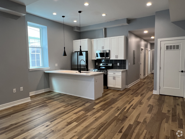
About This Property
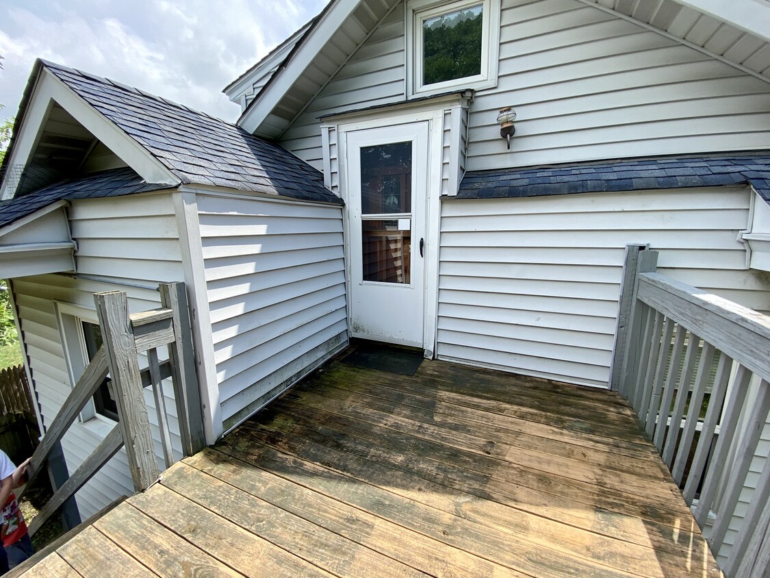
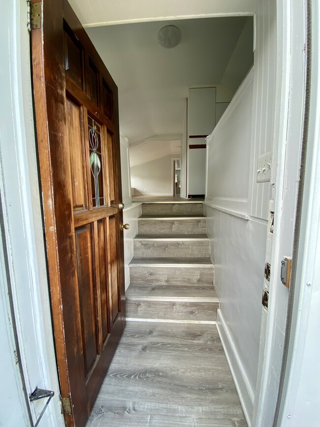
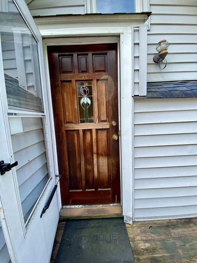
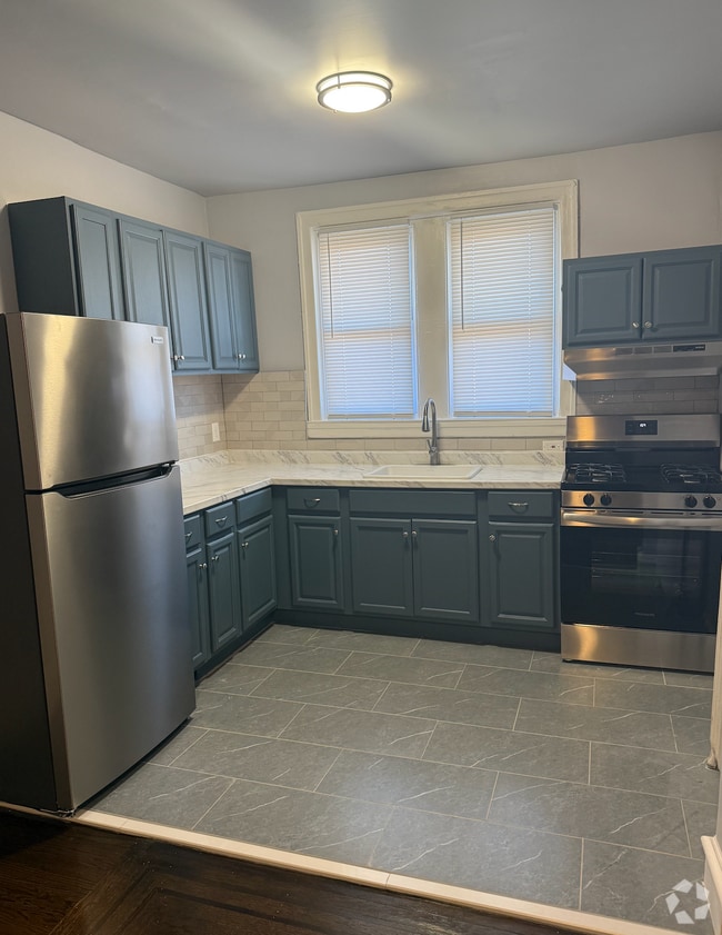
Adorable one bedroom, one bathroom second floor apartment in a quiet neighborhood. Updated kitchen and bathroom. Large living room is lined with windows and includes window seating perfect for curling up with a book and great for extra storage. Very clean and well-cared for. Basement is shared with washer and dryer, as well as storage. Great location in walking distance from the elementary school and bus stop, and close to major highways including easy access to Philadelphia. Also walking distance from great local restaurants and brewery. Tenant pays gas/electric. Call for showings.
43 Walnut St is a house located in Gloucester County and the 08093 ZIP Code.
House Features
Washer/Dryer
Dishwasher
Microwave
Refrigerator
- Washer/Dryer
- Heating
- Smoke Free
- Dishwasher
- Kitchen
- Microwave
- Refrigerator
- Basement
- Balcony
Fees and Policies
The fees below are based on community-supplied data and may exclude additional fees and utilities.
- Parking
-
Street--
Details
Utilities Included
-
Water
-
Trash Removal
-
Sewer
Property Information
-
2 units
Location
Get Directions
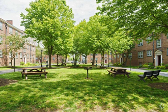
Located across the Delaware River from South Philadelphia, Westville is a small borough in northwestern Gloucester County. Bordered on three sides by navigable waterways, Westville offers residents many options for outdoor activities such as boating, fishing, and hunting. The close-knit community in Westville bonds over regular events, including the annual Halloween Parade, Fall Festival, and Santa in the Park.
Westville exudes a small-town charm, from the local businesses lining Broadway to the seasonal spirit displayed through festive decorations and events. Popular pastimes in Westville include hitting the batting cages at Bat-A-Rama, grabbing a drink at Schileens Pub, and enjoying the tasty offerings at Gateway Diner. Bellmawr Lake is adjacent to Westville as well, providing plenty of recreational opportunities. Access to the I-295 and Route 130 makes getting around from Westville simple, and should you miss the big-city bustle, Center City Philadelphia is only ten miles away.
Learn more about living in Westville
Amenities
- Washer/Dryer
- Heating
- Smoke Free
- Dishwasher
- Kitchen
- Microwave
- Refrigerator
- Basement
- Balcony
Expenses
Utilities Included
Water, Trash Removal, Sewer
Included
Education
| Colleges & Universities | Distance | ||
|---|---|---|---|
| Colleges & Universities | Distance | ||
| Drive: | 13 min | 6.5 mi | |
| Drive: | 11 min | 7.3 mi | |
| Drive: | 12 min | 7.7 mi | |
| Drive: | 16 min | 9.8 mi |
43 Walnut St is within 13 minutes or 6.5 miles from Gloucester County College. It is also near Camden Co. Coll., Camden City and Rutgers, Camden Campus.
Transportation options available in Westville include Ferry Avenue, located 5.5 miles from 43 Walnut St. 43 Walnut St is near Philadelphia International, located 13.5 miles or 24 minutes away, and Trenton Mercer, located 40.6 miles or 57 minutes away.
| Transit / Subway | Distance | ||
|---|---|---|---|
| Transit / Subway | Distance | ||
|
|
Drive: | 9 min | 5.5 mi |
|
|
Drive: | 9 min | 5.9 mi |
|
|
Drive: | 11 min | 7.3 mi |
|
|
Drive: | 11 min | 7.4 mi |
|
|
Drive: | 12 min | 7.7 mi |
| Commuter Rail | Distance | ||
|---|---|---|---|
| Commuter Rail | Distance | ||
|
|
Drive: | 15 min | 9.6 mi |
|
|
Drive: | 20 min | 11.6 mi |
|
|
Drive: | 26 min | 13.2 mi |
|
|
Drive: | 23 min | 13.3 mi |
|
|
Drive: | 24 min | 13.7 mi |
| Airports | Distance | ||
|---|---|---|---|
| Airports | Distance | ||
|
Philadelphia International
|
Drive: | 24 min | 13.5 mi |
|
Trenton Mercer
|
Drive: | 57 min | 40.6 mi |
Time and distance from 43 Walnut St.
| Shopping Centers | Distance | ||
|---|---|---|---|
| Shopping Centers | Distance | ||
| Walk: | 10 min | 0.5 mi | |
| Walk: | 19 min | 1.0 mi | |
| Drive: | 3 min | 1.5 mi |
43 Walnut St has 3 shopping centers within 1.5 miles, which is about a 3-minute walk. The miles and minutes will be for the farthest away property.
| Parks and Recreation | Distance | ||
|---|---|---|---|
| Parks and Recreation | Distance | ||
|
Camden Children's Garden
|
Drive: | 12 min | 7.8 mi |
|
Franklin D. Roosevelt Park
|
Drive: | 15 min | 8.6 mi |
|
Gloria Dei Church National Historic Site
|
Drive: | 14 min | 8.6 mi |
|
Independence Seaport Museum
|
Drive: | 16 min | 9.4 mi |
|
Thaddeus Kosciuszko National Memorial
|
Drive: | 17 min | 9.7 mi |
43 Walnut St has 5 parks within 9.7 miles, including Camden Children's Garden, Independence Seaport Museum, and Thaddeus Kosciuszko National Memorial.
| Hospitals | Distance | ||
|---|---|---|---|
| Hospitals | Distance | ||
| Drive: | 3 min | 1.7 mi | |
| Drive: | 8 min | 5.8 mi | |
| Drive: | 10 min | 6.6 mi |
43 Walnut St has 3 hospitals within 6.6 miles, the nearest is Inspira Medical Center Woodbury which is 1.7 miles away and a 3 minute drive.
| Military Bases | Distance | ||
|---|---|---|---|
| Military Bases | Distance | ||
| Drive: | 14 min | 8.6 mi |
43 Walnut St is 8.6 miles and a 14 minute drive from Philadelphia Naval Busi Center.
You May Also Like
Similar Rentals Nearby

What Are Walk Score®, Transit Score®, and Bike Score® Ratings?
Walk Score® measures the walkability of any address. Transit Score® measures access to public transit. Bike Score® measures the bikeability of any address.
What is a Sound Score Rating?
A Sound Score Rating aggregates noise caused by vehicle traffic, airplane traffic and local sources

43 Walnut St
Westville, NJ 08093