$5,200 / Month
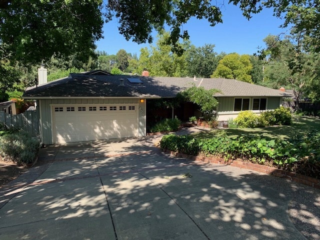
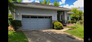
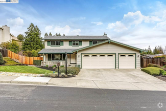
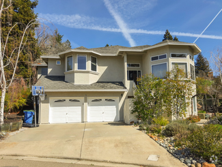
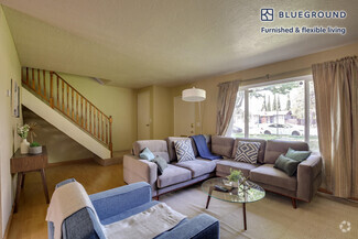
450 Neal St
Pleasanton, CA 94566
Today
Favorites
925-200-6922
-
Bedrooms
3
-
Bathrooms
2
-
Square Feet
2,388 sq ft
-
Available
Available Jun 5
450 Neal St

Favorites
About This Home
$7,800 deposit,
Available Jun 5
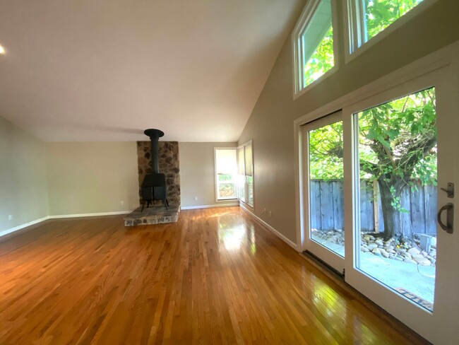
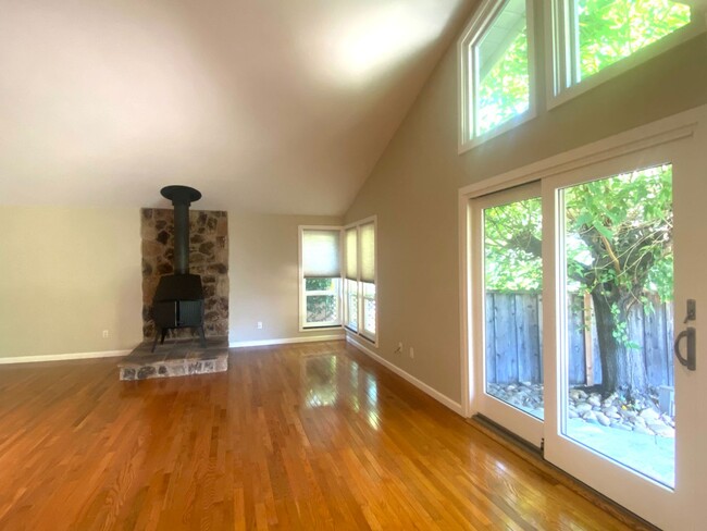
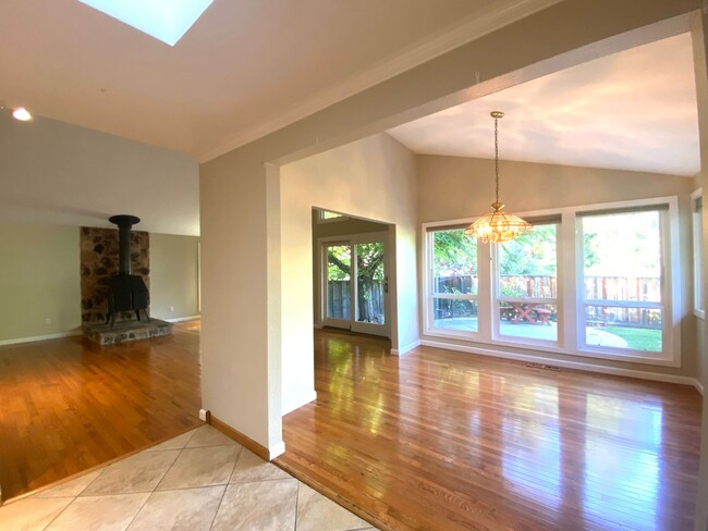
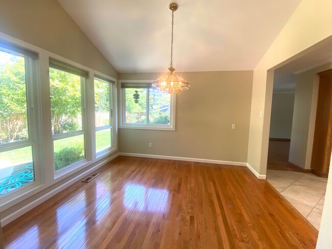
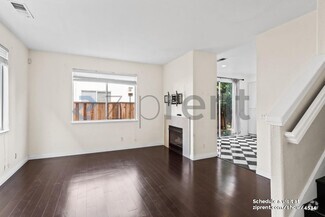
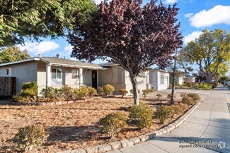
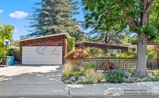
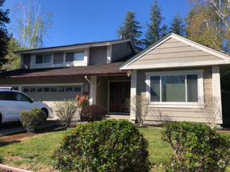
Rent: $5200 3 Bed / 2 BA SF: 2388 Garage: 2 car attached Year Built: 1960 Property: Single Family Available: 6/5/25 Security Deposit: $7800 Pets: Dog depending on size and breed with extra deposit Refrigerator: Yes, without warranty Washer / Dryer: Yes, without warranty A/C: Yes Smoking: No For Showings and Property Information Contact: Daisy Borba For Submitting an Application and Application Status Contact: Cheryl To see additional photos / information and other listings go to the following website: Beautiful Pleasanton Heights, Single story 3 Bed,2 Bath, Kitchen with granite counters, oak cabinets, stainless appliances, ceramic flooring, hardwood floors throughout. Updated baths, Huge primary suite, formal living room & dining room, spacious family room and kitchen. Great back yard for entertaining, owners pays for gardener. Walking distance to Valley View, Pleasanton Middle and Amador High schools, shopping and restaurants. Enjoy summer concerts in the park, walk to Farmer's Market downtown. Dogs ok depending on size and breed with extra security deposit. For more information, please contact : Agent: Daisy Borba Lic. #01355084 Broker: Russell E Gross, R.E. Inc. BRE #01270957 PMD
450 Neal St is a house located in Alameda County and the 94566 ZIP Code. This area is served by the Pleasanton Unified attendance zone.
* Price shown is base rent and may not include non-optional fees and utilities.
Price, availability, fees, and any applicable rent special are subject to change without notice.
* Square footage definitions vary. Displayed square footage is approximate.
Contact
- Listed by Pleasanton Properties Management | Pleasanton Properties Management
- Phone Number
- Contact
Location
Get Directions
The cities of Livermore, Dublin and Pleasanton form a loosely shaped triangle within California's Tri-Valley region, a cluster of three small valleys about 33 miles east of San Francisco and 35 miles northeast of San Jose. Known for its Mediterranean climate, rolling hills and historic vineyards, this once bucolic region now boasts three separate downtown areas, a bustling business community and some of the best wineries in the state.
At the eastern end of the region lies the city of Livermore. Once known as Livermores, Livermore Ranch and Nottingham, the city sits at the center of Livermore Valley, a historic region dotted with more than 5,000 acres of mostly family-owned vineyards. A pastoral neighborhood known for its charming yet functional hilltop windmills, Livermore hosts the internationally recognized and sometimes controversial center of scientific research, Lawrence Livermore National Laboratories.
Learn more about living in Dublin/Pleasanton/Livermore
Education
| Colleges & Universities | Distance | ||
|---|---|---|---|
| Colleges & Universities | Distance | ||
| Drive: | 15 min | 7.8 mi | |
| Drive: | 17 min | 8.1 mi | |
| Drive: | 18 min | 11.7 mi | |
| Drive: | 28 min | 17.8 mi |
450 Neal St is within 15 minutes or 7.8 miles from Las Positas College. It is also near Diablo Valley Coll, San Ramon and Ohlone College, Fremont Campus.
Schools


Public Elementary School
Grades K-5
478 Students
Nearby
Public Elementary School
Grades K-5
641 Students
Attendance Zone
Public Middle School
Grades 6-8
1,050 Students
Attendance Zone
Public High School
Grades 9-12
2,665 Students
Attendance Zone
Private Elementary School
Grades PK-5
Nearby
Private Elementary, Middle & High School
Grades K-12
23 Students
Nearby
School data provided by
 The GreatSchools Rating helps parents compare schools within a state based on a variety of school quality indicators and provides a helpful picture of how effectively each school serves all of its students. Ratings are on a scale of 1 (below average) to 10 (above average) and can include test scores, college readiness, academic progress, advanced courses, equity, discipline and attendance data. We also advise parents to visit schools, consider other information on school performance and programs, and consider family needs as part of the school selection process.
View GreatSchools Rating Methodology
View GreatSchools Rating Methodology
Transportation options available in Pleasanton include Dublin Pleasanton Station, located 4.3 miles from 450 Neal St. 450 Neal St is near Metro Oakland International, located 24.1 miles or 33 minutes away, and Norman Y Mineta San Jose International, located 26.6 miles or 36 minutes away.
| Transit / Subway | Distance | ||
|---|---|---|---|
| Transit / Subway | Distance | ||
|
|
Drive: | 10 min | 4.3 mi |
|
|
Drive: | 9 min | 5.7 mi |
|
|
Drive: | 23 min | 14.2 mi |
|
|
Drive: | 29 min | 16.0 mi |
| Commuter Rail | Distance | ||
|---|---|---|---|
| Commuter Rail | Distance | ||
| Drive: | 4 min | 1.1 mi | |
| Drive: | 12 min | 6.7 mi | |
| Drive: | 18 min | 10.0 mi | |
| Drive: | 25 min | 15.8 mi | |
|
|
Drive: | 25 min | 16.6 mi |
| Airports | Distance | ||
|---|---|---|---|
| Airports | Distance | ||
|
Metro Oakland International
|
Drive: | 33 min | 24.1 mi |
|
Norman Y Mineta San Jose International
|
Drive: | 36 min | 26.6 mi |
Time and distance from 450 Neal St.
| Shopping Centers | Distance | ||
|---|---|---|---|
| Shopping Centers | Distance | ||
| Walk: | 9 min | 0.5 mi | |
| Walk: | 12 min | 0.6 mi | |
| Walk: | 18 min | 0.9 mi |
450 Neal St has 3 shopping centers within 0.9 mile, which is about a 18-minute walk. The miles and minutes will be for the farthest away property.
| Parks and Recreation | Distance | ||
|---|---|---|---|
| Parks and Recreation | Distance | ||
|
Shadow Cliffs Regional Recreation Area
|
Drive: | 7 min | 2.5 mi |
|
Dublin Hills Regional Parks
|
Drive: | 20 min | 8.5 mi |
|
Niles Canyon Railway
|
Drive: | 22 min | 13.0 mi |
|
Pleasanton Ridge Regional Park
|
Drive: | 23 min | 14.8 mi |
|
Garin/Dry Creek Pioneer Parks
|
Drive: | 29 min | 16.4 mi |
450 Neal St has 5 parks within 16.4 miles, including Shadow Cliffs Regional Recreation Area, Dublin Hills Regional Parks, and Pleasanton Ridge Regional Park.
| Hospitals | Distance | ||
|---|---|---|---|
| Hospitals | Distance | ||
| Drive: | 6 min | 2.7 mi | |
| Drive: | 18 min | 12.3 mi | |
| Drive: | 23 min | 14.4 mi |
450 Neal St has 3 hospitals within 14.4 miles, the nearest is Stanford Health Care - ValleyCare which is 2.7 miles away and a 6 minute drive.
| Military Bases | Distance | ||
|---|---|---|---|
| Military Bases | Distance | ||
| Drive: | 41 min | 29.4 mi |
450 Neal St is 29.4 miles and a 41 minute drive from Ames Research Center.
You May Also Like
Similar Rentals Nearby


What Are Walk Score®, Transit Score®, and Bike Score® Ratings?
Walk Score® measures the walkability of any address. Transit Score® measures access to public transit. Bike Score® measures the bikeability of any address.
What is a Sound Score Rating?
A Sound Score Rating aggregates noise caused by vehicle traffic, airplane traffic and local sources

450 Neal St
Pleasanton, CA 94566