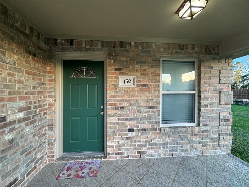
450 W Houston St
Highlands, TX 77562
-
Bedrooms
2
-
Bathrooms
2
-
Square Feet
--
-
Available
Available Now
Highlights
- Lake View
- Deck
- Traditional Architecture
- Fenced Yard
- 1 Car Attached Garage
- Breakfast Bar

About This Home
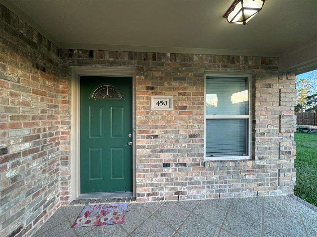
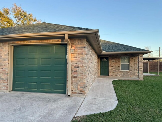
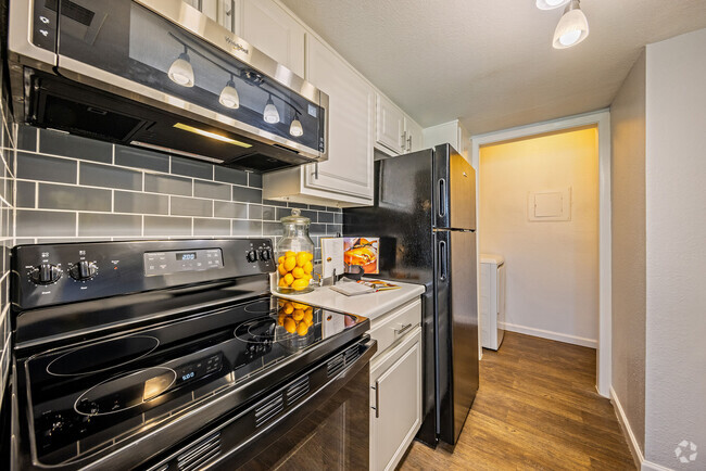
Well now if you are looking for a BEAUTIFUL, PEACEFUL,SMALL PEACE OF HEAVEN, here you go. This is a great single unit of a duplex. This property in a jewel find. The view is AWESOME, location is secured with a large nice 8ft cedar fence with an electric gate and the area is private to residents only. San Jacinto River and all its natural beauty will welcome you morning, noon and night. You have a relaxing patio, a nice lot, and a meticulously cared for home that is a 1245 sqft, 2 bedroom 2 bath, one oversized insulated car garage with insulated garage door. There are custom cabinets
450 W Houston St is an apartment community located in Harris County and the 77562 ZIP Code.
Home Details
Home Type
Year Built
Bedrooms and Bathrooms
Eco-Friendly Details
Flooring
Home Design
Home Security
Interior Spaces
Kitchen
Laundry
Listing and Financial Details
Lot Details
Outdoor Features
Parking
Schools
Utilities
Views
Community Details
Overview
Pet Policy
Security
Fees and Policies
The fees below are based on community-supplied data and may exclude additional fees and utilities.
- Parking
-
Garage--
Details
Lease Options
-
12 Months
Contact
- Listed by Kimberly Ponce | LPT Realty, LLC
- Phone Number (281) 785-7042
- Contact
-
Source
 Houston Association of REALTORS®
- Smoke Free
- Cable Ready
- Dishwasher
- Disposal
- Microwave
Characterized by thick woods and a variety of home prices and styles, North Shore sits on top of the Houston Ship Channel east of Loop 610. Located a 19-minute drive and about 11 miles northeast of Downtown, this primarily residential area straddles Interstate 10.
A number of smaller communities make up this neighborhood, including Songwood, Holiday Forest, Wood Bayou, Cimarron, Home Owned Estates, Woodland Acres, Hidden Forest, and Greens Bayou. Many of these areas contain mid-century ranch-style homes.
The Galena Park and Houston Independent School Districts serve the area, with neighborhoods east of Greens Bayou and south of Market Street falling under Galena Park, while the rest lie in Houston ISD. North Shore residents enjoy close proximity to the sprawling Herman Brown Park, a major nature area and recreational facility.
Learn more about living in North Shore| Colleges & Universities | Distance | ||
|---|---|---|---|
| Colleges & Universities | Distance | ||
| Drive: | 21 min | 13.3 mi | |
| Drive: | 30 min | 18.7 mi | |
| Drive: | 30 min | 21.5 mi | |
| Drive: | 39 min | 23.8 mi |
Transportation options available in Highlands include Cesar Chavez / 67Th St Eb, located 20.3 miles from 450 W Houston St. 450 W Houston St is near William P Hobby, located 27.2 miles or 43 minutes away, and George Bush Intcntl/Houston, located 31.3 miles or 40 minutes away.
| Transit / Subway | Distance | ||
|---|---|---|---|
| Transit / Subway | Distance | ||
| Drive: | 28 min | 20.3 mi | |
| Drive: | 29 min | 20.4 mi | |
| Drive: | 29 min | 20.4 mi | |
| Drive: | 29 min | 20.5 mi | |
| Drive: | 30 min | 21.1 mi |
| Commuter Rail | Distance | ||
|---|---|---|---|
| Commuter Rail | Distance | ||
|
|
Drive: | 31 min | 22.3 mi |
| Airports | Distance | ||
|---|---|---|---|
| Airports | Distance | ||
|
William P Hobby
|
Drive: | 43 min | 27.2 mi |
|
George Bush Intcntl/Houston
|
Drive: | 40 min | 31.3 mi |
Time and distance from 450 W Houston St.
| Shopping Centers | Distance | ||
|---|---|---|---|
| Shopping Centers | Distance | ||
| Walk: | 11 min | 0.6 mi | |
| Drive: | 7 min | 3.5 mi | |
| Drive: | 9 min | 4.7 mi |
| Parks and Recreation | Distance | ||
|---|---|---|---|
| Parks and Recreation | Distance | ||
|
Baytown Nature Center
|
Drive: | 12 min | 6.3 mi |
|
San Jacinto Battleground State Historic Site
|
Drive: | 20 min | 7.0 mi |
|
Eddie V. Gray Wetlands Center
|
Drive: | 16 min | 9.5 mi |
|
Sheldon Lake State Park
|
Drive: | 21 min | 12.1 mi |
|
Battleship TEXAS State Historic Site
|
Drive: | 22 min | 14.7 mi |
| Hospitals | Distance | ||
|---|---|---|---|
| Hospitals | Distance | ||
| Drive: | 15 min | 7.9 mi | |
| Drive: | 15 min | 8.0 mi | |
| Drive: | 17 min | 12.2 mi |
| Military Bases | Distance | ||
|---|---|---|---|
| Military Bases | Distance | ||
| Drive: | 41 min | 26.1 mi | |
| Drive: | 68 min | 50.2 mi |
You May Also Like
Similar Rentals Nearby
What Are Walk Score®, Transit Score®, and Bike Score® Ratings?
Walk Score® measures the walkability of any address. Transit Score® measures access to public transit. Bike Score® measures the bikeability of any address.
What is a Sound Score Rating?
A Sound Score Rating aggregates noise caused by vehicle traffic, airplane traffic and local sources
