$5,500 / Month
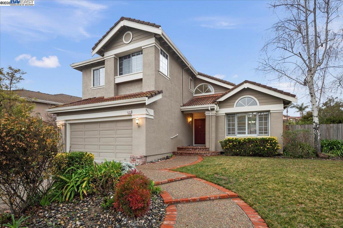
45060 Cougar Cir
Fremont, CA 94539
Today
Favorites
510-504-7177
-
Bedrooms
4
-
Bathrooms
2.5
-
Square Feet
2,144 sq ft
-
Available
Available Now
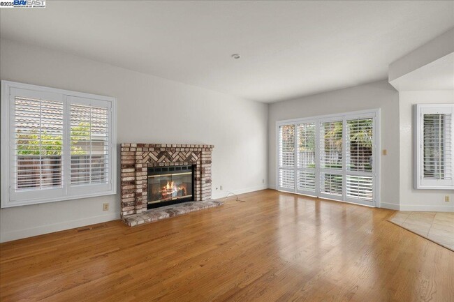
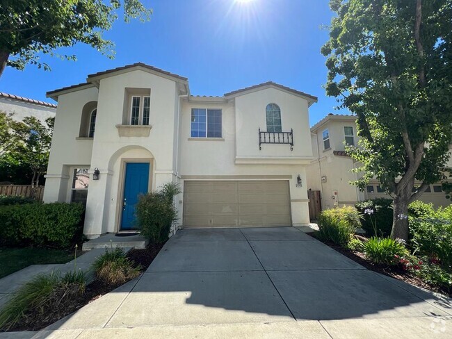
45060 Cougar Cir

Favorites
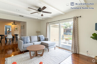
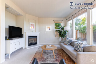
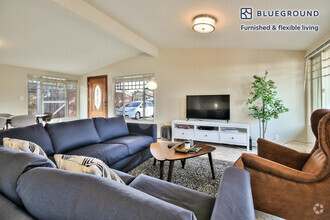
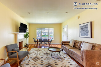
About This Home
Available Now
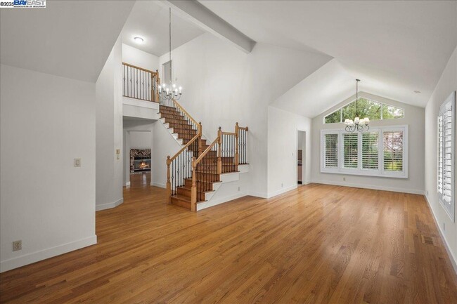
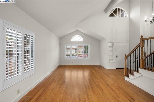
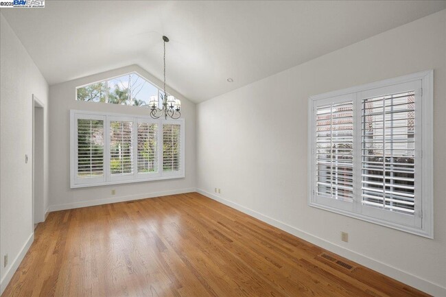
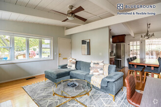
4 Bedrooms,2 Bathrooms,2144 Sq. Ft. 2 Car Garage. Gardener included.
45060 Cougar Cir is a house located in Alameda County and the 94539 ZIP Code. This area is served by the Fremont Unified attendance zone.
* Price shown is base rent and may not include non-optional fees and utilities.
Price, availability, fees, and any applicable rent special are subject to change without notice.
* Square footage definitions vary. Displayed square footage is approximate.
Contact
- Listed by Sherri Stoneberger | Legacy Real Estate & Assoc.
- Phone Number
- Contact
-
Source
 Bay East Association of REALTORS ®
Copyright© 2025 Bay East, Contra Costa, bridgeMLS. All rights reserved. All information provided by the listing agent/broker is deemed reliable but is not guaranteed and should be independently verified.
Location
Get Directions
Fremont is a charming city in the San Francisco Bay Area that sits across the Bay from the Silicon Valley. It is known as an ideal destination for families, offering kid-friendly attractions and excellent public schools like the Children’s Natural History Museum and Washington High School. The rapid expansion of the tech industry in recent years has boosted Fremont’s reputation as a commuter-friendly city for those working in the Silicon Valley. Fremont is located directly north of San Jose, and Palo Alto is a short drive across the Dumbarton Bridge on the Bay.
Fremont’s local culture incorporates the area’s rich history and thriving arts scene. Check out the Old Town Niles region that features a popular art walk, antique fair, and a museum celebrating the town’s role in the early days of motion picture production. Exquisite historic architecture is on display around the city, so be sure to explore Fremont’s picturesque streets that blend urban amenities and suburban neighborhoods.
Learn more about living in Fremont
Education
| Colleges & Universities | Distance | ||
|---|---|---|---|
| Colleges & Universities | Distance | ||
| Drive: | 4 min | 1.6 mi | |
| Drive: | 11 min | 5.9 mi | |
| Drive: | 15 min | 9.7 mi | |
| Drive: | 21 min | 14.5 mi |
45060 Cougar Cir is within 4 minutes or 1.6 miles from Ohlone College, Fremont Campus. It is also near Ohlone College, Newark and Palmer College of Chiropractic West Campus.
Schools


Public Elementary School
Grades K-5
343 Students
Nearby
Public Elementary School
Grades K-5
461 Students
Attendance Zone
Public Middle School
Grades 6-8
1,562 Students
Attendance Zone
Public High School
Grades 9-12
2,207 Students
Attendance Zone
Private Elementary School
Grades PK-6
231 Students
Nearby
Private Elementary School
Grades K
30 Students
Nearby
Private Middle & High School
Grades 7-12
59 Students
Nearby
School data provided by
 The GreatSchools Rating helps parents compare schools within a state based on a variety of school quality indicators and provides a helpful picture of how effectively each school serves all of its students. Ratings are on a scale of 1 (below average) to 10 (above average) and can include test scores, college readiness, academic progress, advanced courses, equity, discipline and attendance data. We also advise parents to visit schools, consider other information on school performance and programs, and consider family needs as part of the school selection process.
View GreatSchools Rating Methodology
View GreatSchools Rating Methodology
Transportation options available in Fremont include Warm Springs / South Fremont, located 2.1 miles from 45060 Cougar Cir. 45060 Cougar Cir is near Norman Y Mineta San Jose International, located 13.8 miles or 19 minutes away, and Metro Oakland International, located 25.8 miles or 35 minutes away.
| Transit / Subway | Distance | ||
|---|---|---|---|
| Transit / Subway | Distance | ||
|
|
Drive: | 5 min | 2.1 mi |
|
|
Drive: | 13 min | 6.2 mi |
|
|
Drive: | 13 min | 8.3 mi |
|
|
Drive: | 13 min | 8.4 mi |
|
|
Drive: | 13 min | 8.5 mi |
| Commuter Rail | Distance | ||
|---|---|---|---|
| Commuter Rail | Distance | ||
| Drive: | 15 min | 7.2 mi | |
| Drive: | 16 min | 11.4 mi | |
| Drive: | 20 min | 13.5 mi | |
| Drive: | 20 min | 14.3 mi | |
| Drive: | 22 min | 14.5 mi |
| Airports | Distance | ||
|---|---|---|---|
| Airports | Distance | ||
|
Norman Y Mineta San Jose International
|
Drive: | 19 min | 13.8 mi |
|
Metro Oakland International
|
Drive: | 35 min | 25.8 mi |
Time and distance from 45060 Cougar Cir.
| Shopping Centers | Distance | ||
|---|---|---|---|
| Shopping Centers | Distance | ||
| Drive: | 4 min | 1.8 mi | |
| Drive: | 5 min | 2.3 mi | |
| Drive: | 5 min | 2.3 mi |
45060 Cougar Cir has 3 shopping centers within 2.3 miles, which is about a 5-minute drive. The miles and minutes will be for the farthest away property.
| Parks and Recreation | Distance | ||
|---|---|---|---|
| Parks and Recreation | Distance | ||
|
Central Park (Lake Elizabeth)
|
Drive: | 13 min | 5.7 mi |
|
Mission Peak Regional Preserve
|
Drive: | 20 min | 6.2 mi |
|
Niles Community Park
|
Drive: | 15 min | 7.3 mi |
|
Ed Levin County Park
|
Drive: | 19 min | 10.2 mi |
|
Sunol Regional Wilderness
|
Drive: | 28 min | 13.2 mi |
45060 Cougar Cir has 5 parks within 13.2 miles, including Mission Peak Regional Preserve, Central Park (Lake Elizabeth), and Niles Community Park.
| Hospitals | Distance | ||
|---|---|---|---|
| Hospitals | Distance | ||
| Drive: | 11 min | 5.6 mi | |
| Drive: | 13 min | 6.5 mi |
45060 Cougar Cir is 5.6 miles from Kaiser Foundation Hospital - Fremont, and is convenient to other hospitals, including Washington Hospital.
| Military Bases | Distance | ||
|---|---|---|---|
| Military Bases | Distance | ||
| Drive: | 25 min | 16.6 mi |
45060 Cougar Cir is 16.6 miles and a 25 minute drive from Ames Research Center.
You May Also Like
Similar Rentals Nearby


What Are Walk Score®, Transit Score®, and Bike Score® Ratings?
Walk Score® measures the walkability of any address. Transit Score® measures access to public transit. Bike Score® measures the bikeability of any address.
What is a Sound Score Rating?
A Sound Score Rating aggregates noise caused by vehicle traffic, airplane traffic and local sources

45060 Cougar Cir
Fremont, CA 94539