
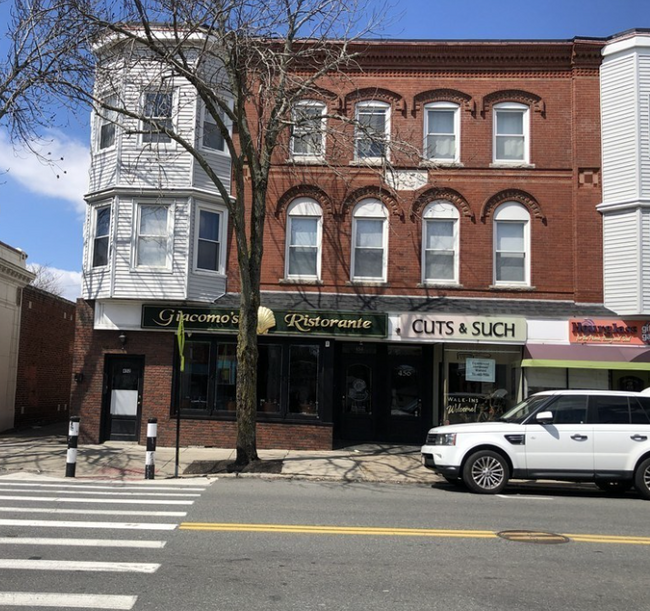
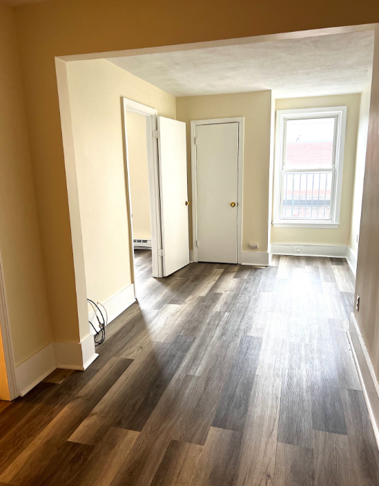
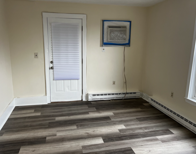
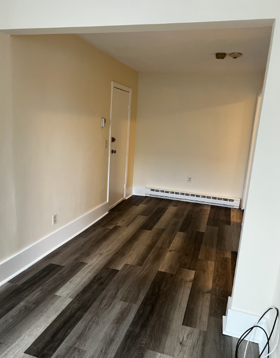
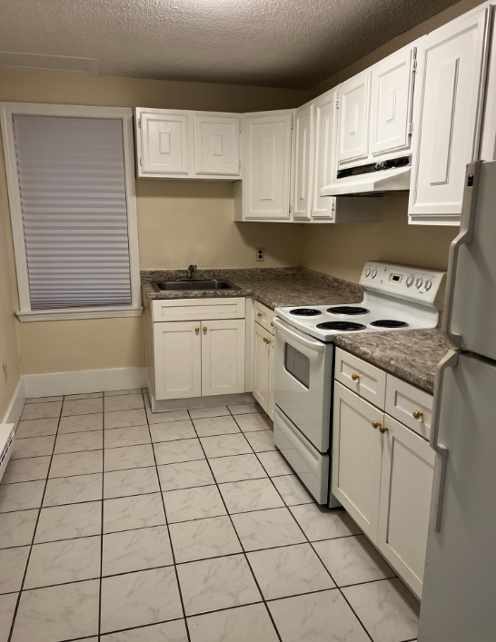
452 Main St Unit 3
Melrose, MA 02176
Favorites

452 Main St Unit 3
Favorites
Check Back Soon for Upcoming Availability
| Beds | Baths | Average SF |
|---|---|---|
| 1 Bedroom 1 Bedroom 1 Br | 1 Bath 1 Bath 1 Ba | 9,999 SF |
Fees and Policies
The fees below are based on community-supplied data and may exclude additional fees and utilities.
- Parking
-
Surface Lot--
Details
Utilities Included
-
Water
Property Information
-
4 units
Property Address:
452 Main St,
Melrose,
MA
02176
 This Property
 Available Property
Downtown Melrose combines a lively commercial area with the feel of a suburb. Located 10 miles north of Boston, commuters can travel into the large city via Interstate 93 or the MBTA Haverhill Commuter Rail Line. Downtown Melrose has great schools, locally owned restaurants and stores, and a scenic pond. Ell Pond is surrounded by several parks and recreational facilities including Melrose Dog Park, a skate park, tennis courts, and a pool. For even more outdoor fun, Downtown Melrose is just a mile from Middlesex Fells Reservation, a local favorite for hiking and kayaking. Residents in this close-knit neighborhood host many annual events like the Home for the Holidays festival in December. Rental options in Downtown Melrose include a mix of stately multi-family Victorian houses, apartments, and upscale condos.
Learn more about living in Downtown MelroseBelow are rent ranges for similar nearby apartments
Expenses
Utilities Included
Water
Included
Education
| Colleges & Universities | Distance | ||
|---|---|---|---|
| Colleges & Universities | Distance | ||
| Drive: | 10 min | 5.3 mi | |
| Drive: | 12 min | 5.9 mi | |
| Drive: | 14 min | 7.1 mi | |
| Drive: | 15 min | 7.5 mi |
452 Main St Unit 3 is within 10 minutes or 5.3 miles from Tufts Univ., Medford. It is also near Bunker Hill Community College and Lesley University, Porter.
Transportation options available in Melrose include Oak Grove Station, located 1.4 miles from 452 Main St Unit 3. 452 Main St Unit 3 is near General Edward Lawrence Logan International, located 8.2 miles or 17 minutes away.
| Transit / Subway | Distance | ||
|---|---|---|---|
| Transit / Subway | Distance | ||
|
|
Drive: | 2 min | 1.4 mi |
|
|
Drive: | 5 min | 2.4 mi |
|
|
Drive: | 8 min | 4.0 mi |
| Drive: | 10 min | 5.3 mi | |
| Drive: | 11 min | 5.7 mi |
| Commuter Rail | Distance | ||
|---|---|---|---|
| Commuter Rail | Distance | ||
|
|
Walk: | 7 min | 0.4 mi |
|
|
Walk: | 11 min | 0.6 mi |
|
|
Drive: | 3 min | 1.3 mi |
|
|
Drive: | 5 min | 2.2 mi |
|
|
Drive: | 5 min | 2.4 mi |
| Airports | Distance | ||
|---|---|---|---|
| Airports | Distance | ||
|
General Edward Lawrence Logan International
|
Drive: | 17 min | 8.2 mi |
Time and distance from 452 Main St Unit 3.
| Shopping Centers | Distance | ||
|---|---|---|---|
| Shopping Centers | Distance | ||
| Walk: | 16 min | 0.8 mi | |
| Walk: | 20 min | 1.1 mi | |
| Drive: | 4 min | 2.0 mi |
452 Main St Unit 3 has 3 shopping centers within 2.0 miles, which is about a 4-minute drive. The miles and minutes will be for the farthest away property.
| Parks and Recreation | Distance | ||
|---|---|---|---|
| Parks and Recreation | Distance | ||
|
Friends of Middlesex Fells Reservation
|
Walk: | 5 min | 0.3 mi |
|
Middlesex Fells Reservation
|
Drive: | 3 min | 1.5 mi |
|
Walter D. Stone Memorial Zoo
|
Drive: | 4 min | 2.0 mi |
|
Saugus Ironworks National Historic Site
|
Drive: | 8 min | 4.1 mi |
|
Breakheart Reservation
|
Drive: | 13 min | 5.0 mi |
452 Main St Unit 3 has 5 parks within 5.0 miles, including Friends of Middlesex Fells Reservation, Middlesex Fells Reservation, and Walter D. Stone Memorial Zoo.
| Hospitals | Distance | ||
|---|---|---|---|
| Hospitals | Distance | ||
| Walk: | 9 min | 0.5 mi | |
| Drive: | 10 min | 4.1 mi | |
| Drive: | 14 min | 7.2 mi |
452 Main St Unit 3 has 3 hospitals within 7.2 miles, the nearest is MelroseWakefield Healthcare which is 0.5 mile away and a 9 minutes drive.
| Military Bases | Distance | ||
|---|---|---|---|
| Military Bases | Distance | ||
| Drive: | 26 min | 14.0 mi | |
| Drive: | 25 min | 14.8 mi |
452 Main St Unit 3 is 14.0 miles from Fort Pickering, and is convenient to other military bases, including Hanscom Air Force Base.
You May Also Like
Similar Rentals Nearby


What Are Walk Score®, Transit Score®, and Bike Score® Ratings?
Walk Score® measures the walkability of any address. Transit Score® measures access to public transit. Bike Score® measures the bikeability of any address.
What is a Sound Score Rating?
A Sound Score Rating aggregates noise caused by vehicle traffic, airplane traffic and local sources
452 Main St
Melrose, MA 02176