$2,345 / Month
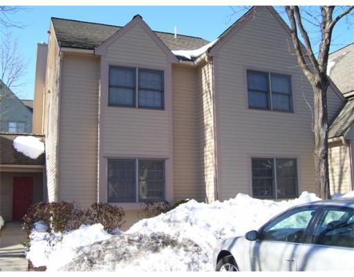
46 Kings Way
Waltham, MA 02451
2 Weeks Ago
Favorites
46 Kings Way

Favorites
Check Back Soon for Upcoming Availability
| Beds | Baths | Average SF |
|---|---|---|
| 2 Bedrooms 2 Bedrooms 2 Br | 1 Bath 1 Bath 1 Ba | 1,100 SF |
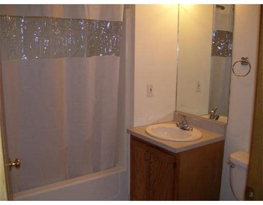
About This Property
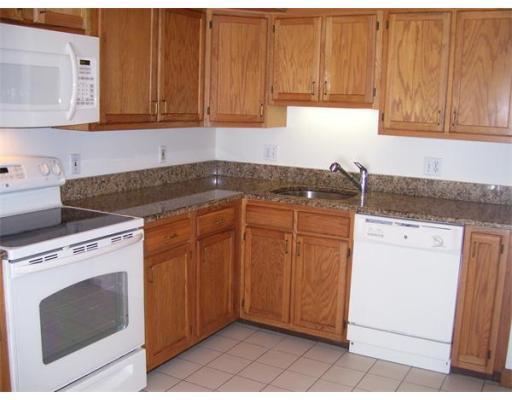
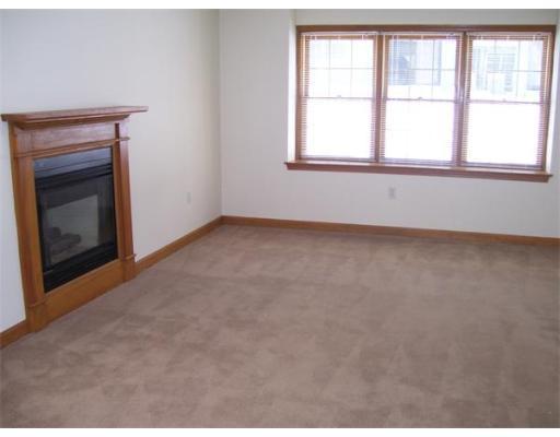
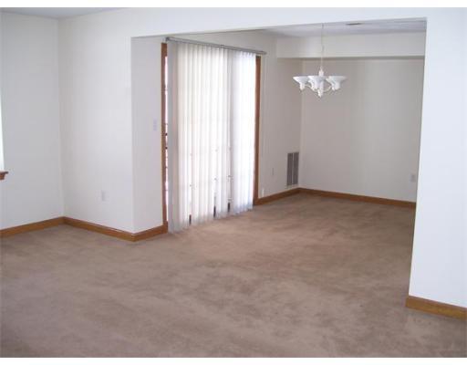
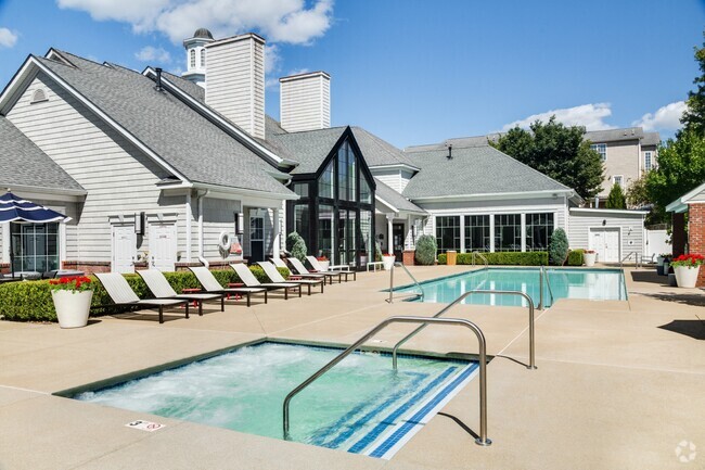
Beautiful three bedrom two bath apartment, gas fireplace, private entrance, and patio. Fully applianced kitchen with granite countertops. Central air conditioning, tennis court, extra parking, ceramic tiled kitchen and baths, w/d hookups and rentals available. Convenient to Routes 128 & 2, cats welcome. All the amenities of a home without the worries!
46 Kings Way is an apartment community located in Middlesex County and the 02451 ZIP Code.
Location
Get Directions
Suburban life is calling in the family-friendly neighborhood of Lakeview! This suburban paradise is situated just a few minutes north of Downtown Waltham, Massachusetts. Though not actually located on a lake, Lakeview surrounds Hardy Pond and offers scenic water views with opportunities for fishing on the shoreline!
Throughout the neighborhood, you’ll discover playgrounds, tennis courts, basketball courts, and baseball fields perfect for family fun. Popular retailers like T.J. Maxx and convenience stores like CVS reside around town, but if you’re looking for more shopping, just travel south to Downtown Waltham for a larger variety.
Public bus stations make traveling through the neighborhood and to nearby towns convenient, and Lakeview is near major interstates like I-95, as well.
Learn more about living in LakeviewBelow are rent ranges for similar nearby apartments
Education
| Colleges & Universities | Distance | ||
|---|---|---|---|
| Colleges & Universities | Distance | ||
| Drive: | 8 min | 3.0 mi | |
| Drive: | 10 min | 4.2 mi | |
| Drive: | 20 min | 8.2 mi | |
| Drive: | 18 min | 8.6 mi |
46 Kings Way is within 8 minutes or 3.0 miles from Bentley University. It is also near Brandeis University and Boston College.
Transportation options available in Waltham include Riverside Station, located 5.5 miles from 46 Kings Way. 46 Kings Way is near General Edward Lawrence Logan International, located 16.8 miles or 29 minutes away, and Worcester Regional, located 43.3 miles or 62 minutes away.
| Transit / Subway | Distance | ||
|---|---|---|---|
| Transit / Subway | Distance | ||
|
|
Drive: | 13 min | 5.5 mi |
|
|
Drive: | 12 min | 7.3 mi |
|
|
Drive: | 16 min | 7.4 mi |
|
|
Drive: | 13 min | 7.9 mi |
|
|
Drive: | 15 min | 8.6 mi |
| Commuter Rail | Distance | ||
|---|---|---|---|
| Commuter Rail | Distance | ||
|
|
Drive: | 6 min | 2.8 mi |
| Drive: | 7 min | 2.8 mi | |
|
|
Drive: | 8 min | 3.6 mi |
|
|
Drive: | 9 min | 4.1 mi |
|
|
Drive: | 10 min | 4.6 mi |
| Airports | Distance | ||
|---|---|---|---|
| Airports | Distance | ||
|
General Edward Lawrence Logan International
|
Drive: | 29 min | 16.8 mi |
|
Worcester Regional
|
Drive: | 62 min | 43.3 mi |
Time and distance from 46 Kings Way.
| Shopping Centers | Distance | ||
|---|---|---|---|
| Shopping Centers | Distance | ||
| Drive: | 4 min | 1.3 mi | |
| Drive: | 5 min | 1.9 mi | |
| Drive: | 5 min | 2.0 mi |
46 Kings Way has 3 shopping centers within 2.0 miles, which is about a 5-minute drive. The miles and minutes will be for the farthest away property.
| Parks and Recreation | Distance | ||
|---|---|---|---|
| Parks and Recreation | Distance | ||
|
Beaver Brook Reservation
|
Drive: | 9 min | 4.1 mi |
|
Codman Community Farms
|
Drive: | 10 min | 5.3 mi |
|
Mass Audubon's Drumlin Farm Wildlife Sanctuary
|
Drive: | 10 min | 5.6 mi |
|
Land's Sake Farm
|
Drive: | 11 min | 5.6 mi |
|
Mass Audubon's Habitat Education Center and Wildlife Sanctuary
|
Drive: | 12 min | 6.0 mi |
46 Kings Way has 5 parks within 6.0 miles, including Beaver Brook Reservation, Mass Audubon's Habitat Education Center and Wildlife Sanctuary, and Land's Sake Farm.
| Hospitals | Distance | ||
|---|---|---|---|
| Hospitals | Distance | ||
| Drive: | 7 min | 3.3 mi | |
| Drive: | 9 min | 5.1 mi | |
| Drive: | 12 min | 7.6 mi |
46 Kings Way has 3 hospitals within 7.6 miles, the nearest is Walden Behavioral Care which is 3.3 miles away and a 7 minute drive.
| Military Bases | Distance | ||
|---|---|---|---|
| Military Bases | Distance | ||
| Drive: | 12 min | 4.9 mi | |
| Drive: | 24 min | 13.4 mi |
46 Kings Way is 4.9 miles from Hanscom Air Force Base, and is convenient to other military bases, including US Military Reservation.
You May Also Like
Similar Rentals Nearby


What Are Walk Score®, Transit Score®, and Bike Score® Ratings?
Walk Score® measures the walkability of any address. Transit Score® measures access to public transit. Bike Score® measures the bikeability of any address.
What is a Sound Score Rating?
A Sound Score Rating aggregates noise caused by vehicle traffic, airplane traffic and local sources

46 Kings Way
Waltham, MA 02451