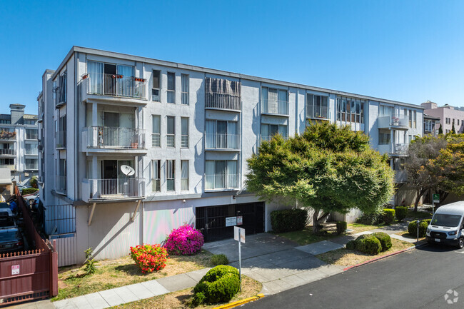
460 N Civic Dr
460 N Civic Dr,
Walnut Creek,
CA
94596
2 Weeks Ago
Favorites
460 N Civic Dr

Favorites
Check Back Soon for Upcoming Availability
About 460 N Civic Dr Walnut Creek, CA 94596
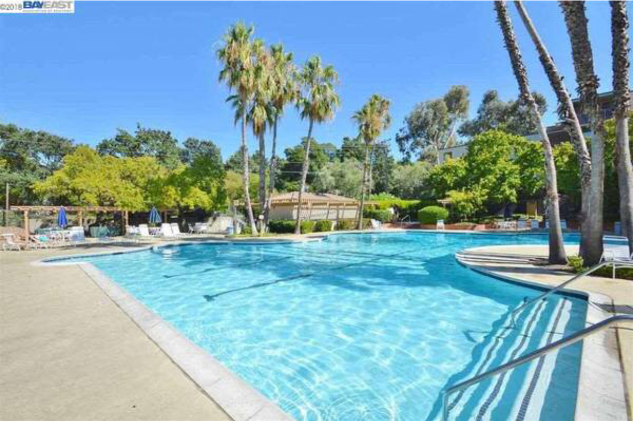
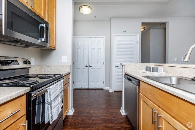
This cozy condo is conveniently located within a walking distance to downtown Walnut Creek. located on the top floor, where the laundry is located. The condo is about 550 Sqft. Enjoy all the amenities The Keys has to offer. Beautiful grounds, the clubhouse, 3 pools, tennis court, and gym. The rent: $1900 Includes water, garbage, garage parking and basic cable
460 N Civic Dr is an apartment community located in Contra Costa County and the 94596 ZIP Code.
Apartment Features
- Laundry Facilities
- Clubhouse
- Pool
- Tennis Court
Fees and Policies
The fees below are based on community-supplied data and may exclude additional fees and utilities.
- Parking
-
Garage--
Details
Lease Options
-
12 Month
Location
Get Directions
The Keys is a small suburban neighborhood located just a few blocks north of Downtown Walnut Creek. The neighborhood itself is almost entirely residential, with several parks and public schools nearby. Residents enjoy prime access to the wealth of shopping, dining, and entertainment in the city center, from the high-end Broadway Plaza open-air mall to the eclectic cafes and bars along Main Street. With convenient access to Interstate 680 and the Pleasant Hill/Contra Costa Centre BART station, living in The Keys puts the entire bay area at your fingertips.
Learn more about living in The KeysBelow are rent ranges for similar nearby apartments
Amenities
- Laundry Facilities
- Clubhouse
- Pool
- Tennis Court
Education
| Colleges & Universities | Distance | ||
|---|---|---|---|
| Colleges & Universities | Distance | ||
| Drive: | 11 min | 4.6 mi | |
| Drive: | 18 min | 7.7 mi | |
| Drive: | 25 min | 15.3 mi | |
| Drive: | 29 min | 19.1 mi |
460 N Civic Dr is within 11 minutes or 4.6 miles from Diablo Valley, Pleasant Hill. It is also near Saint Marys Coll. of Calif. and UC Berkeley.
Transportation options available in Walnut Creek include Walnut Creek Station, located 1.0 miles from 460 N Civic Dr. 460 N Civic Dr is near Metro Oakland International, located 25.1 miles or 35 minutes away, and San Francisco International, located 37.1 miles or 53 minutes away.
| Transit / Subway | Distance | ||
|---|---|---|---|
| Transit / Subway | Distance | ||
|
|
Walk: | 19 min | 1.0 mi |
|
|
Walk: | 20 min | 1.1 mi |
|
|
Drive: | 8 min | 5.1 mi |
|
|
Drive: | 10 min | 5.5 mi |
|
|
Drive: | 11 min | 7.1 mi |
| Commuter Rail | Distance | ||
|---|---|---|---|
| Commuter Rail | Distance | ||
|
|
Drive: | 16 min | 11.0 mi |
|
|
Drive: | 25 min | 16.5 mi |
|
|
Drive: | 25 min | 18.2 mi |
|
|
Drive: | 27 min | 19.8 mi |
|
|
Drive: | 28 min | 20.2 mi |
| Airports | Distance | ||
|---|---|---|---|
| Airports | Distance | ||
|
Metro Oakland International
|
Drive: | 35 min | 25.1 mi |
|
San Francisco International
|
Drive: | 53 min | 37.1 mi |
Time and distance from 460 N Civic Dr.
| Shopping Centers | Distance | ||
|---|---|---|---|
| Shopping Centers | Distance | ||
| Walk: | 10 min | 0.5 mi | |
| Walk: | 11 min | 0.6 mi | |
| Drive: | 3 min | 1.1 mi |
460 N Civic Dr has 3 shopping centers within 1.1 miles, which is about a 3-minute walk. The miles and minutes will be for the farthest away property.
| Parks and Recreation | Distance | ||
|---|---|---|---|
| Parks and Recreation | Distance | ||
|
Civic Park
|
Walk: | 18 min | 1.0 mi |
|
Butterfly Habitat Gardens
|
Walk: | 18 min | 1.0 mi |
|
Contra Costa Canal Regional Trail
|
Drive: | 3 min | 1.5 mi |
|
Gardens at Heather Farm
|
Drive: | 5 min | 2.2 mi |
|
Heather Farm Park
|
Drive: | 5 min | 2.3 mi |
460 N Civic Dr has 5 parks within 2.3 miles, including Civic Park, Butterfly Habitat Gardens, and Contra Costa Canal Regional Trail.
| Hospitals | Distance | ||
|---|---|---|---|
| Hospitals | Distance | ||
| Drive: | 3 min | 1.8 mi | |
| Drive: | 4 min | 1.8 mi | |
| Drive: | 9 min | 6.0 mi |
460 N Civic Dr has 3 hospitals within 6.0 miles, the nearest is John Muir Medical Center - Walnut Creek Campus which is 1.8 miles away and a 3 minute drive.
You May Also Like
Similar Rentals Nearby


What Are Walk Score®, Transit Score®, and Bike Score® Ratings?
Walk Score® measures the walkability of any address. Transit Score® measures access to public transit. Bike Score® measures the bikeability of any address.
What is a Sound Score Rating?
A Sound Score Rating aggregates noise caused by vehicle traffic, airplane traffic and local sources