
$1,200 / Month
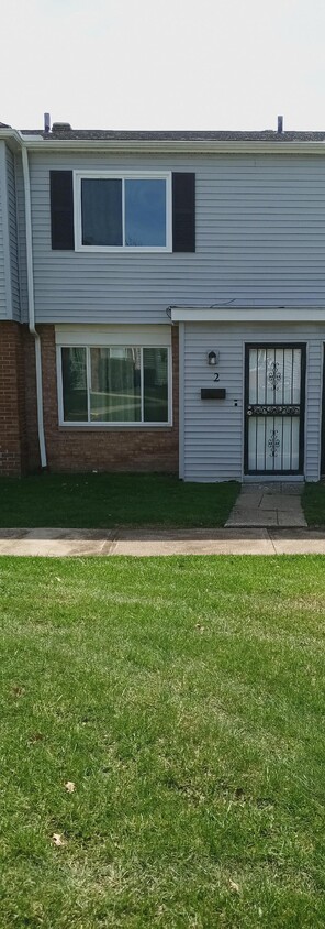
4670 Country Ln
Warrensville Heights, OH 44128
1 Day Ago
Favorites
216-400-5235
-
Bedrooms
2
-
Bathrooms
1.5
-
Square Feet
942 sq ft
-
Available
Available Now
4670 Country Ln

Favorites
About This Home
12 Month Lease,
$1,200 deposit,
Available Now
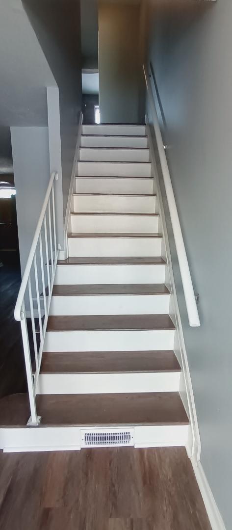
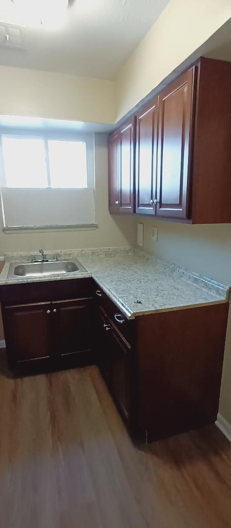
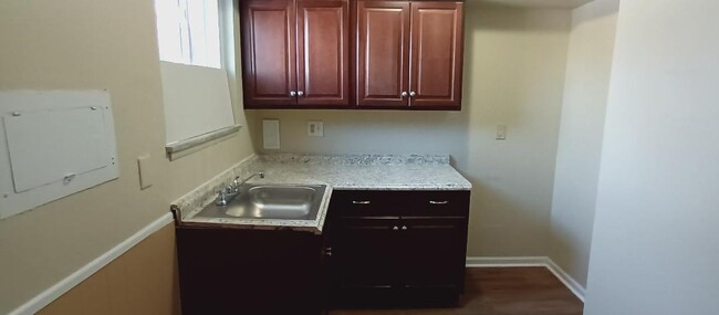
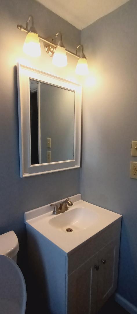
Beautifully Renovated Apartment — Move-In Ready! Step into this stunning, fully updated apartment featuring fresh, modern touches from top to bottom. Enjoy brand-new windows that fill the space with natural light, a sleek kitchen with contemporary finishes, and a stylishly updated bathroom. The chic laminate flooring flows seamlessly throughout, creating a warm, inviting atmosphere. Designed for comfort and convenience — this is the perfect place to call home. Come see it today!
4670 Country Ln is a townhome located in Cuyahoga County and the 44128 ZIP Code. This area is served by the Warrensville Heights City attendance zone.
* Price shown is base rent and may not include non-optional fees and utilities.
Price, availability, fees, and any applicable rent special are subject to change without notice.
* Square footage definitions vary. Displayed square footage is approximate.
Townhome Features
- Washer/Dryer Hookup
- Ceiling Fans
- Storage Space
- Kitchen
Fees and Policies
The fees below are based on community-supplied data and may exclude additional fees and utilities.
- Parking
-
Other--
Details
Utilities Included
-
Water
-
Sewer
Contact
- Phone Number
Location
Get Directions
Warrensville Heights is a southeastern suburb of Cleveland surrounded by the neighboring cities of Shaker Heights, Bedford Heights, and Maple Heights. Nicknamed “The Friendly City,” Warrensville Heights touts a community-oriented atmosphere along with quiet residential neighborhoods brimming with apartments and houses available for rent.
Warrensville Heights offers residents easy access to shopping opportunities at Harvard Park Shopping Center and Eton Chagrin Boulevard. Exciting entertainment options abound at JACK Thistledown Racino, where guests enjoy horseracing, dining, and much more.
Quick access to I-271 and I-480 makes commuting and traveling to Downtown Cleveland from Warrensville Heights easy.
Learn more about living in Warrensville Heights
Education
| Colleges & Universities | Distance | ||
|---|---|---|---|
| Colleges & Universities | Distance | ||
| Drive: | 6 min | 1.5 mi | |
| Drive: | 8 min | 2.9 mi | |
| Drive: | 15 min | 6.4 mi | |
| Drive: | 13 min | 7.1 mi |
4670 Country Ln is within 6 minutes or 1.5 miles from Cuyahoga C.C., East. It is also near Cuyahoga C.C., Eastern Campus and John Carroll University.
Schools

Public Elementary School
Grades PK-5
876 Students
Attendance Zone
Public Elementary School
Grades 3-5
255 Students
Attendance Zone
Public Middle School
Grades 6-8
374 Students
Attendance Zone
Public High School
Grades 9-12
547 Students
Attendance Zone
Private Elementary School
Grades K-6
45 Students
Nearby
Private High School
Grades 9-12
306 Students
Nearby
School data provided by
 The GreatSchools Rating helps parents compare schools within a state based on a variety of school quality indicators and provides a helpful picture of how effectively each school serves all of its students. Ratings are on a scale of 1 (below average) to 10 (above average) and can include test scores, college readiness, academic progress, advanced courses, equity, discipline and attendance data. We also advise parents to visit schools, consider other information on school performance and programs, and consider family needs as part of the school selection process.
View GreatSchools Rating Methodology
View GreatSchools Rating Methodology
Transportation options available in Warrensville Heights include Warrensville (Blue Line), located 4.7 miles from 4670 Country Ln. 4670 Country Ln is near Cleveland-Hopkins International, located 21.2 miles or 35 minutes away.
| Transit / Subway | Distance | ||
|---|---|---|---|
| Transit / Subway | Distance | ||
|
|
Drive: | 9 min | 4.7 mi |
|
|
Drive: | 11 min | 5.0 mi |
|
|
Drive: | 12 min | 5.1 mi |
|
|
Drive: | 9 min | 5.3 mi |
|
|
Drive: | 10 min | 5.6 mi |
| Commuter Rail | Distance | ||
|---|---|---|---|
| Commuter Rail | Distance | ||
| Drive: | 23 min | 10.5 mi | |
| Drive: | 20 min | 10.6 mi | |
| Drive: | 28 min | 14.6 mi | |
| Drive: | 29 min | 17.6 mi | |
|
|
Drive: | 33 min | 18.4 mi |
| Airports | Distance | ||
|---|---|---|---|
| Airports | Distance | ||
|
Cleveland-Hopkins International
|
Drive: | 35 min | 21.2 mi |
Time and distance from 4670 Country Ln.
| Shopping Centers | Distance | ||
|---|---|---|---|
| Shopping Centers | Distance | ||
| Walk: | 13 min | 0.7 mi | |
| Drive: | 5 min | 1.6 mi | |
| Drive: | 5 min | 1.7 mi |
4670 Country Ln has 3 shopping centers within 1.7 miles, which is about a 5-minute walk. The miles and minutes will be for the farthest away property.
| Parks and Recreation | Distance | ||
|---|---|---|---|
| Parks and Recreation | Distance | ||
|
South Chagrin Reservation
|
Drive: | 13 min | 5.5 mi |
|
Acacia Reservation
|
Drive: | 12 min | 6.6 mi |
|
Garfield Park Nature Center
|
Drive: | 15 min | 7.3 mi |
|
Nature Center at Shaker Lakes
|
Drive: | 14 min | 7.7 mi |
|
Bedford Reservation
|
Drive: | 20 min | 10.1 mi |
4670 Country Ln has 5 parks within 10.1 miles, including South Chagrin Reservation, Acacia Reservation, and Bedford Reservation.
| Hospitals | Distance | ||
|---|---|---|---|
| Hospitals | Distance | ||
| Drive: | 5 min | 2.0 mi | |
| Drive: | 7 min | 3.1 mi | |
| Drive: | 7 min | 3.7 mi |
4670 Country Ln has 3 hospitals within 3.7 miles, the nearest is University Hospitals Ahuja Medical Center which is 2.0 miles away and a 5 minute drive.
| Military Bases | Distance | ||
|---|---|---|---|
| Military Bases | Distance | ||
| Drive: | 99 min | 82.3 mi |
4670 Country Ln is 82.3 miles and a 99 minute drive from Mansfield Lahm Airport Air Guard Station.
Amenities
- Washer/Dryer Hookup
- Ceiling Fans
- Storage Space
- Kitchen
4670 Country Ln Photos
What Are Walk Score®, Transit Score®, and Bike Score® Ratings?
Walk Score® measures the walkability of any address. Transit Score® measures access to public transit. Bike Score® measures the bikeability of any address.
What is a Sound Score Rating?
A Sound Score Rating aggregates noise caused by vehicle traffic, airplane traffic and local sources
4670 Country Ln
Warrensville Heights, OH 44128