47 N Main St Unit 2
West Boylston, MA 01583
-
Bedrooms
1
-
Bathrooms
1
-
Square Feet
--
-
Available
Available May 1

About This Home
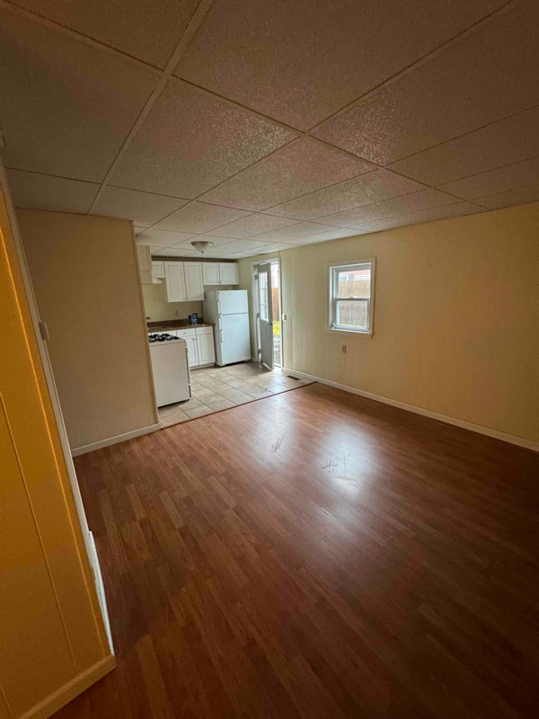
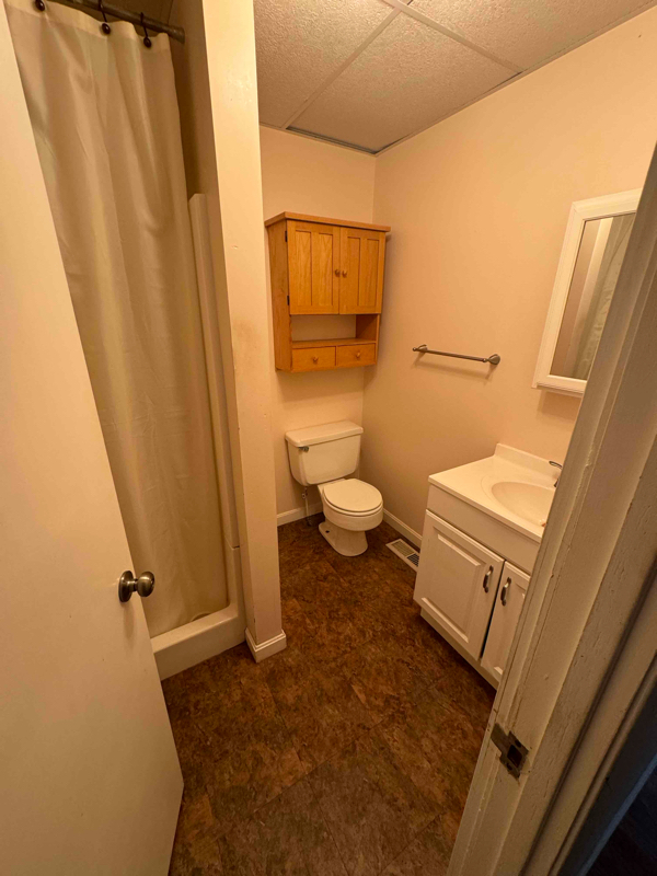
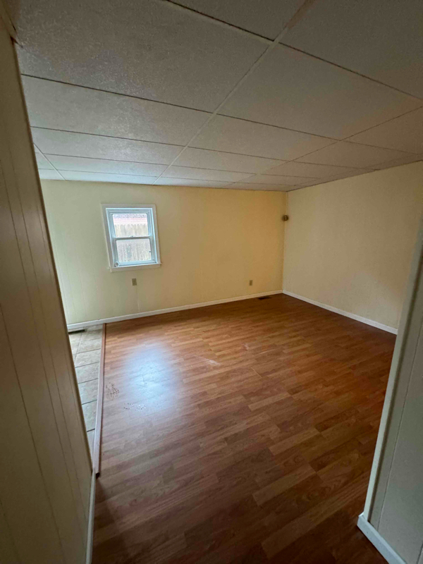
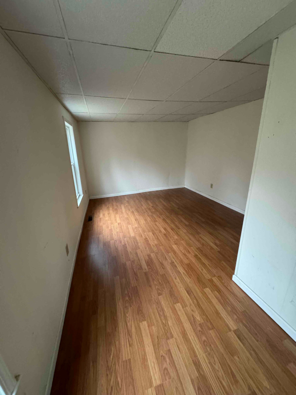
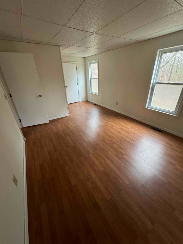
Property Id: 1816031 Nice first floor one bedroom in great location. Close To 190 and walking trails. Parking in driveway and laundry in building. Tenant pays propane and electricity. One year lease. First and last (security negotiable) To view please text Wally RE Agent .
47 N Main St is an apartment community located in Worcester County and the 01583 ZIP Code.
Contact
- Phone Number
- Contact
-
Source

Wrapped around the Wachusett Reservoir, West Boylston provides a classic New England setting complete with expansive, wooded areas, historic charm, and large homes. First settled in 1642 and incorporated in 1808, West Boylston is known as the “small town with a big heart.” Today, it is a popular suburb of Worcester, located directly south. Residents of West Boylston enjoy easy access to the University of Massachusetts Medical School, Quinsigamond Community College, and Tower Hill Botanic Garden.
If you believe classic New England is synonymous with the Farmer’s Almanac, then it’s worth noting that the founder and editor of the Farmer’s Almanac, Robert B. Thomas, lived in West Boylston. He started the Farmer’s Almanac in 1792, making it the oldest continuously published periodical in the country. Other historic locations include Bigelow Tavern, built in 1810; the Oakdale Village Historic District, dating back to 1780; and the Quinapoxet River Bridge, built in 1903.
Learn more about living in West Boylston| Colleges & Universities | Distance | ||
|---|---|---|---|
| Colleges & Universities | Distance | ||
| Drive: | 13 min | 6.2 mi | |
| Drive: | 17 min | 9.1 mi | |
| Drive: | 14 min | 11.1 mi | |
| Drive: | 19 min | 12.0 mi |
Transportation options available in West Boylston include Riverside Station, located 41.1 miles from 47 N Main St Unit 2. 47 N Main St Unit 2 is near Worcester Regional, located 16.3 miles or 25 minutes away.
| Transit / Subway | Distance | ||
|---|---|---|---|
| Transit / Subway | Distance | ||
|
|
Drive: | 56 min | 41.1 mi |
|
|
Drive: | 56 min | 41.4 mi |
|
|
Drive: | 57 min | 42.1 mi |
|
|
Drive: | 60 min | 43.7 mi |
|
|
Drive: | 60 min | 43.9 mi |
| Commuter Rail | Distance | ||
|---|---|---|---|
| Commuter Rail | Distance | ||
|
|
Drive: | 16 min | 11.8 mi |
|
|
Drive: | 16 min | 11.9 mi |
|
|
Drive: | 16 min | 12.4 mi |
|
|
Drive: | 25 min | 13.7 mi |
|
|
Drive: | 26 min | 14.5 mi |
| Airports | Distance | ||
|---|---|---|---|
| Airports | Distance | ||
|
Worcester Regional
|
Drive: | 25 min | 16.3 mi |
Time and distance from 47 N Main St Unit 2.
| Shopping Centers | Distance | ||
|---|---|---|---|
| Shopping Centers | Distance | ||
| Drive: | 4 min | 2.6 mi | |
| Drive: | 5 min | 2.8 mi | |
| Drive: | 6 min | 3.1 mi |
| Parks and Recreation | Distance | ||
|---|---|---|---|
| Parks and Recreation | Distance | ||
|
Mass Audubon's Eagle Lake Wildlife Sanctuary
|
Drive: | 13 min | 6.1 mi |
|
Tower Hill Botanic Garden
|
Drive: | 12 min | 7.1 mi |
|
Mass Audubon's Wachusett Meadow Wildlife Sanctuary
|
Drive: | 14 min | 8.2 mi |
|
Heifer Learning Center at Overlook Farm
|
Drive: | 18 min | 9.2 mi |
|
Mount Pisgah Conservation Area
|
Drive: | 25 min | 10.8 mi |
| Hospitals | Distance | ||
|---|---|---|---|
| Hospitals | Distance | ||
| Drive: | 17 min | 9.1 mi | |
| Drive: | 18 min | 9.6 mi | |
| Drive: | 14 min | 10.9 mi |
You May Also Like
What Are Walk Score®, Transit Score®, and Bike Score® Ratings?
Walk Score® measures the walkability of any address. Transit Score® measures access to public transit. Bike Score® measures the bikeability of any address.
What is a Sound Score Rating?
A Sound Score Rating aggregates noise caused by vehicle traffic, airplane traffic and local sources

47 N Main St
West Boylston, MA 01583