
$3,299 / Month
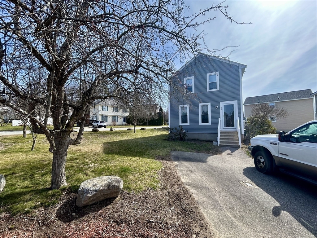
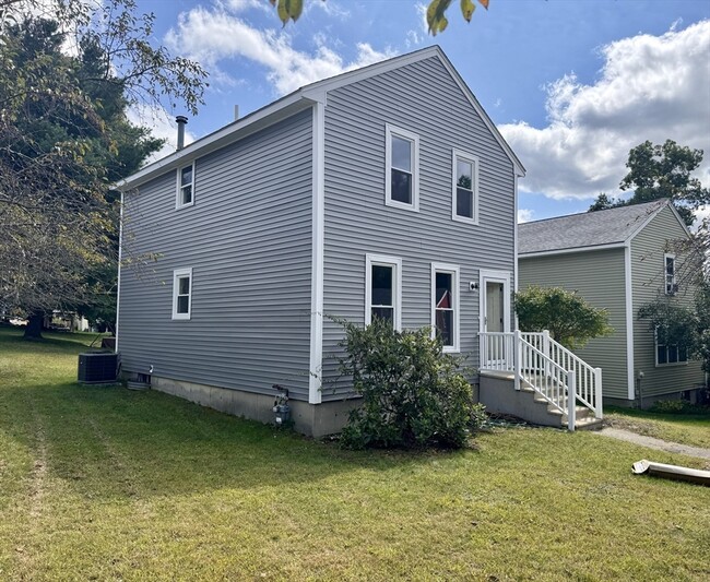
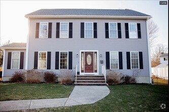
47 Wyman Rd
Dracut, MA 01826
Today
Favorites
978-390-1700
-
Bedrooms
2
-
Bathrooms
1.5
-
Square Feet
1,200 sq ft
-
Available
Available Now
Highlights
- Golf Course Community
- Medical Services
- Deck
- Property is near public transit
- Jogging Path
- No Cooling
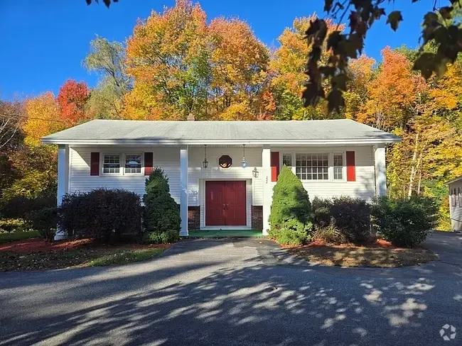
47 Wyman Rd

Favorites
About This Home
$3,299 deposit,
Available Now
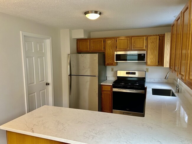
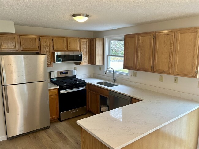
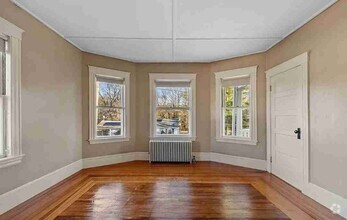
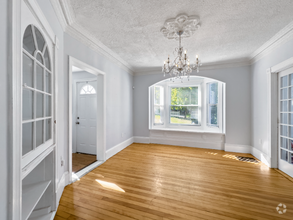
This is the one you've been waiting for! This beautifully renovated single-family home features modern finishes throughout. Located at the end of a cul-de-sac just outside of Dracut's Collinsville district in a quiet neighborhood,this property offers a level of privacy rarely found in Greater Lowell's rental market. The first floor welcomes you with a spacious living room and dining area,a half bath,and a fully updated kitchen complete with new stainless steel appliances and quartz countertops. Through the sliding glass doors in the dining area,you will find a deck and a private,shaded outdoor space. On the second floor of the home,there are two generously sized bedrooms and a full bathroom. The unfinished basement space offers ample storage opportunities. This home won't last long; reach out today!
47 Wyman Rd is a house located in Middlesex County and the 01826 ZIP Code. This area is served by the Dracut attendance zone.
* Price shown is base rent and may not include non-optional fees and utilities.
Price, availability, fees, and any applicable rent special are subject to change without notice.
* Square footage definitions vary. Displayed square footage is approximate.
Home Details
Home Type
Single Family Detached Home
Year Built
Built in 1993
Accessible Home Design
Entry on the 1st floor
Bedrooms and Bathrooms
Primary bedroom located on second floor
1.5 Bathrooms
2 Bedrooms
Interior Spaces
1,200 Sq Ft Home
Laundry
Laundry in unit
Listing and Financial Details
Security Deposit $3,299
Property Available on 6/1/25
12 Month Lease Term
Assessor Parcel Number M:33 B:6 L:26,3510535
Rent includes trash collection, snow removal, gardener
Location
Property is near public transit
Property is near schools
Lot Details
Near Conservation Area
Outdoor Features
Deck
Parking
2 Car Parking Spaces
Schools
Dracut Elementary And Middle School
Dracut High School
Utilities
No Cooling
Community Details
Amenities
Medical Services
Shops
Coin Laundry
Overview
No Home Owners Association
Pet Policy
Pets Allowed
Recreation
Golf Course Community
Jogging Path
Park
Bike Trail
Contact
- Listed by Michael Page | LAER Realty Partners
- Phone Number
-
Source
 MLS Property Information Network
The property listing data and information set forth herein were provided to MLS Property Information Network, Inc. from third party sources, including sellers, lessors and public records, and were compiled by MLS Property Information Network, Inc. The property listing data and information are for the personal, non-commercial use of consumers having a good faith interest in purchasing or leasing listed properties of the type displayed to them and may not be used for any purpose other than to identify prospective properties which such consumers may have a good faith interest in purchasing or leasing. MLS Property Information Network, Inc. and its subscribers disclaim any and all representations and warranties as to the accuracy of the property listing data and information set forth herein. All properties are subject to prior sale, change or withdrawal. Copyright © 2025 MLS Property Information Network, Inc. All rights reserved.
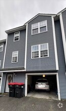
$3,604 / month
$589,900 Listing Price
5 Beds
•1.5 Baths
•
2,192 Sq Ft
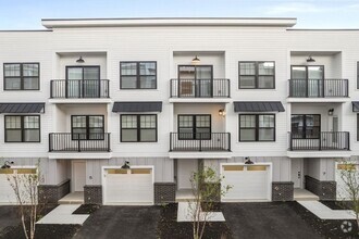
$2,959 / month
$479,900 Listing Price
3 Beds
•2 Baths
•
1,620 Sq Ft
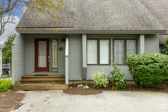
$2,941 / month
$479,999 Listing Price
3 Beds
•2 Baths
•
936 Sq Ft
Location
Get Directions
Amenities
- Deck
The city of Dracut is settled on the Massachusetts-New Hampshire state line to the north and the Merrimack River to the south. This riverfront suburb offers a quaint, peaceful atmosphere with a park-like environment that you’re sure to enjoy.
Though the residential streets of Dracut are calm, once you take a leap over the Merrimack River, you’ll be in Downtown Lowell where you’ll discover historic museums, galleries, restaurants, shops, and more! Situated 32 miles northwest of Boston, Dracut is far enough from the hustle and bustle of urban living while still being in easy driving distance. Directly north of the University of Massachusetts Lowell, the city has a youthful vibe that comes from this popular university just minutes from your potential new home.
To the east, Dracut shares a portion of national state forest with its neighboring cities of Lowell and Tyngsborough.
Learn more about living in Dracut
Education
| Colleges & Universities | Distance | ||
|---|---|---|---|
| Colleges & Universities | Distance | ||
| Drive: | 6 min | 3.2 mi | |
| Drive: | 9 min | 4.2 mi | |
| Drive: | 19 min | 8.9 mi | |
| Drive: | 28 min | 15.5 mi |
47 Wyman Rd is within 6 minutes or 3.2 miles from UMass Lowell. It is also near Middlesex C.C., Lowell Campus and Rivier College.
Schools


Public Elementary School
Grades K-5
532 Students
Attendance Zone
Public Elementary School
Grades PK-4
428 Students
Nearby
Public Middle School
Grades 6-8
848 Students
Attendance Zone
Public High School
Grades 9-12
847 Students
Attendance Zone
Private Elementary School
Grades PK-1
7 Students
Nearby
Private Elementary & Middle School
Grades PK-8
239 Students
Nearby
Private Middle & High School
Grades 6-12
19 Students
Nearby
School data provided by
 The GreatSchools Rating helps parents compare schools within a state based on a variety of school quality indicators and provides a helpful picture of how effectively each school serves all of its students. Ratings are on a scale of 1 (below average) to 10 (above average) and can include test scores, college readiness, academic progress, advanced courses, equity, discipline and attendance data. We also advise parents to visit schools, consider other information on school performance and programs, and consider family needs as part of the school selection process.
View GreatSchools Rating Methodology
View GreatSchools Rating Methodology
Transportation options available in Dracut include Alewife Station, located 25.4 miles from 47 Wyman Rd. 47 Wyman Rd is near Manchester Boston Regional, located 25.8 miles or 43 minutes away, and General Edward Lawrence Logan International, located 34.1 miles or 53 minutes away.
| Transit / Subway | Distance | ||
|---|---|---|---|
| Transit / Subway | Distance | ||
|
|
Drive: | 43 min | 25.4 mi |
|
|
Drive: | 43 min | 26.3 mi |
|
|
Drive: | 43 min | 27.6 mi |
| Drive: | 43 min | 27.8 mi | |
|
|
Drive: | 44 min | 28.7 mi |
| Commuter Rail | Distance | ||
|---|---|---|---|
| Commuter Rail | Distance | ||
|
|
Drive: | 9 min | 4.4 mi |
|
|
Drive: | 18 min | 8.7 mi |
|
|
Drive: | 27 min | 12.7 mi |
|
|
Drive: | 25 min | 12.8 mi |
|
|
Drive: | 26 min | 14.7 mi |
| Airports | Distance | ||
|---|---|---|---|
| Airports | Distance | ||
|
Manchester Boston Regional
|
Drive: | 43 min | 25.8 mi |
|
General Edward Lawrence Logan International
|
Drive: | 53 min | 34.1 mi |
Time and distance from 47 Wyman Rd.
| Shopping Centers | Distance | ||
|---|---|---|---|
| Shopping Centers | Distance | ||
| Walk: | 9 min | 0.5 mi | |
| Drive: | 4 min | 2.2 mi | |
| Drive: | 5 min | 2.2 mi |
47 Wyman Rd has 3 shopping centers within 2.2 miles, which is about a 5-minute walk. The miles and minutes will be for the farthest away property.
| Parks and Recreation | Distance | ||
|---|---|---|---|
| Parks and Recreation | Distance | ||
|
Lowell National Historical Park
|
Drive: | 8 min | 4.0 mi |
|
Lowell Heritage State Park
|
Drive: | 9 min | 5.0 mi |
|
Lowell-Dracut-Tyngsboro State Forest
|
Drive: | 12 min | 5.5 mi |
|
The Butterfly Place
|
Drive: | 16 min | 8.0 mi |
|
MIT Haystack Observatory
|
Drive: | 25 min | 12.4 mi |
47 Wyman Rd has 5 parks within 12.4 miles, including Lowell-Dracut-Tyngsboro State Forest, Lowell National Historical Park, and Lowell Heritage State Park.
| Hospitals | Distance | ||
|---|---|---|---|
| Hospitals | Distance | ||
| Drive: | 7 min | 3.7 mi | |
| Drive: | 22 min | 10.0 mi | |
| Drive: | 22 min | 11.3 mi |
47 Wyman Rd has 3 hospitals within 11.3 miles, the nearest is Lowell General Hospital which is 3.7 miles away and a 7 minute drive.
| Military Bases | Distance | ||
|---|---|---|---|
| Military Bases | Distance | ||
| Drive: | 33 min | 19.0 mi |
47 Wyman Rd is 19.0 miles and a 33 minute drive from Hanscom Air Force Base.
You May Also Like
Similar Rentals Nearby
What Are Walk Score®, Transit Score®, and Bike Score® Ratings?
Walk Score® measures the walkability of any address. Transit Score® measures access to public transit. Bike Score® measures the bikeability of any address.
What is a Sound Score Rating?
A Sound Score Rating aggregates noise caused by vehicle traffic, airplane traffic and local sources

47 Wyman Rd
Dracut, MA 01826