

$2,495 / Month
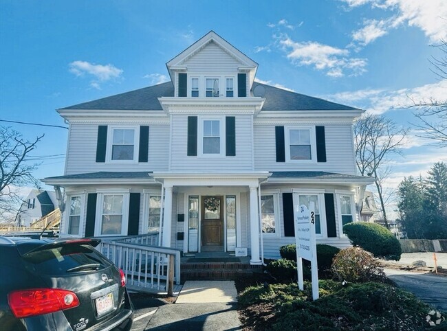
471 Hunnewell St Unit 2
Needham, MA 02494
2 Weeks Ago
Favorites
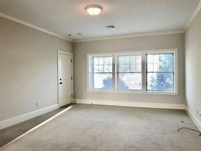
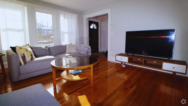
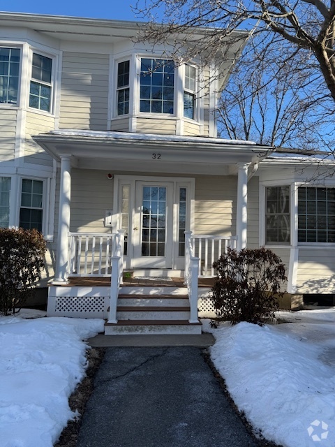
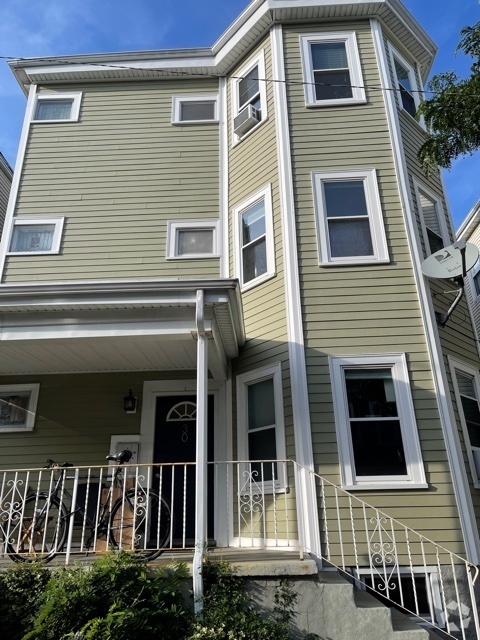
471 Hunnewell St Unit 2

Favorites
Check Back Soon for Upcoming Availability
| Beds | Baths | Average SF |
|---|---|---|
| 2 Bedrooms 2 Bedrooms 2 Br | 2 Baths 2 Baths 2 Ba | 1,500 SF |
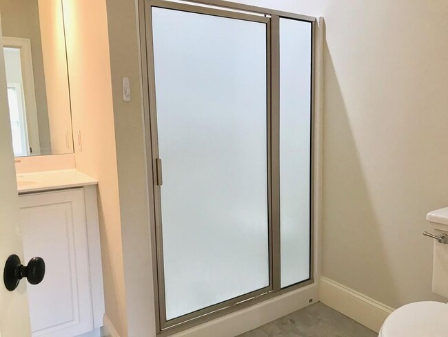
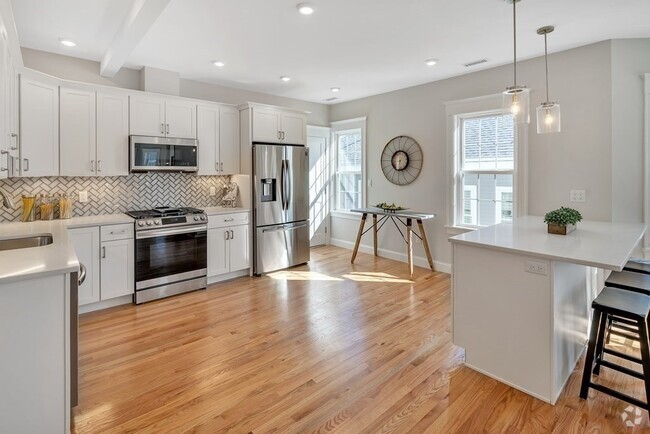
About This Property
471 Hunnewell St is a condo located in Norfolk County and the 02494 ZIP Code.
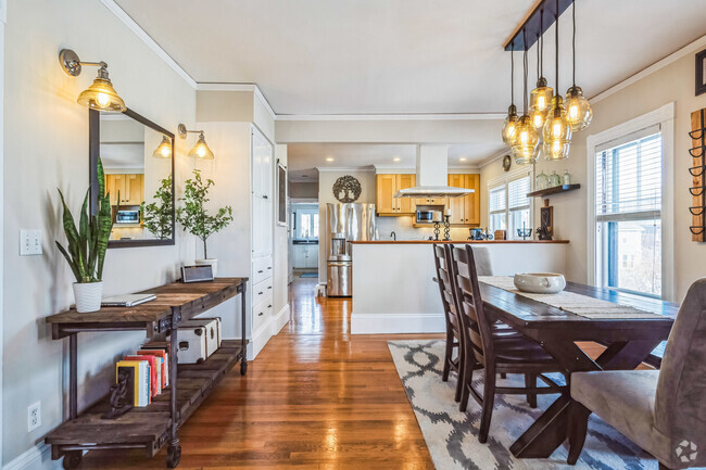
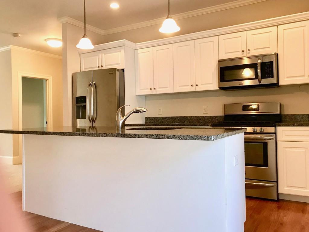
Condo Features
- Washer/Dryer
Fees and Policies
The fees below are based on community-supplied data and may exclude additional fees and utilities.
- Dogs Allowed
-
Fees not specified
- Cats Allowed
-
Fees not specified
- Parking
-
Surface Lot--
Property Address:
471 Hunnewell St,
Needham,
MA
02494
Needham is a serene neighborhood spanning west of Interstate 95. The majority of Needham is made up of lush greenery hiding suburban homes located on spacious lots. The area remains free of large commercial developments, but the town’s central corridors, Chestnut Street and Highland Avenue, are lined with local businesses and restaurants. Residents don’t have to go far for more choices of great food and premier shopping; Boston is about 30 minutes north of Needham via car or train.
Learn more about living in Needham
Amenities
- Washer/Dryer
Education
| Colleges & Universities | Distance | ||
|---|---|---|---|
| Colleges & Universities | Distance | ||
| Drive: | 7 min | 3.2 mi | |
| Drive: | 11 min | 4.6 mi | |
| Drive: | 10 min | 5.6 mi | |
| Drive: | 12 min | 5.9 mi |
471 Hunnewell St Unit 2 is within 7 minutes or 3.2 miles from Babson College. It is also near Wellesley College and Boston College.
Transportation options available in Needham include Newton Highlands Station, located 2.6 miles from 471 Hunnewell St Unit 2. 471 Hunnewell St Unit 2 is near General Edward Lawrence Logan International, located 15.8 miles or 28 minutes away, and Worcester Regional, located 42.3 miles or 60 minutes away.
| Transit / Subway | Distance | ||
|---|---|---|---|
| Transit / Subway | Distance | ||
|
|
Drive: | 5 min | 2.6 mi |
|
|
Drive: | 6 min | 2.8 mi |
|
|
Drive: | 6 min | 3.0 mi |
|
|
Drive: | 7 min | 4.2 mi |
|
|
Drive: | 8 min | 4.5 mi |
| Commuter Rail | Distance | ||
|---|---|---|---|
| Commuter Rail | Distance | ||
|
|
Walk: | 3 min | 0.2 mi |
|
|
Drive: | 2 min | 1.1 mi |
|
|
Drive: | 3 min | 1.7 mi |
|
|
Drive: | 5 min | 2.5 mi |
|
|
Drive: | 7 min | 3.1 mi |
| Airports | Distance | ||
|---|---|---|---|
| Airports | Distance | ||
|
General Edward Lawrence Logan International
|
Drive: | 28 min | 15.8 mi |
|
Worcester Regional
|
Drive: | 60 min | 42.3 mi |
Time and distance from 471 Hunnewell St Unit 2.
| Shopping Centers | Distance | ||
|---|---|---|---|
| Shopping Centers | Distance | ||
| Walk: | 20 min | 1.0 mi | |
| Walk: | 20 min | 1.1 mi | |
| Drive: | 2 min | 1.2 mi |
471 Hunnewell St Unit 2 has 3 shopping centers within 1.2 miles, which is about a 2-minute walk. The miles and minutes will be for the farthest away property.
| Parks and Recreation | Distance | ||
|---|---|---|---|
| Parks and Recreation | Distance | ||
|
Cutler Park Reservation
|
Drive: | 3 min | 1.8 mi |
|
Hemlock Gorge Reservation
|
Drive: | 4 min | 1.8 mi |
|
Whitin Observatory
|
Drive: | 10 min | 4.0 mi |
|
Brook Farm Historic Site
|
Drive: | 8 min | 4.5 mi |
|
Horticultural Society at Elm Bank
|
Drive: | 13 min | 5.5 mi |
471 Hunnewell St Unit 2 has 5 parks within 5.5 miles, including Cutler Park Reservation, Hemlock Gorge Reservation, and Whitin Observatory.
| Hospitals | Distance | ||
|---|---|---|---|
| Hospitals | Distance | ||
| Drive: | 2 min | 1.2 mi | |
| Drive: | 6 min | 4.0 mi | |
| Drive: | 10 min | 5.6 mi |
471 Hunnewell St Unit 2 has 3 hospitals within 5.6 miles, the nearest is Beth Israel Deaconess Hospital - Needham which is 1.2 miles away and a 2 minute drive.
| Military Bases | Distance | ||
|---|---|---|---|
| Military Bases | Distance | ||
| Drive: | 15 min | 7.2 mi | |
| Drive: | 24 min | 14.0 mi |
471 Hunnewell St Unit 2 is 7.2 miles from US Military Reservation, and is convenient to other military bases, including Hanscom Air Force Base.
You May Also Like
Similar Rentals Nearby
What Are Walk Score®, Transit Score®, and Bike Score® Ratings?
Walk Score® measures the walkability of any address. Transit Score® measures access to public transit. Bike Score® measures the bikeability of any address.
What is a Sound Score Rating?
A Sound Score Rating aggregates noise caused by vehicle traffic, airplane traffic and local sources
471 Hunnewell St
Needham, MA 02494