$3,690 / Month
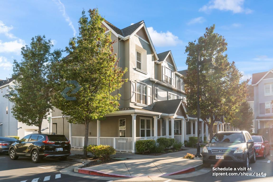
471 Metro Walk Way
Richmond, CA 94801
2 Weeks Ago
Favorites
471 Metro Walk Way

Favorites
Check Back Soon for Upcoming Availability
| Beds | Baths | Average SF |
|---|---|---|
| 3 Bedrooms 3 Bedrooms 3 Br | 3.5 Baths 3.5 Baths 3.5 Ba | 1,739 SF |
About This Property
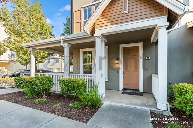
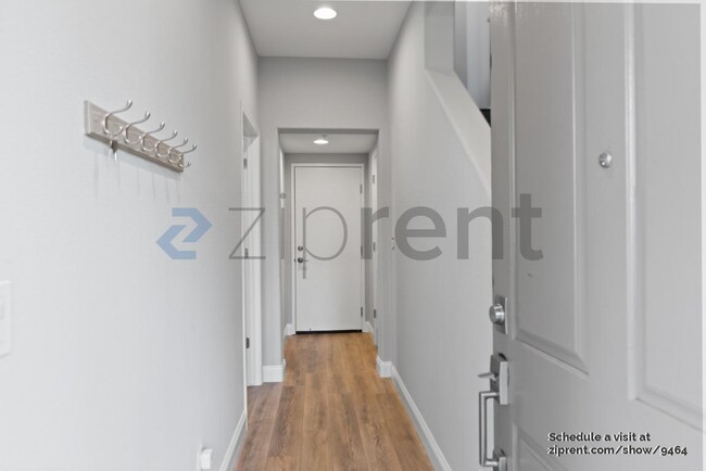
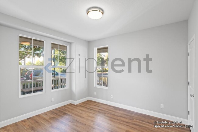
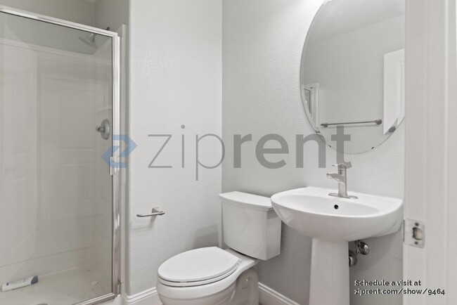
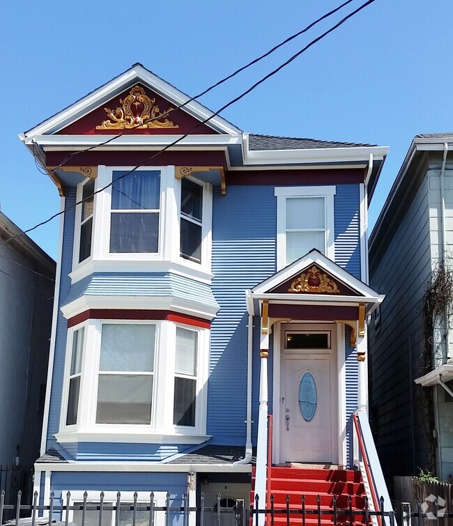
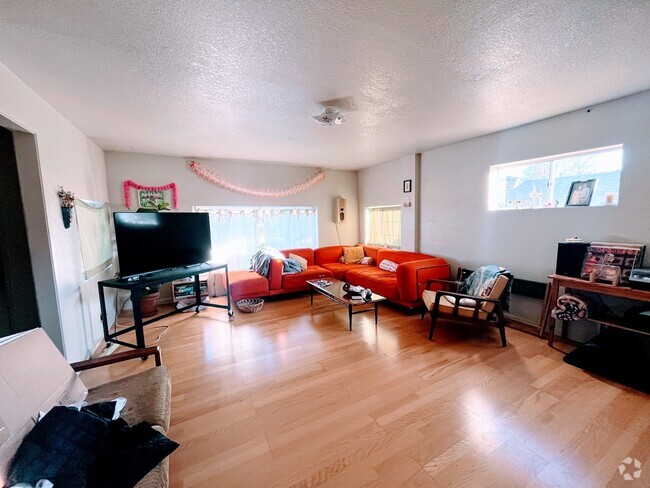
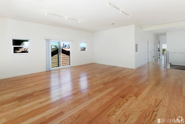
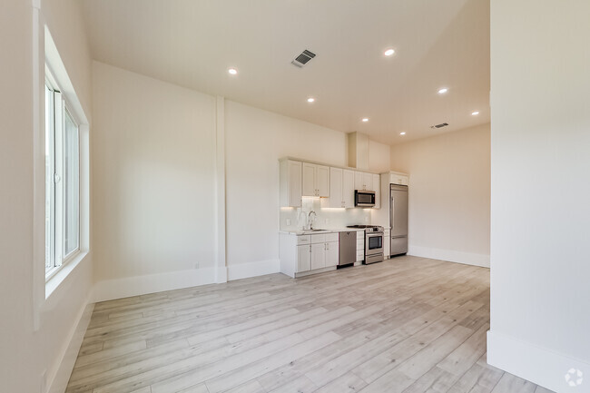
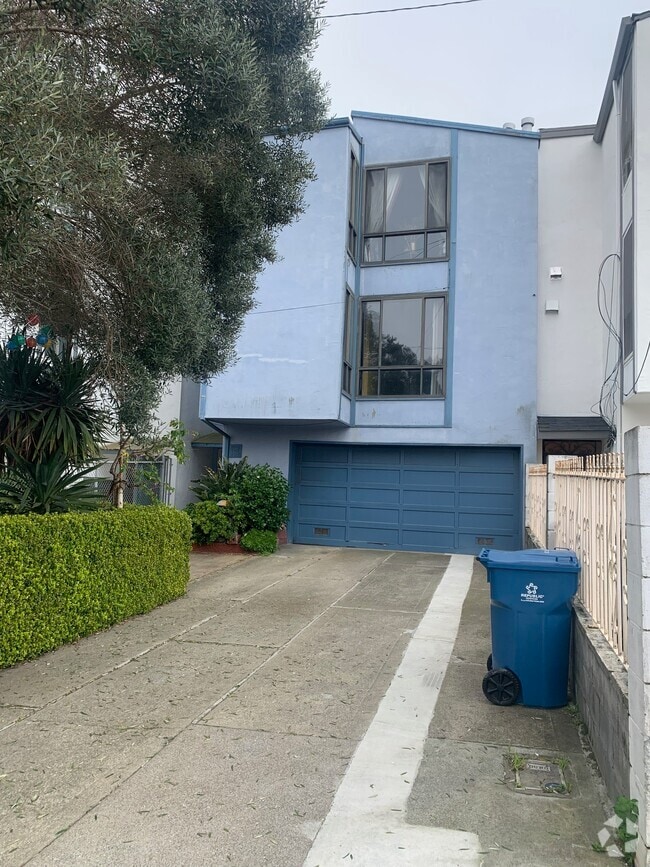
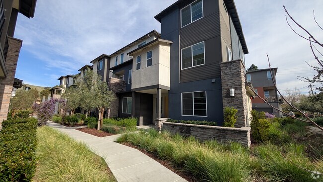
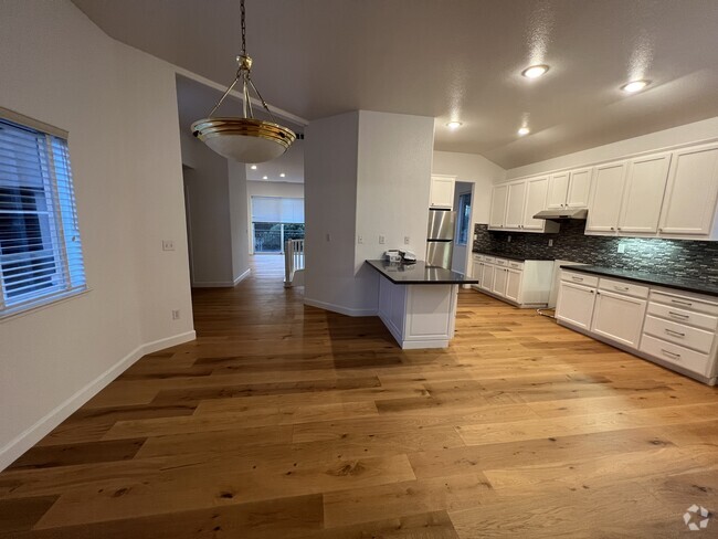
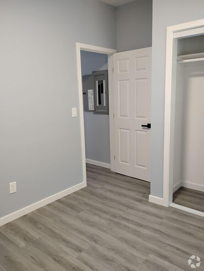
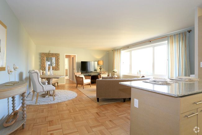
Esta propiedad está disponible. Consulta en este sitio para programar una visita. ¡Casa adosada de 3 habitaciones y 3,5 baños en esquina DISPONIBLE AHORA! Esta casa cuenta con iluminación empotrada, pisos de tablones de vinilo en todas partes, artefactos de iluminación renovados, 3 niveles, garaje adjunto para 2 autos, lavandería en la unidad con lavadora/secadora provista tal como está, ventiladores de techo, calefacción central, pintura fresca, plano de planta abierto, cortinas y está ubicada dentro de una comunidad deseable mantenida por una asociación de propietarios. La cocina está equipada con encimeras de azulejos, isla, fregadero doble, refrigerador, lavavajillas, microondas y estufa a gas. El depósito de seguridad es igual a un mes de alquiler. Basura y agua incluidos; todos los demás servicios públicos son responsabilidad del inquilino. Las mascotas se considerarán caso por caso y se requiere un depósito adicional. Disponible: AHORA Calefacción: Aire forzado Refrigeración: Ninguna Lavandería: En la unidad Estacionamiento: Garaje adjunto, 2 espacios Mascotas: Caso por caso Depósito de seguridad: $3,690.00 Servicios incluidos: Basura, agua Depósito adicional/mascota: $500.00 Descargo de responsabilidad: Ziprent actúa como agente del propietario. La información se considera confiable, pero no está garantizada. Toda la información debe ser verificada de forma independiente por el inquilino.
471 Metro Walk Way is a townhome located in Contra Costa County and the 94801 ZIP Code. This area is served by the West Contra Costa Unified attendance zone.
Property Address:
471 Metro Walk Way,
Richmond,
CA
94801
The Iron Triangle neighborhood sits in the heart of Central Richmond, California. With the area being largely residential, most rentals reside in the upper part of the triangle and an easy three-mile commute north to Point Richmond, a major shipping and industrial area. To the south, Berkeley and Oakland lie roughly 10 miles away via Interstate 580.
Locals often head for the Miller/Knox Regional Shoreline for a bit of jogging or cycling, or to cast a line off the fishing pier. Wade into the waters of San Francisco Bay at Keller Beach on the northern end of the park, or enjoy a show at the Masquers Playhouse, also just outside the Iron Triangle's southern border. Most eateries sit along Interstate 580, including several fast food chains. The MacDonald 80 Shopping Center lies roughly three miles east of the neighborhood. Drive another three miles and find Wildcat Canyon Regional Park and the Tilden Nature Area.
Learn more about living in Iron TriangleBelow are rent ranges for similar nearby apartments
Expenses
Utilities Included
Water, Trash Removal
Included
Education
| Colleges & Universities | Distance | ||
|---|---|---|---|
| Colleges & Universities | Distance | ||
| Drive: | 7 min | 3.3 mi | |
| Drive: | 16 min | 8.8 mi | |
| Drive: | 20 min | 9.9 mi | |
| Drive: | 20 min | 11.9 mi |
471 Metro Walk Way is within 7 minutes or 3.3 miles from Contra Costa College. It is also near Berkeley City College and UC Berkeley.
Schools


Public Elementary School
Grades K-5
270 Students
Nearby
Public Elementary School
Grades K-6
444 Students
Attendance Zone
Public Middle School
Grades 7-8
404 Students
Attendance Zone
Public High School
Grades 9-12
823 Students
Attendance Zone
Private Elementary, Middle & High School
Grades PK-12
Nearby
Private Elementary, Middle & High School
Grades K-12
18 Students
Nearby
School data provided by
 The GreatSchools Rating helps parents compare schools within a state based on a variety of school quality indicators and provides a helpful picture of how effectively each school serves all of its students. Ratings are on a scale of 1 (below average) to 10 (above average) and can include test scores, college readiness, academic progress, advanced courses, equity, discipline and attendance data. We also advise parents to visit schools, consider other information on school performance and programs, and consider family needs as part of the school selection process.
View GreatSchools Rating Methodology
View GreatSchools Rating Methodology
Transportation options available in Richmond include Richmond Station, located 0.2 mile from 471 Metro Walk Way. 471 Metro Walk Way is near Metro Oakland International, located 21.8 miles or 31 minutes away, and San Francisco International, located 29.4 miles or 43 minutes away.
| Transit / Subway | Distance | ||
|---|---|---|---|
| Transit / Subway | Distance | ||
|
|
Walk: | 2 min | 0.2 mi |
|
|
Drive: | 6 min | 2.8 mi |
|
|
Drive: | 9 min | 4.9 mi |
|
|
Drive: | 14 min | 8.3 mi |
|
|
Drive: | 16 min | 8.9 mi |
| Commuter Rail | Distance | ||
|---|---|---|---|
| Commuter Rail | Distance | ||
|
|
Drive: | 11 min | 7.4 mi |
|
|
Drive: | 14 min | 9.2 mi |
| Drive: | 17 min | 10.1 mi | |
| Drive: | 17 min | 11.1 mi | |
| Drive: | 21 min | 14.5 mi |
| Airports | Distance | ||
|---|---|---|---|
| Airports | Distance | ||
|
Metro Oakland International
|
Drive: | 31 min | 21.8 mi |
|
San Francisco International
|
Drive: | 43 min | 29.4 mi |
Time and distance from 471 Metro Walk Way.
| Shopping Centers | Distance | ||
|---|---|---|---|
| Shopping Centers | Distance | ||
| Walk: | 5 min | 0.3 mi | |
| Drive: | 4 min | 2.1 mi | |
| Drive: | 4 min | 2.1 mi |
471 Metro Walk Way has 3 shopping centers within 2.1 miles, which is about a 4-minute walk. The miles and minutes will be for the farthest away property.
| Parks and Recreation | Distance | ||
|---|---|---|---|
| Parks and Recreation | Distance | ||
|
Rosie the Riveter WWII Home Front National Historical Park
|
Drive: | 5 min | 1.8 mi |
|
Marina Park & Green
|
Drive: | 5 min | 2.1 mi |
|
Shimada Friendship Park
|
Drive: | 6 min | 2.6 mi |
|
Miller/Knox Regional Shoreline
|
Drive: | 6 min | 3.1 mi |
|
Brooks Island Regional Preserve
|
Drive: | 11 min | 4.7 mi |
471 Metro Walk Way has 5 parks within 4.7 miles, including Rosie the Riveter WWII Home Front National Historical Park, Marina Park & Green, and Shimada Friendship Park.
| Hospitals | Distance | ||
|---|---|---|---|
| Hospitals | Distance | ||
| Drive: | 18 min | 10.4 mi | |
| Drive: | 16 min | 11.3 mi | |
| Drive: | 16 min | 11.4 mi |
471 Metro Walk Way has 3 hospitals within 11.4 miles, the nearest is Alta Bates Summit Medical Center - Alta Bates Campus which is 10.4 miles away and a 18 minute drive.
| Military Bases | Distance | ||
|---|---|---|---|
| Military Bases | Distance | ||
| Drive: | 7 min | 3.2 mi | |
| Drive: | 12 min | 5.6 mi | |
| Drive: | 25 min | 15.5 mi |
471 Metro Walk Way has 3 military bases within 15.5 miles, the nearest is Armory West Contra Costa which is 3.2 miles away and a 7 minute drive.
You May Also Like
Similar Rentals Nearby
-
-
-
-
-
-
-
 $5,9503 Beds, 2.5 Baths, 2,050 sq ftTownhome for Rent
 -
-
-

What Are Walk Score®, Transit Score®, and Bike Score® Ratings?
Walk Score® measures the walkability of any address. Transit Score® measures access to public transit. Bike Score® measures the bikeability of any address.
What is a Sound Score Rating?
A Sound Score Rating aggregates noise caused by vehicle traffic, airplane traffic and local sources

471 Metro Walk Way
Richmond, CA 94801