
$1,500 / Month
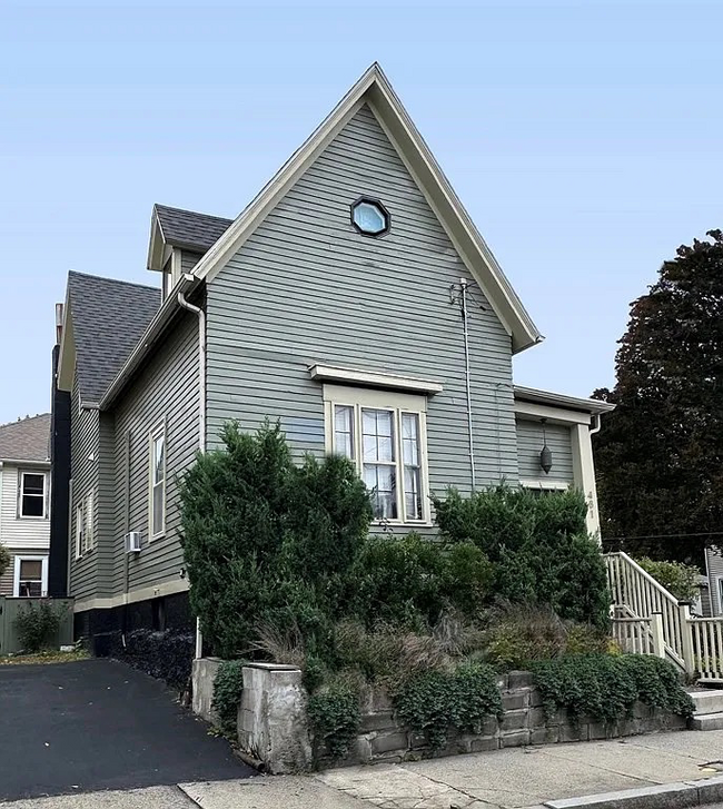
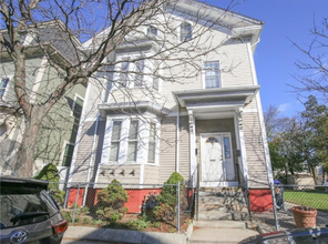
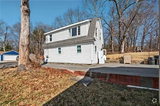
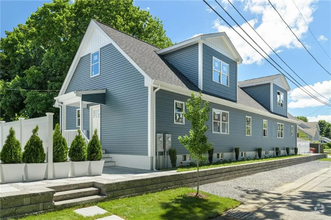
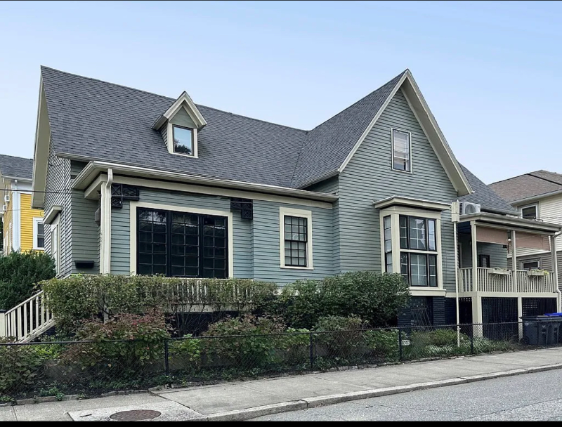
481 Pine St
Providence, RI 02907
2 Weeks Ago
Favorites
481 Pine St

Favorites
Check Back Soon for Upcoming Availability
| Beds | Baths | Average SF |
|---|---|---|
| 1 Bedroom 1 Bedroom 1 Br | 1 Bath 1 Bath 1 Ba | 950 SF |
About This Property
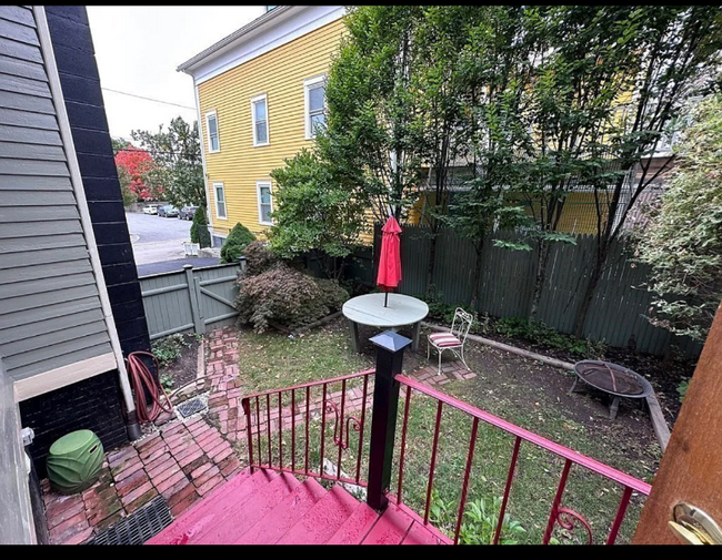
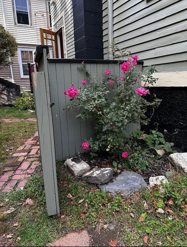
Property Id: 1233412 Are you looking for a charming and convenient place to call home? Look no further! This inviting unfurnished upper floor apartment is now available for rent, offering an unbeatable combination of comfort, convenience, and location. This unfurnished apartment offers generous living spaces, providing ample room for all your furniture and decor. Enjoy a shared fenced-in yard, perfect for outdoor gatherings, gardening, or simply relaxing in the fresh air. This additional space is a rare find in city living and adds to the appeal of this apartment. The location of this apartment is ideal for healthcare professionals and students alike. Situated in close proximity to prominent hospitals and esteemed colleges, your daily commute will be a breeze. - **Hospitals:** Rhode Island Hospital, Miriam Hospital, Fatima - **Colleges:** Brown University, Rhode Island School of Design (RISD), RI College and Providence College. Close proximity to both 95 and 195
481 Pine St is a house located in Providence County and the 02907 ZIP Code. This area is served by the Providence attendance zone.
House Features
Washer/Dryer
Dishwasher
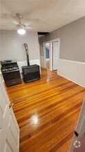
Hardwood Floors
Microwave
- Washer/Dryer
- Cable Ready
- Security System
- Dishwasher
- Microwave
- Oven
- Refrigerator
- Freezer
- Hardwood Floors
- Vaulted Ceiling
- Fenced Lot
- Lawn
Fees and Policies
The fees below are based on community-supplied data and may exclude additional fees and utilities.
- Dogs Allowed
-
Fees not specified
- Cats Allowed
-
Fees not specified
Details
Utilities Included
-
Water
-
Trash Removal
-
Sewer
Property Address:
481 Pine St,
Providence,
RI
02907
Largely a residential community, Lower South Providence maintains a small-town feel just outside of Downtown Providence. While Lower South Providence has several bars and clubs of its own, residents enjoy nearby access to the many museums and entertainment venues in surrounding areas.
Neighboring Lower South Providence to the south of I-95 is the large Roger Williams Park, which is listed on the National Register of Historic Places and home to a prominent zoo, botanical center, and seven lakes.
Convenient to I-95, I-195, and several bus routes, getting around from Lower South Providence is simple. T. F. Green Airport is just eight miles south of the neighborhood, making travel plans easy.
Learn more about living in Lower South ProvidenceBelow are rent ranges for similar nearby apartments
Amenities
- Washer/Dryer
- Cable Ready
- Security System
- Dishwasher
- Microwave
- Oven
- Refrigerator
- Freezer
- Hardwood Floors
- Vaulted Ceiling
- Fenced Lot
- Lawn
Expenses
Utilities Included
Water, Trash Removal, Sewer
Included
Education
| Colleges & Universities | Distance | ||
|---|---|---|---|
| Colleges & Universities | Distance | ||
| Walk: | 12 min | 0.6 mi | |
| Walk: | 15 min | 0.8 mi | |
| Drive: | 2 min | 1.2 mi | |
| Drive: | 3 min | 1.5 mi |
481 Pine St is within 12 minutes or 0.6 mile from C.C. of Rhode Island, Liston. It is also near Johnson & Wales Univ Downcity and C.C. of Rhode Island, Downcity.
Schools


Public Elementary School
Grades PK-1
249 Students
Attendance Zone
Public Elementary School
Grades K-5
394 Students
Attendance Zone
Public Middle School
Grades 6-8
631 Students
Attendance Zone
Public Middle School
Grades 6-8
683 Students
Attendance Zone
Public High School
Grades 9-12
1,302 Students
Attendance Zone
Private Elementary, Middle & High School
Grades 2-12
10 Students
Nearby
Private Elementary & Middle School
Grades 4-8
127 Students
Nearby
School data provided by
 The GreatSchools Rating helps parents compare schools within a state based on a variety of school quality indicators and provides a helpful picture of how effectively each school serves all of its students. Ratings are on a scale of 1 (below average) to 10 (above average) and can include test scores, college readiness, academic progress, advanced courses, equity, discipline and attendance data. We also advise parents to visit schools, consider other information on school performance and programs, and consider family needs as part of the school selection process.
View GreatSchools Rating Methodology
View GreatSchools Rating Methodology
Transportation options available in Providence include Braintree Station, located 41.9 miles from 481 Pine St. 481 Pine St is near Rhode Island Tf Green International, located 7.4 miles or 17 minutes away.
| Transit / Subway | Distance | ||
|---|---|---|---|
| Transit / Subway | Distance | ||
|
|
Drive: | 57 min | 41.9 mi |
| Commuter Rail | Distance | ||
|---|---|---|---|
| Commuter Rail | Distance | ||
|
|
Drive: | 4 min | 1.6 mi |
| Drive: | 9 min | 5.6 mi | |
| Drive: | 14 min | 7.7 mi | |
|
|
Drive: | 13 min | 8.5 mi |
|
|
Drive: | 20 min | 13.3 mi |
| Airports | Distance | ||
|---|---|---|---|
| Airports | Distance | ||
|
Rhode Island Tf Green International
|
Drive: | 17 min | 7.4 mi |
Time and distance from 481 Pine St.
| Shopping Centers | Distance | ||
|---|---|---|---|
| Shopping Centers | Distance | ||
| Walk: | 7 min | 0.4 mi | |
| Drive: | 3 min | 1.3 mi | |
| Drive: | 3 min | 1.4 mi |
481 Pine St has 3 shopping centers within 1.4 miles, which is about a 3-minute walk. The miles and minutes will be for the farthest away property.
| Parks and Recreation | Distance | ||
|---|---|---|---|
| Parks and Recreation | Distance | ||
|
Providence Children's Museum
|
Walk: | 14 min | 0.8 mi |
|
Roger Williams National Memorial
|
Drive: | 4 min | 1.7 mi |
|
Woonasquatucket River Greenway - Riverside Park
|
Drive: | 5 min | 1.9 mi |
|
Roger Williams Park Zoo
|
Drive: | 7 min | 2.1 mi |
|
Museum of Natural History and Planetarium
|
Drive: | 7 min | 2.2 mi |
481 Pine St has 5 parks within 2.2 miles, including Providence Children's Museum, Roger Williams National Memorial, and Woonasquatucket River Greenway - Riverside Park.
| Hospitals | Distance | ||
|---|---|---|---|
| Hospitals | Distance | ||
| Walk: | 11 min | 0.6 mi | |
| Walk: | 17 min | 0.9 mi | |
| Drive: | 5 min | 2.1 mi |
481 Pine St has 3 hospitals within 2.1 miles, the nearest is Women & Infants Hospital of Rhode Island which is 0.6 mile away and a 11 minute walk.
| Military Bases | Distance | ||
|---|---|---|---|
| Military Bases | Distance | ||
| Drive: | 33 min | 20.7 mi | |
| Drive: | 65 min | 43.1 mi |
481 Pine St is 20.7 miles from Rhode Island National Gaurd, and is convenient to other military bases, including US Military Reservation.
You May Also Like
Similar Rentals Nearby

What Are Walk Score®, Transit Score®, and Bike Score® Ratings?
Walk Score® measures the walkability of any address. Transit Score® measures access to public transit. Bike Score® measures the bikeability of any address.
What is a Sound Score Rating?
A Sound Score Rating aggregates noise caused by vehicle traffic, airplane traffic and local sources
481 Pine St
Providence, RI 02907