-
Monthly Rent
$3,800
-
Bedrooms
4 bd
-
Bathrooms
2 ba
-
Square Feet
1,616 sq ft
Details

About This Property
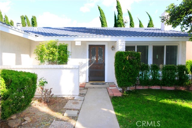
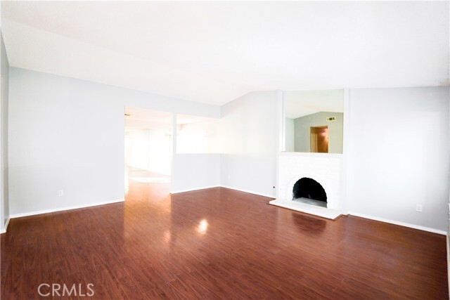
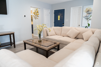
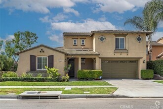
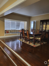
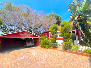
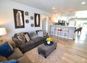
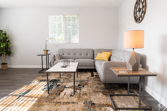
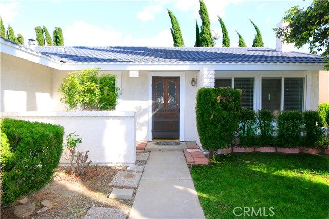
This single family house is located in the prestigious Walnut Unified School District. It is within 3 minute walk to Walnut High School, 5 minutes to Suzanne Middle School, and 10 minutes to Vejar Elementary. You can easily and safely walk to your kids to and from school. the home is also nearby city hall, library, gym and popular restaurants and shops.The home is extremely well maintained and is located within a cul-de-sac. It also has a great floor plan. This home features newer laminated flooring throughout and newer tile in two bathrooms. Cozy fire place in living room and central A/C and heater keep the house felling comfortable. There is an in-ground swimming pool at the lush green back yard. The home also has an attached 2 car garage with laundry facility.
482 Wrangler Way is a house located in Los Angeles County and the 91789 ZIP Code. This area is served by the Walnut Valley Unified attendance zone.
Contact
House Features
- Air Conditioning
- Heating
- Fireplace
- Pool
Fees and Policies
The fees below are based on community-supplied data and may exclude additional fees and utilities.
- Parking
-
Other--
 This Property
 Available Property
- Air Conditioning
- Heating
- Fireplace
- Pool
Walnut Valley is a picturesque community in the San Gabriel Valley. Its rolling hills and proximity to major Southern California cities like Los Angeles, located 30 miles west, make Walnut Valley an ideal spot to settle down. Its southern border partially encompasses Chino Hills State Park, ensuring that outdoor recreation is always available. More outdoor recreation is nearby, with the Angeles National Forest being just a short drive north of town. Inside Walnut Valley, business centers, shopping plazas, and other commercial developments dot the area, providing essentials close to home. Walnut Valley provides a variety of single-family homes and apartments for rent.
Learn more about living in Walnut Valley| Colleges & Universities | Distance | ||
|---|---|---|---|
| Colleges & Universities | Distance | ||
| Drive: | 6 min | 2.8 mi | |
| Drive: | 10 min | 4.7 mi | |
| Drive: | 12 min | 5.2 mi | |
| Drive: | 15 min | 8.1 mi |
Transportation options available in Walnut include Apu / Citrus College Station, located 11.0 miles from 482 Wrangler Way. 482 Wrangler Way is near Ontario International, located 18.7 miles or 27 minutes away, and Long Beach (Daugherty Field), located 33.0 miles or 45 minutes away.
| Transit / Subway | Distance | ||
|---|---|---|---|
| Transit / Subway | Distance | ||
| Drive: | 21 min | 11.0 mi | |
| Drive: | 20 min | 11.6 mi | |
| Drive: | 22 min | 12.8 mi | |
| Drive: | 26 min | 15.6 mi | |
| Drive: | 27 min | 17.0 mi |
| Commuter Rail | Distance | ||
|---|---|---|---|
| Commuter Rail | Distance | ||
|
|
Drive: | 6 min | 2.3 mi |
|
|
Drive: | 14 min | 7.6 mi |
|
|
Drive: | 14 min | 7.6 mi |
|
|
Drive: | 18 min | 9.9 mi |
|
|
Drive: | 18 min | 10.8 mi |
| Airports | Distance | ||
|---|---|---|---|
| Airports | Distance | ||
|
Ontario International
|
Drive: | 27 min | 18.7 mi |
|
Long Beach (Daugherty Field)
|
Drive: | 45 min | 33.0 mi |
Time and distance from 482 Wrangler Way.
| Shopping Centers | Distance | ||
|---|---|---|---|
| Shopping Centers | Distance | ||
| Walk: | 11 min | 0.6 mi | |
| Walk: | 20 min | 1.0 mi | |
| Drive: | 3 min | 1.5 mi |
| Parks and Recreation | Distance | ||
|---|---|---|---|
| Parks and Recreation | Distance | ||
|
Galster Wilderness Park Nature Center
|
Drive: | 13 min | 6.5 mi |
|
Schabarum Regional Park
|
Drive: | 16 min | 7.6 mi |
|
Covina Park
|
Drive: | 14 min | 7.6 mi |
|
Frank G. Bonelli Regional Park
|
Drive: | 16 min | 8.8 mi |
|
San Dimas Canyon Nature Center
|
Drive: | 20 min | 12.2 mi |
| Hospitals | Distance | ||
|---|---|---|---|
| Hospitals | Distance | ||
| Drive: | 14 min | 7.7 mi | |
| Drive: | 14 min | 8.4 mi | |
| Drive: | 16 min | 9.9 mi |
| Military Bases | Distance | ||
|---|---|---|---|
| Military Bases | Distance | ||
| Drive: | 41 min | 29.3 mi |
You May Also Like
Similar Rentals Nearby
-
$7,5006 Beds, 5 Baths, 4,901 sq ftHouse for Rent
-
$6,3755 Beds, 3 Baths, 3,269 sq ftHouse for Rent
-
$7,5005 Beds, 2 Baths, 1,600 sq ftHouse for Rent
-
$4,9005 Beds, 5 Baths, 4,146 sq ftHouse for Rent
-
$4,5005 Beds, 2 Baths, 1,670 sq ftHouse for Rent
-
-
$5,9504 Beds, 2 Baths, 2,856 sq ftHouse for Rent
-
$4,0004 Beds, 2 Baths, 1,500 sq ftHouse for Rent
-
$7,0004 Beds, 2 Baths, 1,649 sq ftHouse for Rent
-
What Are Walk Score®, Transit Score®, and Bike Score® Ratings?
Walk Score® measures the walkability of any address. Transit Score® measures access to public transit. Bike Score® measures the bikeability of any address.
What is a Sound Score Rating?
A Sound Score Rating aggregates noise caused by vehicle traffic, airplane traffic and local sources
