$2,150 / Month
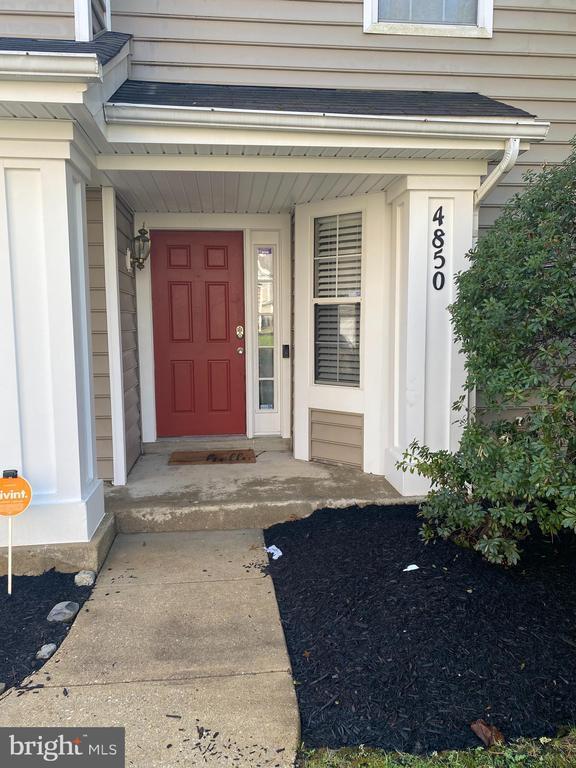
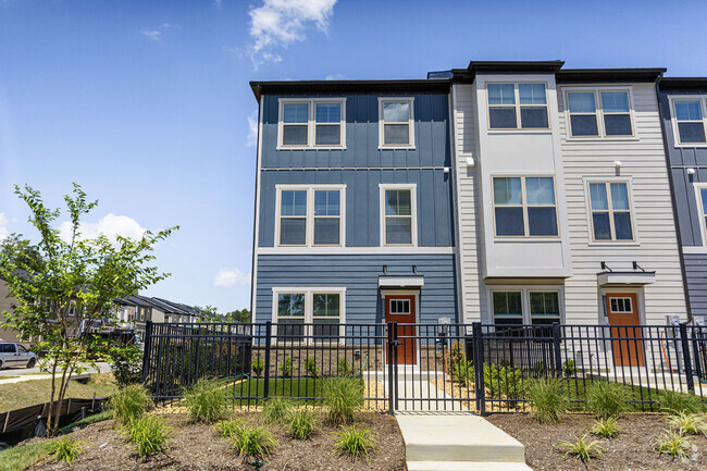
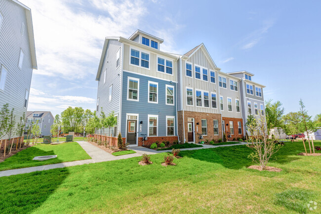
4850 King John Way
Upper Marlboro, MD 20772
Today
Favorites
240-737-8197
-
Bedrooms
2
-
Bathrooms
1.5
-
Square Feet
--
-
Available
Available Now
Highlights
- Private Pool
- Open Floorplan
- Colonial Architecture
- Clubhouse
- 1 Fireplace
- Community Pool
4850 King John Way

Favorites
About This Home
Available Now
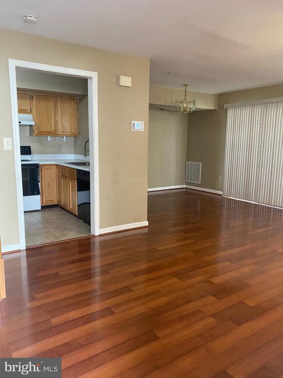
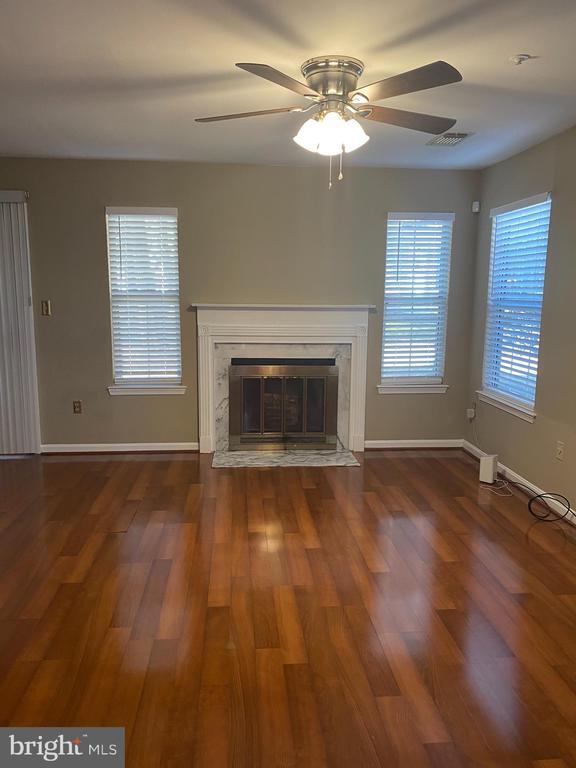
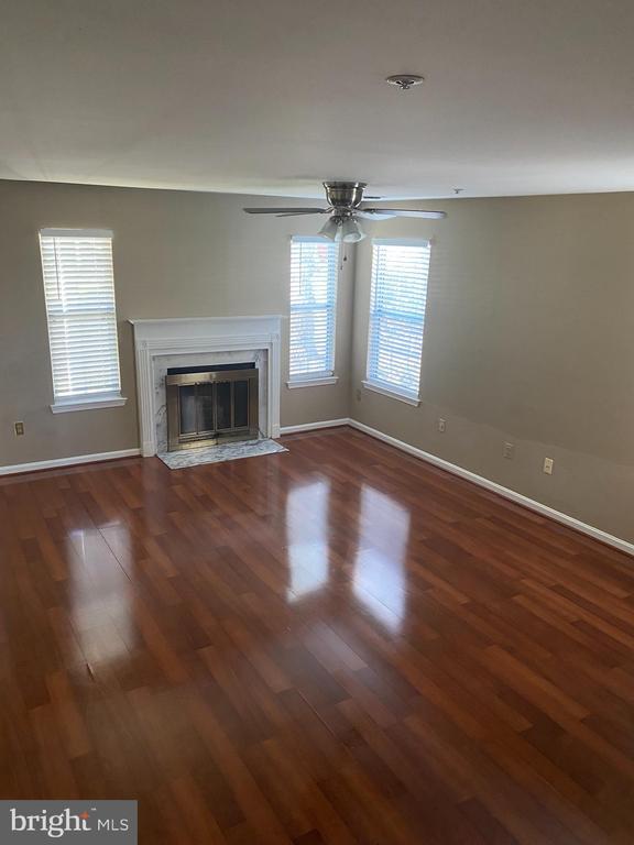
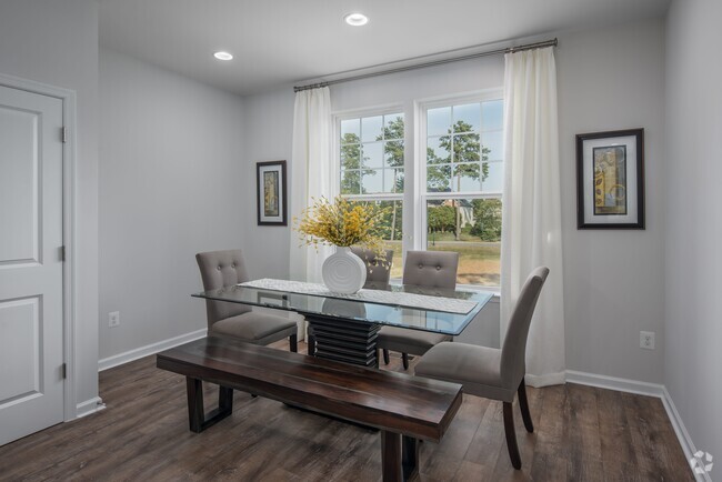
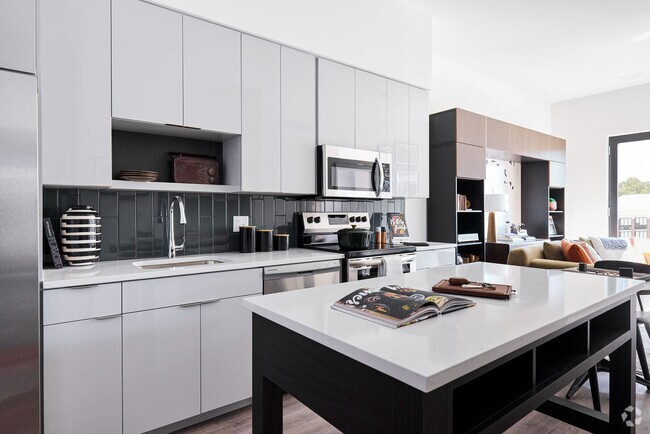
Sunny two story townhome with one car garage . Walking distance to pool and club house. Home boast a wood burning fire place, open space floor plan, large living room and dining room. 2 generous size bedrooms. Close to shopping center.
4850 King John Way is a townhome located in Prince George's County and the 20772 ZIP Code. This area is served by the Prince George's County Public Schools attendance zone.
* Price shown is base rent and may not include non-optional fees and utilities.
Price, availability, fees, and any applicable rent special are subject to change without notice.
* Square footage definitions vary. Displayed square footage is approximate.
Home Details
Home Type
Interior Unit Townhome
Year Built
Built in 1992
Bedrooms and Bathrooms
1.5 Bathrooms
2 Bedrooms
Home Design
Colonial Architecture
Back-to-Back Home
Vinyl Siding
Concrete Perimeter Foundation
Interior Spaces
Open Floorplan
1 Fireplace
Combination Dining and Living Room
1,242 Sq Ft Home
Property has 2 Levels
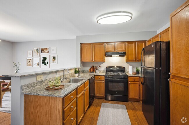
Kitchen
Breakfast Area or Nook
Galley Kitchen
Listing and Financial Details
Security Deposit $2,150
12-Month Min and 24-Month Max Lease Term
Available 2/3/25
Assessor Parcel Number 17030219097
Residential Lease
Lot Details
2,960 Sq Ft Lot
Parking
1 Car Attached Garage
Rear-Facing Garage
Driveway
Pool
Private Pool
Utilities
90% Forced Air Heating and Cooling System
Electric Water Heater
Community Details
Amenities
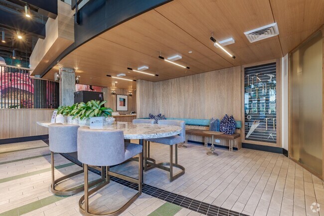
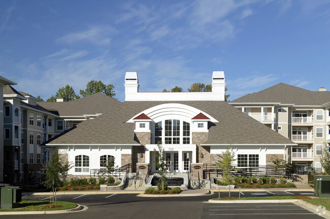
Clubhouse
Overview
Property has a Home Owners Association
Kings Council Co Community
Property Manager
Kings Council Condo Subdivision
Association fees include pool(s)
Pet Policy
No Pets Allowed
Recreation
Community Pool
Contact
- Listed by Zina Dixon
- Phone Number (240) 737-8197
- Contact
-
Source
 Bright MLS, Inc.
Copyright © 2025 Bright MLS, Inc.
$2,436 / month
$325,000 Listing Price
2 Beds
•2.5 Baths
•
1,452 Sq Ft
$2,406 / month
$290,000 Listing Price
2 Beds
•2 Baths
•
1,310 Sq Ft
$2,364 / month
$289,000 Listing Price
2 Beds
•2 Baths
•
1,200 Sq Ft
Location
Get Directions
Amenities
- Fireplace
Popularly known as a government district in Prince George’s County in the state of Maryland, Upper Marlboro offers residents a small-town vibe. Lined with an assortment of businesses, Main Street provides immediate access to the courthouse and county administrative building.
You'll find a combination of busy thoroughfares within the city and a quiet atmosphere in the residential suburbs. To the west of downtown are residential homes on quiet streets with mostly single-family homes, parks, and civic centers. Take a short walk from Main Street to access the Prince George’s County Public system. Aside from the few grocery stores and big-box retailers, the rural nature of the area is the biggest draw for residents. But it also means you might have to head to surrounding areas for more shopping and restaurant options.
Learn more about living in Greater Upper Marlboro
Education
| Colleges & Universities | Distance | ||
|---|---|---|---|
| Colleges & Universities | Distance | ||
| Drive: | 17 min | 7.1 mi | |
| Drive: | 20 min | 9.8 mi | |
| Drive: | 31 min | 17.5 mi | |
| Drive: | 30 min | 17.7 mi |
4850 King John Way is within 17 minutes or 7.1 miles from Prince George's Comm. Coll.. It is also near Univ. of Md. Univ. Coll. and Gallaudet University.
Schools
Public Elementary School
Grades PK-5
746 Students
Attendance Zone
5
Out of 10
Public Middle School
Grades 6-8
873 Students
Attendance Zone
3
Out of 10
Public High School
Grades 9-12
2,257 Students
Attendance Zone
2
Out of 10
Private Elementary & Middle School
Grades PK-8
215 Students
Nearby
Private Middle & High School
Grades 6-12
120 Students
Nearby
School data provided by
GreatSchools
The GreatSchools Rating helps parents compare schools within a state based on a variety of school quality indicators and provides a helpful picture of how effectively each school serves all of its students. Ratings are on a scale of 1 (below average) to 10 (above average) and can include test scores, college readiness, academic progress, advanced courses, equity, discipline and attendance data. We also advise parents to visit schools, consider other information on school performance and programs, and consider family needs as part of the school selection process.
Transportation options available in Upper Marlboro include Morgan Boulevard, located 8.7 miles from 4850 King John Way. 4850 King John Way is near Ronald Reagan Washington Ntl, located 21.1 miles or 37 minutes away, and Baltimore/Washington International Thurgood Marshall, located 33.3 miles or 51 minutes away.
| Transit / Subway | Distance | ||
|---|---|---|---|
| Transit / Subway | Distance | ||
|
|
Drive: | 19 min | 8.7 mi |
|
|
Drive: | 20 min | 9.2 mi |
|
|
Drive: | 20 min | 9.9 mi |
| Drive: | 22 min | 10.6 mi | |
|
|
Drive: | 21 min | 12.2 mi |
| Commuter Rail | Distance | ||
|---|---|---|---|
| Commuter Rail | Distance | ||
|
|
Drive: | 26 min | 13.6 mi |
|
|
Drive: | 26 min | 13.9 mi |
|
|
Drive: | 32 min | 16.4 mi |
| Drive: | 35 min | 17.6 mi | |
| Drive: | 30 min | 17.8 mi |
| Airports | Distance | ||
|---|---|---|---|
| Airports | Distance | ||
|
Ronald Reagan Washington Ntl
|
Drive: | 37 min | 21.1 mi |
|
Baltimore/Washington International Thurgood Marshall
|
Drive: | 51 min | 33.3 mi |
Time and distance from 4850 King John Way.
| Shopping Centers | Distance | ||
|---|---|---|---|
| Shopping Centers | Distance | ||
| Walk: | 16 min | 0.9 mi | |
| Drive: | 7 min | 2.8 mi | |
| Drive: | 7 min | 2.8 mi |
4850 King John Way has 3 shopping centers within 2.8 miles, which is about a 7-minute drive. The miles and minutes will be for the farthest away property.
| Parks and Recreation | Distance | ||
|---|---|---|---|
| Parks and Recreation | Distance | ||
|
School House Pond
|
Drive: | 4 min | 1.7 mi |
|
Cheltenham Wetlands Park
|
Drive: | 7 min | 3.5 mi |
|
Watkins Nature Center
|
Drive: | 13 min | 7.4 mi |
|
Rosaryville State Park
|
Drive: | 16 min | 8.0 mi |
|
Mount Calvert Historical and Archaeological Park
|
Drive: | 24 min | 9.4 mi |
4850 King John Way has 5 parks within 9.4 miles, including School House Pond, Cheltenham Wetlands Park, and Watkins Nature Center.
| Hospitals | Distance | ||
|---|---|---|---|
| Hospitals | Distance | ||
| Drive: | 21 min | 11.3 mi |
4850 King John Way is 11.3 miles and a 21 minutes drive from MedStar Southern Maryland Hospital Center.
| Military Bases | Distance | ||
|---|---|---|---|
| Military Bases | Distance | ||
| Drive: | 18 min | 9.6 mi | |
| Drive: | 28 min | 15.9 mi |
4850 King John Way is 9.6 miles from Andrews Airforce Base, and is convenient to other military bases, including Washington Navy Yard.
You May Also Like
Similar Rentals Nearby
-
-
-
1 / 23
-
-
-
-
-
-
-


What Are Walk Score®, Transit Score®, and Bike Score® Ratings?
Walk Score® measures the walkability of any address. Transit Score® measures access to public transit. Bike Score® measures the bikeability of any address.
What is a Sound Score Rating?
A Sound Score Rating aggregates noise caused by vehicle traffic, airplane traffic and local sources

4850 King John Way
Upper Marlboro, MD 20772