-
Monthly Rent
$2,995
-
Bedrooms
2 bd
-
Bathrooms
1 ba
-
Square Feet
850 sq ft
Details

About This Property
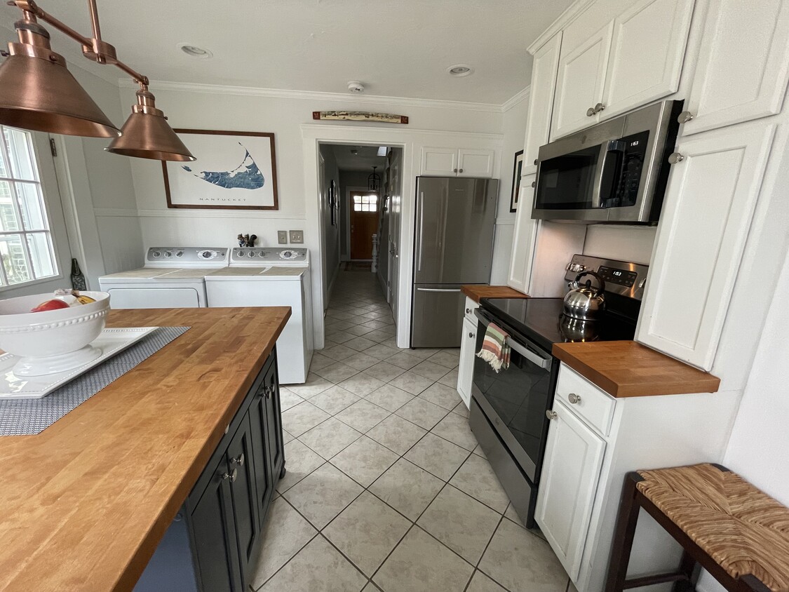
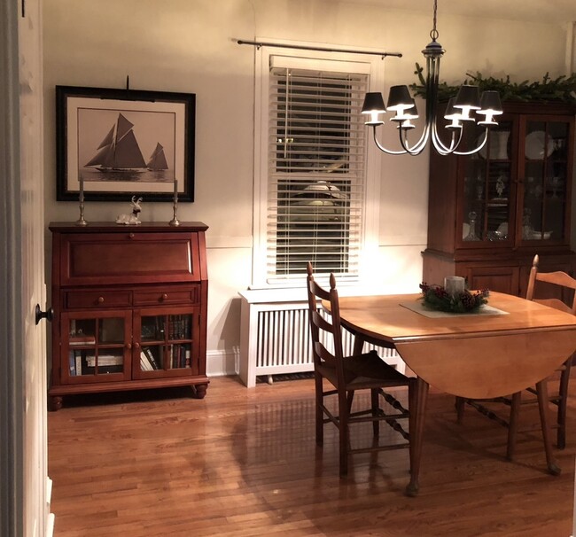
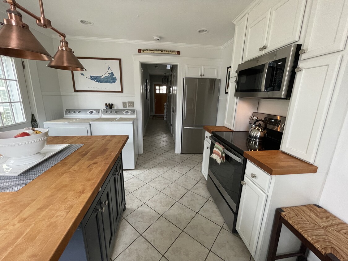
Furnished apartment. Convenient Needham Heights location. 3 month lease term. Updated kitchen with stainless steel appliances and butcher block island. In-unit laundry. Outdoor space with partially fenced yard. Enclosed front porch. Close proximity to shopping, dining, commuter rail train. . Near Olin and Babson College. Tenant pays all utilities. Available Jan 1
49 West St is a townhome located in Norfolk County and the 02494 ZIP Code.
Townhome Features
Washer/Dryer
High Speed Internet Access
Tub/Shower
Stainless Steel Appliances
- High Speed Internet Access
- Washer/Dryer
- Ceiling Fans
- Cable Ready
- Tub/Shower
- Stainless Steel Appliances
- Kitchen
- Dining Room
- Furnished
- Furnished Units Available
- Patio
- Porch
- Yard
Fees and Policies
The fees below are based on community-supplied data and may exclude additional fees and utilities.
- Parking
-
Surface Lot--
Details
Property Information
-
Furnished Units Available
Just west of Boston and East of Worcester sits Metro West, a region that houses a group of towns and cities with significant historical backgrounds. A total of 19 municipalities make up the core of this community, but other municipalities are considered to be a part of the Interstate 495/Metro West Corridor.
Learn more about living in Metro West| Colleges & Universities | Distance | ||
|---|---|---|---|
| Colleges & Universities | Distance | ||
| Drive: | 6 min | 2.8 mi | |
| Drive: | 12 min | 4.7 mi | |
| Drive: | 11 min | 5.7 mi | |
| Drive: | 12 min | 6.1 mi |
Transportation options available in Needham include Newton Highlands Station, located 2.7 miles from 49 West St. 49 West St is near General Edward Lawrence Logan International, located 15.9 miles or 28 minutes away, and Worcester Regional, located 42.4 miles or 60 minutes away.
| Transit / Subway | Distance | ||
|---|---|---|---|
| Transit / Subway | Distance | ||
|
|
Drive: | 5 min | 2.7 mi |
|
|
Drive: | 6 min | 2.9 mi |
|
|
Drive: | 6 min | 3.2 mi |
|
|
Drive: | 7 min | 4.4 mi |
|
|
Drive: | 8 min | 4.6 mi |
| Commuter Rail | Distance | ||
|---|---|---|---|
| Commuter Rail | Distance | ||
|
|
Walk: | 1 min | 0.1 mi |
|
|
Walk: | 19 min | 1.0 mi |
|
|
Drive: | 3 min | 1.6 mi |
|
|
Drive: | 5 min | 2.4 mi |
|
|
Drive: | 7 min | 3.2 mi |
| Airports | Distance | ||
|---|---|---|---|
| Airports | Distance | ||
|
General Edward Lawrence Logan International
|
Drive: | 28 min | 15.9 mi |
|
Worcester Regional
|
Drive: | 60 min | 42.4 mi |
Time and distance from 49 West St.
| Shopping Centers | Distance | ||
|---|---|---|---|
| Shopping Centers | Distance | ||
| Walk: | 18 min | 1.0 mi | |
| Drive: | 2 min | 1.2 mi | |
| Drive: | 2 min | 1.3 mi |
| Parks and Recreation | Distance | ||
|---|---|---|---|
| Parks and Recreation | Distance | ||
|
Cutler Park Reservation
|
Drive: | 3 min | 1.4 mi |
|
Hemlock Gorge Reservation
|
Drive: | 4 min | 1.9 mi |
|
Brook Farm Historic Site
|
Drive: | 8 min | 4.2 mi |
|
Whitin Observatory
|
Drive: | 10 min | 4.2 mi |
|
Horticultural Society at Elm Bank
|
Drive: | 13 min | 5.4 mi |
| Hospitals | Distance | ||
|---|---|---|---|
| Hospitals | Distance | ||
| Drive: | 2 min | 1.1 mi | |
| Drive: | 6 min | 4.1 mi | |
| Drive: | 12 min | 6.6 mi |
| Military Bases | Distance | ||
|---|---|---|---|
| Military Bases | Distance | ||
| Drive: | 15 min | 7.4 mi | |
| Drive: | 24 min | 14.1 mi |
- High Speed Internet Access
- Washer/Dryer
- Ceiling Fans
- Cable Ready
- Tub/Shower
- Stainless Steel Appliances
- Kitchen
- Dining Room
- Furnished
- Furnished Units Available
- Patio
- Porch
- Yard
49 West St Photos
What Are Walk Score®, Transit Score®, and Bike Score® Ratings?
Walk Score® measures the walkability of any address. Transit Score® measures access to public transit. Bike Score® measures the bikeability of any address.
What is a Sound Score Rating?
A Sound Score Rating aggregates noise caused by vehicle traffic, airplane traffic and local sources


