
$14,995 / Month
490 Patrick Way
Los Altos, CA 94022
Today
Favorites
-
Bedrooms
4
-
Bathrooms
3
-
Square Feet
2,545 sq ft
-
Available
Available Now
Highlights
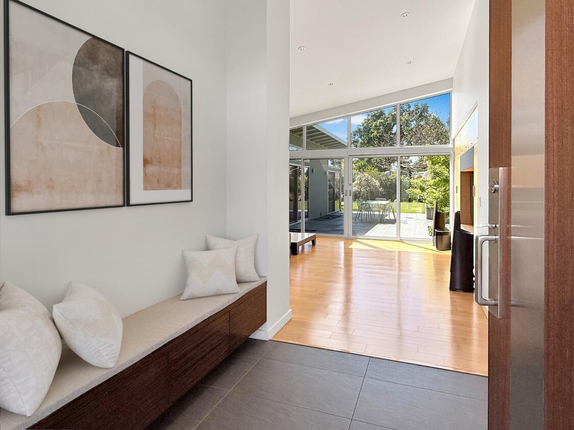
- Wood Flooring
- Balcony
- Skylights
- Double Pane Windows
- Tile Flooring
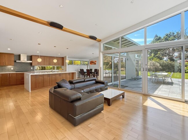
- Kitchen Island
490 Patrick Way

Favorites
About This Home
Available Now
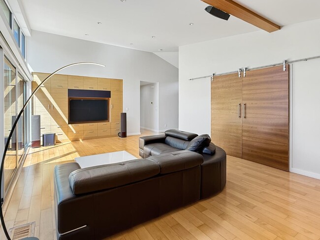
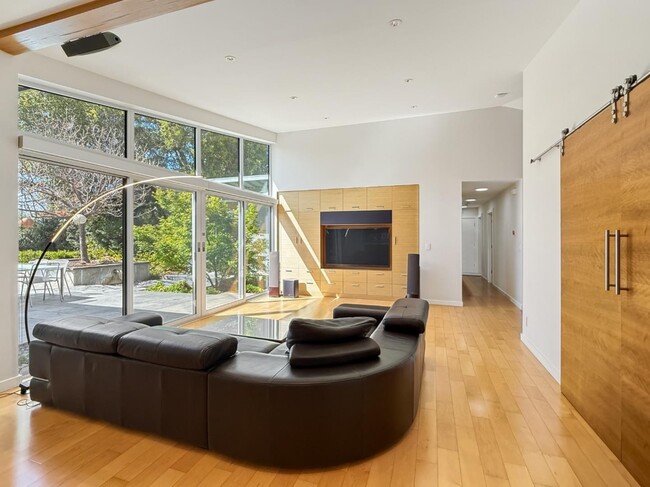
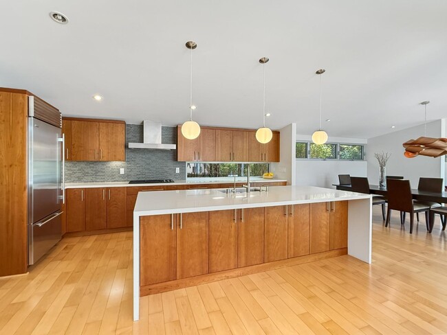
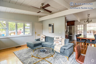
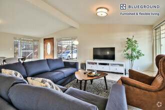
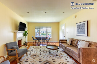
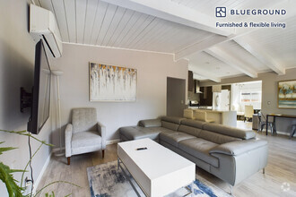
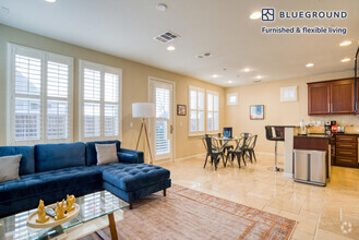
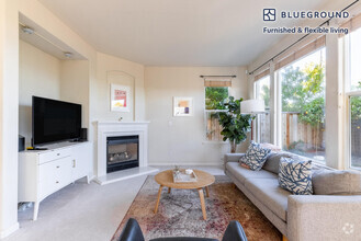
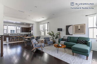
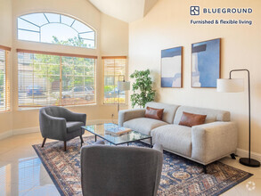
Designed by renowned San Francisco architect Jonathan Feldman, this stunning 4-bedroom, 3-bathroom custom modern home offers 2,545 sq ft of light-filled living on a 12,800 sq ft lot in a prime Los Altos location. With soaring ceilings, walls of glass, and impeccable finishes, the open-concept layout seamlessly connects the kitchen, dining, and living spaces, perfect for everyday living and entertaining. The chef's kitchen features custom cabinetry, quartz countertops, high-end appliances, and an oversized island. A spacious family room and office/bedroom off the living room provide flexible living options, while the luxurious primary suite boasts a spa-like bathroom and a walk-in closet with custom organizers. Additional highlights include three beautifully updated bathrooms, a well-appointed laundry/mudroom, and generous storage throughout. Step outside to a serene backyard retreat with mature landscaping and an expansive patio ideal for outdoor dining and relaxation. Not an Eichler, the home features traditional forced air heating and cooling for year-round comfort. All this, just a short stroll from downtown Los Altos and top-rated Santa Rita Elementary and Egan Middle School. Minimum 740 FICO and Income 3X the rent to qualify. No pets preferred (service animals ok).
490 Patrick Way is a house located in Santa Clara County and the 94022 ZIP Code. This area is served by the Los Altos Elementary attendance zone.
* Price shown is base rent and may not include non-optional fees and utilities.
Price, availability, fees, and any applicable rent special are subject to change without notice.
* Square footage definitions vary. Displayed square footage is approximate.
Home Details
Home Type
Single Family Detached Home
Bedrooms and Bathrooms
3 Full Bathrooms
4 Bedrooms
Eco-Friendly Details
Energy-Efficient HVAC
ENERGY STAR/CFL/LED Lights
Flooring
Wood
Tile
Interior Spaces
Skylights
Double Pane Windows
Separate Family Room
Dining Area
2,545 Sq Ft Home
1-Story Property
Kitchen
Electric Oven
Kitchen Island
Gas Cooktop
Microwave
Dishwasher
Laundry
Washer and Dryer
Listing and Financial Details
Security Deposit $20,000
Property Available on 6/1/25
12-Month Lease Term
Rent includes gardener, manager
Lot Details
0.29 Acre Lot
Grass Covered Lot
Back Yard
Outdoor Features
Balcony
Parking
On-Street Parking
Uncovered Parking
2 Car Garage
Utilities
Thermostat
Forced Air Heating and Cooling System
Community Details
Contact
- Listed by Tim Proschold | Luxuriant Realty
- Contact
-
Source
 MLSListings Inc.
Copyright © 2025 MLSListings Inc.
Location
Get Directions
North Los Altos contains the city’s vibrant commercial centers. The many shops and eateries of Main Street are in the southern portion of North Los Altos, while the diverse restaurants and cafes of San Antonio Road are in the northern stretches near San Antonio Center.
Outside of these commercial areas, North Los Altos is predominantly residential, offering an array of apartments available for rent along tree-lined avenues. Many of the rentals in North Los Altos feature stunning mountain views, as well as close proximity to Mountain View, Foothill College, Stanford University, and Palo Alto. Getting around from North Los Altos is simple with access to El Camino Real, Interstate 280, and San Antonio Station.
Learn more about living in North Los Altos
Education
| Colleges & Universities | Distance | ||
|---|---|---|---|
| Colleges & Universities | Distance | ||
| Drive: | 7 min | 2.6 mi | |
| Drive: | 8 min | 3.0 mi | |
| Drive: | 12 min | 5.5 mi | |
| Drive: | 17 min | 7.3 mi |
490 Patrick Way is within 7 minutes or 2.6 miles from Foothill College, Middlefield. It is also near Foothill Coll., Los Altos and Stanford University.
Schools

Public Elementary School
Grades K-5
367 Students
Nearby
Public Elementary School
Grades K-6
385 Students
Attendance Zone
Public Middle School
Grades 7-8
497 Students
Attendance Zone
Public High School
Grades 9-12
2,141 Students
Attendance Zone
Private Elementary & Middle School
Grades PK-8
188 Students
Nearby
Private Elementary, Middle & High School
Grades K-12
612 Students
Nearby
Private Elementary & Middle School
Grades K-8
268 Students
Nearby
Private Elementary School
Grades K-1
Nearby
School data provided by
 The GreatSchools Rating helps parents compare schools within a state based on a variety of school quality indicators and provides a helpful picture of how effectively each school serves all of its students. Ratings are on a scale of 1 (below average) to 10 (above average) and can include test scores, college readiness, academic progress, advanced courses, equity, discipline and attendance data. We also advise parents to visit schools, consider other information on school performance and programs, and consider family needs as part of the school selection process.
View GreatSchools Rating Methodology
View GreatSchools Rating Methodology
Transportation options available in Los Altos include Mountain View Station, located 3.6 miles from 490 Patrick Way. 490 Patrick Way is near Norman Y Mineta San Jose International, located 13.0 miles or 21 minutes away, and San Francisco International, located 25.3 miles or 35 minutes away.
| Transit / Subway | Distance | ||
|---|---|---|---|
| Transit / Subway | Distance | ||
|
|
Drive: | 7 min | 3.6 mi |
|
|
Drive: | 10 min | 4.8 mi |
|
|
Drive: | 12 min | 5.5 mi |
|
|
Drive: | 11 min | 5.6 mi |
|
|
Drive: | 13 min | 6.4 mi |
| Commuter Rail | Distance | ||
|---|---|---|---|
| Commuter Rail | Distance | ||
| Drive: | 4 min | 1.7 mi | |
| Drive: | 10 min | 3.8 mi | |
| Drive: | 10 min | 4.1 mi | |
| Drive: | 13 min | 5.4 mi | |
| Drive: | 14 min | 6.7 mi |
| Airports | Distance | ||
|---|---|---|---|
| Airports | Distance | ||
|
Norman Y Mineta San Jose International
|
Drive: | 21 min | 13.0 mi |
|
San Francisco International
|
Drive: | 35 min | 25.3 mi |
Time and distance from 490 Patrick Way.
| Shopping Centers | Distance | ||
|---|---|---|---|
| Shopping Centers | Distance | ||
| Drive: | 3 min | 1.3 mi | |
| Drive: | 3 min | 1.3 mi | |
| Drive: | 3 min | 1.5 mi |
490 Patrick Way has 3 shopping centers within 1.5 miles, which is about a 3-minute drive. The miles and minutes will be for the farthest away property.
| Parks and Recreation | Distance | ||
|---|---|---|---|
| Parks and Recreation | Distance | ||
|
Redwood Grove
|
Drive: | 4 min | 1.4 mi |
|
Terman Park
|
Drive: | 6 min | 2.8 mi |
|
Esther Clark Nature Preserve
|
Drive: | 6 min | 2.8 mi |
|
Foothill College Observatory
|
Drive: | 8 min | 3.2 mi |
|
Bol Park
|
Drive: | 9 min | 3.5 mi |
490 Patrick Way has 5 parks within 3.5 miles, including Terman Park, Redwood Grove, and Esther Clark Nature Preserve.
| Hospitals | Distance | ||
|---|---|---|---|
| Hospitals | Distance | ||
| Drive: | 10 min | 3.6 mi | |
| Drive: | 14 min | 5.7 mi | |
| Drive: | 14 min | 6.3 mi |
490 Patrick Way has 3 hospitals within 6.3 miles, the nearest is El Camino Hospital which is 3.6 miles away and a 10 minute drive.
| Military Bases | Distance | ||
|---|---|---|---|
| Military Bases | Distance | ||
| Drive: | 14 min | 5.8 mi |
490 Patrick Way is 5.8 miles and a 14 minute drive from Ames Research Center.
You May Also Like
Similar Rentals Nearby

What Are Walk Score®, Transit Score®, and Bike Score® Ratings?
Walk Score® measures the walkability of any address. Transit Score® measures access to public transit. Bike Score® measures the bikeability of any address.
What is a Sound Score Rating?
A Sound Score Rating aggregates noise caused by vehicle traffic, airplane traffic and local sources

490 Patrick Way
Los Altos, CA 94022