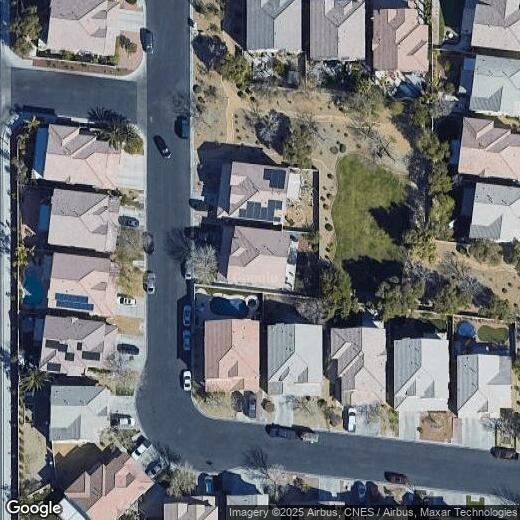
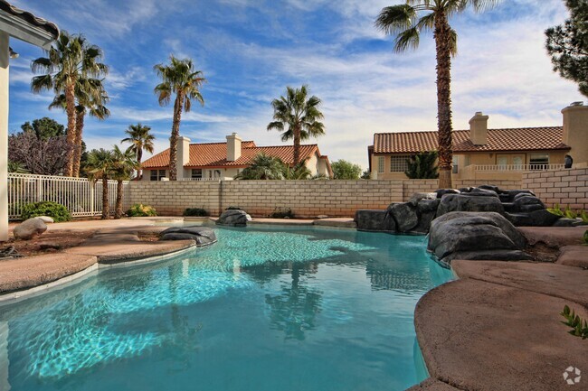
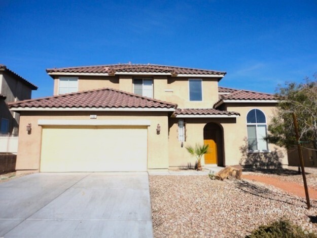
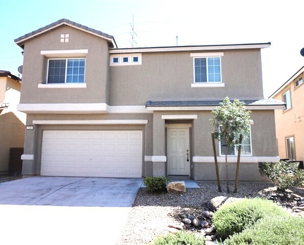
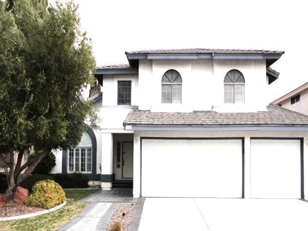
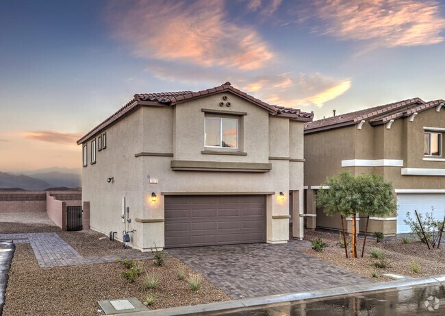
4912 Capo Gallo St
4912 Capo Gallo St
Las Vegas, NV 89130
2 Weeks Ago
Favorites
4912 Capo Gallo St

Favorites
Check Back Soon for Upcoming Availability
| Beds | Baths | Average SF |
|---|---|---|
| 6 Bedrooms 6 Bedrooms 6 Br | 3 Baths 3 Baths 3 Ba | — |
Property Address:
4912 Capo Gallo St,
Las Vegas,
NV
89130
Despite its “Sin City” reputation, Las Vegas has a huge personality that goes well beyond the glimmering neon of the Strip. In fact, many of the Strip’s most famous landmarks are actually outside of the Las Vegas city limits in Paradise, Nevada. The City of Las Vegas tends to be much more subdued overall, mainly comprised of residential neighborhoods and an exceptional selection of golf courses and country clubs. The community’s bike-friendly configuration has earned national recognition, and parents are able to choose between dozens of excellent public schools in the area. Outdoor exploration is always close at hand, with Lake Mead to the east and Red Rock Canyon to the west. The local arts and culture scene incorporates the glossy entertainment of the Strip, fine arts like ballet and classical music, and a hip local creative community.
Learn more about living in Las Vegas
Education
| Colleges & Universities | Distance | ||
|---|---|---|---|
| Colleges & Universities | Distance | ||
| Drive: | 14 min | 8.0 mi | |
| Drive: | 14 min | 8.3 mi | |
| Drive: | 17 min | 9.2 mi | |
| Drive: | 25 min | 13.0 mi |
4912 Capo Gallo St is within 14 minutes or 8.3 miles from Southern Nevada, Charleston. It is also near Nev. State Coll., Shadow Lane and Southern Nevada, Cheyenne.
Transportation options available in Las Vegas include Sahara Station, located 9.9 miles from 4912 Capo Gallo St. 4912 Capo Gallo St is near Harry Reid International, located 14.2 miles or 26 minutes away, and Boulder City Municipal, located 34.2 miles or 46 minutes away.
| Transit / Subway | Distance | ||
|---|---|---|---|
| Transit / Subway | Distance | ||
|
|
Drive: | 17 min | 9.9 mi |
|
|
Drive: | 19 min | 10.3 mi |
|
|
Drive: | 19 min | 10.5 mi |
|
|
Drive: | 21 min | 11.2 mi |
|
|
Drive: | 20 min | 11.8 mi |
| Airports | Distance | ||
|---|---|---|---|
| Airports | Distance | ||
|
Harry Reid International
|
Drive: | 26 min | 14.2 mi |
|
Boulder City Municipal
|
Drive: | 46 min | 34.2 mi |
Time and distance from 4912 Capo Gallo St.
| Shopping Centers | Distance | ||
|---|---|---|---|
| Shopping Centers | Distance | ||
| Walk: | 11 min | 0.6 mi | |
| Walk: | 13 min | 0.7 mi | |
| Walk: | 18 min | 1.0 mi |
4912 Capo Gallo St has 3 shopping centers within 1.0 mile, which is about a 18-minute walk. The miles and minutes will be for the farthest away property.
| Parks and Recreation | Distance | ||
|---|---|---|---|
| Parks and Recreation | Distance | ||
|
Spring Mountains National Recreation Area
|
Walk: | 7 min | 0.4 mi |
|
Craig Ranch Regional Park
|
Drive: | 11 min | 5.6 mi |
|
Springs Preserve
|
Drive: | 14 min | 7.1 mi |
|
Floyd Lamb Park
|
Drive: | 15 min | 7.3 mi |
|
DISCOVERY Children's Museum
|
Drive: | 15 min | 8.9 mi |
4912 Capo Gallo St has 5 parks within 8.9 miles, including Spring Mountains National Recreation Area, Craig Ranch Regional Park, and Springs Preserve.
| Hospitals | Distance | ||
|---|---|---|---|
| Hospitals | Distance | ||
| Drive: | 6 min | 3.5 mi | |
| Drive: | 7 min | 4.8 mi | |
| Drive: | 12 min | 8.3 mi |
4912 Capo Gallo St has 3 hospitals within 8.3 miles, the nearest is Mountainview Hospital which is 3.5 miles away and a 6 minute drive.
| Military Bases | Distance | ||
|---|---|---|---|
| Military Bases | Distance | ||
| Drive: | 29 min | 15.5 mi |
4912 Capo Gallo St is 15.5 miles and a 29 minute drive from Nellis Air Force Base.
You May Also Like
Similar Rentals Nearby
-
-
-
-
 $2,2904 Beds, 2.5 Baths, 2,097 sq ftHouse for Rent
 -
-
-
-
-
-


What Are Walk Score®, Transit Score®, and Bike Score® Ratings?
Walk Score® measures the walkability of any address. Transit Score® measures access to public transit. Bike Score® measures the bikeability of any address.
What is a Sound Score Rating?
A Sound Score Rating aggregates noise caused by vehicle traffic, airplane traffic and local sources

4912 Capo Gallo St
Las Vegas, NV 89130