
The Darien
815 Poplar St,
Philadelphia, PA 19123
Studio - 3 Beds $1,600 - $4,255


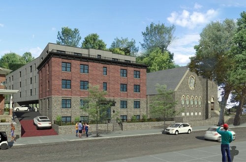
Find your new place at 492 Roxborough Ave. You'll find this community in the Manayunk area of Philadelphia. From pricing to features, the professional leasing team is available to help you find your perfect home. It's time to love where you live. Stop by for a visit today.
492 Roxborough Ave is an apartment community located in Philadelphia County and the 19128 ZIP Code. This area is served by the The School District of Philadelphia attendance zone.
Let Apartments.com help you find the ideal Philadelphia, PA apartment for rent. Whether you're looking for a Philadelphia apartment stunning views of the Delaware River, want to find the best pet friendly Philadelphia Apartment or you're looking for cheap Philadelphia apartments, we have the tools to help you discover your new Philadelphia apartment.
Nestled along the banks of the Delaware River near the Pennsylvania-New Jersey state line, the historic city of Philadelphia played a major role in the fight for independence, even serving as the nation’s capital for a brief period. Today, Philly’s rich history blends seamlessly with its modern, progressive spirit, forming a one-of-a-kind urban experience.
Learn more about living in Philadelphia| Colleges & Universities | Distance | ||
|---|---|---|---|
| Colleges & Universities | Distance | ||
| Drive: | 4 min | 1.6 mi | |
| Drive: | 7 min | 2.4 mi | |
| Drive: | 6 min | 2.4 mi | |
| Drive: | 11 min | 3.9 mi |


Transportation options available in Philadelphia include Hunting Park, located 4.4 miles from 492 Roxborough Ave. 492 Roxborough Ave is near Philadelphia International, located 16.0 miles or 30 minutes away, and Trenton Mercer, located 32.8 miles or 57 minutes away.
| Transit / Subway | Distance | ||
|---|---|---|---|
| Transit / Subway | Distance | ||
|
|
Drive: | 10 min | 4.4 mi |
|
|
Drive: | 10 min | 4.5 mi |
|
|
Drive: | 13 min | 4.6 mi |
|
|
Drive: | 10 min | 4.7 mi |
|
|
Drive: | 11 min | 5.0 mi |
| Commuter Rail | Distance | ||
|---|---|---|---|
| Commuter Rail | Distance | ||
|
|
Walk: | 15 min | 0.8 mi |
|
|
Walk: | 22 min | 1.1 mi |
|
|
Drive: | 5 min | 1.8 mi |
|
|
Drive: | 6 min | 1.9 mi |
|
|
Drive: | 6 min | 2.0 mi |
| Airports | Distance | ||
|---|---|---|---|
| Airports | Distance | ||
|
Philadelphia International
|
Drive: | 30 min | 16.0 mi |
|
Trenton Mercer
|
Drive: | 57 min | 32.8 mi |
Time and distance from 492 Roxborough Ave.
| Shopping Centers | Distance | ||
|---|---|---|---|
| Shopping Centers | Distance | ||
| Walk: | 4 min | 0.2 mi | |
| Walk: | 5 min | 0.3 mi | |
| Drive: | 5 min | 1.5 mi |
| Parks and Recreation | Distance | ||
|---|---|---|---|
| Parks and Recreation | Distance | ||
|
Awbury Arboretum
|
Drive: | 9 min | 3.4 mi |
|
Schuylkill Center for Environmental Education
|
Drive: | 9 min | 3.6 mi |
|
Arboretum of the Barnes Foundation
|
Drive: | 10 min | 3.8 mi |
|
Rolling Hill Park
|
Drive: | 13 min | 4.5 mi |
|
Merion Botanical Park
|
Drive: | 12 min | 4.6 mi |
| Hospitals | Distance | ||
|---|---|---|---|
| Hospitals | Distance | ||
| Walk: | 3 min | 0.2 mi | |
| Drive: | 4 min | 1.4 mi | |
| Drive: | 10 min | 4.5 mi |
| Military Bases | Distance | ||
|---|---|---|---|
| Military Bases | Distance | ||
| Drive: | 23 min | 12.7 mi |
What Are Walk Score®, Transit Score®, and Bike Score® Ratings?
Walk Score® measures the walkability of any address. Transit Score® measures access to public transit. Bike Score® measures the bikeability of any address.
What is a Sound Score Rating?
A Sound Score Rating aggregates noise caused by vehicle traffic, airplane traffic and local sources
492 Roxborough Ave
Philadelphia, PA 19128


