
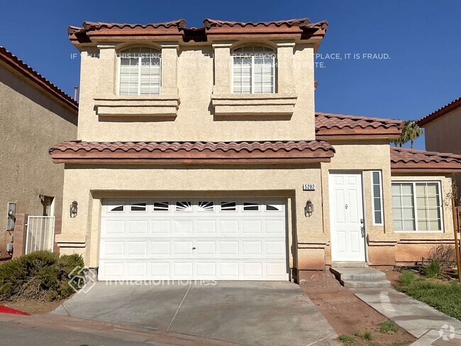
$2,295 / Month
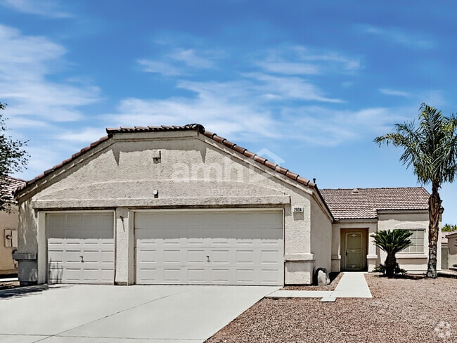
4929 Cedar Lawn Way
Las Vegas, NV 89130
Today
Favorites
702-857-0396
-
Bedrooms
3
-
Bathrooms
2
-
Square Feet
--
-
Available
Available Now
4929 Cedar Lawn Way

Favorites
Contact
- Listed by Donald Carlisle
- Phone Number (702) 857-0396
- Contact
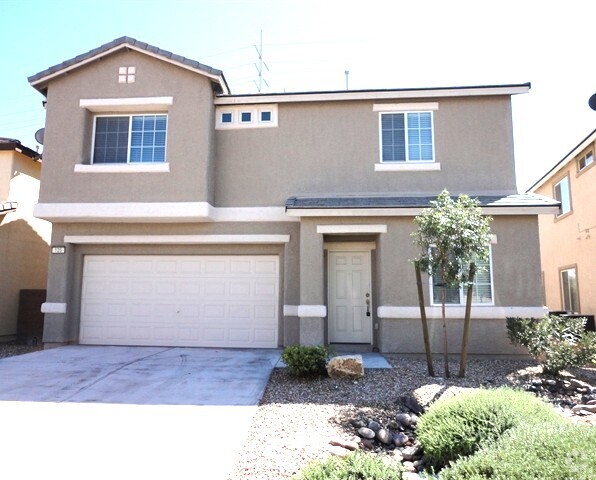
$2,552 / month
$429,900 Listing Price
3 Beds
•2.5 Baths
•
1,703 Sq Ft
$2,597 / month
$440,000 Listing Price
3 Beds
•2 Baths
•
1,370 Sq Ft
$2,511 / month
$424,900 Listing Price
3 Beds
•2 Baths
•
1,370 Sq Ft
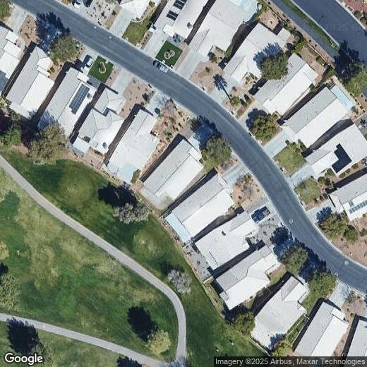
Location
Get Directions
Despite its “Sin City” reputation, Las Vegas has a huge personality that goes well beyond the glimmering neon of the Strip. In fact, many of the Strip’s most famous landmarks are actually outside of the Las Vegas city limits in Paradise, Nevada. The City of Las Vegas tends to be much more subdued overall, mainly comprised of residential neighborhoods and an exceptional selection of golf courses and country clubs. The community’s bike-friendly configuration has earned national recognition, and parents are able to choose between dozens of excellent public schools in the area. Outdoor exploration is always close at hand, with Lake Mead to the east and Red Rock Canyon to the west. The local arts and culture scene incorporates the glossy entertainment of the Strip, fine arts like ballet and classical music, and a hip local creative community.
Learn more about living in Las Vegas
Education
| Colleges & Universities | Distance | ||
|---|---|---|---|
| Colleges & Universities | Distance | ||
| Drive: | 16 min | 9.1 mi | |
| Drive: | 18 min | 9.9 mi | |
| Drive: | 18 min | 11.1 mi | |
| Drive: | 27 min | 14.1 mi |
4929 Cedar Lawn Way is within 18 minutes or 9.9 miles from Southern Nevada, Cheyenne. It is also near Nev. State Coll., Shadow Lane and Southern Nevada, Charleston.
Schools
Public Elementary School
Grades PK-5
584 Students
Attendance Zone
6
Out of 10
Public Middle School
Grades 6-8
1,041 Students
Attendance Zone
4
Out of 10
Public High School
Grades 9-12
3,243 Students
Attendance Zone
6
Out of 10
Private Elementary School
Grades PK-1
115 Students
Nearby
Private Elementary, Middle & High School
Grades K-12
103 Students
Nearby
School data provided by
GreatSchools
The GreatSchools Rating helps parents compare schools within a state based on a variety of school quality indicators and provides a helpful picture of how effectively each school serves all of its students. Ratings are on a scale of 1 (below average) to 10 (above average) and can include test scores, college readiness, academic progress, advanced courses, equity, discipline and attendance data. We also advise parents to visit schools, consider other information on school performance and programs, and consider family needs as part of the school selection process.
Transportation options available in Las Vegas include Sahara Station, located 11.0 miles from 4929 Cedar Lawn Way. 4929 Cedar Lawn Way is near Harry Reid International, located 15.3 miles or 28 minutes away, and Boulder City Municipal, located 35.2 miles or 48 minutes away.
| Transit / Subway | Distance | ||
|---|---|---|---|
| Transit / Subway | Distance | ||
|
|
Drive: | 19 min | 11.0 mi |
|
|
Drive: | 21 min | 11.4 mi |
|
|
Drive: | 21 min | 11.6 mi |
|
|
Drive: | 23 min | 12.3 mi |
|
|
Drive: | 22 min | 12.8 mi |
| Airports | Distance | ||
|---|---|---|---|
| Airports | Distance | ||
|
Harry Reid International
|
Drive: | 28 min | 15.3 mi |
|
Boulder City Municipal
|
Drive: | 48 min | 35.2 mi |
Time and distance from 4929 Cedar Lawn Way.
| Shopping Centers | Distance | ||
|---|---|---|---|
| Shopping Centers | Distance | ||
| Walk: | 6 min | 0.3 mi | |
| Walk: | 7 min | 0.4 mi | |
| Walk: | 7 min | 0.4 mi |
4929 Cedar Lawn Way has 3 shopping centers within 0.4 mile, which is about a 7-minute walk. The miles and minutes will be for the farthest away property.
| Parks and Recreation | Distance | ||
|---|---|---|---|
| Parks and Recreation | Distance | ||
|
Spring Mountains National Recreation Area
|
Drive: | 6 min | 2.6 mi |
|
Craig Ranch Regional Park
|
Drive: | 11 min | 5.1 mi |
|
Floyd Lamb Park
|
Drive: | 17 min | 8.0 mi |
|
Springs Preserve
|
Drive: | 16 min | 8.2 mi |
|
College of Southern Nevada Planetarium
|
Drive: | 17 min | 9.6 mi |
4929 Cedar Lawn Way has 5 parks within 9.6 miles, including Spring Mountains National Recreation Area, Craig Ranch Regional Park, and Springs Preserve.
| Hospitals | Distance | ||
|---|---|---|---|
| Hospitals | Distance | ||
| Drive: | 9 min | 5.4 mi | |
| Drive: | 11 min | 6.3 mi | |
| Drive: | 15 min | 8.6 mi |
4929 Cedar Lawn Way has 3 hospitals within 8.6 miles, the nearest is Centennial Hills Hospital Medical Center which is 5.4 miles away and a 9 minute drive.
| Military Bases | Distance | ||
|---|---|---|---|
| Military Bases | Distance | ||
| Drive: | 29 min | 15.5 mi |
4929 Cedar Lawn Way is 15.5 miles and a 29 minute drive from Nellis Air Force Base.
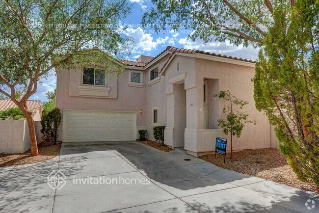
You May Also Like
Similar Rentals Nearby
-
-
-
-
1 / 14
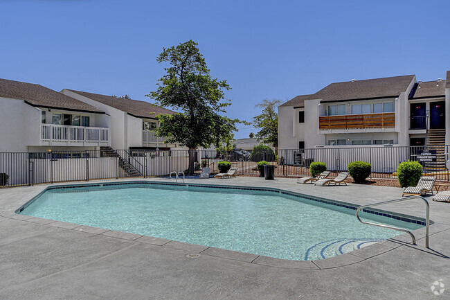
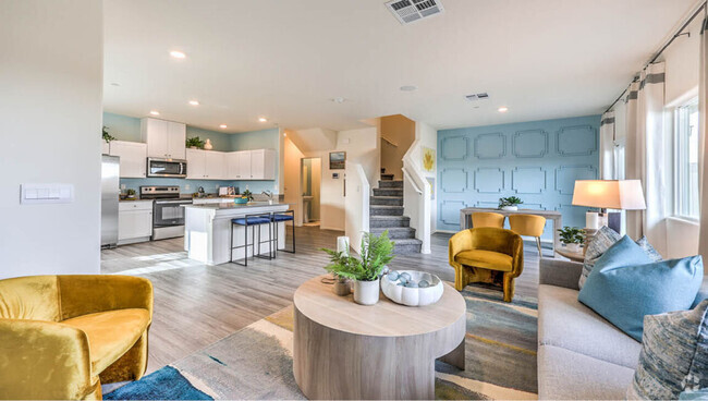 Single-Family Homes Specials
Pets Allowed Pool In Unit Washer & Dryer Stainless Steel Appliances Gated
-
-
-
-
-
 $2,1454 Beds, 2 Baths, 1,646 sq ftHouse for Rent
 -
 $2,5504 Beds, 2.5 Baths, 2,386 sq ftHouse for Rent


What Are Walk Score®, Transit Score®, and Bike Score® Ratings?
Walk Score® measures the walkability of any address. Transit Score® measures access to public transit. Bike Score® measures the bikeability of any address.
What is a Sound Score Rating?
A Sound Score Rating aggregates noise caused by vehicle traffic, airplane traffic and local sources

4929 Cedar Lawn Way
Las Vegas, NV 89130