4953 G St SE Unit A6
Washington, DC 20019

-
Monthly Rent
$1,668
-
Bedrooms
2 bd
-
Bathrooms
1 ba
-
Square Feet
Details

About This Property
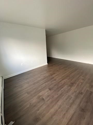
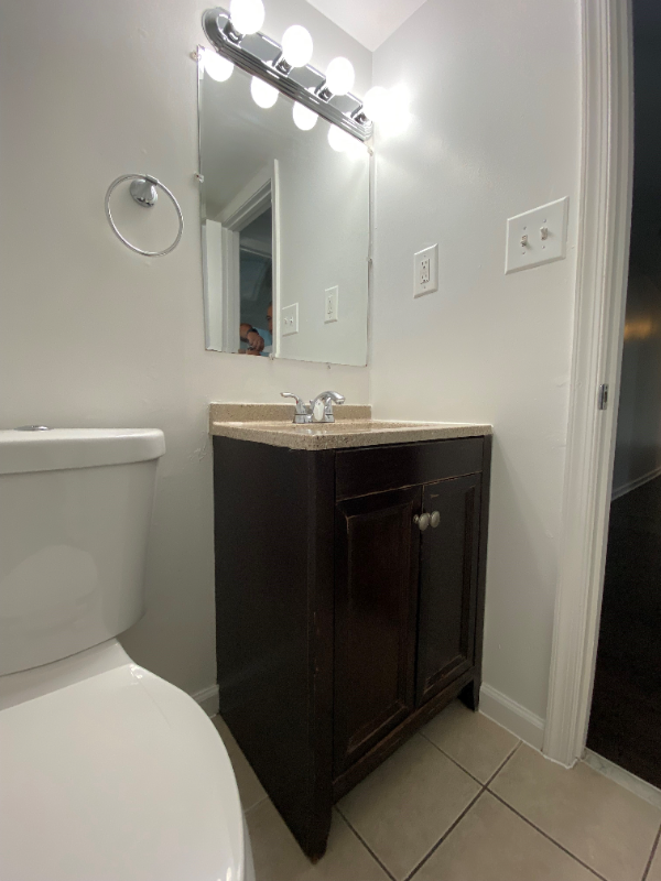
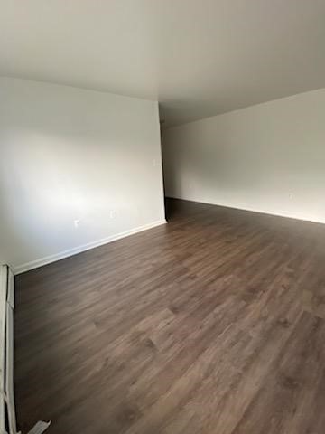
Property Id: 754554 Come make this 2 bed/ 1 bath apartment your new home. Blocks from Benning Road and Capitol Heights metro stations. New appliances, hardwood floors, and nice size bedrooms. This community is also gated. E-mail: or call or today and make this your new home.
4953 G St SE is an apartment community located in District of Columbia County and the 20019 ZIP Code.
Features
Refrigerator
Disposal
Tile Floors
Security System
- Security System
- Disposal
- Refrigerator
- Tile Floors
- Fenced Lot
- Lawn
Fees and Policies
The fees below are based on community-supplied data and may exclude additional fees and utilities.
Details
Utilities Included
-
Gas
-
Water
-
Trash Removal
-
Sewer
 This Property
 Available Property
- Security System
- Disposal
- Refrigerator
- Tile Floors
- Fenced Lot
- Lawn
A triangular-shaped community wedged between Capitol View and Capitol Heights, Marshall Heights is roughly eight miles southeast of Downtown Washington, DC. Bordered by East Capitol Street on the north, Southern Avenue on the south, and Benning Road on the west, this neighborhood is part of DC's Seventh Ward. A walkable landscape means the few cafes and shops in the area can be reached in just minutes. With its proximity to downtown and fast commute times, apartments in Marshall Heights are ideal for those who want a suburban home while still enjoying easy access to DC.
Learn more about living in Marshall Heights| Colleges & Universities | Distance | ||
|---|---|---|---|
| Colleges & Universities | Distance | ||
| Drive: | 9 min | 4.4 mi | |
| Drive: | 10 min | 5.3 mi | |
| Drive: | 10 min | 5.3 mi | |
| Drive: | 12 min | 6.4 mi |
Transportation options available in Washington include Benning Road, located 0.8 mile from 4953 G St SE Unit A6. 4953 G St SE Unit A6 is near Ronald Reagan Washington Ntl, located 10.9 miles or 20 minutes away, and Baltimore/Washington International Thurgood Marshall, located 29.4 miles or 44 minutes away.
| Transit / Subway | Distance | ||
|---|---|---|---|
| Transit / Subway | Distance | ||
|
|
Walk: | 15 min | 0.8 mi |
| Drive: | 3 min | 1.5 mi | |
|
|
Drive: | 5 min | 2.1 mi |
|
|
Drive: | 4 min | 2.2 mi |
|
|
Drive: | 7 min | 3.5 mi |
| Commuter Rail | Distance | ||
|---|---|---|---|
| Commuter Rail | Distance | ||
|
|
Drive: | 9 min | 4.8 mi |
|
|
Drive: | 12 min | 6.2 mi |
|
|
Drive: | 15 min | 7.2 mi |
|
|
Drive: | 15 min | 8.6 mi |
|
|
Drive: | 16 min | 9.5 mi |
| Airports | Distance | ||
|---|---|---|---|
| Airports | Distance | ||
|
Ronald Reagan Washington Ntl
|
Drive: | 20 min | 10.9 mi |
|
Baltimore/Washington International Thurgood Marshall
|
Drive: | 44 min | 29.4 mi |
Time and distance from 4953 G St SE Unit A6.
| Shopping Centers | Distance | ||
|---|---|---|---|
| Shopping Centers | Distance | ||
| Walk: | 14 min | 0.7 mi | |
| Walk: | 15 min | 0.8 mi | |
| Walk: | 18 min | 1.0 mi |
| Parks and Recreation | Distance | ||
|---|---|---|---|
| Parks and Recreation | Distance | ||
|
Fort Dupont Park
|
Drive: | 5 min | 1.4 mi |
|
Kingman and Heritage Island Park
|
Drive: | 5 min | 2.6 mi |
|
Washington Youth Garden
|
Drive: | 7 min | 4.1 mi |
|
Frederick Douglass National Historic Site
|
Drive: | 11 min | 4.3 mi |
|
National Arboretum
|
Drive: | 11 min | 4.9 mi |
| Hospitals | Distance | ||
|---|---|---|---|
| Hospitals | Distance | ||
| Drive: | 9 min | 4.6 mi | |
| Drive: | 12 min | 5.0 mi | |
| Drive: | 12 min | 5.8 mi |
| Military Bases | Distance | ||
|---|---|---|---|
| Military Bases | Distance | ||
| Drive: | 11 min | 5.0 mi | |
| Drive: | 14 min | 5.8 mi |
You May Also Like
What Are Walk Score®, Transit Score®, and Bike Score® Ratings?
Walk Score® measures the walkability of any address. Transit Score® measures access to public transit. Bike Score® measures the bikeability of any address.
What is a Sound Score Rating?
A Sound Score Rating aggregates noise caused by vehicle traffic, airplane traffic and local sources


