
$1,500
/ Month
4954 Columbia Rd Unit 4
Columbia, MD 21044
2 Weeks Ago
|
Edit
Favorites
4954 Columbia Rd Unit 4

Favorites
Check Back Soon for Upcoming Availability
| Beds | Baths | Average SF |
|---|---|---|
| 1 Bedroom 1 Bedroom 1 Br | 1 Bath 1 Bath 1 Ba | 756 SF |
About This Property
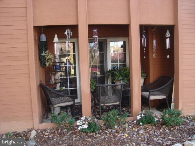
Location,Location,Location for those looking for convenience and quality. Close to Route 108, Route 29 and Route 100. Easily accessible amenities through Columbia Association. Alarm system, washer dryer,brand new carpet & extra storage area. Outdoor patio on main level adds to convenience. Well kept and maintained condominium complex. Columbia Mall within 2 minutes. PLUS fresh paint.
4954 Columbia Rd is an apartment community located in Howard County and the 21044 ZIP Code.
Features
- Fireplace
- Dishwasher
Location
Get Directions
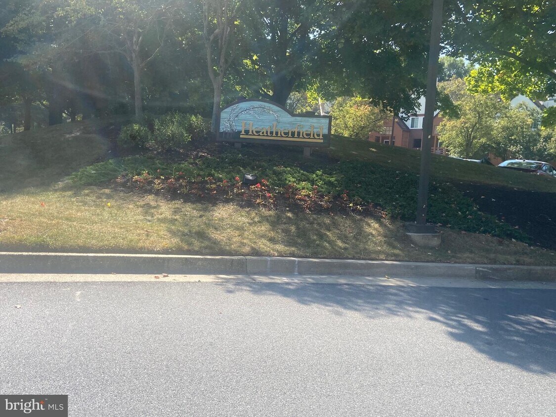
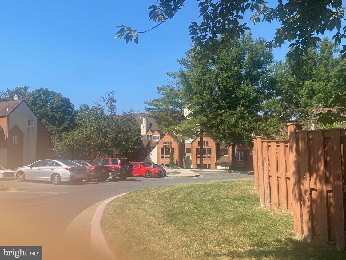
As the northernmost community in Columbia, Fairway Hills is flanked by beautiful parks and the Fairway Hills Golf Course. Roads naturally curve and bend with the land, designed to provide natural vistas within the area's residential districts. The scenic community is mostly residential, offering a wide variety of apartments available for rent in a park-like environment.
Fairway Hills lies adjacent to the popular Centennial Park, which provides endless opportunities for outdoor recreation close to home. Downtown Baltimore is just a 20-minute drive northwest of the community, connecting residents to a broad range of employment opportunities nearby.
Learn more about living in Fairway HillsBelow are rent ranges for similar nearby apartments
Amenities
- Fireplace
- Dishwasher
Education
| Colleges & Universities | Distance | ||
|---|---|---|---|
| Colleges & Universities | Distance | ||
| Drive: | 9 min | 4.8 mi | |
| Drive: | 20 min | 12.3 mi | |
| Drive: | 20 min | 12.8 mi | |
| Drive: | 28 min | 15.6 mi |
4954 Columbia Rd Unit 4 is within 9 minutes or 4.8 miles from Howard Community College. It is also near CCBC Cantonsville and UMBC.
Transportation options available in Columbia include Dorsey, located 8.6 miles from 4954 Columbia Rd Unit 4. 4954 Columbia Rd Unit 4 is near Baltimore/Washington International Thurgood Marshall, located 15.0 miles or 23 minutes away, and Ronald Reagan Washington Ntl, located 32.2 miles or 51 minutes away.
| Transit / Subway | Distance | ||
|---|---|---|---|
| Transit / Subway | Distance | ||
|
|
Drive: | 14 min | 8.6 mi |
|
|
Drive: | 23 min | 15.1 mi |
| Commuter Rail | Distance | ||
|---|---|---|---|
| Commuter Rail | Distance | ||
| Drive: | 14 min | 8.6 mi | |
| Drive: | 14 min | 8.6 mi | |
|
|
Drive: | 15 min | 8.8 mi |
| Drive: | 19 min | 12.0 mi | |
|
|
Drive: | 19 min | 12.0 mi |
| Airports | Distance | ||
|---|---|---|---|
| Airports | Distance | ||
|
Baltimore/Washington International Thurgood Marshall
|
Drive: | 23 min | 15.0 mi |
|
Ronald Reagan Washington Ntl
|
Drive: | 51 min | 32.2 mi |
Time and distance from 4954 Columbia Rd Unit 4.
| Shopping Centers | Distance | ||
|---|---|---|---|
| Shopping Centers | Distance | ||
| Walk: | 11 min | 0.6 mi | |
| Drive: | 7 min | 2.3 mi | |
| Drive: | 5 min | 2.4 mi |
4954 Columbia Rd Unit 4 has 3 shopping centers within 2.4 miles, which is about a 5-minute drive. The miles and minutes will be for the farthest away property.
| Parks and Recreation | Distance | ||
|---|---|---|---|
| Parks and Recreation | Distance | ||
|
Clark's Elioak Farm
|
Drive: | 3 min | 2.0 mi |
|
Benjamin Banneker Historical Park and Museum
|
Drive: | 15 min | 6.8 mi |
|
Mt Pleasant - Howard County Conservancy
|
Drive: | 14 min | 9.1 mi |
|
Banneker Planetarium
|
Drive: | 20 min | 12.8 mi |
|
Patapsco Valley State Park
|
Drive: | 26 min | 14.6 mi |
4954 Columbia Rd Unit 4 has 5 parks within 14.6 miles, including Clark's Elioak Farm, Benjamin Banneker Historical Park and Museum, and Mt Pleasant - Howard County Conservancy.
| Hospitals | Distance | ||
|---|---|---|---|
| Hospitals | Distance | ||
| Drive: | 8 min | 3.6 mi | |
| Drive: | 18 min | 10.4 mi | |
| Drive: | 18 min | 12.8 mi |
4954 Columbia Rd Unit 4 has 3 hospitals within 12.8 miles, the nearest is Howard County General Hospital which is 3.6 miles away and a 8 minute drive.
| Military Bases | Distance | ||
|---|---|---|---|
| Military Bases | Distance | ||
| Drive: | 25 min | 16.0 mi |
4954 Columbia Rd Unit 4 is 16.0 miles and a 25 minute drive from Fort George Meade.
You May Also Like
Similar Rentals Nearby


What Are Walk Score®, Transit Score®, and Bike Score® Ratings?
Walk Score® measures the walkability of any address. Transit Score® measures access to public transit. Bike Score® measures the bikeability of any address.
What is a Sound Score Rating?
A Sound Score Rating aggregates noise caused by vehicle traffic, airplane traffic and local sources
4954 Columbia Rd
Columbia, MD 21044