
Citrus Commons
14150 Riverside Dr,
Sherman Oaks, CA 91423
$2,725 - $5,495
Studio - 2 Beds

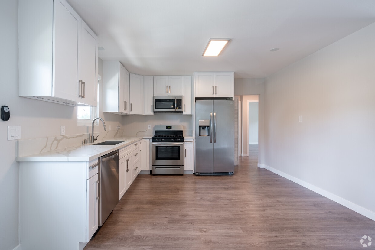
Located across the street from the Sherman Oaks Park and just blocks from the Westfield Fashion Square, Hazel Park is a garden-style masterpiece nestled into the heart of Sherman Oaks. Hazel Park has undergone extensive renovation featuring Calcutta quartz countertops, shaker cabinetry, vinyl plank flooring, stainless steel appliances, and an IN-UNIT WASHER & DRYER. The property is entered via a controlled access gate to the building and features a pool in the courtyard of the property. The building is across the street from the Park where you have open grass fields, tennis courts, baseball fields, and all different types of recreational areas. APPLICATION FEES WAIVED FOR THE MONTH OF DECEMBER MANAGED BY: Coastline Find us on Google. Licensed by the California Department of Real Estate #01856672 IT491227 - IT49CO5008Haze
5008 Hazeltine Ave is an apartment community located in Los Angeles County and the 91423 ZIP Code. This area is served by the Los Angeles Unified attendance zone.
Washer/Dryer
Air Conditioning
Dishwasher
Heating
Located in the heart of the San Fernando Valley, Sherman Oaks combines residential comfort with city accessibility. This established neighborhood, spanning 14 square miles and extending into the Santa Monica Mountains, features tree-lined streets and varied housing options. Current rental trends show one-bedroom apartments averaging $2,069 and two-bedroom units around $2,696.
Life in Sherman Oaks centers around Ventura Boulevard, home to local shops, restaurants, and entertainment venues. The community offers several recreational spaces, including Van Nuys Sherman Oaks Park with its tennis courts, swimming pools, and expansive grounds. Westfield Fashion Square provides shopping options, while Sherman Oaks Castle Park features miniature golf courses and an arcade. Established in 1927 by General Moses Hazeltine Sherman, the area has evolved from agricultural land into an established Los Angeles neighborhood.
Learn more about living in Sherman Oaks| Colleges & Universities | Distance | ||
|---|---|---|---|
| Colleges & Universities | Distance | ||
| Drive: | 6 min | 2.8 mi | |
| Drive: | 10 min | 6.6 mi | |
| Drive: | 16 min | 8.7 mi | |
| Drive: | 23 min | 11.6 mi |


Transportation options available in Sherman Oaks include North Hollywood Station, located 4.5 miles from 5008 Hazeltine Ave. 5008 Hazeltine Ave is near Bob Hope, located 7.3 miles or 13 minutes away, and Los Angeles International, located 19.9 miles or 29 minutes away.
| Transit / Subway | Distance | ||
|---|---|---|---|
| Transit / Subway | Distance | ||
|
|
Drive: | 8 min | 4.5 mi |
|
|
Drive: | 9 min | 5.7 mi |
|
|
Drive: | 13 min | 8.6 mi |
|
|
Drive: | 13 min | 8.9 mi |
|
|
Drive: | 14 min | 9.7 mi |
| Commuter Rail | Distance | ||
|---|---|---|---|
| Commuter Rail | Distance | ||
|
|
Drive: | 9 min | 4.5 mi |
|
|
Drive: | 13 min | 7.3 mi |
| Drive: | 14 min | 8.2 mi | |
|
|
Drive: | 14 min | 8.3 mi |
|
|
Drive: | 14 min | 8.6 mi |
| Airports | Distance | ||
|---|---|---|---|
| Airports | Distance | ||
|
Bob Hope
|
Drive: | 13 min | 7.3 mi |
|
Los Angeles International
|
Drive: | 29 min | 19.9 mi |
Time and distance from 5008 Hazeltine Ave.
| Shopping Centers | Distance | ||
|---|---|---|---|
| Shopping Centers | Distance | ||
| Walk: | 9 min | 0.5 mi | |
| Walk: | 14 min | 0.7 mi | |
| Walk: | 14 min | 0.8 mi |
| Parks and Recreation | Distance | ||
|---|---|---|---|
| Parks and Recreation | Distance | ||
|
The Japanese Garden
|
Drive: | 7 min | 3.7 mi |
|
Sepulveda Basin Wildlife Reserve
|
Drive: | 11 min | 4.1 mi |
|
Los Encinos State Historic Park
|
Drive: | 8 min | 4.2 mi |
|
Sooky Goldman Nature Center
|
Drive: | 15 min | 5.4 mi |
|
Skirball Cultural Center
|
Drive: | 11 min | 5.9 mi |
| Hospitals | Distance | ||
|---|---|---|---|
| Hospitals | Distance | ||
| Walk: | 12 min | 0.7 mi | |
| Drive: | 7 min | 3.5 mi | |
| Drive: | 8 min | 3.8 mi |
| Military Bases | Distance | ||
|---|---|---|---|
| Military Bases | Distance | ||
| Drive: | 29 min | 22.5 mi |
What Are Walk Score®, Transit Score®, and Bike Score® Ratings?
Walk Score® measures the walkability of any address. Transit Score® measures access to public transit. Bike Score® measures the bikeability of any address.
What is a Sound Score Rating?
A Sound Score Rating aggregates noise caused by vehicle traffic, airplane traffic and local sources
5008 Hazeltine Ave
Sherman Oaks, CA 91423


