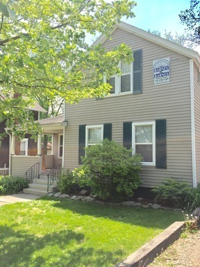
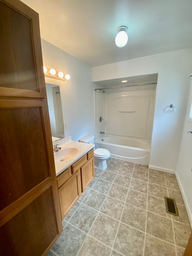
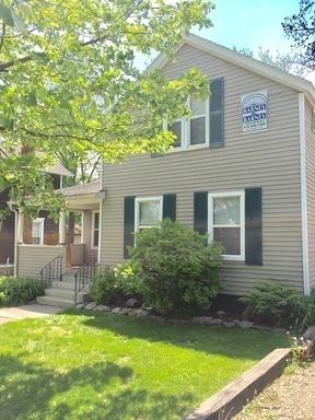
511 Emmet St Unit 1
Ypsilanti, MI 48197
-
Bedrooms
3
-
Bathrooms
1
-
Square Feet
--
-
Available
Available Now

Contact
- Listed by Barnes | Barnes & Barnes Apartment Rentals
- Phone Number
- Contact
For students of Eastern Michigan University, Midtown Ypsilanti is a convenient, highly sought-after neighborhood. Situated just north of the University and just outside of Downtown Ypsilanti, Midtown is a thriving urban neighborhood with walkable streets, tree-lined roads, and commuter benefits. The public bus stations around the city will get you where you need to go, and if you’re traveling into nearby Ann Arbor for work or school, it’s a quick eight or so miles northwest.
Residents enjoy the restaurants along Highway 17 like Sweetwaters Coffee & Tea, and more dining options can be found along Michigan Avenue, like Red Rock Downtown Barbeque and Ma Lou’s Fried Chicken nearing the Huron River. Though Midtown is quaint, it has a lively atmosphere with plenty of apartments and houses to choose from for students, families, and more.
Learn more about living in Midtown Ypsilanti| Colleges & Universities | Distance | ||
|---|---|---|---|
| Colleges & Universities | Distance | ||
| Drive: | 3 min | 1.3 mi | |
| Drive: | 7 min | 3.6 mi | |
| Drive: | 15 min | 7.5 mi | |
| Drive: | 17 min | 12.3 mi |
Transportation options available in Ypsilanti include Ferry St - Southbound, located 34.1 miles from 511 Emmet St Unit 1. 511 Emmet St Unit 1 is near Detroit Metro Wayne County, located 18.0 miles or 24 minutes away.
| Transit / Subway | Distance | ||
|---|---|---|---|
| Transit / Subway | Distance | ||
| Drive: | 41 min | 34.1 mi | |
| Drive: | 42 min | 34.2 mi | |
| Drive: | 42 min | 34.2 mi | |
| Drive: | 41 min | 34.2 mi | |
| Drive: | 42 min | 34.3 mi |
| Commuter Rail | Distance | ||
|---|---|---|---|
| Commuter Rail | Distance | ||
|
|
Drive: | 15 min | 7.7 mi |
|
|
Drive: | 33 min | 24.9 mi |
|
|
Drive: | 42 min | 34.1 mi |
|
|
Drive: | 55 min | 41.2 mi |
|
|
Drive: | 60 min | 42.1 mi |
| Airports | Distance | ||
|---|---|---|---|
| Airports | Distance | ||
|
Detroit Metro Wayne County
|
Drive: | 24 min | 18.0 mi |
Time and distance from 511 Emmet St Unit 1.
| Shopping Centers | Distance | ||
|---|---|---|---|
| Shopping Centers | Distance | ||
| Walk: | 18 min | 1.0 mi | |
| Drive: | 2 min | 1.2 mi | |
| Drive: | 3 min | 1.4 mi |
| Parks and Recreation | Distance | ||
|---|---|---|---|
| Parks and Recreation | Distance | ||
|
Parker Mill Park
|
Drive: | 8 min | 4.4 mi |
|
County Farm Park
|
Drive: | 8 min | 4.6 mi |
|
Rolling Hills Park
|
Drive: | 14 min | 5.6 mi |
|
Matthaei Botanical Gardens
|
Drive: | 11 min | 6.5 mi |
|
Nichols Arboretum
|
Drive: | 21 min | 7.4 mi |
| Hospitals | Distance | ||
|---|---|---|---|
| Hospitals | Distance | ||
| Drive: | 3 min | 1.4 mi | |
| Drive: | 5 min | 3.1 mi | |
| Drive: | 15 min | 7.5 mi |
You May Also Like
Similar Rentals Nearby
What Are Walk Score®, Transit Score®, and Bike Score® Ratings?
Walk Score® measures the walkability of any address. Transit Score® measures access to public transit. Bike Score® measures the bikeability of any address.
What is a Sound Score Rating?
A Sound Score Rating aggregates noise caused by vehicle traffic, airplane traffic and local sources
