
$3,800 / Month
516 W Arlight St
Monterey Park, CA 91754
Today
Favorites
909-225-5168
-
Bedrooms
3
-
Bathrooms
2
-
Square Feet
1,003 sq ft
-
Available
Available Now
Highlights
- Updated Kitchen
- Open Floorplan
- Main Floor Bedroom
- Great Room
- Granite Countertops
- Lawn
516 W Arlight St

Favorites
About This Home
12 Month Lease,
$4,500 deposit,
Available Now
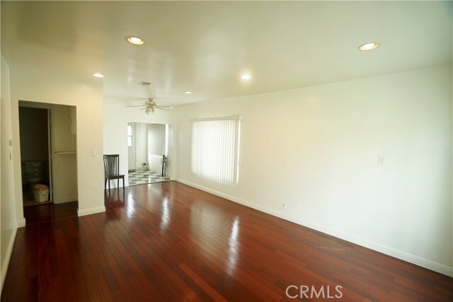
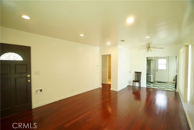
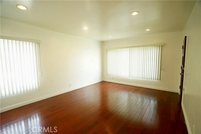
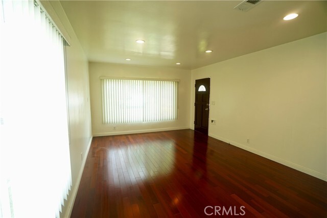
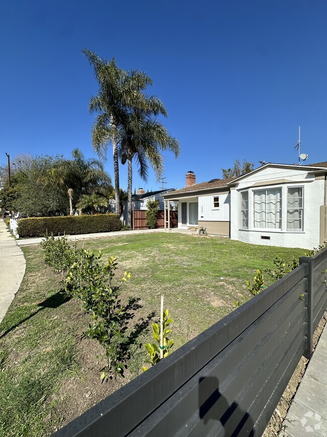
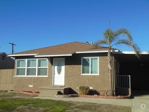
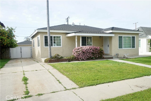
Cozy & Elegant one story 3 bedrooms + enclosed patio / 2 baths / 2 cars detected garage; Located in convenience Monterey Park area ; Newly remodel baths and kitchen with granite counter top & back splash; Newer installed laminate floor, double pane windows throughout & sliding doors; Open and airy floor plan; Restaurants, schools, markets, banks, library, post office, pharmacy are near by; Easy access 60 Freeway, Atlantic Blvd. & Garfield Ave exit.
516 W Arlight St is a house located in Los Angeles County and the 91754 ZIP Code. This area is served by the Montebello Unified attendance zone.
* Price shown is base rent and may not include non-optional fees and utilities.
Price, availability, fees, and any applicable rent special are subject to change without notice.
* Square footage definitions vary. Displayed square footage is approximate.
Home Details
Home Type
Single Family Detached Home
Year Built
Built in 1948
Accessible Home Design
Entry on the 1st floor
Bedrooms and Bathrooms
Bathtub with Shower
Bathroom on Main Level
Walk-in Shower
Remodeled Bathroom
3 Main Level Bedrooms
2 Full Bathrooms
Exhaust Fan In Bathroom
Flooring
Tile
Laminate
Home Design
Shingle Roof
Turnkey
Fire Rated Drywall
Composition Roof
Stucco
Raised Foundation
Home Security
Carbon Monoxide Detectors
Fire and Smoke Detector
Interior Spaces
Open Floorplan
Great Room
Recessed Lighting
Sliding Doors
Dining Room
Entryway
1,003 Sq Ft Home
1-Story Property
Kitchen
Updated Kitchen
Granite Countertops
Gas Oven
Gas Range
Free-Standing Range
Range Hood
Disposal
Laundry
Laundry Room
Laundry in Kitchen
Washer and Gas Dryer Hookup
Listing and Financial Details
Security Deposit $4,500
12-Month Minimum Lease Term
Available 4/3/25
Tax Lot 78
Tax Tract Number 14993
Assessor Parcel Number 5266012005
Lot Details
5,411 Sq Ft Lot
No Common Walls
Lawn
Landscaped
Rectangular Lot
Wood Fence
Block Wall Fence
Level Lot
Back and Front Yard
Fence is in good condition
Property is zoned MPR1YY
Outdoor Features
Enclosed patio or porch
Exterior Lighting
Parking
Side by Side Parking
2 Car Garage
Single Garage Door
Parking Available
Garage Door Opener
Driveway
Utilities
Forced Air Heating and Cooling System
Gas Water Heater
Heating System Uses Natural Gas
Cable TV Available
Phone Available
Community Details
Overview
No Home Owners Association
Fees and Policies
The fees below are based on community-supplied data and may exclude additional fees and utilities.
- Parking
-
Garage--
Details
Lease Options
-
12 Months
Contact
- Listed by James Chou | RE/MAX 2000 REALTY
- Phone Number
- Contact
-
Source
 California Regional Multiple Listing Service
Copyright 2025 © California Regional MLS. All rights reserved.
Location
Get Directions
Amenities
- Washer/Dryer Hookup
- Air Conditioning
- Heating
- Disposal
- Granite Countertops
- Oven
- Range
- Tile Floors
- Vinyl Flooring
- Dining Room
- Fenced Lot
- Patio
Nestled in the San Gabriel Valley, Monterey Park is just eight miles east of Los Angeles. The commercial districts on Atlantic Boulevard and Garvey Avenue are teeming with restaurants specializing in Asian cuisine, along with markets, shops, and salons.
Several parks in town offer residents a peaceful reprieve from busy modern life. Monterey Park residents enjoy relaxing and engaging in outdoor recreation at Barnes Park, Sequoia Park, and Garvey Ranch Park. Lively events draw the community together in Monterey Park, including the Cherry Blossom Festival, Geranium Festival, Cinco de Mayo Celebration, and Lunar New Year Festival. Convenient freeway access brings Monterey Park residents to the many amenities of Downtown Los Angeles in 15 minutes.
Learn more about living in Monterey Park
Education
| Colleges & Universities | Distance | ||
|---|---|---|---|
| Colleges & Universities | Distance | ||
| Walk: | 14 min | 0.8 mi | |
| Drive: | 10 min | 4.1 mi | |
| Drive: | 12 min | 6.6 mi | |
| Drive: | 14 min | 8.8 mi |
516 W Arlight St is within 14 minutes or 0.8 mile from East Los Angeles College. It is also near Cal State Los Angeles and USC, Health Sciences Campus.
Schools


Public Elementary School
Grades K-5
493 Students
Attendance Zone
Public Elementary School
Grades K-6
596 Students
Nearby
Public Middle School
Grades 6-8
526 Students
Attendance Zone
Public High School
Grades 9-12
2,224 Students
Attendance Zone
Private Elementary & Middle School
Grades K-8
151 Students
Nearby
Private Elementary, Middle & High School
Grades K-12
15 Students
Nearby
Private Elementary & Middle School
Grades PK-8
39 Students
Nearby
School data provided by
 The GreatSchools Rating helps parents compare schools within a state based on a variety of school quality indicators and provides a helpful picture of how effectively each school serves all of its students. Ratings are on a scale of 1 (below average) to 10 (above average) and can include test scores, college readiness, academic progress, advanced courses, equity, discipline and attendance data. We also advise parents to visit schools, consider other information on school performance and programs, and consider family needs as part of the school selection process.
View GreatSchools Rating Methodology
View GreatSchools Rating Methodology
Transportation options available in Monterey Park include Atlantic, located 1.1 miles from 516 W Arlight St. 516 W Arlight St is near Long Beach (Daugherty Field), located 19.9 miles or 30 minutes away, and Los Angeles International, located 22.0 miles or 33 minutes away.
| Transit / Subway | Distance | ||
|---|---|---|---|
| Transit / Subway | Distance | ||
|
|
Drive: | 3 min | 1.1 mi |
|
|
Drive: | 3 min | 1.5 mi |
| Drive: | 5 min | 2.0 mi | |
|
|
Drive: | 6 min | 3.9 mi |
|
|
Drive: | 8 min | 5.1 mi |
| Commuter Rail | Distance | ||
|---|---|---|---|
| Commuter Rail | Distance | ||
|
|
Drive: | 7 min | 2.9 mi |
|
|
Drive: | 11 min | 4.5 mi |
|
|
Drive: | 12 min | 7.8 mi |
|
|
Drive: | 14 min | 7.9 mi |
| Drive: | 15 min | 11.7 mi |
| Airports | Distance | ||
|---|---|---|---|
| Airports | Distance | ||
|
Long Beach (Daugherty Field)
|
Drive: | 30 min | 19.9 mi |
|
Los Angeles International
|
Drive: | 33 min | 22.0 mi |
Time and distance from 516 W Arlight St.
| Shopping Centers | Distance | ||
|---|---|---|---|
| Shopping Centers | Distance | ||
| Walk: | 6 min | 0.3 mi | |
| Walk: | 8 min | 0.4 mi | |
| Walk: | 12 min | 0.6 mi |
516 W Arlight St has 3 shopping centers within 0.6 mile, which is about a 12-minute walk. The miles and minutes will be for the farthest away property.
| Parks and Recreation | Distance | ||
|---|---|---|---|
| Parks and Recreation | Distance | ||
|
Hollenbeck Lake
|
Drive: | 9 min | 5.4 mi |
|
Whittier Narrows Recreation Area
|
Drive: | 12 min | 5.8 mi |
|
Pio Pico State Historic Park
|
Drive: | 13 min | 6.2 mi |
|
Whittier Narrows Nature Center
|
Drive: | 11 min | 6.8 mi |
|
Audubon Center at Debs Park
|
Drive: | 16 min | 10.7 mi |
516 W Arlight St has 5 parks within 10.7 miles, including Hollenbeck Lake, Whittier Narrows Recreation Area, and Pio Pico State Historic Park.
| Hospitals | Distance | ||
|---|---|---|---|
| Hospitals | Distance | ||
| Walk: | 20 min | 1.1 mi | |
| Drive: | 6 min | 2.7 mi | |
| Drive: | 7 min | 4.2 mi |
516 W Arlight St has 3 hospitals within 4.2 miles, the nearest is Monterey Park Hospital which is 1.1 miles away and a 20 minute walk.
| Military Bases | Distance | ||
|---|---|---|---|
| Military Bases | Distance | ||
| Drive: | 34 min | 21.9 mi | |
| Drive: | 31 min | 22.7 mi |
516 W Arlight St is 21.9 miles from Los Alamitos Army Airfield, and is convenient to other military bases, including Los Angeles Air Force Base.
You May Also Like
Similar Rentals Nearby

What Are Walk Score®, Transit Score®, and Bike Score® Ratings?
Walk Score® measures the walkability of any address. Transit Score® measures access to public transit. Bike Score® measures the bikeability of any address.
What is a Sound Score Rating?
A Sound Score Rating aggregates noise caused by vehicle traffic, airplane traffic and local sources
516 W Arlight St
Monterey Park, CA 91754