

$3,900
/ Month
52 Innes Ct
San Francisco, CA 94124
2 Weeks Ago
Favorites
-
Bedrooms
2
-
Bathrooms
2
-
Square Feet
--
52 Innes Ct

Favorites
About This Home
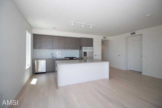
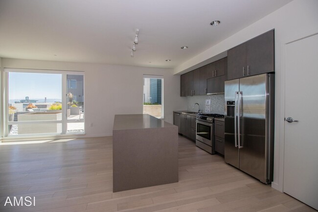
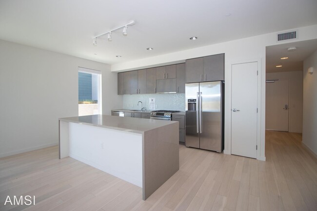
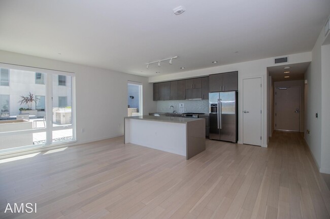
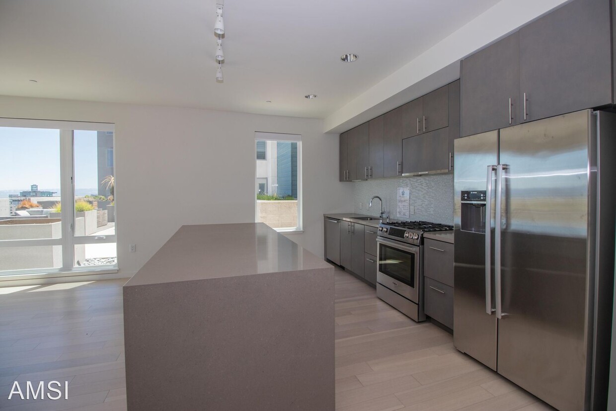
- Luxurious 2BD/2BTH at The Monarch w/ Parking and Views | AMSI | Alexandr Metlinski - Spacious condo with large windows allowing for lots of natural light. The kitchen has Caesarstone quartz countertops, a glass mosaic backsplash, modern cabinetry, and stainless steel Bosch appliances. Enjoy the scenery from your front patio in this very quiet area with beautiful views of the bay and great for walks, running, or biking. Free shuttle to all major transportation, light rail, and downtown. Parking included! Water, Trash, and Gas included. Features: Washer/Dryer Dishwasher Fridge Gas Stove/Oven Hardwood Floors Carpeted Bedrooms Patio Year Built – 2018 Rent - $3,900.00 Security Deposit - $3,900.00 Application Fee - $40 Alexandr Metlinski AMSI / Leasing / Property Management DRE # 02043065 No Pets Allowed (RLNE7521604) Pet policies: No Dogs Allowed, No Cats Allowed.
Unique Features
- No Dogs Allowed, No Cats Allowed
52 Innes Ct is a house located in San Francisco County and the 94124 ZIP Code. This area is served by the San Francisco Unified attendance zone.
* Price shown is base rent. Excludes user-selected optional fees and variable or usage-based fees and required charges due at or prior to move-in or at move-out. Price, availability, fees, and any applicable rent special are subject to change without notice.
* Square footage definitions vary. Displayed square footage is approximate.
Fees and Policies
The fees below are based on community-supplied data and may exclude additional fees and utilities.
Contact
- Listed by AMSI
Location
Get Directions
Amenities
- No Dogs Allowed, No Cats Allowed
Located about five miles southeast of downtown San Francisco, Hunters Point showcases the history, culture, and art of the city. The neighborhood contains several buildings considered historic by the California Registry, including the Bayview Opera House and the Quinn House. Over 250 artists gather at the Hunters Point Shipyard Artists community, which opens for public viewings three times every year. You can find modern apartments all over Hunters Point, with many providing excellent views of the water. If you really want an unparalleled view of the bay, check out Heron's Head Park, a relaxing place for a walk on a sunny day.
Home to the renowned Candlestick Point State Recreation Area, outdoor enthusiasts revel in its lush green spaces, hiking trails, and picnicking spots. Residents of Hunters Point can reach a variety of nearby businesses, shops, and employers like Genentech, area universities, and numerous hospitals.
Learn more about living in Hunters Point
Education
| Colleges & Universities | Distance | ||
|---|---|---|---|
| Colleges & Universities | Distance | ||
| Drive: | 9 min | 3.6 mi | |
| Drive: | 9 min | 3.9 mi | |
| Drive: | 12 min | 5.6 mi | |
| Drive: | 13 min | 7.0 mi |
52 Innes Ct is within 9 minutes or 3.6 miles from UC San Francisco, Mission Bay. It is also near California College of the Arts and Golden Gate Univ., San Fran..
Schools


Public Elementary School
Grades K-5
Nearby
Public Elementary School
Grades K-5
102 Students
Attendance Zone
Public Middle School
Grades 6-8
257 Students
Attendance Zone
Charter High School
Grades 9-12
316 Students
Nearby
Private Elementary School
Grades PK-1
Nearby
Private Elementary, Middle & High School
Grades K-12
Nearby
School data provided by
 The GreatSchools Rating helps parents compare schools within a state based on a variety of school quality indicators and provides a helpful picture of how effectively each school serves all of its students. Ratings are on a scale of 1 (below average) to 10 (above average) and can include test scores, college readiness, academic progress, advanced courses, equity, discipline and attendance data. We also advise parents to visit schools, consider other information on school performance and programs, and consider family needs as part of the school selection process.
View GreatSchools Rating Methodology
Data provided by GreatSchools.org © 2025. All rights reserved.
View GreatSchools Rating Methodology
Data provided by GreatSchools.org © 2025. All rights reserved.
Transportation options available in San Francisco include Oakdale/Palou Station, located 1.7 miles from 52 Innes Ct. 52 Innes Ct is near San Francisco International, located 11.2 miles or 22 minutes away, and Metro Oakland International, located 23.7 miles or 37 minutes away.
| Transit / Subway | Distance | ||
|---|---|---|---|
| Transit / Subway | Distance | ||
|
|
Drive: | 6 min | 1.7 mi |
|
|
Drive: | 4 min | 1.7 mi |
|
|
Drive: | 6 min | 1.8 mi |
|
|
Drive: | 5 min | 1.8 mi |
|
|
Drive: | 7 min | 1.9 mi |
| Commuter Rail | Distance | ||
|---|---|---|---|
| Commuter Rail | Distance | ||
| Drive: | 11 min | 3.3 mi | |
| Drive: | 8 min | 3.8 mi | |
| Drive: | 8 min | 3.9 mi | |
| Drive: | 10 min | 4.7 mi | |
| Drive: | 10 min | 4.7 mi |
| Airports | Distance | ||
|---|---|---|---|
| Airports | Distance | ||
|
San Francisco International
|
Drive: | 22 min | 11.2 mi |
|
Metro Oakland International
|
Drive: | 37 min | 23.7 mi |
Time and distance from 52 Innes Ct.
| Shopping Centers | Distance | ||
|---|---|---|---|
| Shopping Centers | Distance | ||
| Drive: | 4 min | 1.7 mi | |
| Drive: | 10 min | 3.8 mi | |
| Drive: | 9 min | 4.2 mi |
52 Innes Ct has 3 shopping centers within 4.2 miles, which is about a 9-minute drive. The miles and minutes will be for the farthest away property.
| Parks and Recreation | Distance | ||
|---|---|---|---|
| Parks and Recreation | Distance | ||
|
Heron's Head Park
|
Drive: | 3 min | 1.2 mi |
|
Candlestick Point State Recreation Area
|
Drive: | 11 min | 2.8 mi |
|
Children's Creativity Museum
|
Drive: | 11 min | 5.4 mi |
|
Randall Museum
|
Drive: | 14 min | 6.4 mi |
|
San Bruno Mountain State Park
|
Drive: | 23 min | 8.5 mi |
52 Innes Ct has 5 parks within 8.5 miles, including Heron's Head Park, Candlestick Point State Recreation Area, and Children's Creativity Museum.
| Hospitals | Distance | ||
|---|---|---|---|
| Hospitals | Distance | ||
| Drive: | 9 min | 3.3 mi | |
| Drive: | 10 min | 3.9 mi | |
| Drive: | 10 min | 4.4 mi |
52 Innes Ct has 3 hospitals within 4.4 miles, the nearest is Zuckerberg San Francisco General Hospital & Trauma Center which is 3.3 miles away and a 9 minute drive.
| Military Bases | Distance | ||
|---|---|---|---|
| Military Bases | Distance | ||
| Drive: | 33 min | 18.1 mi | |
| Drive: | 34 min | 18.3 mi |
52 Innes Ct is 18.1 miles from Alameda/US Naval Air Station Alameda, and is convenient to other military bases, including Alameda/US Naval Air Station San Francisco.
You May Also Like
Similar Rentals Nearby
-
-

-

-

-

-

-
-
1 / 25

-
-


What Are Walk Score®, Transit Score®, and Bike Score® Ratings?
Walk Score® measures the walkability of any address. Transit Score® measures access to public transit. Bike Score® measures the bikeability of any address.
What is a Sound Score Rating?
A Sound Score Rating aggregates noise caused by vehicle traffic, airplane traffic and local sources
52 Innes Ct
San Francisco, CA 94124